- Home
- :
- All Communities
- :
- Industries
- :
- Water Resources
- :
- Water Resources Questions
- :
- Re: Hydraulic modelling/predictions - Free form ev...
- Subscribe to RSS Feed
- Mark Topic as New
- Mark Topic as Read
- Float this Topic for Current User
- Bookmark
- Subscribe
- Mute
- Printer Friendly Page
Hydraulic modelling/predictions - Free form evaporation pond planning
- Mark as New
- Bookmark
- Subscribe
- Mute
- Subscribe to RSS Feed
- Permalink
- Report Inappropriate Content
Hello all,
We are currently in the planning stages for a Free Form Evaporation (FFE) pond. In our industry FFE ponds are used when we produce excess water, which is discharged into clay swales in an arid dune system environment. Depending on the size and shape of the swale area and the volume of water discharged, we often need to engineer berm walls or similar to contain the water within specific areas.
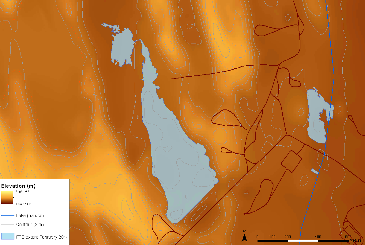
The image below gives an example of an actual FFE extent overlayed with a 2m DEM. A berm wall was engineered at the southern end of this area to stop water from encroaching on the road.
For planning new areas, ideally I would like to be able to nominate a 'pour point' (or similar) on the DEM and input the water discharge amount (in litres or megalitres) to obtain a final output layer that delineates the predicted surface water extent (in 3D Analyst would be great). I know that this will be affected by evaporation rates, soil types etc. but a 'ball park' prediction would be good enough. I will have a 50cm DEM available for analysis/modelling.
Has anyone got any ideas on the best way to go about this? or the next best thing?
I have been doing a bit of research and it looks like HEC-GeoRAS could be a good way to go. However, if this tool is designed for dendritic systems only, it may be inappropriate for this environment which is a dunal system comprising of long parallel dunes separated by clay swales with numerous natural sinks.
Any ideas/guidance on this would be greatly appreciated!
- Mark as New
- Bookmark
- Subscribe
- Mute
- Subscribe to RSS Feed
- Permalink
- Report Inappropriate Content
I don't know an exact answer, but I'll throw out some ideas here that may lead to a solution. There may be a way to employ one or both of these 3D Analyst tools to come up with a solution. There does not appear to be a way to specify a volume; however, you could use Modelbuilder (or Python) to iterate through several different heights/reference planes to then come up with volumes, then narrow it down to your specified volume .
Surface Volume (3D Analyst)
Polygon Volume (3D Analyst)
Chris Donohue, GISP
- Mark as New
- Bookmark
- Subscribe
- Mute
- Subscribe to RSS Feed
- Permalink
- Report Inappropriate Content
Thanks for this Chris.
I will have a play around with these and let you know how I go.
- Mark as New
- Bookmark
- Subscribe
- Mute
- Subscribe to RSS Feed
- Permalink
- Report Inappropriate Content
Thank for the ideas
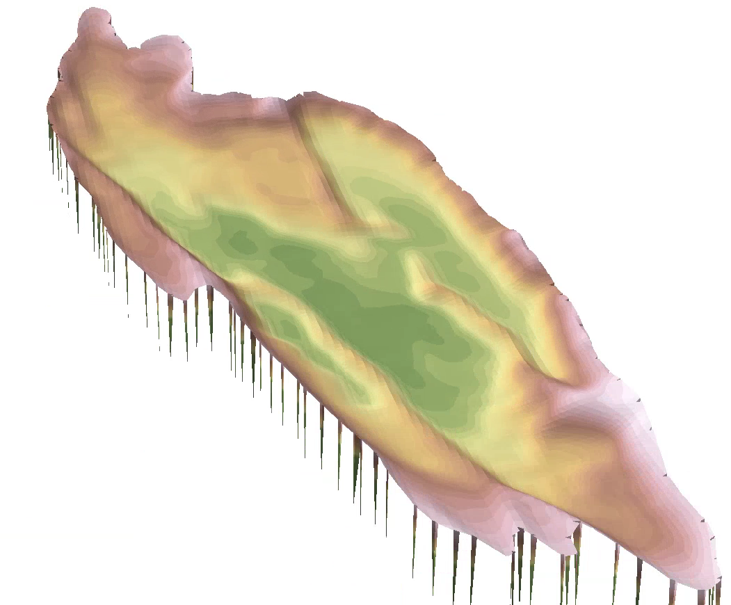
In order to calculate volumes for specific areas that I wish to simulate flooding, I first had to isolate/clip those areas of the TIN separately.
The trick here was getting the polygon clip shape correct. It was important that the polygon boundary was on the ridgeline or highest point of the basin extent. If I got this slightly wrong, it would throw out the volume calculations substantially.
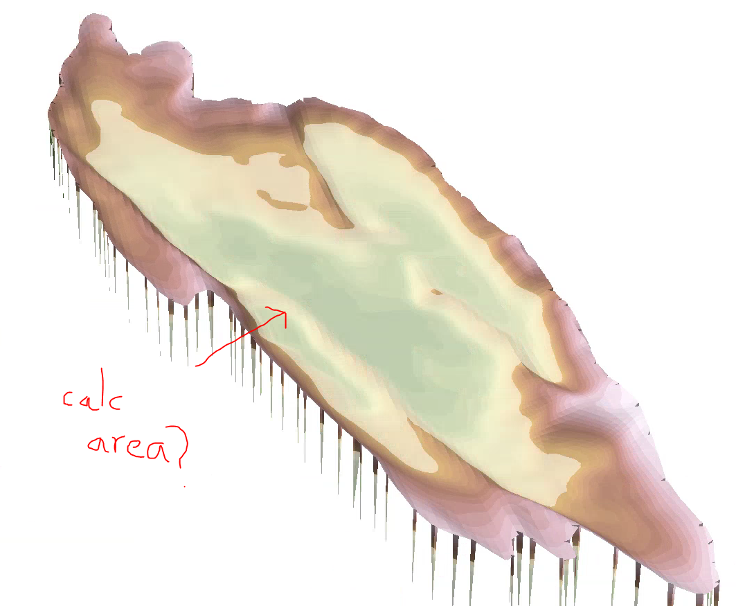
For the sake of visualisation, I created some constant rasters to represent various flood heights within the basin (see below).
What I would like to do is calculate the area of the simulated flood extent within the basin i.e. the area inside where the constant plain intersects with the TIN. Any ideas?
The 2D area output by the Surface Volume tool doesn't seem quite right.
I am assuming there is a simple fix here but I have been working on this for a while so am struggling to think outside of the box right now. Any help would be appreciated.
- Mark as New
- Bookmark
- Subscribe
- Mute
- Subscribe to RSS Feed
- Permalink
- Report Inappropriate Content
- Seems silly, but make sure that your X,Y, and Z units are all the same.
- Since you said that your calculations are very sensitive to any changes, ensure that when you made the TIN that you specified the Z-tolerance. If you leave it default, it will guess for you. Not good in this case.
- Try using the Polygon Volume tool instead of various flood extents. I will assume for this exercise that the WSEL is uniform.
- Mark as New
- Bookmark
- Subscribe
- Mute
- Subscribe to RSS Feed
- Permalink
- Report Inappropriate Content
Thanks Andrew.
I found that the polygon volume tool was easier than clipping my TIN into various 'mini-basins'.
- Mark as New
- Bookmark
- Subscribe
- Mute
- Subscribe to RSS Feed
- Permalink
- Report Inappropriate Content
Another idea - totally different strategy. How about ArcHydro?
Arc Hydro Overview | ArcGIS Resource Center
I have not used it myself, but it seems like it may offer a solution to what you are trying to do. There is also a group here on GeoNet for it:
Also, let me add some of the folks who I believe are very good with raster/tin spatial analysis here in case they have ideas:
Chris Donohue, GISP
- Mark as New
- Bookmark
- Subscribe
- Mute
- Subscribe to RSS Feed
- Permalink
- Report Inappropriate Content
Thanks Chris - much appreciated!