- Home
- :
- All Communities
- :
- Industries
- :
- Public Safety
- :
- Public Safety Questions
- :
- Need to make a Hurricane / Tropical Storm Map? Her...
- Subscribe to RSS Feed
- Mark Topic as New
- Mark Topic as Read
- Float this Topic for Current User
- Bookmark
- Subscribe
- Mute
- Printer Friendly Page
Need to make a Hurricane / Tropical Storm Map? Here is a template.
- Mark as New
- Bookmark
- Subscribe
- Mute
- Subscribe to RSS Feed
- Permalink
- Report Inappropriate Content
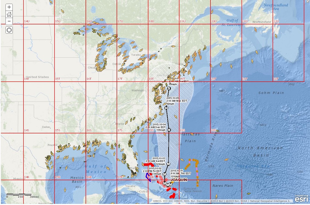
If you need to make a situational awareness view or briefing map for the upcoming tropical storm or hurricane - here is a link with some live feeds from the Esri Disaster Response Program / Living Atlas. Remember, this is just a web map that you can save as your own and share using a web mapping application of your choice depending on your audience.
Web Map Links: http://napsg.maps.arcgis.com/home/webmap/viewer.html?webmap=5b8dfcdcb45c4ef79425c5ee0c33ef65
or try the item property page: http://www.arcgis.com/home/item.html?id=5b8dfcdcb45c4ef79425c5ee0c33ef65
Here is a Map Journal that explains more about each of these Live Feeds created by the Esri Disaster Response Program: http://napsg.maps.arcgis.com/apps/MapJournal/index.html?appid=13e476fea2644110ba94f05dff011a2b
For more on live feeds - attend this seminar: Leveraging Live Feeds for Situational Awareness with ArcGIS Online
If you want to see the list of map services to build your own, here it is:
- Category 5 Hurricane Storm Surge Inundation:http://tiles.arcgis.com/tiles/C8EMgrsFcRFL6LrL/arcgis/rest/services/NHC_SeamlessSLOSH_Category5/MapS...
- Category 4 Hurricane Storm Surge Inundation:http://tiles.arcgis.com/tiles/C8EMgrsFcRFL6LrL/arcgis/rest/services/NHC_SeamlessSLOSH_Category4/MapS...
- Category 3 Hurricane Storm Surge Inundation:http://tiles.arcgis.com/tiles/C8EMgrsFcRFL6LrL/arcgis/rest/services/NHC_SeamlessSLOSH_Category3/MapS...
- Category 2 Hurricane Storm Surge Inundation:http://tiles.arcgis.com/tiles/C8EMgrsFcRFL6LrL/arcgis/rest/services/NHC_SeamlessSLOSH_Category2/MapS...
- Category 1 Hurricane Storm Surge Inundation:http://tiles.arcgis.com/tiles/C8EMgrsFcRFL6LrL/arcgis/rest/services/NHC_SeamlessSLOSH_Category1/MapS...
- Weather Stations (NOAA):http://tmservices1.esri.com/arcgis/rest/services/LiveFeeds/NOAA_METAR_current_wind_speed_direction/M...
- Active Hurricanes (NOAA / NHC / CPHC/ JTWC):http://tmservices1.esri.com/arcgis/rest/services/LiveFeeds/Hurricane_Active/MapServer
- NDFD_WindGust:http://tmservices1.esri.com/arcgis/rest/services/LiveFeeds/NDFD_WindGust/MapServer
- NDFD_Precipitation:http://tmservices1.esri.com/arcgis/rest/services/LiveFeeds/NDFD_Precipitation/MapServer
- Recent Hurricanes (NOAA / NHC):http://tmservices1.esri.com/arcgis/rest/services/LiveFeeds/Hurricane_Recent/MapServer
- Social_Vulnerability_2010:http://tiles.arcgis.com/tiles/nGt4QxSblgDfeJn9/arcgis/rest/services/Social_Vulnerability_2010/MapSer...
- U.S. National Grid (USNG):http://maps1.arcgisonline.com/ArcGIS/rest/services/NGA_US_National_Grid/MapServerOceans:http://services.arcgisonline.com/ArcGIS/rest/services/Ocean_Basemap/MapServer
Need more live feeds? Here is an ArcGIS Online Group by the Esri Disaster Response Program full of live feeds: http://arcg.is/1FJUwBF
Message was edited by: Paul Doherty I added a link for the Esri DRP Live Feeds Group: Need more live feeds? Here is an ArcGIS Online Group by the Esri Disaster Response Program full of live feeds: http://arcg.is/1FJUwBF
- Mark as New
- Bookmark
- Subscribe
- Mute
- Subscribe to RSS Feed
- Permalink
- Report Inappropriate Content
A number of hurricane related layers are also available from NOAA and FEMA.
See:
nowcoast/wwa_meteocean_tropicalcyclones_trackintensityfcsts_time (MapServer)