- Home
- :
- All Communities
- :
- Developers
- :
- JavaScript Maps SDK
- :
- JavaScript Maps SDK Questions
- :
- Re: Problem with Search with Customization
- Subscribe to RSS Feed
- Mark Topic as New
- Mark Topic as Read
- Float this Topic for Current User
- Bookmark
- Subscribe
- Mute
- Printer Friendly Page
Problem with Search with Customization
- Mark as New
- Bookmark
- Subscribe
- Mute
- Subscribe to RSS Feed
- Permalink
- Report Inappropriate Content
Hello,
Im developing an web app (a form), and in one textfield i wanna put a Street Search using the example on this web(Search with customization | ArcGIS API for JavaScript ).
I have a secured service that im accesing to get the streets that i wanna search, but for some reason it doesnt work.
Im doing something wrong?
My structure folder is:
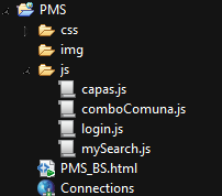
The login.js: is used to bypass the IdentityManager and have access to another modules like: capas.js (layers are loaded here), comboComuna.js(the combobox that show some cities) and the search (where i wanna add the code for the Calles(streets) and make a search as showed in the example Search with customization).
And my codes for earch file are:
<!DOCTYPE html>
<html lang="en">
<head>
  <title>Bootstrap Example</title>
  <meta charset="utf-8">
  <meta name="author" content="ehernanr">
   <meta http-equiv="X-UA-Compatible" content="IE=edge,chrome=1">
  <meta name="viewport" content="width=device-width, initial-scale=1">
  <link rel="stylesheet" href="css/bootstrap.min.css">

   <link rel="stylesheet" href="http://js.arcgis.com/3.13/dijit/themes/claro/claro.css">

   <link rel="stylesheet" href="http://js.arcgis.com/3.13/esri/css/esri.css">
  <style>
      #map {
        height: 100%;
        width: 100%;
        margin: 0;
        padding: 0;
      }
      body {
        background-color: #FFF;
        overflow: hidden;
        font-family: "Trebuchet MS";
      }

      #contenedorMapa{
        height:600px;
      }

      #contenedorBtnGrabar {
        vertical-align: middle;
      }

    #search {
         display: block;
         position: absolute;
         z-index: 2;
         top: 20px;
         left: 74px;
      }

    </style>

  <!-- jQuery library -->
  <script src="https://ajax.googleapis.com/ajax/libs/jquery/1.11.3/jquery.min.js"></script>

  <!-- Latest compiled JavaScript -->
  <script src="http://maxcdn.bootstrapcdn.com/bootstrap/3.3.5/js/bootstrap.min.js"></script>

   <script>var dojoConfig = {parseOnLoad: true,
                packages: [
                    {
                        name: "js",
                        location: "/js"
                    }
                ]


            };</script>

    <script src="http://js.arcgis.com/3.13/"></script>

    <script src="js/login.js"></script>
    <script>
      var map;
      var token;
      var esriId;
      var valorComuna = document.getElementById("id_comuna_dmps");

      require(["esri/map",
              "dojo/parser",
              "esri/IdentityManager",
              "dojo/domReady!" ],
      function(Map,parser,IdentityManager) {

        parser.parse();
        esriId = IdentityManager;

        map = new Map("map", {
        basemap: "topo",
        center: [-71.0659,-32.9252], // long, lat
        zoom: 8
        });

        //valida login
        map.onload(validate());


      });
    </script>


</head>
<body data-spy="scroll"  data-target="form-group" >

<div class="container-fluid">
  <h1>PMS</h1>
  <div class="panel-group">

   <div class="panel panel-default">
      <div class="panel-body">
          <form class="form-inline" role="form">
              <div class="form-group">
                <label for="email">COMUNA</label>
                <select id="id_comuna_dmps"><option value="" >Seleccione una Comuna</option></select>
              </div>
              <div class="form-group">
                <label>CALLE:</label>
                <!-- <input type="text" class="form-control" id="gl_nombre_calle" size="20" maxlength="30" /> -->
               <div id="search"></div>
              </div>
              <div class="form-group">
                <label>PREFIJO:</label>
                <input type="text" class="form-control" id="gl_num_prefijo"   size="2" maxlength="4" />
              </div>

              <div class="form-group">
                <label>NUMERO:</label>
               <input type="text" class="form-control" id="nr_municipal"   size="4" maxlength="6" />
              </div>
              <div class="form-group">
                <label>SUFIJO:</label>
               <input type="text" class="form-control" id="gl_num_sufijo" size="2" maxlength="4" />
              </div>
              <div class="form-group">
                <label>ID DIRECCION:</label>
               <input type="text" class="form-control" id="id_direccion" size="6" />
              </div>

              <div class="form-group">
                  <button type="submit" class="btn btn-default">Validar Direccion</button>

              </div>
          </form>
      </div>
    </div>


     <div class="panel panel-default">
        <div class="panel-body">
           <form class="form-inline" role="form">
              <div class="form-group">
                <label for="email">BUSCAR:</label>
                <select name="lstTipoElemento" id="lstTipoElemento" class="form-control">
                      <option value="camara">CAMARA</option>
                      <option value="poste" selected="selected">POSTE</option>
                      <option value="nis">NIS</option></select>

              </div>
               <div class="form-group"><input name="txtValorBusqueda" type="text" id="txtValorBusqueda" class="form-control"  size="60" maxlength="80"></div>
               <div class="form-group"><input name="button" type="button" value="Buscar" class="btn btn-default"></div>
               <div class="form-group"><input name="button2" type="button" value="Manual" class="btn btn-default"></div>

           </form>

        </div>
       </div>
     </div>

  <div class="panel panel-default"><div class="panel-body" id="contenedorMapa"><div id="map"> </div></div></div>
  <div class="panel panel-default"><div class="panel-body"><div class="form-group" id="contenedorBtnGrabar"><input name="button" type="button" value="Grabar" class="btn btn-default"></div></div></div>


 </div>  <!-- panel group -->


</body>
</html>
login.js:
function validate() {


var username =  'myusername';
var password = 'mypassword';

    var http = new XMLHttpRequest();
    var url = "myrestsrv/arcgis/tokens/generateToken";


    var str1 = "username=";
    var str2 = "&password=";
    var str3 = "&f=json&client=requestip&expiration=1440";
    var params = str1.concat(username, str2, password, str3);
    //f="json", client="requestip", expiration="1440"

    http.open("POST", url, true);


    http.setRequestHeader("Content-type", "application/x-www-form-urlencoded");
    http.setRequestHeader("Content-length", params.length);
    http.setRequestHeader("Connection", "close");


    http.onreadystatechange = function () {


        if (http.readyState == 4 && http.status == 200) {
            var tokenRespuesta = http.responseText;
            token=JSON.parse(tokenRespuesta);
            if (tokenRespuesta.search("error") == -1) {

                esri.id.registerToken(
                 {server:  'http://myRestSrv/arcgis/rest/services',
                  userId:  'userejemplo',
                  token:   token.token,
                  expires: token.expires,
                  ssl:     false
                });


                //HABILITAR MODULOS Y COMBOS UNA VEZ HECHO EL LOGIN
                dojo.registerModulePath("capas", "http://127.0.0.1:8020/PMS/js/capas");
                dojo.require('capas');

                dojo.registerModulePath("comboComuna", "http://127.0.0.1:8020/PMS/js/comboComuna");
                dojo.require('comboComuna');


                dojo.registerModulePath("mySearch", "http://127.0.0.1:8020/PMS/js/mySearch");
                dojo.require('mySearch');


        } else {
                alert("Login incorrecto, intente nuevamente.");
            }
        }
    };


    http.send(params);


    return false;
}
comboComuna.js
require([
        "dojo/dom",
        "esri/tasks/query", "esri/tasks/QueryTask","dojo/domReady!"
      ], function (dom, Query, QueryTask) {


        var queryTask = new QueryTask("myRestSrv/arcgis/rest/services/Chilquinta_006/Equipos_pto_006/MapServer/0");
        var query = new Query();
        query.returnGeometry = false;
        query.outFields = ["nombre"];
        query.where= "1=1";
        queryTask.execute(query, showResults);
          function showResults (results) {
              document.getElementById("id_comuna_dmps").innerHTML = "";
              var submenu = new Array();
              var resultItems = [];
              var resultCount = results.features.length;
              var x = document.getElementById("id_comuna_dmps");


              for (var i = 0; i < resultCount; i++) {
                var featureAttributes = results.features.attributes;

                for (var attr in featureAttributes) {
                  var c = document.createElement("option");

                  c.text = featureAttributes[attr];
                  x.options.add(c, attr);
                }
                //resultItems.push("<br>");
              }
           }//showresults
        });
capas.js
require([
        "esri/map", "esri/InfoTemplate", "esri/layers/FeatureLayer",
        "dojo/parser" , "dojo/domReady!"
      ], function(Map, InfoTemplate, FeatureLayer, parser) {
          parser.parse();


          var fLayerDist = new FeatureLayer("myRestSrv/arcgis/rest/services/PMS/Concesiones/MapServer/1",{
            mode: FeatureLayer.MODE_ONDEMAND,
            outFields: ["*"],

          });
          var fLayerTrans = new FeatureLayer("myRestSrv/arcgis/rest/services/PMS/Concesiones/MapServer/0",{
            mode: FeatureLayer.MODE_ONDEMAND,
            outFields: ["*"],

          });
           var fLayerComuna = new FeatureLayer("myRestSrv/arcgis/rest/services/MANTENIMIENTO/MANTENIMIENTO_PODAS/FeatureServer/0", {
            outFields: ["*"]
         });


          map.addLayers([fLayerDist,fLayerTrans,fLayerComuna]);
         // map.addLayer(fLayerComuna);


      });
mySearch.js
require([
      "esri/map",
      "esri/layers/FeatureLayer",
      "esri/dijit/Search",
      "esri/InfoTemplate",
      "dojo/domReady!"
      ], function (Map, FeatureLayer, Search, InfoTemplate) {


             //Create search widget
         var search = new Search({
            map: map,
            sources: [],
            zoomScale: 5000000
         }, "gl_nombre_calle");


         //listen for the load event and set the source properties
         search.on("load", function () {


            var sources = search.sources;
            sources.push({
               featureLayer: fLayerComuna,
               placeholder: "123",
               enableLabel: false,
               searchFields: ["CODIGO_SAP"],
               displayField: "CODIGO_SAP",
               exactMatch: false,
               outFields: ["*"],


               //Create an InfoTemplate and include three fields
               infoTemplate: new InfoTemplate("Ecological Footprint", "<a href= ${URL} target=_blank ;'>Additional Info</a></br></br>Country: ${Country}</br>Rating: ${Rating}")


            });
            //Set the sources above to the search widget
            search.set("sources", sources);
         });
         search.startup();
      });
Thanks in advice 
Mensaje editado por: Evelyn Hernandez Updated with the search.set("sources", sources);
- Mark as New
- Bookmark
- Subscribe
- Mute
- Subscribe to RSS Feed
- Permalink
- Report Inappropriate Content
- Mark as New
- Bookmark
- Subscribe
- Mute
- Subscribe to RSS Feed
- Permalink
- Report Inappropriate Content
OK atleast now loads the layers and map. I just modified this
queryTask.execute(query, function(){}
for this : queryTask.execute(query, function(results){
Cuz it doesnt find the variable for the comboBox.
Also i edited something else to show the Search textfield and I modified the layer for the search.
But the Search Customized doesnt work 
- Mark as New
- Bookmark
- Subscribe
- Mute
- Subscribe to RSS Feed
- Permalink
- Report Inappropriate Content
So the query task works? also what is esri.id.registerToken?
I was wonder if you needed to append the token along with the featureservice url like this Accessing secure ArcGIS Server services
- Mark as New
- Bookmark
- Subscribe
- Mute
- Subscribe to RSS Feed
- Permalink
- Report Inappropriate Content
I have to do that.
I wanted to not show the identity Manager in the beginning and just load the map passing the parameters inside the code, thats why i use the login.js file.
Idk if theres another way to do it...
- Mark as New
- Bookmark
- Subscribe
- Mute
- Subscribe to RSS Feed
- Permalink
- Report Inappropriate Content
I have this now, but the error that gives me its pagination. How can i activate pagination on the service?
define(["dojo/_base/declare",
"dojo/_base/lang",
"esri/map",
"esri/InfoTemplate",
"esri/layers/FeatureLayer",
"esri/dijit/Search",
"dojo/dom",
"esri/tasks/query",
"esri/tasks/QueryTask"],
function(declare,
lang,
Map,
InfoTemplate,
FeatureLayer,
Search,
dom,
Query,
QueryTask) {
return declare(null, {
search:null,
map: null,
fLayerDist: null,
fLayerTrans: null,
fLayerComuna: null,
constructor: function(map){
this.map = map;
},
initLayers: function(){
this.fLayerDist = new FeatureLayer("",{
mode: FeatureLayer.MODE_ONDEMAND,
outFields: ["*"],
});
this.fLayerTrans = new FeatureLayer("",{
mode: FeatureLayer.MODE_ONDEMAND,
outFields: ["*"],
});
this.fLayerComuna = new FeatureLayer("", {
outFields: ["ALIMENTADOR"]
});
this.map.addLayers([this.fLayerDist,this.fLayerTrans]);
},
initSearch: function(){
this.search = new Search({
map: this.map,
sources: [],
zoomScale: 10000000
}, "search");
//listen for the load event and set the source properties
this.search.on("load", lang.hitch(this, function(){
var sources = this.search.get("sources");
/*sources.push({
featureLayer: this.fLayerComuna,
placeholder: "Argentina",
enableLabel: false,
searchFields: ["nombre_calle"],
displayField: "nombre_calle",
exactMatch: false,
outFields: ["nombre_calle"],
//Create an InfoTemplate and include three fields
infoTemplate: new InfoTemplate("Ecological Footprint", "</br></br>Country: ${nombre_calle}</br>Rating: ${nombre_calle}")
});
*/
sources.push({
featureLayer: new FeatureLayer(""),
searchFields: ["CODIGO_SAP"],
displayField: "CODIGO_SAP",
exactMatch: false,
outFields: ["CODIGO_SAP", "SOLICITANTE", "MONTO_PAGO"],
name: "MANTENIMIENTO_SOLICITUD_PODAS",
placeholder: "1234",
maxResults: 6,
maxSuggestions: 6,
//Create an InfoTemplate and include three fields
infoTemplate: new InfoTemplate("Congressional District", "District ID: ${CODIGO_SAP}</br>Name: ${SOLICITANTE}</br>Party Affiliation: ${MONTO_PAGO}"),
enableSuggestions: true,
minCharacters: 0
});
//Set the sources above to the search widget
// this.search.set("sources", sources);
this.search.set("sources", sources);
}));
// this.search.startup();
this.search.startup();
},
initOptions: function(){
var queryTask = new QueryTask("");
var query = new Query();
query.returnGeometry = false;
query.outFields = ["nombre"];
query.where= "1=1";
queryTask.execute(query, function(results){
document.getElementById("id_comuna_dmps").innerHTML = "";
var submenu = new Array();
var resultItems = [];
var resultCount = results.features.length;
var x = document.getElementById("id_comuna_dmps");
for (var i = 0; i < resultCount; i++) {
var featureAttributes = results.features.attributes;
for (var attr in featureAttributes) {
var c = document.createElement("option");
c.text = featureAttributes[attr];
x.options.add(c, attr);
}
//resultItems.push("<br>");
}
});
}
});
});
- Mark as New
- Bookmark
- Subscribe
- Mute
- Subscribe to RSS Feed
- Permalink
- Report Inappropriate Content
You should find some help here.
How do you enable the "Supports Pagination" on a layer at 10.3?
- Mark as New
- Bookmark
- Subscribe
- Mute
- Subscribe to RSS Feed
- Permalink
- Report Inappropriate Content
I tried the example but it still doesnt work. Maybe i will have to wait for the next release...
- Mark as New
- Bookmark
- Subscribe
- Mute
- Subscribe to RSS Feed
- Permalink
- Report Inappropriate Content
What version of ArcGIS Server are you using? 10.3 or 10.3.1?
- Mark as New
- Bookmark
- Subscribe
- Mute
- Subscribe to RSS Feed
- Permalink
- Report Inappropriate Content
10.3
- « Previous
-
- 1
- 2
- Next »
- « Previous
-
- 1
- 2
- Next »