- Home
- :
- All Communities
- :
- Products
- :
- ArcGIS Survey123
- :
- ArcGIS Survey123 Blog
- :
- 万里长城版本发布 Great Wall Release (2.6)
万里长城版本发布 Great Wall Release (2.6)
- Subscribe to RSS Feed
- Mark as New
- Mark as Read
- Bookmark
- Subscribe
- Printer Friendly Page
- Report Inappropriate Content
This update to Survey123 is in tribute to our Esri Beijing R&D Center, which leads the vision and development of the Survey123 website and Web Forms.
Survey123 for ArcGIS is developed by a small (but passionate  ) team spreading over Redlands (USA), Melbourne (Australia) and Beijing (China). Coinciding with GIS Day, on November 15 2017, our Beijing friends put together a field exercise at the Mutianyu section of the Great Wall. We headed up, capturing data with Survey123 all the way to Tower 26. It was an unforgettable experience!

The Great Wall of China spans over more than 10,000里 (5,000km). It is certainly one of the most impressive architectural feats in history.
Better Web Forms
The significance of this release is the introduction of a much improved support for Web Forms. Web Forms let you capture data with the surveys you design in Survey123, from web browsers. Web Forms are handy because they run well on desktop and mobile devices, not requiring the end user to download anything extra in order to capture data. Web Forms can also be easily shared through a simple link in an e-mail, they can be embedded within a web site or shared via social media.
We see more and more people authoring smart forms with Survey123 for use within a web browser. Typical use cases include campaigns to gather data from the general public, citizen science projects but also forms for routine work within the enterprise.
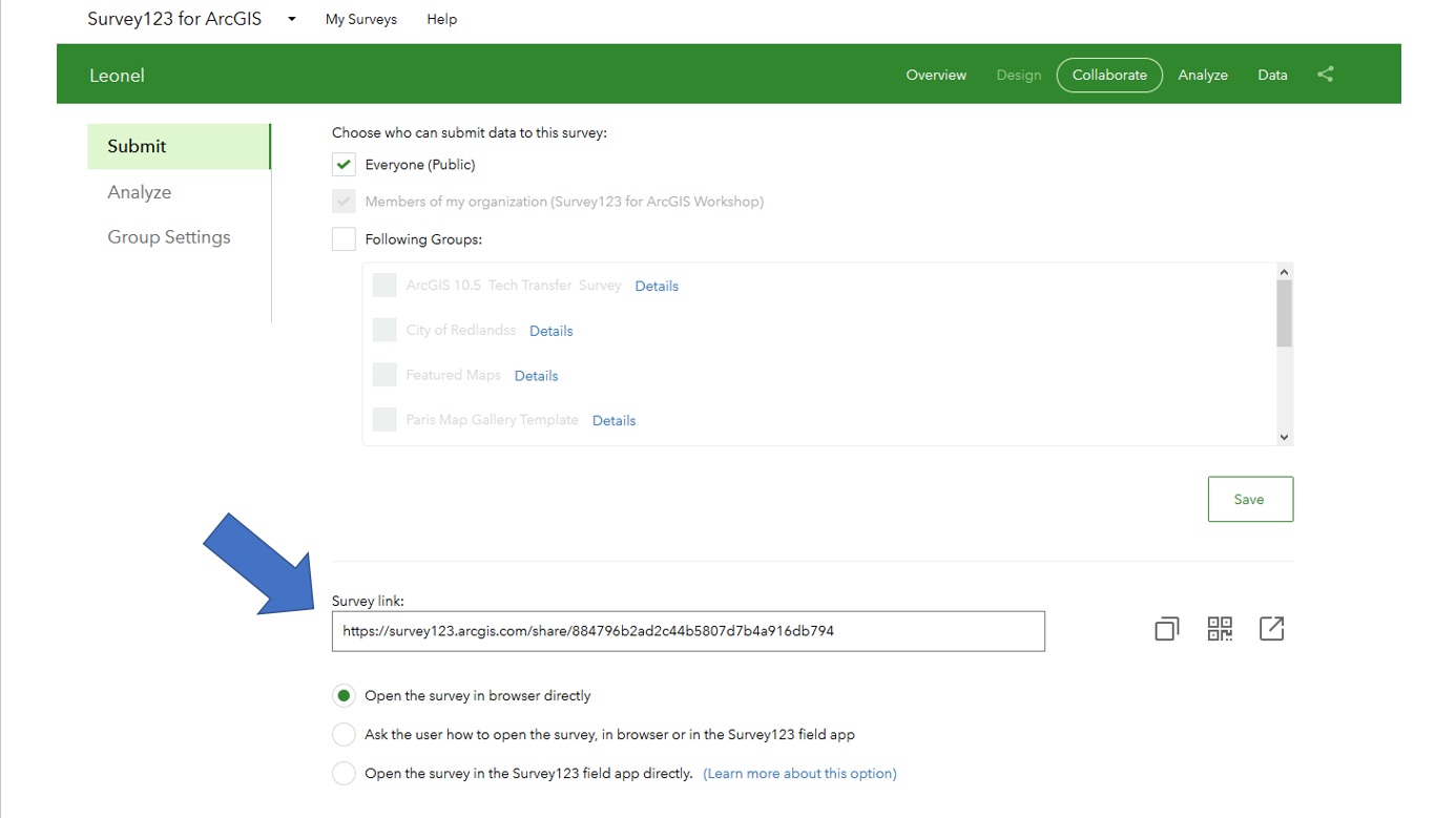
You can open any survey you have published from a web browser by simply using the links provided in the Collaborate tab of the Survey123 web site.
The above will not take you by surprise, because we have supported Web Forms since June 2016. So what is new?
Web Forms authored from Survey123 web designer are faster: If you use the web designer to create your own surveys, you will find a noticeable boost in performance. This counts, because particularly for public surveys people expect an instantaneous response when loading the survey. We have reduced significantly the total size of the surveys. The more lightweight your survey, the less time it takes to download into your web browser. Most importantly, surveys have been improved so the browser can start rendering the questions before the full survey is downloaded. This reduces the perceived startup time significantly. In our own testing, surveys with over 50 questions that used to take 11 seconds to load in the web browser, now only need 2.5 seconds.
This performance boost will only take effect with surveys that you publish with version 2.6. That is, starting today... If you already have published your survey and you want to take advantage of the performance improvements in this release, simply go into the web designer and re-publish your survey.
If you already have published surveys with web designer and want to take advantage of the performance improvements in this release, simply go into web designer and re-publish your survey.
General release for Web Forms authored from Survey123 Connect: If you follow Survey123 development closely, you will know that until this release we supported surveys from Connect on the web as a Beta feature. As of this release, it is not Beta anymore!
A lot of work went into fixing critical issues and improving the user experience so you can author surveys in Connect, and then have people use them from a web browser. While there are still some known limitations, we feel confident that Web Forms now are solid to support the more common advanced features that Survey123 Connect offers. This includes additional question types not currently available in web designer, as well as your own custom logic for user-input validation, conditional statements, repeats, groups etc
Not everything that is possible in Survey123 Connect will work in a Web Form, but most will. The following table provides a quick reference to help you identify which XLSForm features are not supported in Survey123 Web Forms.
| XLSForm features not supported in Survey123 Web Forms | |
|---|---|
| Question types | All XLSForm question types supported in Connect are supported except barcode. |
| Appearances | All appearances supported except spike and spike-full-measure supported (more on these appearances in a couple of weeks...) |
| Other XLSForm Columns | body::esri:inputMask and bind::saveIncomplete are not supported. |
| XLSForm expressions |
|
Please also note that the look and feel of Web Forms may differ (although no drastically) from the way the survey is rendered in the Survey123 field app. Overall, the experience will be similar, but we have made conscious decisions to optimize data capture in the web versus the native app.
Web Forms in this release also come with refinements in the user experience of various question types, particularly questions to capture locations, images/photos and single and multiple choice questions as well as many, many software defects fixed.
The release of this new Web Form engine involved a pretty big undertaking so we are really excited about you finally having access to it.
Enhanced Report Print Templates (Beta)
As you may already know, Survey123 includes a handy built-in reporting engine that allows you to define the look and feel of reports using templates built with Microsoft Word. Once the template is associated with your survey, you can easily create high quality printable documents using data submitted to Survey123. This work was first introduced through Tega's blog post Leveraging Custom Form Report Templates in Survey123. The report service is at the moment exposed as a Beta feature and we continue evolving it with your feedback.
In this release we have simplified and expanded the syntax used in Microsoft Word document templates as follows:
- Images: Up until 2.6, you could include images in your Microsoft Word template using the keyword ${%image1}, where image1 would be the name of the question in your survey with the image. As of this release, you no longer need to prefix the question name with the percent sign %. That is, ${image1} will do! This makes things easier for all of us. Most importantly, you can also specify the exact size of the image in your document. For example, you can set the width of your image in the final report to 300 pixels by using ${image1 | size:300:0}. You can specify both the width and the height, but if you leave the height set to 0, we will ensure that the aspect ratio is preserved. That is, we will guarantee that the image in your document has the width you specify, and then we will set the height accordingly to preserve the aspect ratio of the original photo. You can also now retrieve metadata from your images and include it as part of your report. Here is the syntax:
- ${image1 | getValue:"x"} and ${image1 | getValue:"y"} will give you the X,Y coordinates from which the photo was taken.
- ${image1 | getValue:"date"} and ${image1 | getValue:"time"} will extract the date and time when the photo was taken.
- ${image1 | getValue:"name"} returns the name of the file.
Many thanks to Peters, Amy and all who voted for Include photo coordinates on reports from Survey123
- Maps: Simplified grammar so you can simply say ${Location} instead of ${%Location}. Many of you have requested the means to define not only the scale and size of the map, but also the Web Map to be used. This now can be achieved through the mapSettings optional parameter as follows: ${Location | mapSettings:webmapID:mapScale}.
For example: ${Location | mapSettings:ffb2f300ceeb417e9b384f52b60ce4e4:10000 | size:600:400} will include in your report a map centered at the geometry found in the Location question (this is expected to be a geopoint question), using a Web Map with ID ffb2f300ceeb417e9b384f52b60ce4e4, at a scale of 10000 and with a size of 600 pixels in width and 400 pixels in height. If you do not remember the name of the geopoint question in your survey, you can also use the keyword $shape. For example: ${Location | mapSettings:ffb2f300ceeb417e9b384f52b60ce4e4:10000 | size:600:400} is equivalent to ${shape | mapSettings:ffb2f300ceeb417e9b384f52b60ce4e4:10000 | size:600:400}
- Multiple choices: With this new release you can decide how to include in your report the information contained in multiple-choice questions. For example, if you use ${multichoice1}, your Word document will include all selected choices in a single-line and separated by commas. If you choose to use ${multichoice1 | appearance:"bullets"}, then your Microsoft Word document will output the user selection as a bulleted list.
All the above new grammar is in addition to everything supported so far and described in the Print Individual Responses help topic. It is also in addition to the old-style grammar you used before, so if you have already uploaded your own report templates, they will continue to work as usual.
We will continue listening to your feedback regarding this beta feature and evolve it accordingly.
Survey123 web site
The Survey123 website includes some additional fixes and enhancements. I want to highlight a number of them:
- BUG-000109826 In Individual response window on Survey123 for ArcGIS website, leading zero is dropped for a selected record if the survey form contains values with leading zero in label column.
- BUG-000109752 When using Survey123 for ArcGIS web app, users are unable to scroll through the 'Thank You' screen if the message after submitting a survey does not fit within the web browser display
- BUG-000108470 Individual Response fields appear blank for a selected record in the Data tab of the Survey123 for ArcGIS (survey123.arcgis.com) website if the submission contains a leading zero
- BUG-000107912 Survey results exported to PDF from survey123.arcgis.com show the tags if html was used to style the survey with multiple selections
- ENH-000104866 Provide URL parameters to apply to fields for web surveys from Survey 123 online
- BUG-000110685: Date values do not get submitted from Web Forms published from Connect in Safari and IE11 browser
- BUG-000109871: HTML tags added to choices tab in XLSForm are displayed in Survey123 website
Survey123 Field App and Survey123 Connect for ArcGIS
The Survey123 field app and Connect have been updated to version 2.6. You can download the field app from the Apple, Google Play and Amazon app stores. As usual, you can also download the desktop version of the app and Connect from our Downloads Page.
This is a minor release including a few fixes and minor enhancements:
- BUG-000106527 / DE-000002011: Date & Time cannot take selected values. A usability fix for the Date and Time controls.
- BUG-000103945 / DE-000001638: Android Photo Gallery. You can now browse for photos in Android devices using a nice photo gallery.
- BUG-000109192: Save survey in Draft option is not working when the survey form is created with repeat_count value.
- BUG-000107386: Hints cut off all text after a less than symbol '<' in Survey123 for ArcGIS field app.
- BUG-000105455: Home button on the Inbox (and Drafts) map overview ignores the custom home location.
- Eliminated conditions that caused the field app to occasionally crash after a new survey download.
- Clearing the Inbox and Sent folders in one survey will no longer clear Inbox and Sent folders in other surveys downloaded in the device.
- "time" type calculations not refreshing
- Improvements to the camera flash on Android devices.
- Improved zoom capabilities in the barcode scanner.
For more details on What is New in this release as well as all previous updates, refer to our What's New Help Topic.
You must be a registered user to add a comment. If you've already registered, sign in. Otherwise, register and sign in.