- Home
- :
- All Communities
- :
- Events
- :
- GIS Day
- :
- GIS Day Blog
- :
- 15 Inspiring GIS Day 2018 Success Stories
15 Inspiring GIS Day 2018 Success Stories
- Subscribe to RSS Feed
- Mark as New
- Mark as Read
- Bookmark
- Subscribe
- Printer Friendly Page
- Report Inappropriate Content
Thank you to everyone who celebrated GIS Day in 2018. I invite you to share your experiences and continue the celebration by sending in your GIS Day memories to gisday@esri.com, share your event on this story map, or share in the GIS Day group on GeoNet. A total of 1,201 events were held globally. Here are just a few of the many stories coming in from government agencies, universities, schools, nonprofit organizations, and private companies that clearly demonstrate how GIS is making a positive difference all around the world.
In Argentina, at The National Technological University (UTN), in Tucumán, Alejandro Bascolo shared this story of their event. One video in the article features Engineer Alejandro Báscolo, Professor of Geographic Information Systems and Chair, who said: "This is the eleventh edition of this open house in which is exposed how geographic information systems can help in the resolution of different problems that are presented to us daily".
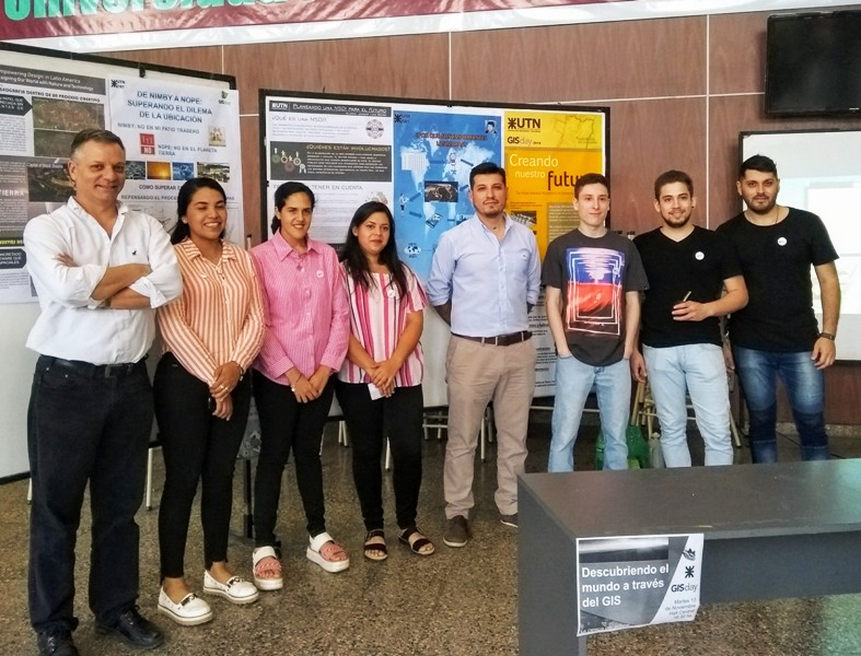
GIS Day celebration at UTN - the National Technological University in Tucumán, Argentina.
Professor Stacey Stark shared the event held at the University of Minnesota Duluth: They held a GIS Fest on campus, attended by 150 people, that included presentations, exhibits, and demonstrations covering a wide range of fields in topics such as GIS in elementary education, fighting the opioid epidemic, learning about mercury distribution in the St Louis River Estuary, solving problems at Minnesota Housing, spatial web services and applications, the future of the geospatial industry, drones, and more. Participants learned from university GIS student alumni, community partners and faculty as they share their work.
_sm.jpg)
One of the exhibits at GIS Fest at University of Minnesota Duluth.
Pakrad Balabanian shared an event in Armenia organized by his non-profit organization KARDÉS (which means maps in Armenian) in partnership with AGBU AVC (Armenian Virtual College) and in coordination with the Ministry of Education and Science of Republic of Armenia. It took place in the AGBU headquarters in Yerevan, Armenia. AGBU (Armenian General Benevolent Union) is the largest non-profit Armenian organization, established in 1906. The purposes of the event were to introduce the importance of GIS and maps to teachers of all levels, the importance of GIS in education and its link with STEM (Science Technology Engineering and Mathematics), present a pilot project of introducing GIS in 25 public schools, to get feedback from teachers about the subjects and topics to be used in the pilot, and to celebrate the GIS Day for the first time officially in Armenia.
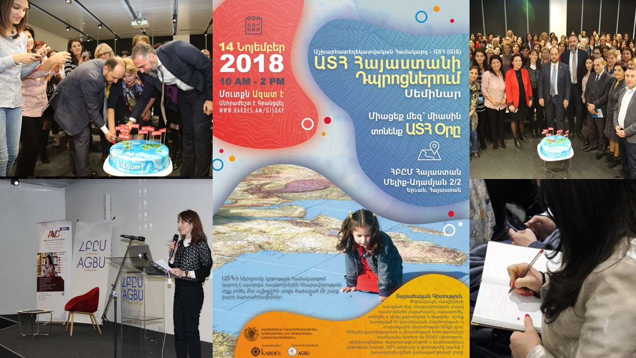
First ever GIS Day event in Armenia, focused on education.
Professor David Padgett shared the Tennessee State University and Morgan State University collaborative GIS Day events and forum. The collaborative GIS Day event included the following presentations, all live streamed: Maps of Black Folk: Geospatial Technologies in Professional Practice and Student Career Mapping, Mapping Southwest Asia and South Asia Climate Data using the ESRI Story Maps Platform", GIS Scoping Methods for Health Impact Assessments (HIAs) for Four Gulf Coast Environmental Justice Communities, student GIS project presentations, Geospatial Technologies in Professional Practice, Student Career Mapping in Geospatial Technologies, and using GLOBE Urban Heat Islands - Surface Temperature Field Campaign Data to develop a Research Question.
One of the activities (pictured below) was a GLOBE Atmosphere Protocol outdoor exercise at Stratford STEM Magnet High School. Pre-service teachers enrolled Dr Padgett's World Regional Geography course led Mr. Rodney Donaldson's 9th grade class in completing the data collection. Dr Padgett's students then did a data visualization converting the GLOBE data into map format using ArcGIS online. On GIS Day, Dr Padgett's students engaged in a live interactive discussion on the atmosphere data they collected and how it is symbolized on the map. At a later date we plan to give the 9th graders the opportunity to work with ArcGIS Online hands-on. This is a great example of university students and faculty working with K-12 students!
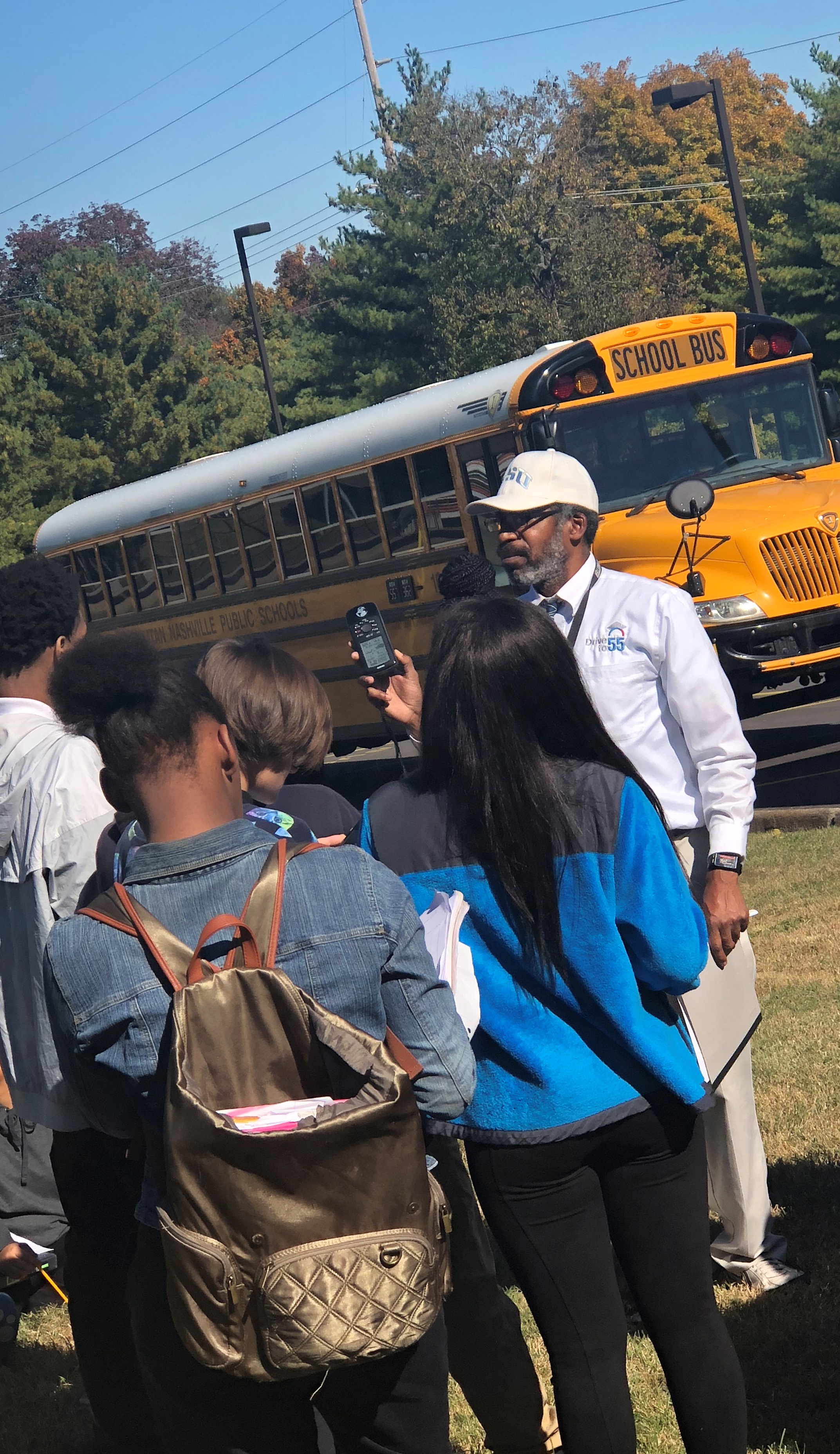
Dr David Padgett explains field data collection procedures to students in Tennessee.
Samuel Macedo shared their 2nd annual event at the Universidade Estadual de Santa Cruz, in Ilhéus, Brazil. The entire event can be seen on YouTube, including five presentations given during the day.
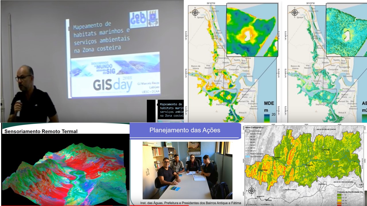
GIS Day events in Brazil.
Janaki Gattu, Manager at GeoSys Enterprise Solutions in India, shared this story: They held an event for employees who work on smart city projects, focusing on the role of GIS in the digital transformation of society focusing on the web GIS platform, on 17 November in Hyderabad. A video of the event touches on the highlights.
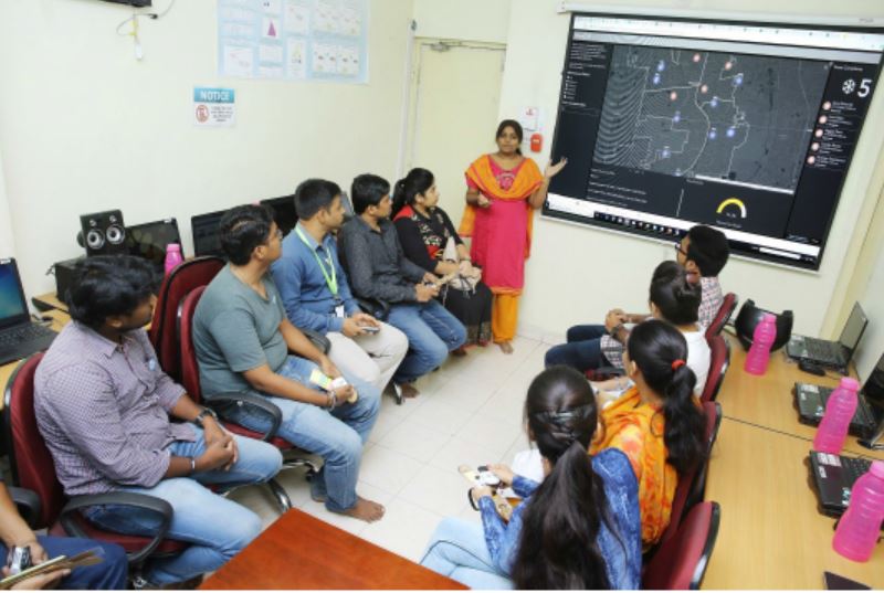
GIS Day event at GeoSys Enterprise Solutions in Hyderabad, India.
Hayleigh Conway, Geomatics Technician, Western Arctic Field Unit for Parks Canada, shared their story from way up in Inuvik Northwest Territories (NWT), Canada, where she, Celtie Ferguson from the Aurora Research Institute, William Woodley and Nanar Hakobyan from the NWT Centre for Geomatics, Alice Wilson from Environment and Natural Resources, and Annika Trimble, Garfield Giff, and Amir Zeb from the Aurora Research Institute organized a whole "Geo-Week". This included a 3-hour public event at Aurora College where members of the community visited tables highlighting research performed using GIS in the Mackenzie Delta region, including a scavenger hunt around town!
The next day, the organizers spent the day at East Three High School presenting to grades 7, 8, 9 and one grade 11 science class. This included topographic map work, a remote sensing activity, wildlife collars and telemetry to track caribou movements, and a demonstration of different GIS apps (including the Gwich’in Place Name and Story Atlas. Then over the following two days, they presented to all the grade 4, 5 and 6 classes (9 classes total) at the East Three Elementary School. Said Hayleigh, "It was bananas but a lot of fun." It included activities on a huge Canadian Geographic floor map of the Boreal Forest, learning about scale and legends and had some fun scavenger hunts looking for different cities and towns. Students also traced sections of a map of the Mackenzie Delta and put them all together to make a complete map.
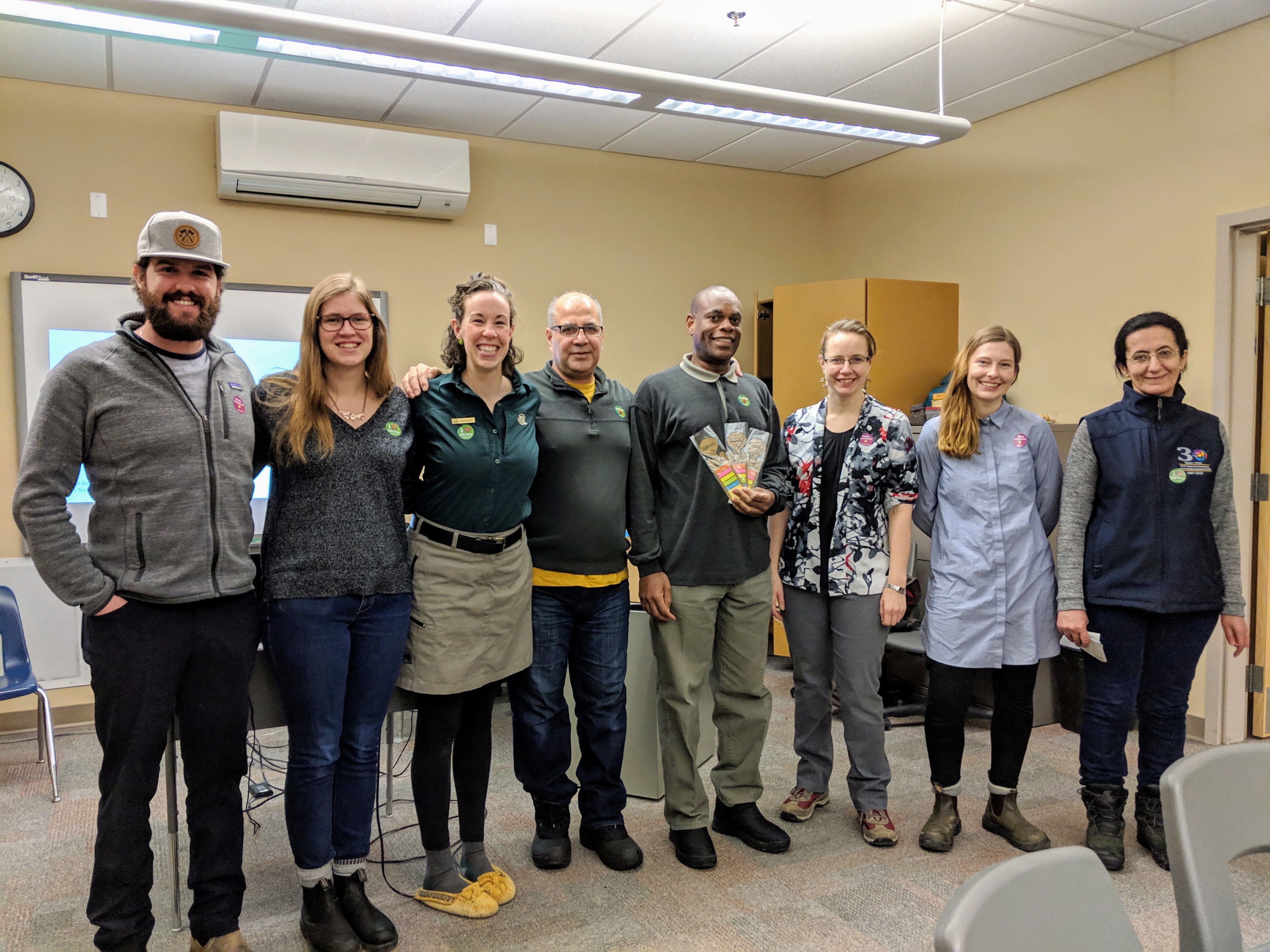
Team organizing the GIS Day event in Inuvik, Canada.
In Côte d'Ivoire, the Youth Mappers of the Centre Universitaire de Recherche et d'Application en Télédétection (Research Centre for Applied Remote Sensing) (CURAT) participated in GIS Day on 17 November 2018. It brought together students and professionals. This included a Mapathon on Abobo project task 4921, initiated by three main organizations: AidData, Development Gateway, the Ministry’s Direction de l'Informatique et de l'Information Sanitaire (DIIS), and USAID/CIV.
Presentations included those from Gerard Allali, GIS Engineer and working for a commercial company on various geospatial projects in Ivory Coast and Mali, and Nesit Abedje, GIS Consultant for an International Foundation. His main tasks are implementing the project OpenDCH is Ivory Coast and training Ivorian staff in the health area. Traoré Salim, GIS Analyst, Marius Guede, Geographer, and Chérif Aïdara, Data Analyst, also shared their experiences. Another professional (Kouakou Ulrich Franck) who is working for a telecommunication company shared his work with using big data and machine learning in spatial analysis.
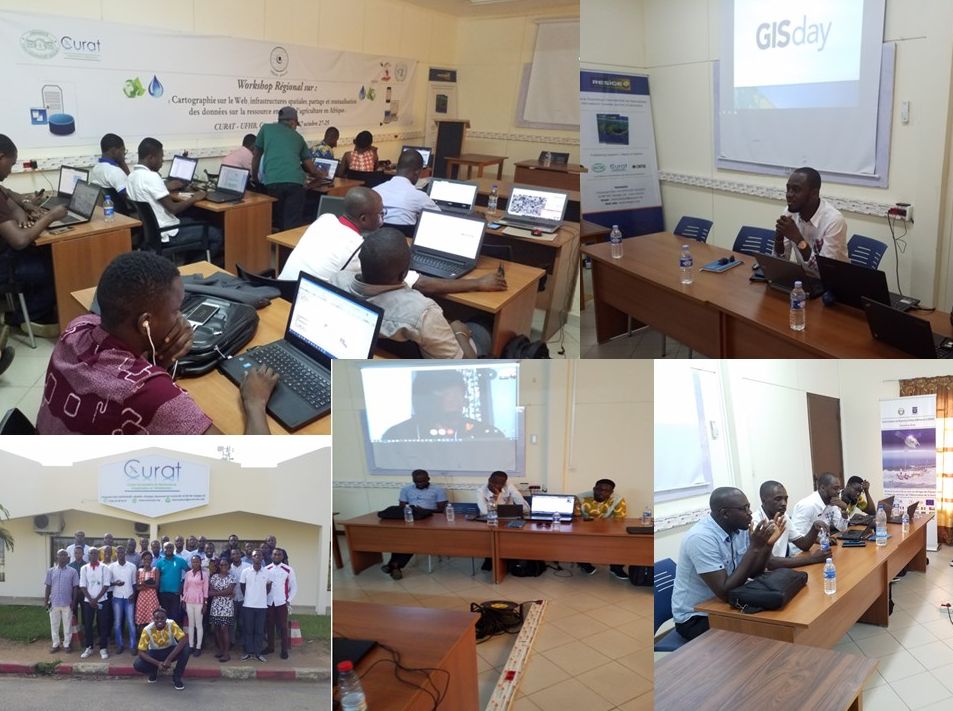
GIS Day activities from the Youth Mappers of CURAT - Centre Universitaire de Recherche et d'Application en Télédétection (Research Centre for Applied Remote Sensing) in the Côte d'Ivoire.
I participated in a GIS Day Live Chat on Friday 9 November. It was great fun, with more than 5,000 views and 95 comments between the GIS Day Live Chat guests and GeoNet members posting their questions. I salute my colleagues Nicole Minni from the University of Delaware, Luis Olivieri from Hopeworks, the GeoNet team, and all who participated, for making it a great success. Plus, the poster that my GeoNet colleagues put together made us look like we had recorded our own multi-platinum album!
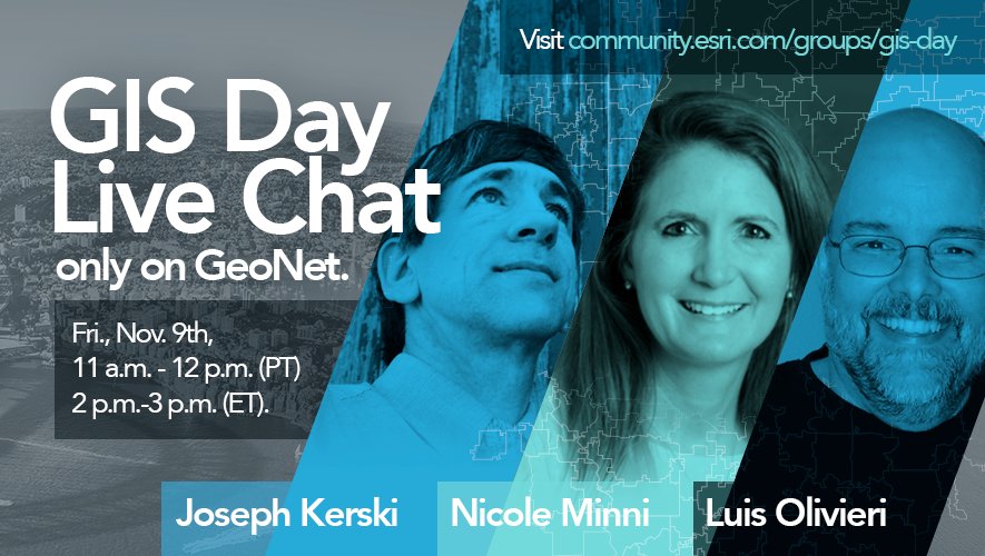
Live Chat GIS Day flyer.
Dr Patricia Carbajales-Dale from Clemson University shared their event, which included drones, Lidar, a mapathon, pizza, and cupcakes (pictured below).
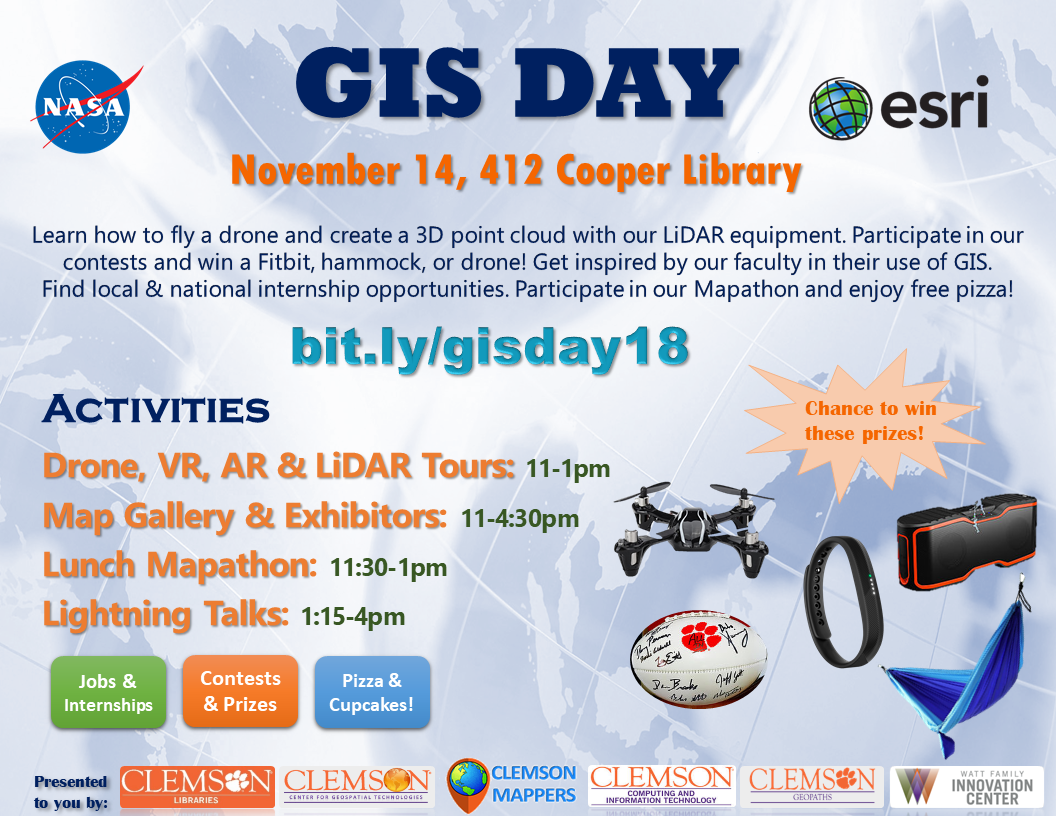
Clemson University GIS Day event flyer.
I also found it fascinating to read about the major event hosted by Esri France (with photos and videos included), incredible speakers that Stacy Curry-Johnson and her colleagues lined up for GIS Day at Vanderbilt University, what geography instructor Bob Lang at the King Edward VI Camp Hill School for Girls did to celebrate GIS Day, as seen in his story map, and the innovative quiz that the Port of Tacoma put together in their story map of ports around the world.
Last but not least for this GeoNet post, Janet Reyes, Geospatial Information Librarian at the University of California Riverside, shared their GIS Day event, which included a poster contest, presentations on Mapping Wildfires in Mediterranean Ecosystems in California (quite appropriate given recent events), the use of GIS in the “Along the Chaparral: Memorializing the Enshrined” project, a Web-based GIS Application for Longitudinal Neighborhood Analysis, Modeling Neighborhoods Through Time and Space with the Open Source Neighborhood Analysis Package, and on GIS in Local Government. Janet also reported that her GIS Day table received a visit from Scotty the Bear, the UCR mascot!
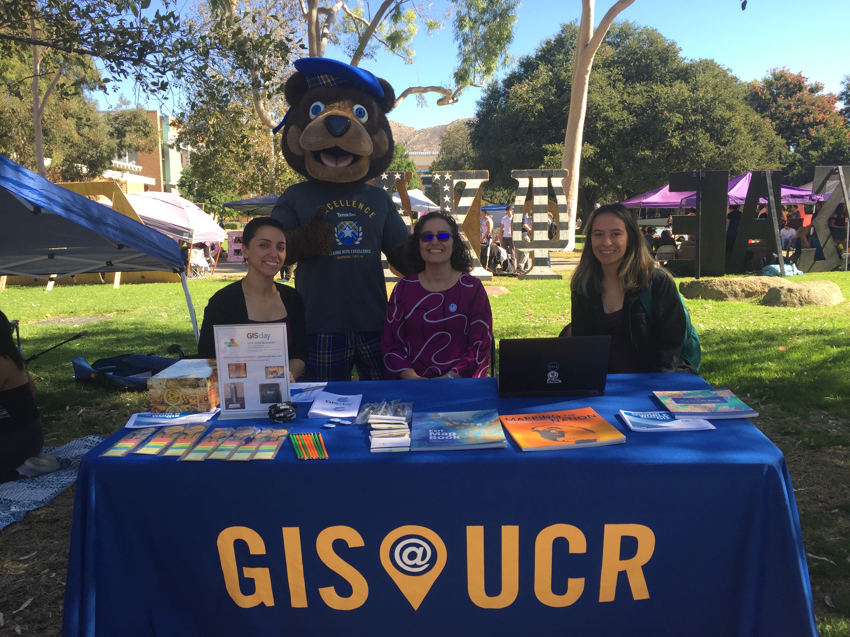
GIS Day table at the University of California Riverside receives a visit from the university mascot, Scotty the Bear!
You must be a registered user to add a comment. If you've already registered, sign in. Otherwise, register and sign in.