Turn on suggestions
Auto-suggest helps you quickly narrow down your search results by suggesting possible matches as you type.
Cancel
- Home
- :
- All Communities
- :
- User Groups
- :
- GeoMentors
- :
- Blog
- :
- May 2019 GeoMentor Spotlight - Michael Timm
May 2019 GeoMentor Spotlight - Michael Timm
Subscribe
961
0
05-28-2019 07:50 AM
- Subscribe to RSS Feed
- Mark as New
- Mark as Read
- Bookmark
- Subscribe
- Printer Friendly Page
- Report Inappropriate Content
05-28-2019
07:50 AM
Each month we feature GeoMentor volunteers to showcase the wonderful talent available in our community to assist K-12 schools.
Read our full collection of GeoMentor spotlights online. Want to be featured? Information is available on our program website.
Name: Michael Timm
Position/Job and Affiliation: Milwaukee Water Stories Program Manager for the nonprofit Reflo Sustainable Water Solutions
What was your favorite class in K-12? Calculus with Mr. Glyzewski.
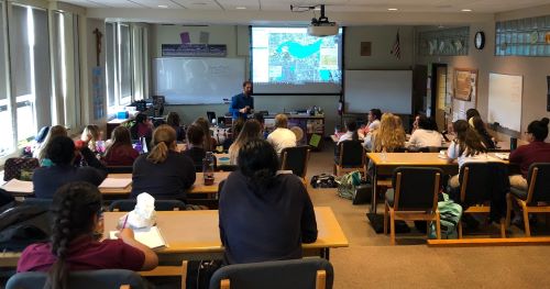
How did you first learn about and/or use GIS? Coming out of grad school at the UW-Milwaukee School of Freshwater Sciences, I was briefly involved in a project that was to map green infrastructure opportunities across the City of Milwaukee. This project led to connecting with Reflo, where my role is to curate the Milwaukee Community Map. It's a free resource using the power of Google Earth to share local water stories and open up new ways for public audiences to explore our city and its relationship to water.

Name one thing you love about GIS and/or geography (I know, just one!): I love visualizing historic changes to the landscape. When I studied archaeology as an undergrad, I came to a simple yet profound realization that humans have literally shaped the landscape that surrounds us. The same is true for what I've dubbed our "waterscape." Historic map overlays in Google Earth allow us to dramatically toggle between views of what was, what is, and what could be in ways that were exponentially more difficult to visualize when I was a kid. Watching the Eames' 1977 video "Powers of Ten" was amazing even in the early 2000s. Now we take this zoomability between scales for granted every day. It's amazing.
Why did you want to volunteer as a GeoMentor? I wanted to help share the story of the free Milwaukee Community Map in Google Earth because our team is moving into a phase where the collection of stories and data available through the map is really quite robust--call it a digital pocketknife--AND we're adding new dynamic video content including what we call "Deeper Dives." I work with K-12 educators in the Milwaukee area and am excited about sharing this resource in ways that are meaningful for educators to inspire the next generation. Of course, folks outside our area may find the tool valuable as well--both as a model for how to leverage existing digital platforms to empower local groups around publicly accessible GIS data, AND as a compelling portrait of the ways so many entities in Milwaukee are leading the charge to transform the urban stormwater challenge faced by many metropolitan areas into a triple-bottom-line asset by integrating green infrastructure into the cultural fabric of our "Water-Centric City."
What kind of GeoMentor volunteer opportunity and experience are you looking for? I am open to sharing the Milwaukee Community Map with anyone, but particularly educators. We hope to organize some more free workshops over the coming year. Motivated educators and the map-curious can feel free to email me!
If someone asked you why they should learn about GIS and/or geography, how would you respond in one sentence? Learning geography opens up a hidden world of understanding relationships between wholes and parts that enriches our experience of place and empowers strategic and tactical decisions great and small.
Email address: michaelalantimm@yahoo.com
Website(s) http://refloh2o.com/milwaukee-community-map; https://www.linkedin.com/in/michael-timm-bb805096; http://www.matimm.com/
Twitter: @platypusfound
You must be a registered user to add a comment. If you've already registered, sign in. Otherwise, register and sign in.
About the Author
Senior Research Geographer with the Association of American Geographers; Map Nerd