- Home
- :
- All Communities
- :
- User Groups
- :
- GeoMentors
- :
- Blog
- :
- GeoMentor Case Study: Scott Freburg (Minnesota)
GeoMentor Case Study: Scott Freburg (Minnesota)
- Subscribe to RSS Feed
- Mark as New
- Mark as Read
- Bookmark
- Subscribe
- Printer Friendly Page
- Report Inappropriate Content
GeoMentor case studies document successful GeoMentoring engagements that not only show us how we can improve the program by learning from our GeoMentors' experiences, but also inspire and encourage other GeoMentors in their efforts! Check out our growing case study library to learn the different ways GeoMentors are working with the K-12 education community throughout the US. If you're interested in submitting your GeoMentor experience for a case study, we would appreciate you doing so through this survey.

Scott Freburg
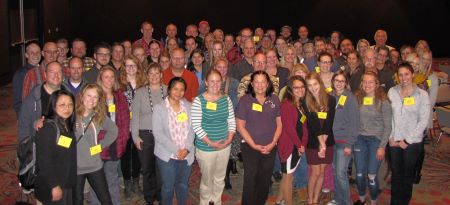
Working in partnership with the Minnesota GIS/LIS Consortium, Minnesota Department of Education, Minnesota Geospatial Information Office, and the Minnesota Alliance for Geographic Education
City/State of School, School District, or Group: Workshops, training and geomentoring in over 200 school districts,43 charter schools and 50+ non-publics in Minnesota between 2014 and 2019. A continuing program to equip K12 teachers with GIS education, mentoring and support.
Grade level of students you or your educator collaborator work/worked with: K12 teachers in grades 2-12 were represented. We developed workshops and training for 790+ K12 teachers through face-to-face meetings and training. These teachers mainly represented middle and high school curriculum, but we have had over 40 elementary teachers get engaged. This training and mentoring has resulted in Minnesota winning the last two National Map Competition contests at the high school level and 30 winners of our State's Map Competition for middle and high school students over the past three years.
Subject/topic of class/group you assisted your collaborator with: All topics, mainly Science and Geography/History, but including agriculture, math, reading and literature.
Approximately how many students were engaged in GIS activities through this collaboration: Unknown ... but a lot! We have had over 400 students enter our three years of Minnesota on the Map GIS competitions. With 790+ teachers we could be reaching somewhere between 5,000 and 10,000 students, or more, with some form of GIS education.

How did you connect with your collaborator? We connect through email and phone to Scott Freburg at MDE, through our workshops, training and Educator Day series and through AAG geo-mentor signups and State of Minnesota geomentor invitations.
Describe your collaboration process. Our geo-mentoring program is on-going and multiplying annually. We have about 45 teacher-mentor relationships right now and hoping to grow that substantially. Some of these relationships are ever-growing resulting in long term growth.
Describe the tasks you assisted your collaborator with. Everything from visiting classrooms to helping students with their Map Competition story maps to helping teachers find, and bring in data to ArcGIS. Almost any GIS geospatial activity has been rendered to teachers through our geomentor relationships.
What available resources, if any, did you use or help your collaborator use to implement GIS in K-12 education? We have definitely used resources from the GeoMentors website. We have also utilized Esri grants, GIS/LIS funding and curriculum including geoinquiries, story maps, spatial analysis, survey123 and collector.
Did you develop any new educational materials or GIS activities through your collaboration? We are working on a set of Minnesota based geoinquiries. The URL below points to a few of the GIs that are being developed. The Shipwrecks geoinquiry was the first one has been showcased and utilized in multiple workshops and teacher mentoring. Later this year we should have 6-7 additional geoinquiries based solely on Minnesota data.
http://umn.maps.arcgis.com/apps/MinimalGallery/index.html?appid=4b2176a8beb842d493a3c762b65e0b54

What did you gain from the experience? What do you think your educator collaborator and/or the students gained? Working with teachers and students to help them gain GIS knowledge and develop spatial thinking skills is the best thing I have done in my 30 years in GIS. Helping formulate and develop these trainings and geomentoring relationships and then hearing of success stories ... Priceless!
At some point in the future all of this and much more will be showcased on our Minnesota Geospatial website. This will be an all-in-one website for K12 teachers. It will hold videos, training, curriculum, data and will continually evolve. The website is www.mngiseducation.org. For now it is more of a holding place but by this time in 2020 we expect it to be up and running with tons of K12 information.
Any additional comments about your experience? Without the collaboration of so many organizations and GIS professionals around the state, this would not be possible. Minnesota is known for its rich GIS history and our entrance into the K12 world has been nothing short of incredible. Minnesota is proud to be a leader in GIS and in helping K12 teachers and students become more spatially educated.
Questions can be sent to Scott Freburg, scott.freburg@state.mn.us
You must be a registered user to add a comment. If you've already registered, sign in. Otherwise, register and sign in.