- Home
- :
- All Communities
- :
- User Groups
- :
- GeoMentors
- :
- Blog
- :
- Washington-Lee High School: Geospatial Tools and T...
Washington-Lee High School: Geospatial Tools and Techniques in GIS Project Presentations
- Subscribe to RSS Feed
- Mark as New
- Mark as Read
- Bookmark
- Subscribe
- Printer Friendly Page
- Report Inappropriate Content
On Tuesday, May 19, 2015, the students of Ryan Miller’s Geospatial Tools and Techniques in GIS gathered to present their final projects in the auditorium of Washington-Lee High School in Arlington, Virginia. The course is a collaboration between Washington-Lee High School and James Madison University where students who take the course have the chance to earn six credits in GIS at JMU. The students in the course had worked over the course of the year to master the basics of using ArcGIS and learning how to manipulate and analyze geospatial data.
During the second semester of the year-long course students devoted much of their time to working on individual final projects. Ryan Miller, through collaboration with various organizations and government agencies such as the U.S. Fish and Wildlife Service and the United States Department of Agriculture, was able to present the students with a wide range of potential projects to complete which would showcase how GIS can be used to solve real-world problems. The organizations would present the students with an issue that needed to be visualized and the data to analyze while working with both the student and their teacher in order to solve the problem at hand. By having the students collaborate with both their teacher and a third party, the students were given a glimpse into how someone in the field would use GIS and what their work might consist of.
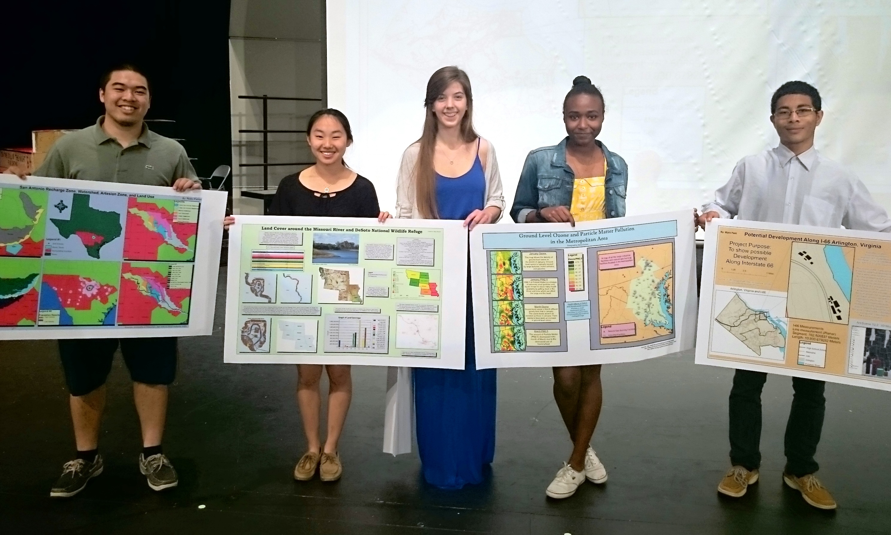
From Left to Right: Nicko Patron, Maya Wheeler, Abigail Stengle, Noha Osman, Bipir Pant
The projects the students presented focused on topics ranging from mapping air pollution in Idaho to the relationship between monarchs and milkweed in the Corn Belt. The students demonstrated a wide variety of techniques and skills in their maps, showing that they can do everything from using buffering and clipping tools, to effectively importing their maps to ArcGIS Online.
Some examples of student work in the form of both posters and links to Esri Storymaps can be found here.
A highlight of the presentations was the fact that many of the people and organizations that the students collaborated with came to Washington-Lee to see the presentations and to meet the students in person. This meant that the students who worked on projects using data from the state of Idaho were given a chance to meet and talk about their projects with a representative from the Office of Senator James Risch, and students who were working with data provided by the U.S. Fish and Wildlife Service were given a chance to meet Ron Salz, the Chief Cartographer for that organization.
It was clear that the students walked away from the presentations and the course with an understanding not only of how to use GIS as a computer program, but with an understanding of how GIS can be used in a tangible, real-world way to solve problems and to connect with others both personally and professionally.
For more information about this course, please contact Ryan Miller, Ed.S. at ryan.miller@apsva.us.
To see examples of the students' work, go here.
You must be a registered user to add a comment. If you've already registered, sign in. Otherwise, register and sign in.