- Home
- :
- All Communities
- :
- Products
- :
- ArcGIS Explorer
- :
- ArcGIS Explorer Blog
- :
- What's new in Explorer (May 2020)
What's new in Explorer (May 2020)
- Subscribe to RSS Feed
- Mark as New
- Mark as Read
- Bookmark
- Subscribe
- Printer Friendly Page
- Report Inappropriate Content
April showers bring May… Explorer updates? Yes! We have some new updates that we want to share with you. We recently released updates to our Windows and Android versions of Explorer. These releases were focused around improving feature parity across platforms as most of this functionality was already in the iOS version of the app. Let's take a look at a few of the updates:
Support for signing-in using PKI or Single Sign-On (SSO)
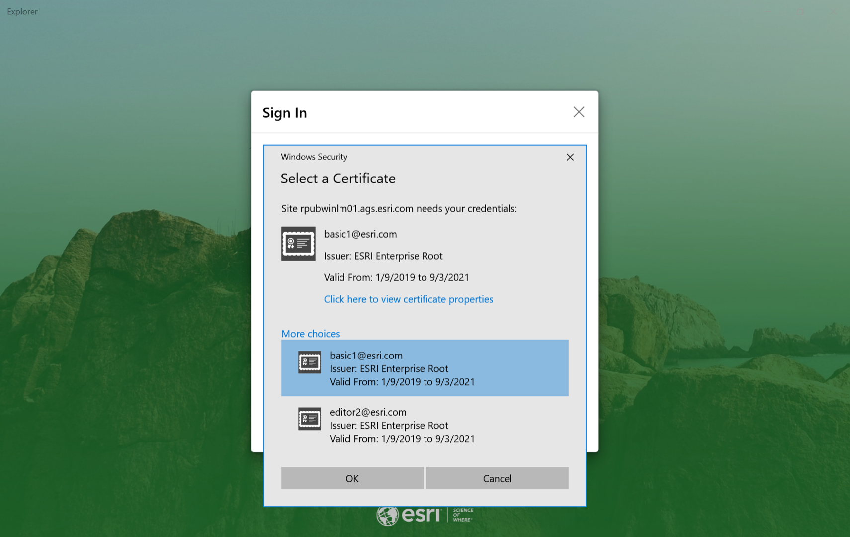
Many of our federal government users have been asking for Explorer to support PKI / smart card authentication – and now it does! When Explorer discovers that the ArcGIS Enterprise portal is using PKI, the user will be prompted to choose a certificate (.pfx). This feature is now available on Windows.
Note: smart-card authentication is not supported in the version of Explorer that is in the Microsoft store. Download and install Explorer directly from Esri for smart-card and multi-certificate support.
Support for on-device basemaps
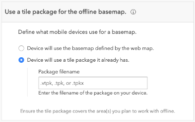
If you have high-resolution imagery or other very large basemaps you want to use with offline areas in web maps, you may want to load them directly onto your Windows device. This was previously only available on iOS and is now supported in Explorer on Windows and Android. Learn more about preparing maps for offline use.
Additional enhancements
- Mobile map packages support scheduled updates and honor expiration dates (Windows)
- Easily identify map areas that have been updated through scheduled updates (Windows)
- Improvements to related record workflows (Windows)
- Improved translations (Windows)
- Various bug fixes and improvements (Windows and Android)
Get Started Today!
Are you ready to do some exploring? If you haven’t already, download Explorer for ArcGIS on your Android, iOS, or Windows 10 device.
You must be a registered user to add a comment. If you've already registered, sign in. Otherwise, register and sign in.