Turn on suggestions
Auto-suggest helps you quickly narrow down your search results by suggesting possible matches as you type.
Cancel
Drones, UAVs, UAS, and RPAs
Whatever you call them - drones, unmanned aerial vehicles, unmanned aerial systems, remotely piloted aircraft systems, etc. - Use this group to ask questions or share experiences about using these robotic systems and sensors (imagery, video, and other sensors) in your geospatial projects. Note for general imagery topics not specific to drones, you may want to look at the Imagery and Remote Sensing place.
Turn on suggestions
Auto-suggest helps you quickly narrow down your search results by suggesting possible matches as you type.
- Home
- :
- User Groups
- :
- Drones, UAVs, UAS, and RPAs
Drones, UAVs, UAS, and RPAs
Group Activity
I'm using the DJI P4 Multispectral and trying to create process this imagery in ArcPro v2.8.3. Can I process this multispectral imagery using the Ortho Mapping Workspace? I'm having trouble, and the only options for multisensor systems seems to be RedEdge or Altum. If not, is there another way of creating stiched together layers for each spectral band?
... View more
2
0
Hello, I used a P4 Pro V2.0 to collect some aerial images. I need more information about the drone camera to create a drone imagery workspace in ArcGIS Pro 2.6. ArcGIS has the camera model in their database, but does not have the parameters. Please see attached screenshot for reference. I was unable to locate this information in the DJI user manual or on the DJI specifications page for the P4 Pro V2.0. I contacted DJI Support, no reply received yet. My question: can anyone please provide the 6 camera specifications identified below? Any guidance is appreciated. Thanks GeoNet!! UAS Product Information UAS Model: Phantom 4 Pro V2.0 Camera: FC6310S Camera specification information needed 1. Focal Length (mm) 2. Radial Coefficient K1 3. Radial Coefficient K2 4. Radial Coefficient K3 5. Tangential Coefficient P1 6. Tangential Coefficient P2
... View more
0
2
Hi, all! I'm using ArcMap 10.7.1 and FMV 1.4.1 on Windows 10. The Multiplexer works fine for me. And the output videos play perfectly within the FMV player. However, nothing other than the FMV player will read them. I get prompts to download codecs that then do not work, and/or media players just crash. Typically I'm asked to download an MPEG-2 codec or encoder. The Export Video Frames for Orthomosaic also does not recognize the output videos (I'm guessing). I get an error saying: Value cannot be null. Parameter name: source Failed to execute (ExtractVideoFramesForOrthomosaic) Is this a file type registration issue? Some other known issue? Thanks in advance.
... View more
0
2
Hi, I'm using a DJI Phantom Pro 4 to capture imagery which I then process in Drone2Map. I am trying to create an accurate orthomosaic using the images. While it looks good, it is off in terms of the accuracy of it. The image below shows my captured orthomaosaic against a 15cm accurate ortho we get from a vendor. As you can see, the road centrelines are off by about 2m. Is there a way to get better accuracy? Either through an enhancement to my drone, or through adjusting the settings in Drone2Map??
... View more
2
5
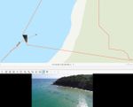
Hi there, Im using FMV with ArcGIS Pro 2.6.3. Got video footage from a DJI Phantom 4 using the SiteScan LE field app. Exported the flight log and multiplexed the video. Process seems to be ok and get the expected footprint: The issue Im having is when I try exporting frames. I only get a small triangular area instead of full extent: Tried changing ellipsoid elevation to match actual altitude from barometer (30 m) by adding 15 but found no difference. Here is a link to the original data and DEM: https://www.dropbox.com/sh/51kddkchar2a7qj/AAAtfH_uFtx5ADC9dxYCmITqa?dl=0 Any help is appreciated. cheers, Javier
... View more
0
2
Group Information
Drones, UAVs, UAS, and RPAs
Whatever you call them - drones, unmanned aerial vehicles, unmanned aerial systems, remotely piloted aircraft systems, etc. - Use this group to ask questions or share experiences about using these robotic systems and sensors (imagery, video, and other sensors) in your geospatial projects. Note for general imagery topics not specific to drones, you may want to look at the Imagery and Remote Sensing place.
27 members
Owned by CodyBenkelman
Open group
Created 08-11-2015
Members (27)
| User |
|---|
|
GustavodaSilvei
Esri
|
|
Jean_DavidDupui
Observer
|
|
JohnsonChan_Esr
Esri Contributor
|
|
TaylorBlose7
New Contributor
|
|
GordonSumerling
Esri Contributor
|

