- Home
- :
- All Communities
- :
- Products
- :
- Imagery and Remote Sensing
- :
- Imagery Blog
- :
- Site Scan - Limited Edition app provides drone fli...
Site Scan - Limited Edition app provides drone flight planning using your GIS content
- Subscribe to RSS Feed
- Mark as New
- Mark as Read
- Bookmark
- Subscribe
- Printer Friendly Page
- Report Inappropriate Content
Esri has released a free app for iOS that interfaces with ArcGIS Online, allowing Esri users to view GIS content from ArcGIS Online to assist with the drone flight planning. (This was originally developed by Esri business partner 3DR)
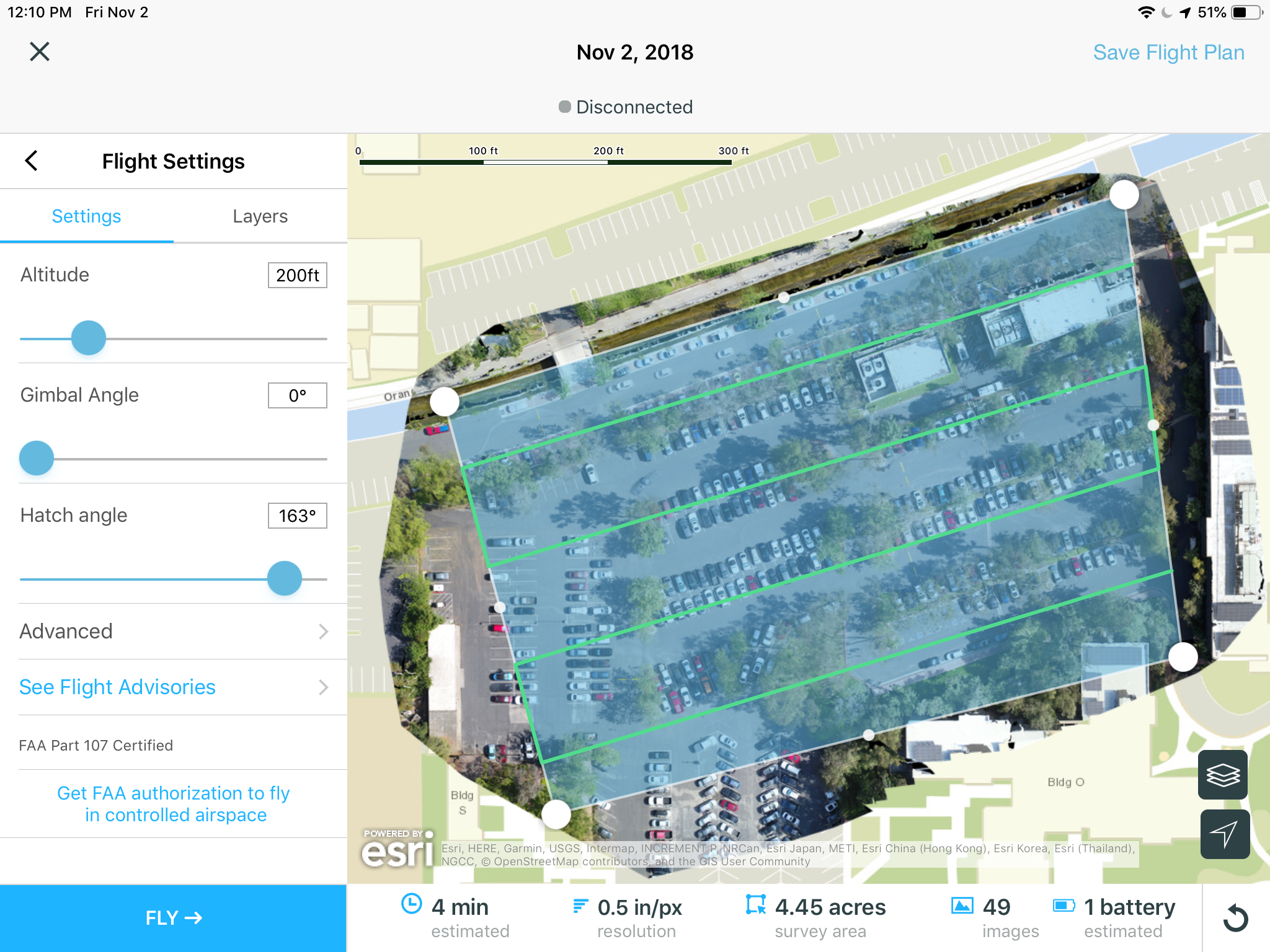
The Site Scan - Limited Edition app (formerly called "Site Scan - Esri Edition") provides mission planning and flight control for a number of leading drones to optimize drone collections for use in Drone2Map or Ortho Mapping in ArcGIS Pro. This release is compatible with the DJI Phantom 4 Pro, DJI M200, DJI M210, DJI Inspire 2, DJI Mavic Pro, or Yuneec H520-G, as well as the 3DR Solo.
The Site Scan - Limited Edition app allows users to take advantage of substantial amounts of publicly accessible data, as well as custom data layers from the user’s ArcGIS Online account, as base and reference data for mission planning.

Site Scan - Limited Edition is free to everyone with an ArcGIS Online account. The app is available on iTunes at http://esriurl.com/SSEE, and will be available soon via ArcGIS Apps.
Try it out!
Note that, as a free app, support for Site Scan - Limited Edition is based on Geonet: http://esriurl.com/SiteScanGeonet.
For the full cloud-based SIte Scan service, see http://esriurl.com/DroneCollections.
You must be a registered user to add a comment. If you've already registered, sign in. Otherwise, register and sign in.
-
Analysis
10 -
ArcGIS Drone2Map
3 -
ArcGIS Excalibur
1 -
ArcGIS Image Analyst
1 -
ArcGIS Image for ArcGIS Online
1 -
ArcGIS Pro
1 -
Change detection
1 -
Deep learning
4 -
Elevation and lidar
8 -
Image classification
1 -
Image management
2 -
Image Mapping
8 -
Image Services
3 -
Mosaic datasets
4 -
Motion imagery
10 -
Multidimensional
2 -
Oriented Imagery
2 -
Raster functions
4 -
Site Scan for ArcGIS
1 -
Visualization
9
- « Previous
- Next »