- Home
- :
- All Communities
- :
- Products
- :
- Imagery and Remote Sensing
- :
- Imagery Blog
- :
- Drone2Map for ArcGIS Version 1.3.2 now available!
Drone2Map for ArcGIS Version 1.3.2 now available!
- Subscribe to RSS Feed
- Mark as New
- Mark as Read
- Bookmark
- Subscribe
- Printer Friendly Page
- Report Inappropriate Content
Drone2Map for ArcGIS version 1.3.2 has been released today and is available for immediate download by all current and future users. For users connecting to ArcGIS Online, download and install the new version directly from the software, or download from http://www.esri.com/drone2map. All users, including those typically working in offline mode, are encouraged to download this new version.

This release of Drone2Map for ArcGIS is primarily focused on the following enhancements and bug fixes:
Enhancements
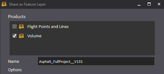
- Volumetric calculations can now be shared to ArcGIS Online or ArcGIS Enterprise through the share as feature layer tool.
- Decimal values in the contour interval field are now supported in all available language systems.
Fixes
- Always have success when creating orthomosaics. Additional camera models have been added to our camera database to greatly improve camera search options so that your orthomosaic gets completed.
- Vector basemap users will no longer experience project creation issues with the vector basemaps in their default basemap gallery.
- With improved camera support, the creation of NDVI (normalized difference vegetation index) layers will no longer be an issue (for appropriate multispectral cameras).
- You can now see spectral band metadata when viewing output data products in ArcGIS Pro.
- Users with the Dansk regional language pack will now have correct image altitudes for more than one layer.
Try the new version, and please let us know what you think! Drone2Map@esri.com
Cody Benkelman
Drone2Map for ArcGIS Product Manager
You must be a registered user to add a comment. If you've already registered, sign in. Otherwise, register and sign in.
-
Analysis
10 -
ArcGIS Drone2Map
3 -
ArcGIS Excalibur
1 -
ArcGIS Image Analyst
1 -
ArcGIS Image for ArcGIS Online
1 -
ArcGIS Pro
1 -
Change detection
1 -
Deep learning
4 -
Elevation and lidar
8 -
Image classification
1 -
Image management
2 -
Image Mapping
8 -
Image Services
3 -
Mosaic datasets
4 -
Motion imagery
10 -
Multidimensional
2 -
Oriented Imagery
2 -
Raster functions
4 -
Site Scan for ArcGIS
1 -
Visualization
9
- « Previous
- Next »