- Home
- :
- All Communities
- :
- User Groups
- :
- Conservation GIS
- :
- Blog
- :
- Sparrow Data Solutions Joins Esri Partner Ecosyste...
Sparrow Data Solutions Joins Esri Partner Ecosystem as a Silver business Partner
- Subscribe to RSS Feed
- Mark as New
- Mark as Read
- Bookmark
- Subscribe
- Printer Friendly Page
- Report Inappropriate Content
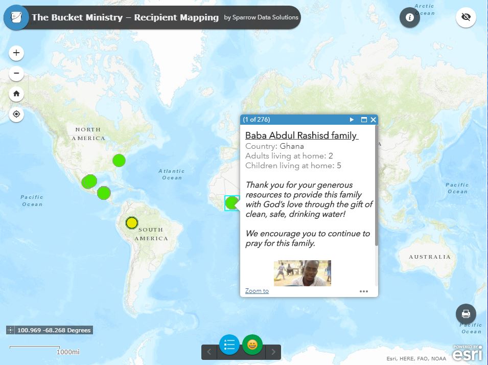
Great news from San Diego as Sparrow Data Solutions have announced that they are now an Esri Silver Business Partner. Sparrow specializes in working with the non-profit community to assist with GIS, mapping, and geospatial technology for such areas as monitoring the deployment of resources (like water filtration units in Africa) and they also assist in connecting the organization with donors to enable the donors to be more connected and have greater information and access to information about the cause they are helping with.
Sparrow launched in 2018 in order to help non-profit organizations collect, process, and report their work to current and potential donors using specialized GIS tools. “We recognized the growing desire of many donors to not only see where their investments are being used but also, to visualize the outcomes of their work. “Unfortunately small NGO’s sometimes struggle to access the same funding that larger NGO’s receive in order to do the critical task of Monitoring and Evaluating their work to show Sustainability. To help out we decided to create a company that can provide them with the same tools as larger NGO’s without having to hire full-time specialists.” (Martha Rodgers, co-founder, Sparrow Data)
Sparrow’s experience and flexible approach allow them to build a plan that helps non-profits effectively collect field data, make informed decisions based on the real-time state of their projects, and tell the organization’s story to potential donors. Noteworthy benefits Sparrow brings to customers:
- Help organizations track, manage and analyze data about the work you are doing.
- Show your impact – Quantify how your work is changing people’s lives with simple tools to set yourself apart.
- Helping donors feel connected – Show your donors how their gifts are being invested in real-time while protecting the recipient and field team’s privacy without adding work to your team.
- Manage Work – At a glance, know the state of your projects, what needs to be scheduled, and watch your teams work in real-time.
- Compile and visualize statistics in real time that allow you to see trends and make informed decisions.
- Tell your story visually – Personalized and interactive storyboards (Story Maps) that walk people through what your organization is striving to accomplish and how successful you are.
- Help you build an Impact Statement that your donors will never forget
How Sparrow can leverage our ESRI partnership to meet your needs:
- Web mapping with ArcGIS Online
- Field data collection with Survey123
- Data management, analysis and processing with ArcGIS Pro
- Maps for your website with Story Maps
- More!
You can learn more about Sparrow at Monitoring and Evaluation Consultants | Sparrow Data Solutions and on Twitter @SparrowData
You must be a registered user to add a comment. If you've already registered, sign in. Otherwise, register and sign in.