- Home
- :
- All Communities
- :
- Products
- :
- ArcGIS Maritime
- :
- ArcGIS Maritime Blog
- :
- UK Shipping Forecast Areas and Maps available on L...
UK Shipping Forecast Areas and Maps available on Living Atlas
- Subscribe to RSS Feed
- Mark as New
- Mark as Read
- Bookmark
- Subscribe
- Printer Friendly Page
- Report Inappropriate Content
UK Shipping Forecast Areas are now available on Living Atlas.
The UK shipping forecast has been in service since 1867, originally created to warn of storms it is now a comprehensive forecast published daily by the MET Office in conjunction with the Maritime and Coastguard Agency. You can hear it on BBC Radio 4 daily.
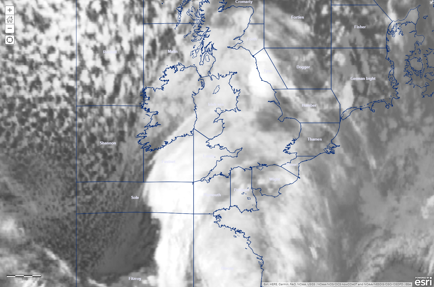
The UK shipping forecast boundaries and areas are published as fully accessible data which you can download and use offline or in your own web mapping. The boundaries and areas have been derived from the MET Office publication fact sheet 8, which designates the coordinate of each forecast area.
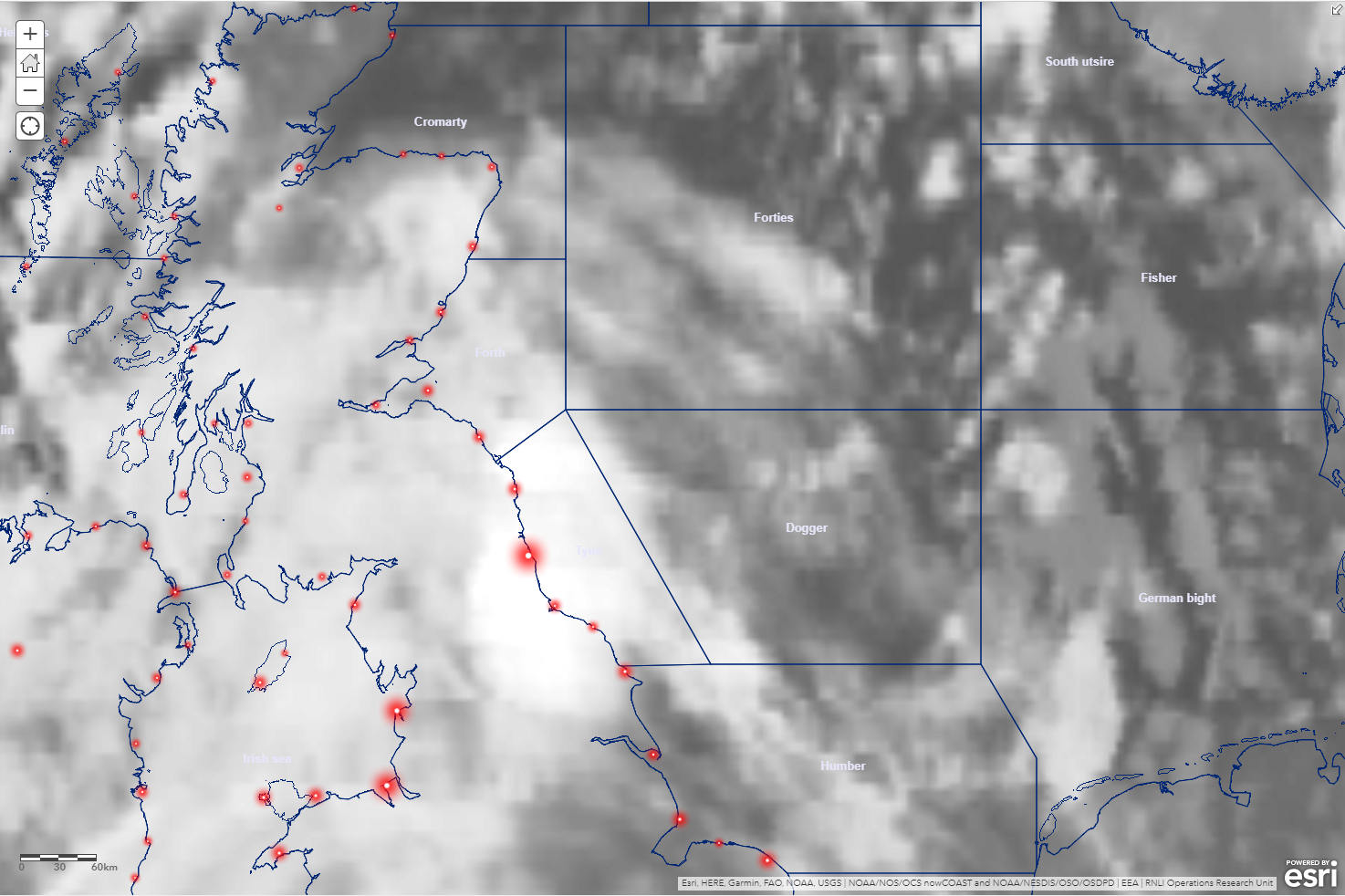
The web map has incorporated other layers available on Living Atlas including GOES weather satellite imagery, enabling visualisation of the weather for forecast areas, as well as location information of the Royal National Lifeboat Institution (RNLI) fleet in the United Kingdom and the Republic of Ireland.
You must be a registered user to add a comment. If you've already registered, sign in. Otherwise, register and sign in.