- Home
- :
- All Communities
- :
- User Groups
- :
- Conservation GIS
- :
- Documents
- :
- Francis Ordoñez, Ecuador
- Subscribe to RSS Feed
- Mark as New
- Mark as Read
- Bookmark
- Subscribe
- Printer Friendly Page
- Report Inappropriate Content
Francis Ordoñez, Ecuador
Francis Ordoñez, Ecuador
Francis Gabriela Ordóñez-Bermúdes, WCS Ecuador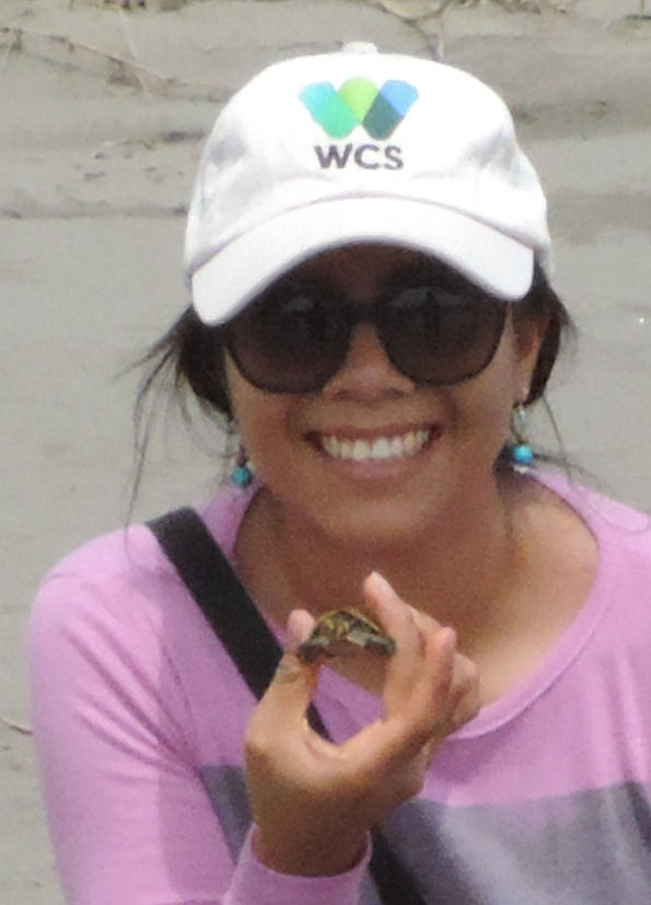
Organization Web site: https://ecuador.wcs.org/en-us/
Main email WCS Ecuador Profile Linkedin Profile
x2020 x2020Scholar x2020Talk xWildlife xEducation xLandscape xPark xReserve xLatin America xEcuador
The WCS Ecuador Program was officially registered by the Ecuadorian government in 2001. Since our foundation, we have worked to conserve wildlife and habitat in the Yasuní Landscape in partnership with indigenous organizations, local government authorities, and Ecuador's Ministry of the Environment (MAE). In 2014, we began expanding our work to the Llanganates landscape. WCS’s team of biologists, geographers, ecologists, resource managers, anthropologists, and communicators have carried out diverse projects in the region, involving elements of applied scientific research, wildlife management, institutional strengthening, capacity building, and environmental education. Our conservation strategy is based on identifying critical conservation problems and developing science-based and community-driven solutions that benefit natural landscapes, wildlife, and human populations. WCS Ecuador has long collaborated with local communities in developing new management strategies to improve their living conditions without threatening the integrity of the natural ecosystems in which they live.
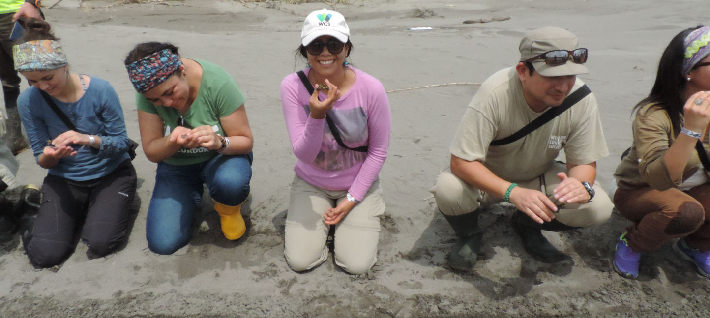
I have been at WCS for four years. I am part of the GIS team in the Landscape Ecology Department. I work in analyzing and modeling social and biological landscapes for our main study area. First, I worked in a mitigation project, I had to determine the current environmental state of Yasuní Biosphere Reserve, and delimitate priority zones for conservation, I did all the work with spatial information. We have the opportunity to work with the environmental ministry and we demonstrated the indirect impacts of road construction in zones with high levels of biodiversity. My maps helped to demonstrate the impacts in land use change, under different scenarios of land-use planning. Now, I am working in an update of the human activities threats map for Yasuní Biosphere Reserve, so I have had to investigate and collect field data for the most important human activities inside the reserve, and map the intensity and extension of these activities.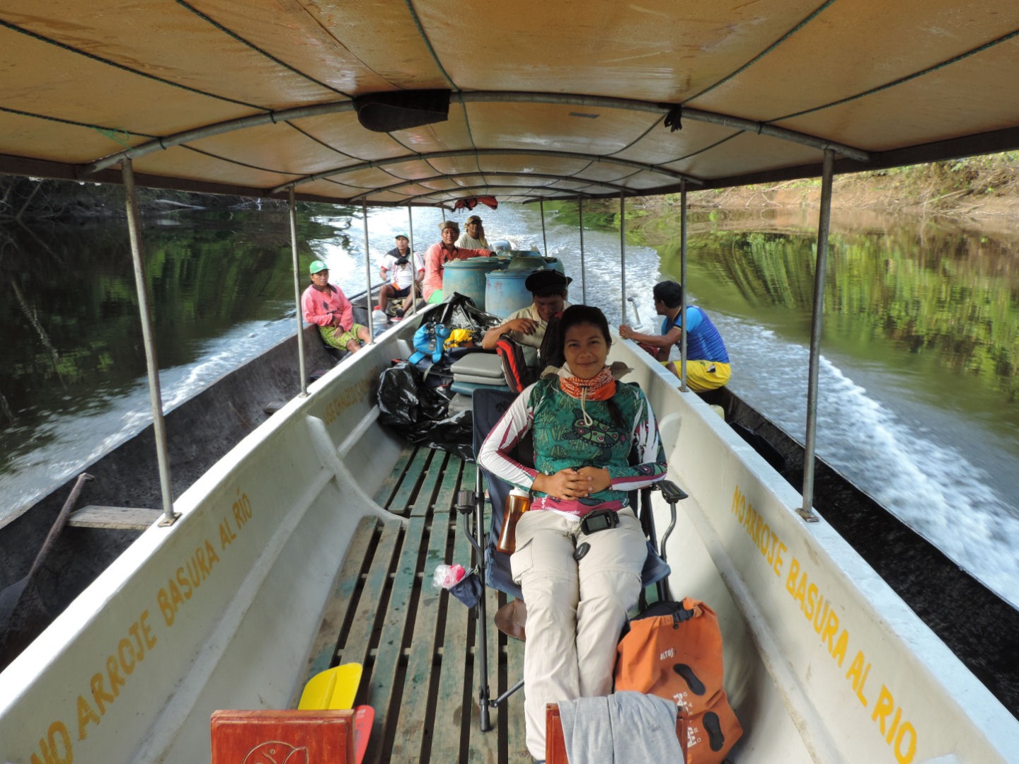
History: My interest in conservation was the main reason I studied geography. Being a geographer has gave me the opportunity to see the world. I want to understand where, why and how natural and anthropic phenomena occur. I want to analyze the interrelation of different elements in the landscape, and how they are modified. Sometimes, this interrelation is not visible, so you need to analyze this issue in a holistic way. Technologies develop very quickly, and GIS is no exception. In terms of conservation there is still a lot to do, and I think that with the right technology and supplies available, research can be carried out to help keep our ecosystems and habitats healthy, and therefore for the species that inhabit them.
EXAMPLE MAPPING WORK #1
I think it is important to take advantage of spatial inputs to make public policies at the local and global level. I am passionate about my work, and I am sure I can generate input for making better decisions for my country. In Ecuador, we still have ecosystems in good condition that are under constant human pressure; and if a good decision is not made on time, this situation could change.
Connection to the local SCGIS chapter: My college Diana Paredes is a member of SCGIS, and she attended SCGIS last year. I attended the 2019 SCGIS Conference too. I am an active member. Now we are working with story maps, and we want to do GIS trainings and push the use of GIS in Ecuador.
Teaching & Leadership: Five years ago, I worked for a non-profit conservation organization called EcoFondo. There I had the chance to give basic ArcGis classes to people from local governments This was planned as a one-week course with approximately 10 students, in rural areas of the Amazon. It was a very rewarding experience because they were happy with theirs maps and had many ideas of what they could do in their daily work. Even now, I have calls from the participants wondering how to do certain things. Inside WCS, we also gave a short course for our biologist colleagues.

What is the most unique and the most challenging about the conservation/GIS work that you do? Working in one of the most biodiverse countries on the planet has its advantages and disadvantages. We still have much to discover and investigate in this area, we do not know much about the state of conservation of some habitats, neither about human impacts on ecosystem services, such as hunting, selective logging and deforestation, and we can only make assumptions. It is also difficult to find updated quality geographic information. For example, large areas, most of the time, are cloudy, so obtaining satellite images without clouds is a challenge, and then processing them is even a bigger challenge, because of the high haze content in the image. In spite of all this, Yasuni National Park is a site that has a great biological and economic interest for the country, because there are untapped oil reserves, and threats from human activities are present at all levels.
For us it is important to point out the impacts of human activities have on wildlife and how these actions can be stopped by better policies, like having improved control and surveillance programs.
EXAMPLE MAPPING WORK #2:
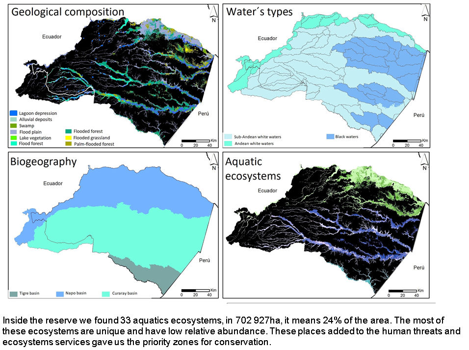
2020 Conference paper Title: “Aquatic ecosystems as an input in the evaluation of the conservation status of Yasuní Biosphere Reserve.”
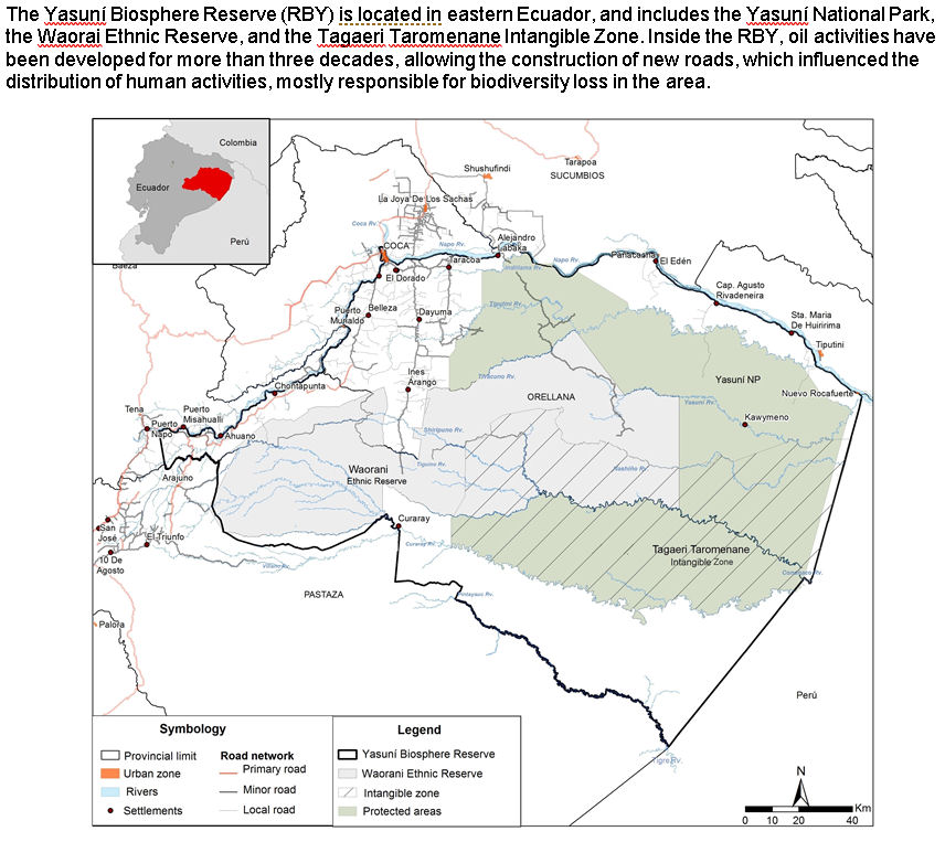
2020 Abstract/summary Yasuní Biosphere Reserve (RBY) is located in eastern Ecuador, and includes Yasuní National Park, the Waorai Ethnic Reserve, and the Tagaeri Taromenane Intangible Zone. Inside the RBY, oil activities have been developed for more than three decades, allowing the construction of new roads, which have influenced the distribution of human activities, most of them responsible for biodiversity loss in the area.
Between 2016 and 2017, WCS Ecuador implemented the project: Balancing conservation priorities and development needs inside Yasuní Biosphere Reserve. The main objectives of this project were: to evaluate the conservation status, and define priority zones considering terrestrial and aquatic ecosystems. We used official information for terrestrial ecosystems, but we didn’t have data on aquatics ecosystems, which are important in this area. So, we developed a methodology to cover this information gap. We delimited the areas that had similar characteristic like geographical location, water types, geological composition and if there were any wetland zones. This classification was updated with official ecosystems information, and then we generated specific ecosystems for different types of vegetation, place and hydrological characteristics. We used secondary information and expert knowledge as inputs, so field verification is necessary.
Inside the reserve, we found 33 aquatics ecosystems, covering 702 927 ha, 24% of the area. Most of these ecosystems are unique and have a low relative abundance. This layer overlapped with information from human threats, helped us identify priority areas for conservation. This methodology is simple and it could be applied to ecosystems in the country, it will generate information about sensible ecosystems which could be integrate to land use plans.
2019 Scgis Conference Abstract: Session: Conservation And Development Impact Issues
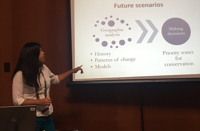
“Future Change Scenarios Associated to Road Construction in Eastern Ecuador “
Francis Ordonez, Wildlife Conservation
The Yasuní Biosphere Reserve (RBY) is located in eastern Ecuador. Inside the RBY, oil activities have been developed for more than three decades, allowing the construction of new roads, which influenced the distribution of human activities, mostly responsible for biodiversity loss in the area. We generated road infrastructure development models based in the study of Soares-Filho et al. (2004). This study analyzed the spatial increase in the areas of influence of hunting, deforestation and selective logging caused by indirect impact on the ecosystems of the RBY due to the increase in road infrastructure. We proposed two scenarios: a best-case scenario with restricted access and limited use of the road; and a worst-case scenario, where we used a high transition matrix that increased the probability of deforestation, and colonization rates along the roads. We used information of land cover maps from 1990 to 2008, road network information from 1996 to 2015, and the attraction and friction map, considering costs and efforts of mobilization to the oil fields. We generated road development scenarios and two land change projections for 2030. Our results provide decision-makers with spatial analysis tools and information to measure the magnitude of the potential negative impacts of road development planning, or lack thereof, in their territories; and the need for timely actions and interventions to reduce these impacts, with the participation of all relevant actors.
2019 Scgis Conference Presentation FULL PRESENTATION & FILM

-
 Anonymous User