- Home
- :
- All Communities
- :
- User Groups
- :
- Conservation GIS
- :
- Documents
- :
- Dean Walton, Univ of Oregon
- Subscribe to RSS Feed
- Mark as New
- Mark as Read
- Bookmark
- Subscribe
- Printer Friendly Page
- Report Inappropriate Content
Dean Walton, Univ of Oregon
Dean Walton, Univ of Oregon
Dean Walton, PhD Lory I. Lokey Science and Technology Outreach / Associate Professor at University of Oregon
https://www.linkedin.com/in/dean-p-walton-x/
https://twitter.com/deywalt?lang=en
https://www.inaturalist.org/observations?place_id=any&user_id=deanwalton
http://uoregon.academia.edu/DeanWalton
University of Oregon, University Libraries & Faculty Member
I am an information specialist and an environmental scientist and hold the Lorry I. Lokey Endowed Chair within the Price Science Commons at the university. My interests are from the perspective of science and technology educator and cover natural history, natural disasters, biology, geology, chemistry, environmental science,natural history and toxicology. I have a strong fondness for GIS and mapping vegetation as well as for keying out sedges and lichens.
I worked on my first digital map using ArcINFO and a Sun workstation back in 1993 at the Smithsonian's Zoological Research Center in Front Royal, Virginia. At the time, Doug Muchoney was the director of GIS and my mentor. It was an exciting time to work with the research center and with The Nature Conservancy on their Smoke Hole project in West Virginia. From that that first digitized line, I was hooked on GIS and it has now been part of my job for the last 25 years.
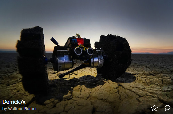
I research and promote identified technologies that further the goals of the university community, and recently chaired the emerging technologies working group within the UO Price Science Commons. Additionally, I oversee running of the Price Science Commons Visualization Lab and DeArmond Makerspace with supervision of 0.50 FTE, and two students. My current projects all involve getting students to use new technologies and include GIS, acquiring remotely sensed data, using drones to create 3D landscape models, converting 3D landscape models to holographic images for viewing on Microsoft HoloLens, and building sensor systems and small autonomously navigating robots to collect environmental data.
(Years: nt17 nt18 nt19 cp13 cp14 cf 15 cf16 cf17 cf18 cf19)
Detailed CV
https://library.uoregon.edu/sites/default/files/cv/dean_walton_april_2018_cv.pdf
PROFESSIONAL MEMBERSHIP AND SERVICE
National Science Teachers Association, 1990-present (with interruptions)
Oregon Academy of Science, 2006-present, Webmaster, 2013-present, OAS Annual Meeting Planning Committee and Proceedings Editor, 2013-present o Education Co-Chair, 2012-present
Society for Conservation GIS, 2012-present, Conference Planning Committee, 2016-present
Dean Walton’s Online Research Guides for Biology, Environmental Studies and more
http://researchguides.uoregon.edu/prf.php?account_id=36539
https://blogs.uoregon.edu/scitechoutreach/
Accessing Satellite Imagery – A Primer on Remote Sensing
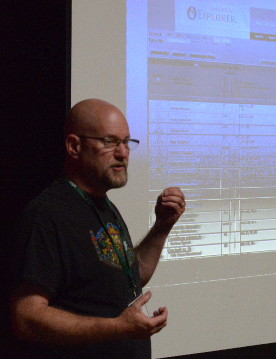
Today, I had a blast giving a workshop on acquiring and analyzing remotely sensed (satellite) imagery as it relates to marine and coastal research that is ongoing at the Oregon Institute of Marine Biology...
PHOTOGRAPHER:
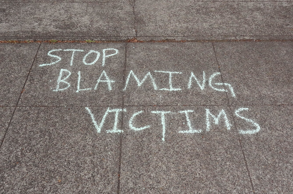
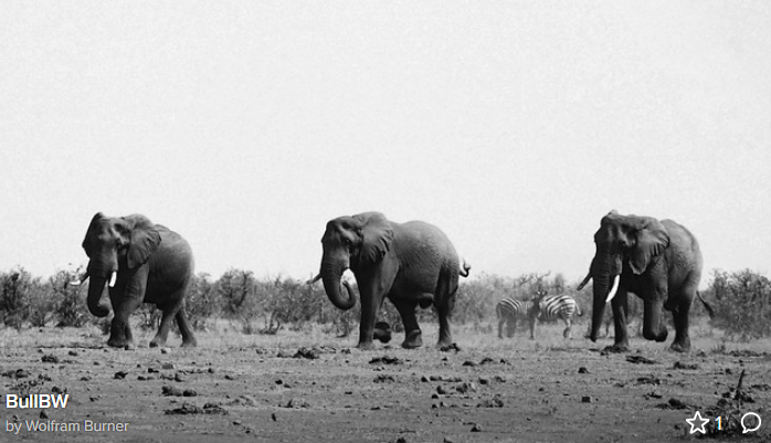
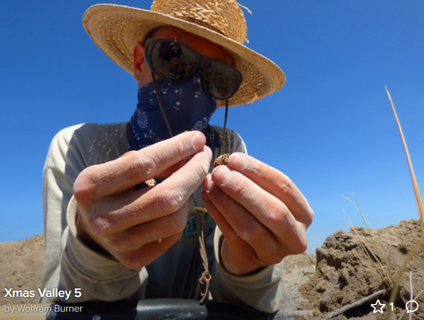
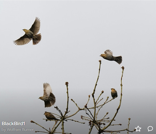
As a photographer, Dean works under the pseudonym "Wolfram Burner", for example, here is one example (below left) of his closeup science & political work that has been widely reprinted for illustrating the problem of plastics pollution: https://www.sciencemag.org/news/2015/04/mediterranean-sea-major-zone-plastic-pollution, followed by a few more examples of his science/political/commentary work


Dean Walton: 2017 to Present Member of the SCGIS Camera/News Team.
https://yourshot.nationalgeographic.com/profile/1785497/
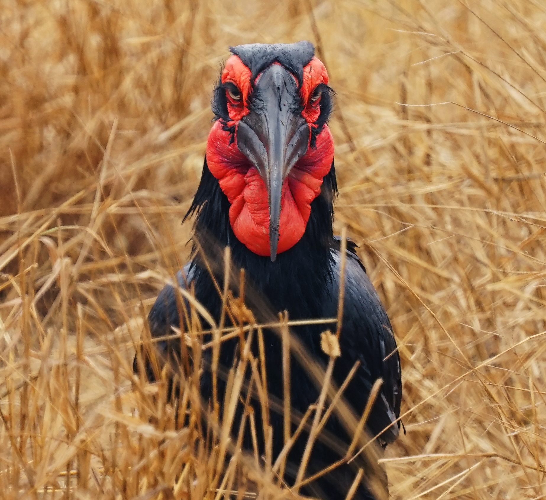
Below: “An endangered southern ground hornbill staring me down as I take its picture in Kruger National Park”
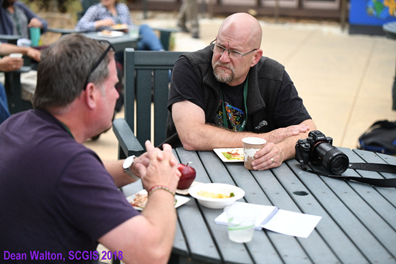
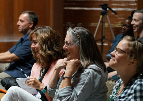
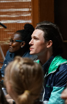
Below: Dean’s conference Photography work from SCGIS 2018

COMMUNITY:
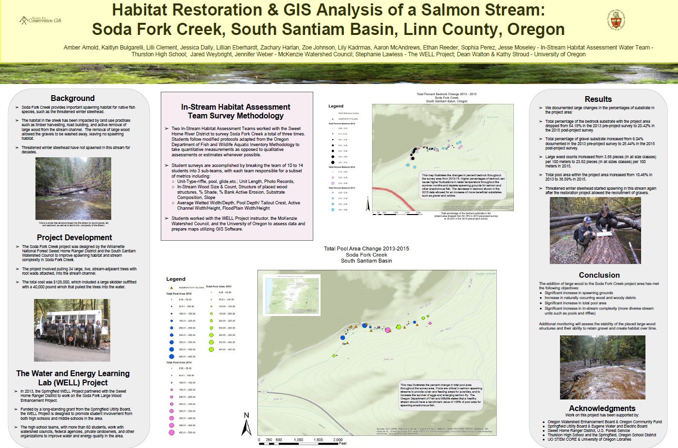
I think the most rewarding project I worked with, here at the Price Science Commons, was one with the students from Thurston High School’s Well Project. The program initially set up by Stuart Perlmeter, past Oregon Academy of Science Educator of the Year, now run by Stephanie Lawless, gets students out in the field collecting water quality data from local streams. The students had all of these data but no way to portray them in a manner that the could transmit the outcomes to the general public. I suggested that they try using a geographical information system to create maps showing off the data. They accepted the challenge and I was invited over to teach ESRI’s ArcMap to them over the course of several visits to the school. The end result was this poster presented at an international conference sponsored by the Society for Conservation GIS with 12 high school students as authors. We partnered with the McKenzie Watershed Council and GIS Librarian Kathy Stroud out of the University of Oregon’s Knight Library to complete the research poster. "
Eugene Natural History Society – Society President, 2017 - present,
Board member & Audio/Visual Coordinator, 2014-present
Sheldon High School Engineering Club Coordinator, 2018 - present
Eugene Rocketry Club – Education Outreach Coordinator, 2014-present
Oregon Native Plant Society – Emerald Valley Chapter – Plant Database Coordinator, 2016-present
Rachel Carson Academy-Churchill HS Advisory Board Member for Environmental Studies, 2015-present
SCGIS Conference Committee Member 2015 to Present:
SELECTED CHRONOLOGY:
Education
1990 Georgetown University Ph.D. Field Of Study Pharmacology
1983 American University B.S. Field Of Study Biology
2005: M.L.S., Information & Library Science, Southern Connecticut State University
1996 – 1999 State Natural Heritage Ecologist The Nature Conservancy / West Virginia Division of Natural Resources
1999 – 2004 Rare Species Field Ecologist Virginia Department of Conservation and Recreation
2004 Lead Organizer, Virginia Native Plant Society Annual Meeting, Richmond, Virginia, 2004.
2006 – Present Univ of Oregon Science Librarian / Associate Professor
2008 Conference Co-Organizer - Natural Resources Information Council (NRIC) Annual Meeting, University of Oregon, August 2008.
2013 Walton, D. P. and S. Miller. (2013, July). Oregon freshwater mussel distribution: A focus on data management. Poster presented at the annual meeting of the Society for Conservation GIS, Monterey, CA.
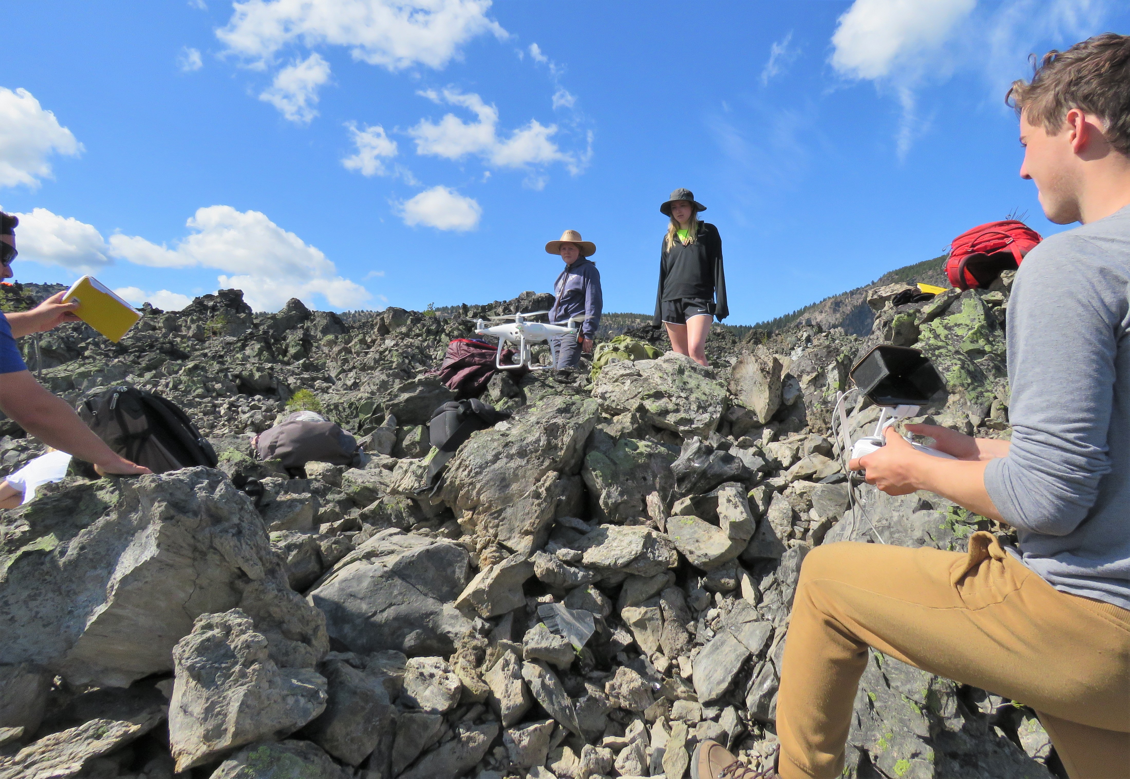
2014 Walton, D. P. (2014, July 12). Trials and Tribulations of drones (UAVs) for ecological monitoring. Society for Conservation GIS, Monterey, CA
2015 to Present: SCGIS Conference Committee Member
2017 to Present SCGIS Camera/News Team.Member
2016 PAPER: Amber Arnold, Kaitlyn Bulgarelli, Lilli Clement, Jessica Dally, Lillian Eberhardt, Zachary Harlan, Zoe Johnson, Lily Kadrmas, Aaron McAndrews, Ethan Reeder, Sophia Perez, Jesse Moseley - In-Stream Habitat Assessment Water Team -Thurston High School; Jared Weybright, Jennifer Weber - McKenzie Watershed Council; Stephanie Lawless - The WELL Project; Dean Walton & Kathy Stroud - University of Oregon. (2016, June) Habitat Restoration & GIS Analysis of a Salmon Stream: Soda Fork Creek, South Santiam Basin, Linn County, Oregon [Poster]. Presented at the annual meeting of the Society for Conservation GIS (SCGIS), Pacific Grove, CA.
2016 ARCGIS Desktop/Online Instructor with Kathy Stroud for the Oregon Well Project and Springfield and Thurston High School students January 11th & 15th; February 16th & 23rd; & March 29th, 2016.
 2017 Scgis Map Gallery Interview about his map gallery presentation on using Holograms & 3D Photogrammetry for Drone Visualization.
Walton, D.P. (2017, July). The Painted Hills: Exploration of 3D visualization and hologram generation as tools for conservation and ecological analysis [Poster]. Society for Conservation GIS, Monterey, CA
2018 Walton, D.P. (2018, Nov. 16). From the ground to the HoloLens. Columbia River Region ASPRS Tech Exchange. American Society for Photogrammetry and Remote Sensing (ASPRS).
2018 SCGIS Conference Presentation
http://www.conservationgis.org/scgis/2018/__PROCEEDINGS/MonCurSD_Walton.html
“Mapping the overlooked: Capturing data on less widely recognized species”
"The habitat and ranges of charismatic flora and megafauna are much more known than those of obscure and overlooked flora and fauna such as pin lichens and snails. A 2001 report on rare species In Oregon lists more 30 snail/slug species with G1 global abundance rankings indicating that there are six or fewer known populations of each G1 species. However, as a result of several recent publications, new range and county occurrence maps have been or are being drafted that are changing these numbers and rankings. This project works to elucidate strategies for data collection and mapping for some of these often ignored or overlooked species in the Pacific Northwest, as well as other places around the globe.
2018 https://blogs.uoregon.edu/scitechoutreach/2019/02/08/uavs-for-research/
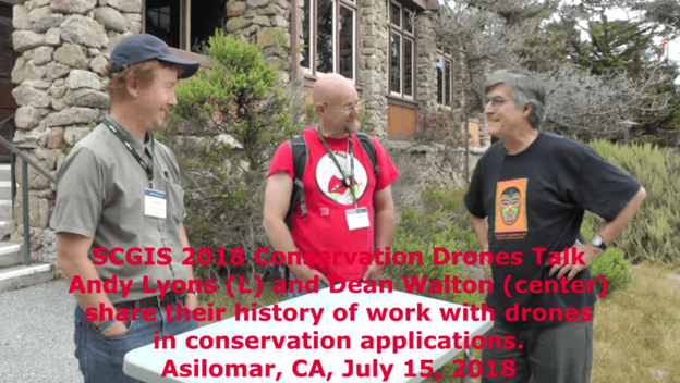
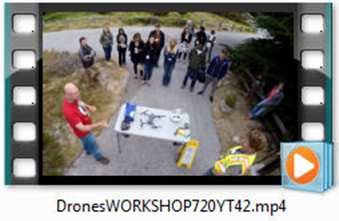
UAVs for Research The Price Science Commons has a Phantom IV Pro Quadcopter UAV for university research projects. If you have a need, we might be able to solve your problem so check in with us. Here is a basic demo of what several types of UAVs/ Drones can do. It was created at the 2018 Annual meeting of the Society for Conservation GIS. Click on the image to get to the video demonstration. Thanks go out the UO Library Administration and Lorry I. Lokey for their support of new technologies for campus evaluation and sharing.
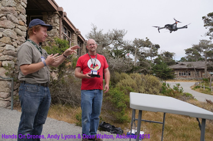
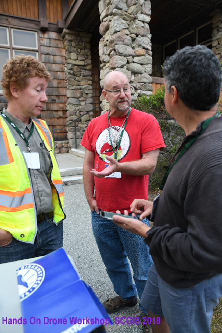
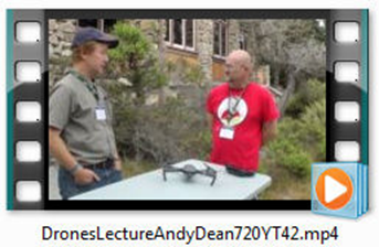
2018 Scgis Conference Hands-on Drone Workshop
http://www.conservationgis.org/scgis/2018/__PROCEEDINGS/DronesLectureAndyDean720YT42.mp4
Exploring Ultramafic Plant Communities – The Weirdness of Southwest Oregon
2019: Learning to Fly for Science, Earth Science | Science & Technology Outreach
Recent Publications:
Stephens, J., Cerreta, J., Walton, D., and Sherman, P. (2020, August). Emerging tools for ornithology: Raptor habitat 3D modeling with an unmanned aircraft system (UAS): An osprey (Pandion halietus) nest case Study. In D. Bird (Chair), Emerging Tools. Symposium conducted at the meeting of the American Ornithology Society and North American Ornithology Society [online].
Walton, D.P. 2020. “The holographic landscape: 3D modeling for the HoloLens” Makerspace and Collaborative Technologies: A LITA Guide [Book Chapter]. Edited by Beth Thomsett-Scott. Rowman & Littlefield. Pp.37-50.
Gregory J. Retallack, James E. Martin, Adrian P. Broz, Brent H. Breithaupt, Neffra A. Matthews, and Dean P. Walton. (2018). Late Pleistocene mammoth trackway from Fossil Lake, Oregon. Palaeogeography, Palaeoclimatology, Palaeoecology. 496, Pp 192-204.
Walton, D.P. (2016, July) “Getting started with programming” [book chapter], The Librarian's Introduction to Programming Languages: A LITA Guide (LITA Guides), Edited by Beth Thomsett-Scott.
Recent Presentations:
Walton, D.P. (2019, July). Remote sensing analysis of remote areas - Isla Clarion, Mexico. Society for Conservation GIS, Monterey, CA.
Walton, D.P. and J. Murray (2018, August). Making to collect, observe, and learn: Activities of the DeArmond Makerspace [Poster] International Society for Academic Makerspaces, Stanford University, Palo Alto, CA
Walton, D.P. (April 2017) Innovation [Panel Presentation]. "What is? Life" Symposium, University of Oregon School of Journalism and Communication, Portland, OR.
Walton, D.P. (2016, June). An Open Source Conservation Analysis & Plan for Rodrigues Island, Mauritius, [Poster]. Presented at the annual meeting of the Society for Conservation GIS (SCGIS), Pacific Grove, CA.
Walton, D.P. (2015, May 27) GIS incorporation of Structure-from-Motion (SfM) models utilizing disaster response related imagery. Information Systems for Crisis Response and Management (ISCRAM) annual meeting, Kristiansand, Norway.
Walton, D.P. (2014, July 12). Trials and tribulations of drones (UAVs) for ecological monitoring. Society for Conservation GIS, Monterey, CA
Walton, D.P. (2014, July 10). Disaster Informatics [Lecture and Exercise] 2nd Annual Western Science Library Boot Camp, Seattle, WA.
-
 Anonymous User