- Home
- :
- All Communities
- :
- User Groups
- :
- Conservation GIS
- :
- Documents
- :
- Dr. Karen Beardsley
- Subscribe to RSS Feed
- Mark as New
- Mark as Read
- Bookmark
- Subscribe
- Printer Friendly Page
- Report Inappropriate Content
Dr. Karen Beardsley
Dr. Karen Beardsley
Karen Beardsley, PhD Director of Global Professional Programs, Global Affairs, Univ of California Davis.
xCommitteeInternational 1997-2019 xScgisBoard xTraining xEducation xTTT x2019International x2018Talk 2017Training x2017Board x2016Training x2014ScgisBoard x2012TTTBoard x2011Training x2009Talk x2003Talk x2002Committee x2000Training x2000CTSP x2000ScgisBoardTreasurer x1999Board x1997EcpTalk x1995EcpTalk x1994ConservationGISAlliance x1993EcpTalk x1991EcpTalk xClimateChange xTalk xTraining xScgisBoard xTTTBoard xEcp xConservationGISAlliance
2020 Storymap "GIS in the Land of the Thunder Dragon"
2019 Map Gallery Webmap on Cultural Stories on behalf of Leslie Backus
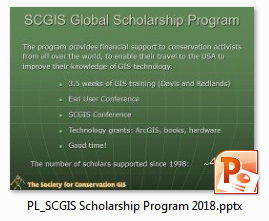
2018 Scgis Conference International Report
Dr. Karen Beardsley was one of 3 International GIS Leaders selected by John Schaeffer in 2012 to head up a new, independent, global conservation GIS training organization that came to be called "Train-the-Trainer". Karen has been associated with the SCGIS International Program ever since it began around campfire meetings at the James Reserve in the early 1990's. I first met Karen many years before in Kenya, when even the idea of an global conservation GIS society was still formulating. Karen was using the very earliest incarnation of Esri GIS Software, ArcEditor, to map and track elephant populations for the United Nations. I still remember her office at the UNDP headquarters, stacked with big white spools of magnetic tape and gigantic binders of computer printouts.
SCGIS Profile (TTT Years: all le19 le18 le17 le16 le15 ttmaster ttleader)
2018 Scgis Intl Program Report PDF 2018 Scgis Intl Program Report FILM
2018 Presentation: "Sharing Impactful Stories with Story Maps" for the USFS Climate Change Seminar
2017 Named as a "GIS Hero" for her work building GIS communities worldwide: 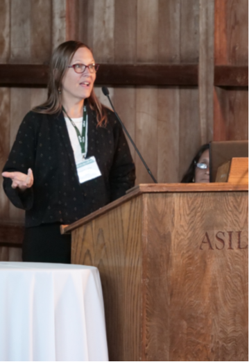 "For Karen Beardsley, GIS is more than software. It gives rise to relationships that can change the world. “GIS is not really all about the technology,” she said. “It’s about connecting people.” As the director of sponsored programs and special projects for global affairs at the University of California (UC), Davis, Beardsley now spends the majority of her time bringing people together from all over the world to solve problems. While this has always been an important aspect of her career, she finds herself, for the first time, in a position that doesn’t center specifically on GIS."
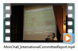
(Photo: Karen presenting the SCGIS International Committee report at the 2017 conference)
2016-present Director of Global Professional Programs/Sponsored Programs, Univ of Calif Davis.
Oversee all aspects of sponsored professional programs in Global Affairs, including the proposal process, budgeting, financial projections, promotion, publicity and program development. Promote collaboration between units of Global Affairs and seek linkages with other campus units and the community. Identify and develop proposals to bring new sponsored professional programs into the Global Affairs portfolio and to the UC Davis campus. Manage international relations database.
2015 Spring Arcnews Article on Karen's work in Bhutan: "On October 13, 2014, the small mountainous country of Bhutan convened the National Geospatial Exposition, a historic unveiling of Bhutan's online GIS data repository. The event included an outdoor display showing the GIS capacity of several ministries; a geospatial competition for secondary school students; and the launching of the Bhutan Geospatial Portal by the lovely 24-year-old queen of Bhutan, Her Majesty the Gyaltsuen. Several international organizations were also present, including representatives from the International Centre for Integrated Mountain Development (ICIMOD), which developed the Bhutan Geospatial Portal with the Bhutan National Land Commission (NLC), and Esri. Thanks to the Esri Education Ambassador program, Dr. Karen Beardsley was also among those present."
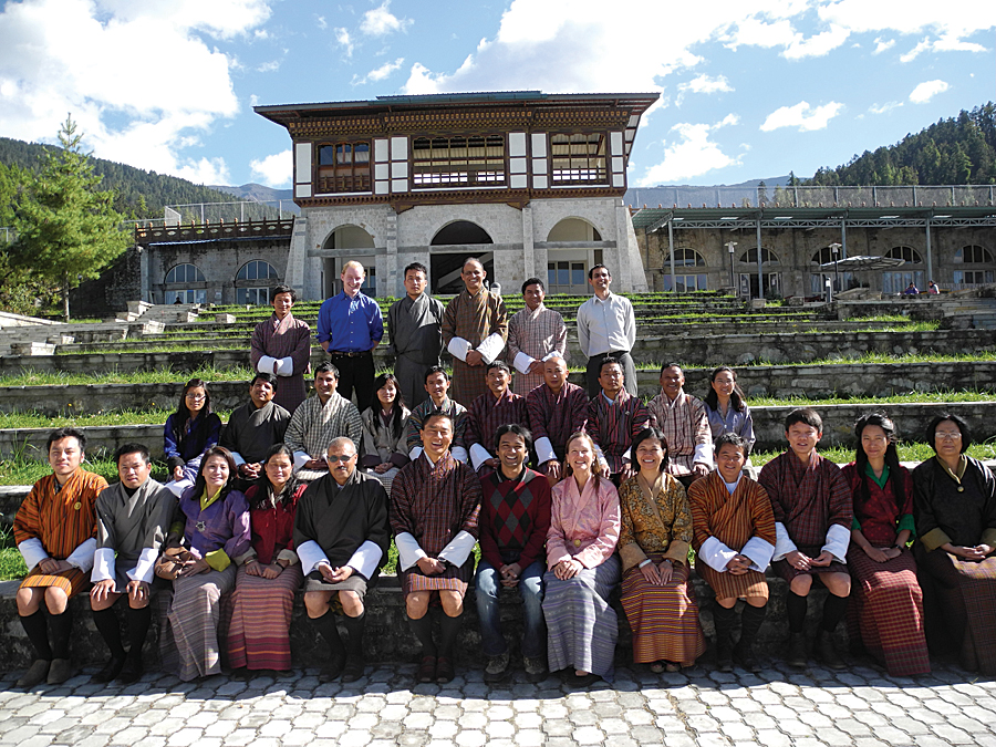
2015-July 2016 Royal Thimphu College, Bhutan Fulbright Core Scholar—GIS Professor Develop and teach Geographic Information Science and Technology courses for second and third year college students at the Royal Thimphu College in Bhutan. Develop and teach multiple-week workshops for government staff at the College. Help promote and expand GIS education and build geospatial knowledge and capacity throughout Bhutan. (Photo: Karen (seated front row center-right in pink shirt) next to TTT Trainer Diyan (on her right) and Esri Trainer and longtime SCGIS Scholar Program Online GIS Trainer Canserina Kurnia (Karen's Left) with the participants of their Cloud GIS Training course at Royal Thimphu College, Bhutan)
2014-present Global Affairs, UC Davis Director of Humphrey Fellowship Program
Provide management and leadership by directing all aspects of the Hubert H. Humphrey Fellowship Program at UC Davis. Deliver and manage educational training in the form of classes and seminars, and facilitate professional affiliations for 10-12 international Humphrey fellows for ten months each year
2014: Elected to vice presidency of SCGIS
2013-2015 Managing Director, Information Center for the Environment UC Davis, CA
Manage the work of 20-25 staff and coordinate multiple simultaneous projects from 15-20 funding sources. Responsible for proposal writing, project reporting, and financial management. Coordinate with University faculty and local/regional/national/international scientists on cooperative natural resource projects involving geospatial technologies and decision support systems. Provide meeting facilitation and technical lectures
1994-2013 Associate Director/Chief of Staff/GIS Manager/Programmer, Environmental Science & Policy, UC Davis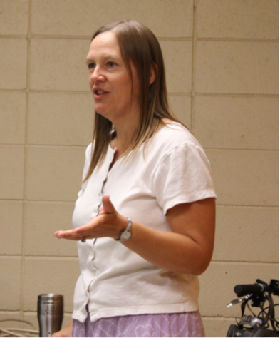
Responsible for program and administrative oversight of the Information Center for the Environment. Develop and implement long- and short-term strategic goals, objectives and policies for an evolving organization, and coordinate the development of research and outreach projects and funding for scientific research. Acquire, integrate and analyze GIS data sets for research projects including California rivers and riparian habitats
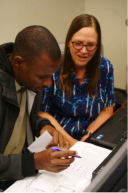
(Photo: Karen teaching Scholars at UC Davis in 2010)
2012 Named to board of new "Train the Trainer" Global Training Program
2011 Conservation GIS Seminar Leader: 'International Climate Change Seminar: The Role of GIS" Starting in 2010, the Information Center for the Environment at UC Davis hosts a three-week international seminar in May on climate change and natural resources management. The seminar is sponsored by the US Forest Service/International Programs and includes 20–25 participants from around the globe. Themes include impacts of climate change, adaptation and mitigation of natural resources management under climate change, and institutional responses to climate change. Participants study climate change issues at multiple levels of government, starting in Washington, D.C., and ending in California (Davis, Yosemite, and Lake Tahoe). GIS is introduced to the participants during the seminar, and participants hear lectures from scientists who use geospatial technology. This presentation will give an overview of the seminar concepts and focus on the role of GIS in climate change science.
2009 Scgis Conference Presentation: "Modeling Population Growth: Understanding Land Use, Natural Resource, and Economic Conflicts"
Presenter: Karen Beardsley, University of California.
ABSTRACT: "While California land use decisions occur at the city and county levels, there has been a recent movement to build consensus among local entities so that they can view their choices within a larger regional context. The Regional Blueprints program helps foster consensus among community leaders, local governments, and stakeholders toward a vision for preferred growth and land-use for regions throughout the State. These Blueprints help people in the regions understand and address the impacts to their air quality, water quality, transportation and growth, affordable housing, and natural resources created by different development options. To facilitate Regional Blueprints, the Information Center for the Environment (ICE) at the University of California, Davis has developed a simple GIS urban growth model called UPlan that is capable of running different growth scenarios for the future based on policy choices. This model is currently being applied in California to develop, adopt, and begin implementation of the Regional Blueprints. In this session I will present applications of the UPlan model in the San Joaquin Valley of California"
2003 SCGIS paper Name: Karen Beardsley Willett Email: kbwillett@ucdavis.edu
Physical Address: Dept. of Environmental Science and Policy, One Shields Ave, UC Davis, Davis, CA 95616 Phone Number: 530-752-5678
Website: http://ice.ucdavis.edu and http://www.cites.org/eng/prog/MIKE/index.shtml
Title: Monitoring the Illegal Killing of Elephants (MIKE)
Abstract: The purpose of the Convention on International Trade of Endangered Species (CITES) is to regulate the international trade in wildlife and wildlife products of endangered species. In 1997, the Parties of CITES passed a resolution stating that a monitoring system be put in place across the entire range of the African and Asian elephants. This goal of this system, known as Monitoring the Illegal Killing of Elephants (MIKE), is to provide information needed for range States (countries with elephants) to make appropriate management and enforcement decisions and build institutional capacity for the long-term management of their elephant populations. An
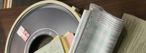
extensive Access Database (the "MIKE DB") has been developed to facilitate collection, manipulation, storage, analysis, and reporting of elephant monitoring information. Scientists will link spatial data sets within the ArcGIS environment to information in the MIKE DB to analyze elephant monitoring and enforcement trends. This paper presentation will focus on describing the MIKE program and demonstrating how spatial tools are used to facilitate decision making and build institutional capacity within the range States.
2002 listed as part of the SCGIS International Journal Committee & it’s proposal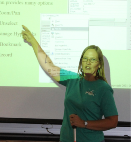
(photo: Karen teaching International Scholars in 2012 at UC Davis)
2000: SCGIS International Training discussion led by Karen Willett and Tracy Katelman". Although Roberta Pickert had already started the SCGIS International Chapters and Scholarships work, at the time their training was based on existing off-the-shelf GIS classes from the Esri learning center. The "International Training" committee begun at this meeting was the start of what became the formal Conservation GIS Training Curriculum that SCGIS Scholars enjoyed in later years, and also became the foundation for the TTT Program:
"The session began with a presentation by Karen Willett about important issues faced when training GIS overseas (based on her experience teaching GIS to conservation professionals in New York and Indonesia). Tracy Katelman then spoke about her experiences in Chile as a trainer and facilitator, also pointing out some of the problems commonly faced (technically and politically). We then broke into a discussion circle and heard from many others about their concerns and ideas. The focus was initially the concept of “reverse scholarships,” but several other ideas were voiced.
-How do we differentiate between international and domestic training needs? Some people expressed that there is little difference, while others suggested that less infrastructure exists outside of the USA and therefore the needs are different.
-Need for mentor relationships
International participants indicated that there is a strong need for access to mentor individuals and organizations. This has been an ongoing issue for both SCGIS and CTSP, and is a topic that perhaps the Training and Outreach Committee needs to address. (How can we connect people better with mentors?)
-Assistance for International individuals and organizations
We quickly ran out of time, so I asked those interested in continuing this conversation to give me their email addresses. The action items we agreed upon at the end were:
-Email summary of meeting to those interested (Karen Willett)
-Look into current web support methods for conservation GIS groups (so that we don’t duplicate a service already provided, such as CTSP’s web site support). (Karen Willett , Janice Thompson)
-Further investigate the Reverse Scholarship idea (Tracy Katelman, Charles Convis)
-Further develop SCGIS training support (TBD)."
2000 CTSP Board of Directors
(CTSP was the Conservation Technology Support Program, an independent 501c3 set up in 1995 as technology granting consortium between Esri, & Hewlett-Packard, with contributions from Apple, Calcomp, Gtco and many others. It was run by an international board of advisors from many NGOS and met and granted annually for 6 years during which time it managed and granted over $6 million in technology to many hundreds of conservation organizations. Karen joined the board in 2000: “As part of this development, we added three new board members, Prof. Kerry Brooks of Clemson University, Roberta Picket of the Archbold Research Station in Florida and Karen Willet, formerly Wildlife Conservation Society and now with Univ. Calif. Davis' ICE program. These three expand our geographic diversity and add important new voices to our decisions and planning”
2000 - 2001 Served as SCGIS Board Officer: Treasurer - (as Karen Willett)
Other board officers included: Intl Committee Chair (2001-2002) Roberta Pickert
Domestic Scholarship Chair (2000-2001): Sandra Coveny [sandrac@PEAK.ORG]
Conf Committee Chair (2000-2001): Susan Miller
Membership Comm Chair (2000-2001): Leslie Backus [Lanius@rocketmail.com]
1999-2000 SCGIS Board Member, listed as part of the “Scgis Training Group”
1999 Ecp Booth Presentation: 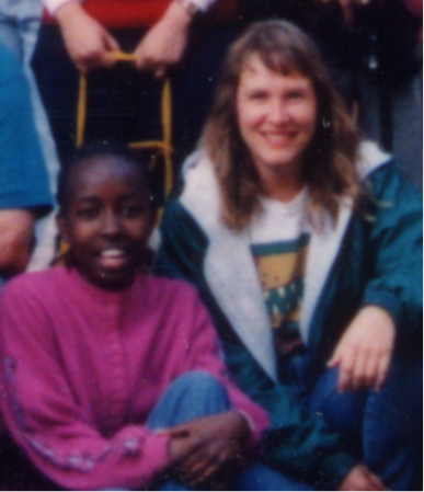 "From the Adirondacks to Indochina: GIS at the Wildlife Conservation Society" by Karen B. Willett
(photo: Karen with future Kenya Chapter Leader Lucy Waruingi at the 1994 Conservation GIS Conference.)
1997 ESRI UC: MODERATOR for UC Session on "Systems for Conservation Planning & Decision Support "
paper session: moderator - Karen Beardsley: "Conservation Planning requires well-organized spatial data, defined analysis methods, and an orderly means for communicating results with stakeholders. This session presents a number of
programs and systems used for overall conservation planning and decision support."
1995 Paper in the Conservation GIS Track at the Esri User Conf: "Forest Elephant Distributions in Relation to the Distance from Roads in Gabon" Using ArcInfo geographic information system, buffer zones were generated around the road network of Gabon and the equations derived from field sampling were used to estimate the dung density in each buffer zone. The forest elephant population was estimated to be 74,842 with asymmetric conference limits from 50,371 to 108,823.
1994 Part of First organizational meeting of the “Conservation Gis User Group”, James Reserve, as Karen Beardsley, University of California - Davis, California/United States
1993 Paper in the Conservation GIS Track at Palm Springs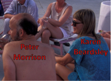
Title "A GIS Approach to Mapping Protected Areas for North America"
Karen Beardsley, University of California, NCGIA
(Photo: Conservation GIS user meeting in 1991)
1991 Paper in the Conservation GIS Track at Palm Springs, session on African Wildlife Conservation: “Elephant Population Estimates for the Central African Forests” Karen Beardsley,Wildlife Conservation International
1989-1993 GIS Analyst, United Nations Environment Programme, Nairobi, Kenya Responsible for analyzing elephant data for African continent using a geographic information system (GIS); integrate a mathematical model with GIS to estimate elephant populations in the Central African forests. Results of analysis led to a worldwide ban on ivory trade. As I said in the article, Karen was the first person I met in my conservation GIS mission work in the eighties who was actually applying current GIS software to work on critical applied conservation problems, and who understood the vision of how spatial analysis would revolutionize the day-to-day management of endangered wildlife and the landscapes they depended upon.
1986-1988 Secondary School Teacher U.S. Peace Corps Volunteer, Nyeri District, Kenya
Teach mathematics, physics, biology, English, and wildlife conservation in a rural African village; initiate and direct development projects for the school and local community
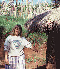
(Photo: Karen in Nyeri District late 19980's)
Certificates and Awards:
Fulbright Teaching Scholarship, Royal Thimphu College, Bhutan, 2015-2016
Geographic Information Systems Professional (GISP) certificate, since 2009
Distinguished Teacher Award, UC Davis Extension, December 2003
Certified Juniper GIS Instructor (www.junipergis.com), July 2013
Completed NAFSA Academy--Class XIV, 2016-2017
Professional Affiliations:
Member of NAFSA since 2016
Current Board Member, Past President, Vice President, and Treasurer Society for Conservation GIS (SCGIS)
Past Board member for Northern California Urban and Regional Information Systems Association (NorCal URISA) and California Geographic Information Association (CGIA)
EDUCATION
2003-2009 Ph.D. in Geography University of California, Davis Davis, CA
Ph.D. Dissertation: An Impact Analysis of Human Settlements on Biological Resources and Greenhouse Gas Emissions in California, and on Wildlife Corridors in a Maasai Group Ranch in Kenya
1990-1993 M.A. in Geography University of California, Santa Barbara Santa Barbara, CA
Master’s Thesis: Compiling a Digital Map of Managed Areas at the National and State Levels
1981-1985 University of California, Davis, Davis, CA
B.S. in Applied Mathematics, emphasis in Computer Science; Psychology minor
SELECTED PUBLICATIONS:
- Beardsley, J.H. Thorne, N.E. Roth, S. Gao, and M.C. McCoy, 2009. “Assessing the influence of rapid urban growth and regional policies on biological resources,” Landscape and Urban Planning, 93(2009):172-183.
Karen B. Willett and Eric W. Sanderson, 2000. “Taking GIS into the Wild: Teaching GIS to Practicing International Conservation Biologists,” Bulletin of the Ecological Society of America, 81(4):276-281.
John C. Hunter, Karen B. Willett, Michael C. McCoy, James F. Quinn, and Kaylene E. Keller, 1999. “Prospects for Preservation and Restoration of Riparian Forests in the Sacramento Valley, California, USA,” Environmental Management, 24(1):65-75.
S.A. Lahm, R.F.W. Barnes, K. Beardsley, P. Cervinka, 1998. “A method for censusing the greater white-nosed monkey in northeastern Gabon using the population density gradient in relation to roads,” Journal of Tropical Ecology, 14:629-643.
R.F.W. Barnes, K. Beardsley, F. Michelmore, K.L. Barnes, M.P.T. Alers, A. Blom, 1997. “Estimating Forest Elephant Numbers with Dung Counts and a Geographic Information System,” Journal of Wildlife Management, 61(4):1384-1393.
- Michelmore, K. Beardsley, R.F.W. Barnes, I. Douglas-Hamilton, 1994. “A model illustrating the changes in forest elephant numbers caused by poaching,” African Journal of Ecology, 32(2):88-99.
Karen Beardsley and David Stoms, 1993. “Compiling a digital map of areas managed for biodiversity in California,” Natural Areas Journal, 13(3):177-190
-
 Anonymous User