- Home
- :
- All Communities
- :
- User Groups
- :
- Conservation GIS
- :
- Documents
- :
- Federico Riet Sapriza, Uruguay
- Subscribe to RSS Feed
- Mark as New
- Mark as Read
- Bookmark
- Subscribe
- Printer Friendly Page
- Report Inappropriate Content
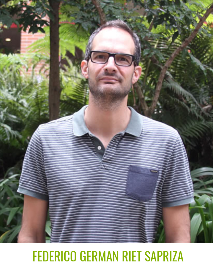
Federico Riet Sapriza, Uruguay
Federico Riet Sapriza, Uruguay


Federico Riet Sapriza Cetáceos Uruguay & University of the Andes, Asst Professor.
xTTT2019-2016 x2019TTT x2016TTTcourse xScholar2012 x2012Talk xUruguay xLatin America xMammal xDistribution xDolphin xWhale xMarine xGenetics xPark
Academic Profile Researchgate Profile
2019 Profile: Federico is a participant in the first-ever SCGIS TTT Summit Meeting.
"I am a marine biologist focus on the conservation and research of marine mammals. In 2007, I gained a PhD in Zoology and started working at Cetaceos Uruguay, non-profit research and conservation group. The main aim of Cetaceos Uruguay is to promote research and conservation of cetaceans in the Uruguayan coast. I have used GIS for conservation and research since 2009 and have found myself that it has become a key part of my day to day work. The most exciting part of my work with marine mammals is that there is a lack of information about the species that I work with so every finding/result is motivating and innovative. However, the most difficult part is to finance the cost of the research, because there virtually no government research grants; and thus my research funding is from overseas. Further, another difficult part of the work is the lack of interest from the local government and lack of management actions and plans towards marine mammal conservation. Along my career I have conducted my research in collaboration with other international lab/group, and it is now an important and crucial component of my research and conservation work."
2017 Paper Population Ecology and Conservation Status of the South American Sea Lion in Uruguay
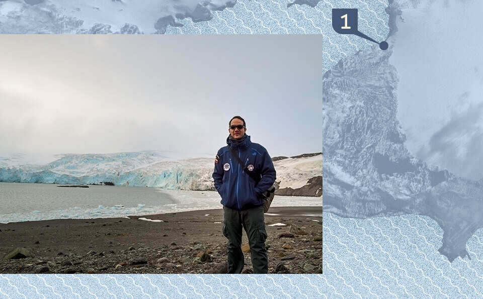
2016 Antarctica Expedition
 AN ENCOUNTER WITH ELEPHANT SEALS IN ANTARCTICA (2016 mission report by University de los Andes) (Photo above courtesy of IBE Television)
"This is how Federico, Ph.D. in zoology at Massey University (New Zealand), recalls his mornings in Antarctica. The researcher,  who carries out postdoctoral studies at the Laboratory of Molecular Ecology of Aquatic Vertebrates of the Andes (Lemva) - directed by Dr. Susana Caballero - was one of the scientists who integrated the Second Colombian Expedition to the Antarctic framed in the Antarctic Program Colombian, coordinated by the Colombian Ocean Commission (CCO), which took place between December and March...When outside the snow and wind were stronger, the atmosphere worsened. But the group that collaborated with Federico was always ready. "We prepared the tubes with alcohol, tweezers and a modified rifle to collect samples of the elephants without hurting them. We just went out looking for adult females and subadult males." A day of collection ended at 7:30 p.m. with four pieces of skin and many times it was impossible to return to the base....This was Federico's first visit to Antarctica. Although he has seen amazing things in other distant lands to which his profession has taken him, this protected area - where, because of its large size, number and personality, the southern elephant seals are the kings - surprised him with the reproductive colonies of several Species of penguins, countless birds and mammals as well as the sea lion, the Wedell seal, the crab and the fearsome leopard seal. These animals move freely through a ecosystem and habitats so rich that they have to resist, imposing and beautiful, in front of the man's hand."
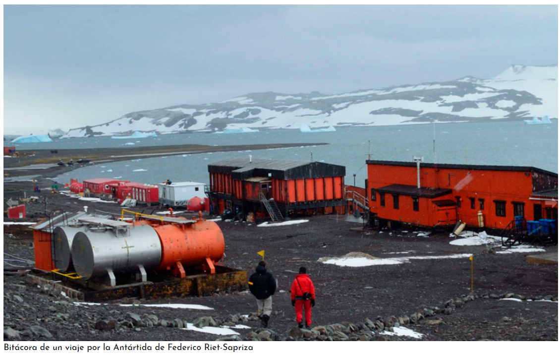
IBE Television report on the 2016 Colombian Antarctica Expeditions (Photo above & below courtesy IBE Television) "Colombian trips to the Antarctic are an initiative of the country to scientifically investigate climate change, climate evolution, biodiversity of organisms, adaptations to the environment and the valuation of Antarctic resources. It also seeks to study the relationship between South America and Antarctica and its contribution to global, regional and national development."
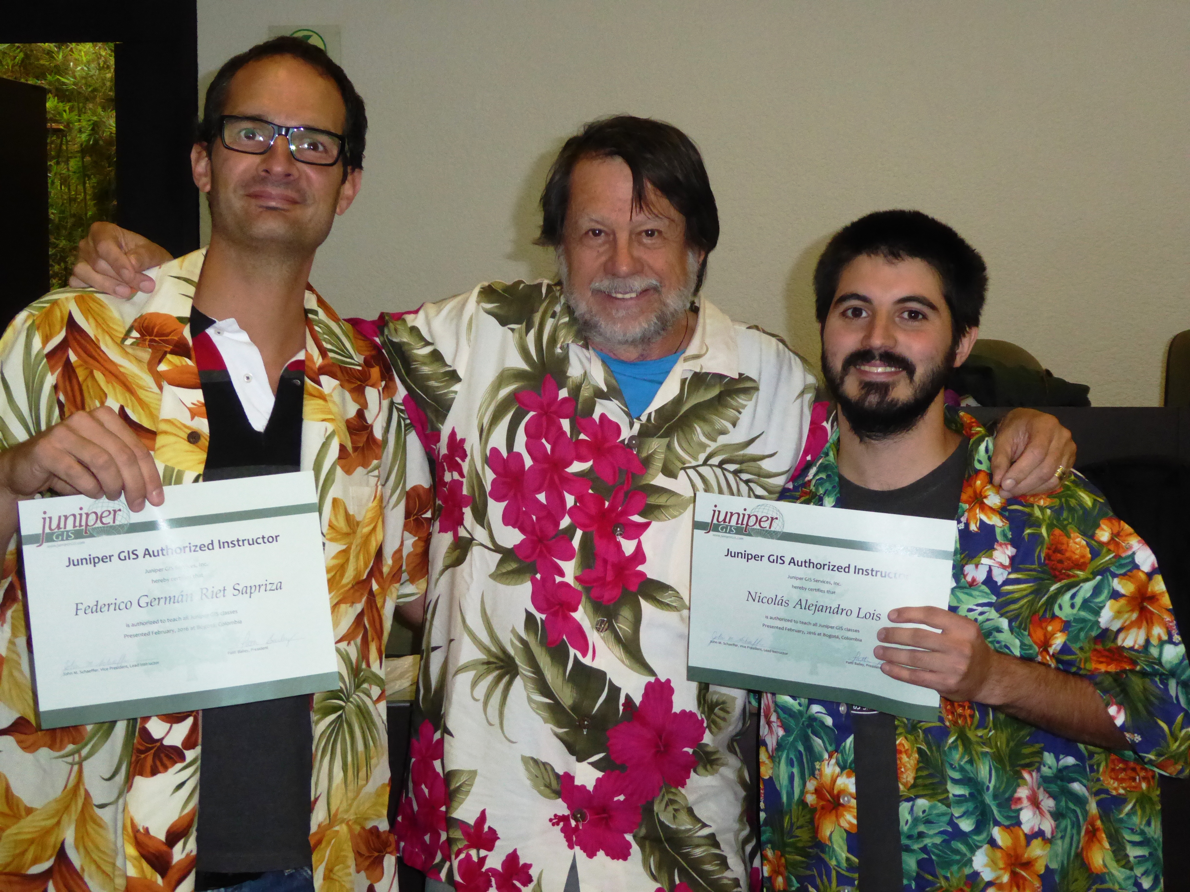
2016 TTT Certification: Federico received his TTT Certification in Jan 2016 at an SCGIS/Juniper GIS Training workshop in Bogota, Colombia. ArcGIS for Environmental Analysis and Advanced Topics for ArcGIS were taught to 41 course attendees at the Universidad de los Andes, thanks to organizational support from Federico and funding from Esri. (Photo Below, Federico (R) and Nicolas "Nico" Alejandro Lois show off their new Scgis TTT Trainer Certifications with Juniper GIS president John Schaeffer.)
2012 Scgis Scholar Profile
(photo, Federico in Muir Woods Calif, photo by SCGIS 2012 Scholar Nico)
"My research and work is focus on marine mammals (cetaceans, sea lions and fur seals) habitat use, home range, spatial density/distribution, overlap with human activities and environmental impact assessment. More than 30 species of marine 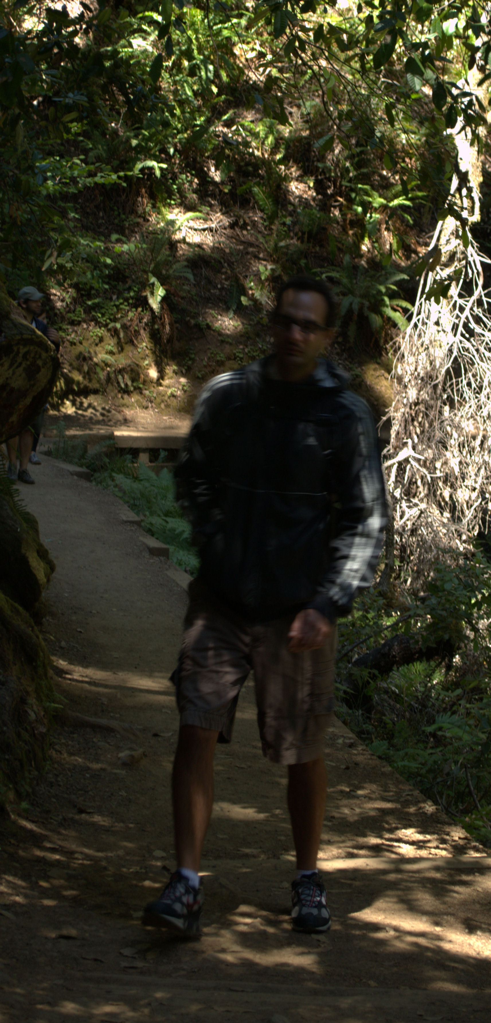 mammals inhabit Uruguayan waters and two the most emblematic species are the southern right whale and Franciscana dolphin, the later have serious conservation issues (IUCN, vulnerable and population trend decreasing). By and large, my aim is to map the distribution, home range and core areas of these animals and the spatial overlap/interaction with human activities (e.g. fisheries, offshore development). And, consequently and most important is to use this data to map the hotspot of interaction and propose areas for conservation (Marine Protected Areas).
There still work to do with the data collected in both conservation projects that I have worked, and that is one of my main motivations to submit this SCGIS scholarship application. I need to enhance my GIS capacity and skills to be able to answer the research questions and maximize the outcome of my projects. My current conservation work is focused on research, community work and environmental education. In the long term, I will continue working on the spatial aspects of marine mammals and in the interaction with human activities (fisheries and offshore developments) and their potential and actual impact on the population. I believe that I can make a long lasting contribution the conservation of the marine fauna through my research work utilizing GIS tools and applications. I believe the SCGIS training will give me the necessary skills and tools to apply in my research and conservation projects, and consequently maximize the outcomes of my projects. In addition, I will have the potential to assist other colleagues in my research group that are not advance GIS user. Being able to attend both, the 32nd ESRI International User Conference and 15th SCGIS Annual Conference, will definitely give me a broad overview of the capabilities and potentials of GIS that I could later apply in my conservation projects. My ultimate goal is to be able to become a GIS Advance User and have the necessary skills to be able to assist other colleagues and students and consequently be more active in the GIS user conservation community. I strongly believe that the skills that I will be able to develop by attending the specialized 2-week GIS training courses and ESRI and SCGIS conferences would allow me to make a significant input in local Conservation GIS community.
I understand that ArcGis has specific tools such as geo-statistical analysis extension in the spatial analysis developed to conduct this data analysis. Other specific information that I calculate from my GPS data is: the distance travelled (sea lion tracks), area (minimum convex polygon), maximum distance from colony, etc. Another aspect that I would like to explore is to use marine environmental data (sea surface temperature, salinity, chlorophyll, depth, fish distribution, etc) to explain the distribution of marine mammals. Other aspect of my work includes environmental impact assessment, I will be involved in two marine projects that aims to evaluate the impact on the distribution of marine mammals of the construction and the presence of a port terminal; and secondly conduct a oil spill environmental sensitivity index map (map of coastal and marine resources that are at risk if an oil spill) of an area surrounding a floating loading buoy.
*-HISTORY: Please describe the history of your personal work in conservation and GIS:
In 2007, I gained a PhD in Zoology and started working at Cetaceos Uruguay, non-profit research and conservation group. The main aim of Cetaceos Uruguay is to promote research and conservation of cetaceans in the Uruguayan coast. I have since then worked as a co-director of a southern right whale project. Southern right whales is a migratory species and has been heavily exploited along its distribution, however, they are starting to recover. The southern right whale project has a strong GIS component since we aim to study the species distribution, home range and identify hot spot along the Uruguayan coast. Our objective is to identify areas of conservation by using GIS tools. The project plays an important role in local and international conservation efforts towards the species conservation. It is the only project collecting systematic scientific data in Uruguay. Last year, I presented a paper on the distribution and habitat use of southern right whales at International Whaling Commission Southern Right Whales Assessment Workshop held in Buenos Aires, Argentina.
Furthermore, since 2009 I have been working as a Principal Investigator in another conservation project aiming to map the foraging areas of South American sea lions and the spatial overlap between sea lion and Uruguayan fisheries. The project was conducted with the financial support of the U.S. Marine Mammal Commission and the collaboration of international colleagues and local government institution. South American sea lions in Uruguay are declining at a critical rate; however, in another part of its geographical distribution they increasing and recovering from commercial exploitation. One of the factor/s that may impede the species recovery in Uruguay is the indirect interaction (resource overlap competition) with fisheries therefore I conducted a study to determine the potential conflict between sea lion and human activities (coastal bottom trawl and artisanal fisheries). This is the first study of this kind in Uruguay and the results have been promising. Using GIS tools, I mapped the foraging areas of sea lions and the areas of overlap with fisheries. My ultimate goal is that the results of this project makes a great contribution to conservation of the species and can aid in the implementation of marine protected areas. In addition, these results may bring light into the factors that are contributing to the decline of the population.
There still work to do with the data collected in both conservation projects that I have worked, and that is one of my main motivations to fill this application. I need the necessary GIS skills to be able to answer the research questions and maximize the outcome of these current and future research projects.
*-LOCAL INVOLVEMENT: Please describe how you work in your local conservation and GIS community:
My current conservation work
My current conservation work is focus on 3 aspects: research, community and environmental education
I’m currently conducting a project on southern right whale off the Atlantic coast of Uruguay, work that I have been doing since 2006. This project aims to study the ecology of right whales; including the habit use, distribution, behavior and the role of our coast in the biology of the species. I’m also involved in two projects with sea lion and fur seals studying the spatial overlap with commercial fisheries.
Since last year, I have been part of a group that is based in Participatory Investigation with artisanal fishermen. The objective of the group is to study the interaction between sea lions and the artisanal fisheries and find a solution to the problem. The interesting about the Participatory Investigation is that it is integrated by marine biologists, sociologists, members of conservation NGOs and artisanal fishermen and that everyone’s opinion and ideas are taken into account. The advantage of this approach is that the problem is viewed from different perspectives and point of view.
Another import aspect of my conservation work is environmental education. Last year, I conducted a several workshops at school and high school presenting a science and nature documentary about sea lions and the interaction with fisheries. At the workshop, I interacted with the students and taught them about the biology of sea lions and basic principal of marine conservation issues. The workshop was well received and the student and teachers gave me excellent feedbacks. This was an interesting experience since I was able to present my research work through a documentary, and then I was able discuss with the student about what they have learn from the video and what they didn’t know before watching it. It was a very rewarding experience both for me and the students.
Work with Local NGOs
Cetaceos Uruguay, which I belong, works and coordinates research projects with local NGOs and government institutions, such as: the National Administration of Aquatic Resources (DINARA); the National Naval Prefecture and General Command of the Army; Uruguayan Antarctic Institute; NGO Karumbé (Marine Turtles research and conservation); NGO Averaves (Bird research and conservation) and the National Museum of Natural History.
Cetaceos Uruguay has worked very closely with NGO Averaves and NGO Karumbé because we share common conservation interest and we face similar conservation problems. We have established partnership with these NGOs. These NGOs have joined to work a few years on a Marine Environmental Education program that was carried out in local community along the coast. This was a very successful experience and finished with the publishing of an Environmental Education guide book for school teachers. We also joined efforts in many cases when we need to discuss conservation issues with the government agencies such a National Administration of Environment. Most recently, we have worked together to present a joint proposal to the university to establish the first marine vertebrate research and conservation unit/lab with great focus on environmental education. I have taken an important role in organizing the meetings and the case that we need to discuss with the government.
Furthermore, I have worked closely with the technical staff from the Fisheries Technology Lab (DINARA) on the project dealing with the spatial overlap between sea lion and the commercial fisheries. They have GIS component in their work and I have collaborated with them in the mapping of the areas of fisheries activities and sea lion foraging areas.
Work with Local community
Cetaceos Uruguay has a long history working with the local artisanal fisheries communities along the Atlantic Uruguayan coast. A conservation project was run for several years in collaboration with the artisanal fishermen in order to study the bycatch of dolphins in fisheries nets. The project could not be conducted without the collaboration of the artisanal fisheries community. In addition, there a long track of environmental education with these fisheries communities in which member Cetaceos Uruguay have been involved.
*-INTERNATIONAL: Please describe how your work involves cooperation with any international groups:
Cooperation (collaboration) with other international labs/groups is an important and crucial component of my research and conservation work.
I the last few years I have collaborated with Prof. Dan Costa from the Long Marine Lab (Santa Cruz, CA) and Dr. Louise Chilvers from the Department of Conservation (Ministry of Conservation, New Zealand) working on the foraging ecology of sea lion and the overlap between sea lion and Uruguayan fisheries. In 2009, I participated in the South American sea lion Status Workshop in Chile where colleagues from the region got together to discuss and joint conservation efforts and actions. Last year, I was invited to participate and give a talk about my work on the spatial and temporal overlap between sea lions foraging areas and fisheries operation areas at the 16th Scientific Symposium “An Ecosystem Approach and its Fisheries Management Application at the Common Fisheries Zone Argentina-Uruguay” organized by the Joint Technical Commission of the Maritime Front. Most participants congratulated me on my presentation and my research work.
Furthermore, I have worked since 2007 in a southern right whale project in Uruguay and in collaboration with Vicky Rowntree (Director of the Right Whale Program) from the Whale Conservation Institute/Ocean Alliance (Lincoln, MA). The southern right whale project is an international conservation project that aim to study the distribution of the species along the southwest Atlantic Ocean. In this context, last year I participated in the Southern right whale Assessment Workshop held in Buenos Aires organized by the International Whaling Commission.
In 2010, I had the opportunity to visit for about two weeks the Sea Mammal Research Unit at St. Andrews University (Scotland) interacting with colleagues and presenting my work at their institute. I was well received and was able to exchange ideas and plan future collaboration work with them. In addition, the previous year, I spend nearly 3 weeks at the Long Marine Lab (Santa Cruz, CA) analyzing the satellite data collected from South American sea lions and the Uruguayan commercial fisheries.
It is crucial for my work and my future that I interact with international research group and shared my work and ideas, either by attending meetings and/or visiting labs and universities.
*-UNIQUE: Please describe what is the most unique and the most challenging about the conservation/GIS work that you do:
The study area where I work more than 20 species of marine mammals have been recorded. The Rio de Plata Estuary is a confluent of warm water from Brazil cold water from the Falkland current (sub-Antarctic waters) and the river input from the Rio de la Plata which make it a very productive and unique ecosystem with great variability in the marine environmental conditions. This makes a very important local and regional fishing area; and therefore increased interaction and competition for food resources with top predators such as marine mammals. In most cases commercial interest collide with conservation efforts. This is one of the most challenging part of my conservation work, try to find a solutions that match both interests. At the end of the day, as a marine conservationist, I would like to make a difference and that the information obtained from my research can make a contribution towards conservation. The most exciting part of my work is that there is a lack of information about the species so every finding/result is motivating and innovative. And the fact that I am working with emblematic species is also very rewarding because my work and efforts will consequently be beneficial for species conservation.
The most difficult part is to finance the cost of the research, because there is virtually no government research grants; and thus my research funding is from overseas. Further, another difficult part of the work is the lack of interest from the local government and lack of management actions and plans towards marine mammal conservation.
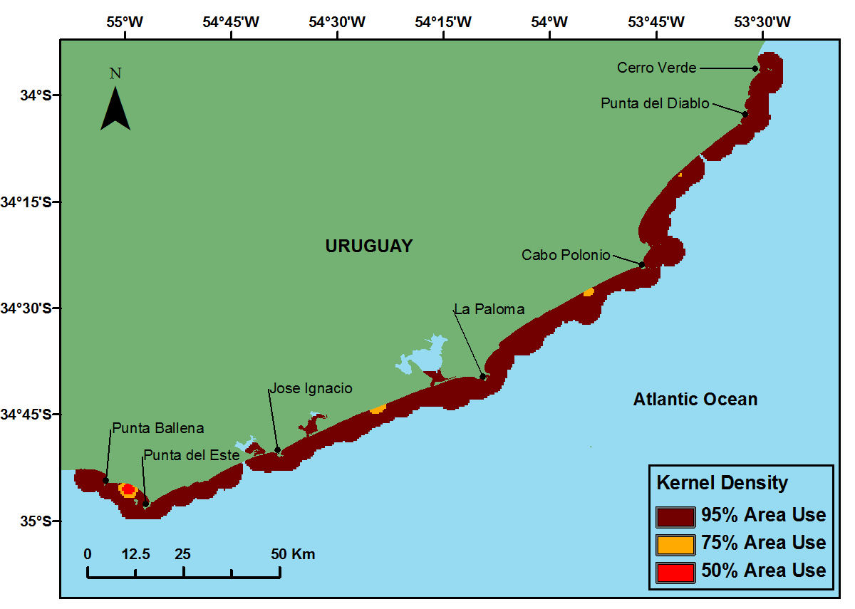
 and sea lion kernel.jpg)
2012 Scgis Conference Paper
Title "Applying GIS tools to determine the spatial-temporal resource overlap between the foraging areas of lactating South American sea lions (Otaria flavescens) and the Uruguayan commercial fisheries."
Abstract: The negative impacts of the trophic competition between fisheries and marine mammal continue to raise considerable concern worldwide. In order to measure the potential overlap, data on fisheries and marine mammal food resource utilization, areas of fisheries operation and at sea movement of marine mammals are needed. Our aims were to determine the foraging behavior, diet, and utilization distribution of lactating South American sea lions (SASL, Otaria flavescens) and assess the potential resource overlap with the artisanal fisheries (AF) and the coastal bottom trawl fisheries (CBTF). Lactating females (n =10) were fitted with satellite tags and Time-Depth Recorders. We used kernel and peeled minimum convex polygon (95%) methods for estimating the foraging utilization distribution of lactating SASL. In order to assess the potential resource overlap, we integrated sea lion diet and consumption estimates; and satellite-tracking data from lactating SASL with data on fishing effort areas and fisheries landings in the Rio de la Plata Estuary-Atlantic Ocean. Restricted to forage in shallow waters within the continental shelf, lactating SASL’s foraging areas overlapped with CBTF (15%) and AF (>1%) fisheries operational areas. For both fisheries the Resource Overlap/Fisheries Impact index identified the “hotspots” and they were distributed along the coast, west of the breeding colony (56oW - 55oW). The results of this work showed differing degrees of resource overlap with AF and CBTF, highlighting a) differences in potential impact from each fishery; and b) that different management/conservation approaches may need to be taken to solve the fisheries-SASL conflict.
-
 Anonymous User