- Home
- :
- All Communities
- :
- User Groups
- :
- Conservation GIS
- :
- Documents
- :
- Dr. Carlos "Carlitos" De Angelo, Argentina
- Subscribe to RSS Feed
- Mark as New
- Mark as Read
- Bookmark
- Subscribe
- Printer Friendly Page
- Report Inappropriate Content
Dr. Carlos "Carlitos" De Angelo, Argentina
Dr. Carlos "Carlitos" De Angelo, Argentina


Dr Carlos "Carlitos" De Angelo, researcher at the Institute of Earth Sciences, Biodiversity and Environment (ICBIA)
Universidad Nacional de Río Cuarto (UNRC) - Consejo Nacional de Investigaciones Científicas y Técnicas (CONICET)
Ruta Nacional 36 Km 601, X5804BYA. Río Cuarto, Córdoba, ARGENTINA Proyecto Yaguareté / Jaguar Project
www.facebook.com/proyaguarete / www.proyectoyaguarete.org.ar
Asociación Civil Centro de Investigaciones del Bosque Atlántico (CeIBA)
www.ceiba.org.ar
x2019TTTBoard x2018TTTBoard x2016TTTBoard x2015TTTLeader x2014TTT x2013TTT x2012TTT x2011Scholar xMammal xEndangered xHabitat xRemote xTTT2012-Present xCommitteeInternational
Contact: biocda@gmail.com / carlos.deangelo@conicet.gov.ar

Photo: Carlos De Angelo explains the SCGIS Program in 2016
Carlos De Angelo SCGIS Profile
About me
I have a Degree in Biological Sciences from the National University of Río Cuarto, and a PhD from the University of Buenos Aires, where I studied the effects of fragmentation and history of landscape use on the distribution and population structure of the puma (Puma concolor) and the jaguar (Panthera onca) in the Upper Paraná Atlantic Forest. Founding partner of the Civil Association CeIBA (www.ceiba.org.ar), and currently I am an Adjunct Researcher of the National Science and Research Council of Argentina (CONICET) at the Institute of Earth Sciences, Biodiversity and Environment (ICBIA) from the National University of Río Cuarto and CONICET.
My main interest lies in understanding the natural and anthropogenic factors that determine the distribution of large vertebrates at a landscape scale, and in using this knowledge for their management and conservation. Specializing in the use of GIS and spatial analysis, I apply this knowledge in the research and conservation of the jaguar within the framework of the Jaguar Project, and in the study of other endangered species of Argentina.
I am a member of the International Committee of the Society for Conservation GIS, haven been a SCGIS Scholar in 2011 and since then participating in different SCGIS activities, mainly as a trainer collaborating with the Juniper GIS / SCGIS TTT program.
SCGIS Scholar & Trainer Capsule HISTORY:
2019: co-leader of SCGIS TTT Summit
2018 Lead Trainer for 2018 Scgis Scholar Training
2016 Assistant Trainer 2016 Scholar Training
2015 Selected to the 3-person Leadership Board of TTT
2014: Achieved TTT Master trainer Status
2013 Began work on Spanish language SCGIS Training
2012 Accepted as TTT Candidate for the SCGIS 2012 Scholar Training Program, Graduated Jul 2012
2011 SCGIS Scholar.
2019 TTT Profile: Carlitos is a co-leader in the first-ever SCGIS TTT Summit Meeting.
2019 Map Gallery Interview: with Nico Lois
2018 TTT Profile: Carlitos served as the Lead Trainer for 2018 Scgis Scholar Training
Carlitos 2018 SCGIS Presentation -pdf 

Carlitos 2018 Scgis Video -mp4 HD
2018 Scgis Conference Paper Title: “Mapping the remaining habitat for the threatened marsh deer in its southern range”
ABSTRACT: "The marsh deer ( Blastocerus dichotomus ) is the largest native deer in South America, a threatened deer that in Argentina, only survives in a few areas. Our aim was to model the habitat for marsh deer in the main population of Argentina (Iberá), and from this to expand the model to all the northeast of the country for detecting other potential populations, expansion areas, and corridors. At Iberá, we used presence records from aerial census along all the area. Using GIS and remote sensing, we generated landscapes variables describing the natural cover and human pressures. We used Maxent for modelling the habitat for Iberá and from the results of this local model, we compiled presence data along the northeast of Argentina and we expanded the model for the whole area. The main variables that determined marsh deer habitat were the distance to water bodies, wetland cover, lower elevations, low human accessibility and protected areas. At Iberá, we estimated 180,000 ha still preserving high-quality habitat. Considering all the northeast of Argentina, the model clearly detected the two already known main populations (Iberá and Delta of Paraná), but also smaller potential core areas, corridors, and expansion areas. Habitat models can work at different scales and with different levels of information, allowing to learn from the species ecology and to use the available information for developing conservation and management tools. "
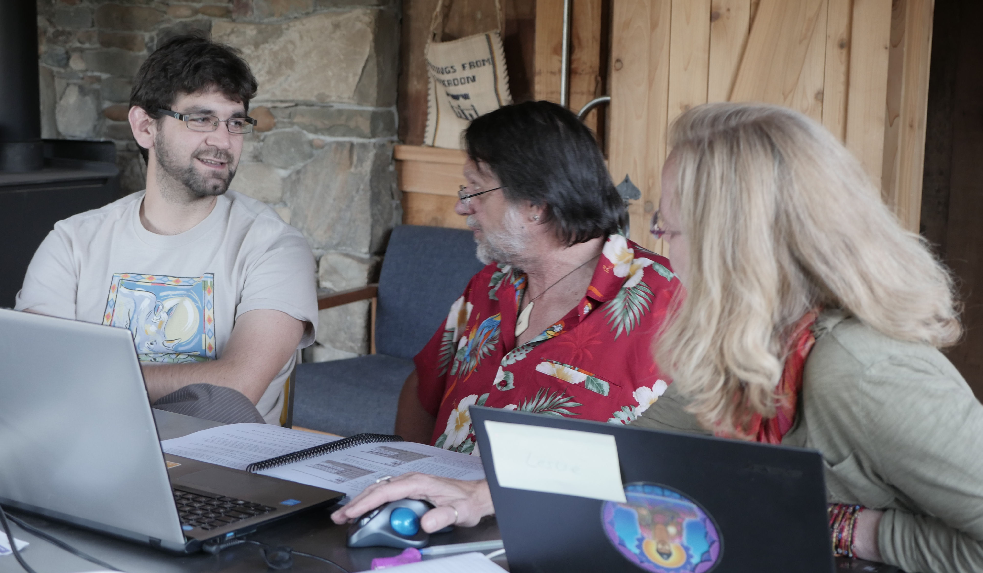
2016 TTT Profile: Carlitos served as the Assistant Trainer for the 2016 Scholar Training Program at the UC Blue Oaks Reserve
(Photo: Carlitos goes over the finer points of class planning with other TTT Board Members John Schaeffer and Leslie Backus)
Carlitos 2016 SCGIS Presentation -pdf 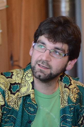
 .
.
Carlitos 2016 Scgis Video -mp4 HD (mb)

2012 SCGIS Train-the-Trainer Candidate Profile
from Carlitos essay about becoming a TTT Trainer: "My experience this year at the SCGIS training was outstanding, not only during the first two weeks in Davis, but also at both conferences where I discovered a completely new world for me, full of people that are thinking and working with the same kind of challenges, using GIS in conservation projects. For this reason, I think that being a “Trainer – Trainee” will give me the opportunity of working on the SCGIS program from a different perspective. (Photo: Carlitos helping 2012 Scholar Dominic Lesimirdana learn new GIS skills. Photo by Sasha Yumakaev)
I have a broad background in training people for different purposes. During my PhD I worked in training park rangers, farmers, students and members of governmental agencies for collecting information about large carnivores along the northeast of Argentina, southern Brazil and eastern Paraguay. Since 2003 I organized many small field training workshops and three tri-national workshops with more than 60 participants each. In the last few years, I have participated more actively in formal graduate and postgraduate courses, mainly in relation to conservation biology, landscape ecology and GIS. For example, I have organized two courses about large carnivores’ conservation and human-wildlife conflicts during 2009 and 2010, and I participated as an assistant professor in the Subtropical Conservation Biology course that we organized for Latin-American post-graduate students in 2010. Also during last year and the current one, I collaborated in graduate courses of ecology and conservation biology, where I talked about landscape ecology and conservation GIS, and I organized some practical exercises on the basis of GIS and their application in landscape ecology (appendix 1). In 2010 I also was the trainer in a post-graduate course about Land Suitability Models organized by the University of Buenos Aires (www.posgradofadu.com.ar/informacion.php?f=carrera_plan&tipo=3&id=252 ). (Photo: Carlitos discusses felid conservation GIS at Asilomar with the world's leading Snow Leopard expert Dr. Rodney Jackson. photo by 2012 scholar Claudia Funi)

My organization is a small institution but with high prestige and leading role in research and conservation in my region, including the northeast of Argentina (mainly Misiones and Corrientes provinces) and the neighbourhood areas of Paraguay and Brazil. We don’t have a GIS department or group, but as the use of GIS tools is becoming more widespread every year for conservation and research, I permanently have requested from projects of my institution and other partner organizations for developing GIS analysis and training in GIS.
2012 SCGIS International Conference Paper presented by Carlitos:
Carlos de Angelo, Subtropical Biology Institute, Argentina
Title: "Using GIS for evaluating habitat availability for species reintroduction: the case of the jaguars in the Iberá Reserve in Argentina"
ABSTRACT: The jaguar (Panthera onca) is the largest felid of the American Continent but it became extinct from most of southern South America, including most of Argentina. The Iberá Reserve is a large protected area of 1.3 million hectares in the Northeast of Argentina, which protect the largest wetland of the country. In this area, jaguars were common until the 20th century when humans start eliminating this species and its prey from the entire region, and the last jaguar was killed around 1950. In the last decades, a reduction of human pressures in combination with increasing efforts of governmental and private conservation actions favoured the recovery of many species of Iberá and triggered the discussion about the possibility of reintroducing jaguars. One of the main aspects for this species reintroduction is the evaluation of habitat availability, but considering in this analysis the possible conflicts and human pressures that still persist in the area. With this aim, we developed GIS layers and combine them in a multi-criteria analysis for predicting the availability of habitat for jaguars in Iberá. We used the information available about jaguars in other regions to construct two models: the habitat condition model (including landscape characteristics, vegetation and prey distribution) and a human pressure model (including distance to human infrastructures, human accessibility, the abundance of cattle, among others). We combine these models using a two-dimensional approach. This approach allowed us to differentiate 250.000 ha of potential core areas for jaguar reintroduction (with good habitat and low human pressures) and the potential sink areas and barriers for the species (with poor habitat and high human pressures). Additionally, these combination of models identified those potentially conflictive areas that jaguars may select because their good habitat conditions but with high risk because human pressures (very important for future management), and those areas with poor habitat conditions but low human pressures that could be useful as buffer areas or corridors (>400.000 ha). Extrapolating the known density of jaguar in other regions, our results suggest that the Iberá Reserve has available habitat to sustain a population of between 25 to 150 jaguars, with an average of ~70 individuals living in core areas with good habitat and low human pressures.
2011 SCGIS Scholar Profile (taken from Carlitos 2011 application to become an SCGIS Scholar)
"I am a researcher with medium expertise in the use of GIS who work in a small NGO that is directly linked to a recently created research institute in Puerto Iguazú, in the border among Argentina, Brazil and Paraguay. I have been working in conservation-research projects for many years mainly focused on endangered animal species and habitat models. Most of my work has been related with the jaguar in the Atlantic Forest, but now I am working with abundance models of species of large vertebrates in the Iberá Marshlands, the largest wetland of Argentina. I have used many GIS tools but I have never been in a formal GIS course, a fact that limits my ability to solve some problems. Additionally, I am particularly interested in cost-distance analysis, connectivity, and in modelling using GIS. I am really interested in the SCGIS scholarship not only to increase my skills using GIS but also to know people with similar interests to share information and experiences. Furthermore, I consider the SCGIS fellowship as a unique opportunity to update my knowledge about GIS and then to transfer this knowledge through local courses and to support other research and conservation projects of my institutions. I consider GIS as one of the most important resources to translate and communicate scientific knowledge in management tools for politicians and managers. I am convinced that strengthening my GIS skills will greatly improve my capacity for generating not only good scientific knowledge but also really useful conservation tools (Photos: Carlitos explains the finer points of Yerba Mate to Mervyn Lotter at the 2011 Scholars program)

*-HISTORY: I initiated my work with GIS and conservation when I was finishing my undergraduate studies in 2002/2003. I started to work as a volunteer in a project of the Fundación Vida Silvestre Argentina (www.vidasilvestre.org.ar), the local representative of the World Wildlife Fund (WWF). My first work was to develop a preliminary multi-criteria GIS model for predicting jaguar presence along the Misiones Province. In this area, the WWF was developing a tri-national strategy for preserving the Upper Paraná Atlantic Forest (UPAF), using the jaguar as an umbrella species. After that, supported by the WWF we constituted a research team (the “Jaguar Project” = “Proyecto yaguareté”) for evaluating the status of jaguars along the UPAF and to use this information to validate the conservation strategy developed by this and other NGOs. My main activity was to construct and coordinate a network of more than 100 volunteers distributed along the UPAF to obtain reliable jaguar records not only in Misiones (Argentina), but also in Brazil and Paraguay (see details in De Angelo et al. 2011a, attached). It was the basis of my PhD project undertaken in the year 2004; in this year I obtained a fellowship from the Argentinean Government to continue this work and develop my thesis. Until 2008 I worked hard to obtain and identify records of jaguar presence (tracks, scats, etc.), and connecting this information to a GIS to update jaguar distribution in the UPAF. This work resulted in significant implications for jaguar conservation not only due to the collected information (presence records, mortality information, jaguar DNA obtained from fecal samples and skins) but also because the volunteer network linked a large number of people and institutions with different characteristics and aims (e.g. governmental institutions and NGOs, ranchers and park rangers, etc.) but sharing the same interest for jaguar protection. It included a permanent contact with the volunteers through meetings, workshops, and communication campaigns (see www.yaguarete.net); this gave me the opportunity to increase my learning of the complexity of biodiversity conservation in developing countries. As a result of our work in the Jaguar Project and the efforts of many other institutions, we expect to finish this year with a tri-national conservation plan for the jaguar population of Misiones Province and the neighborhoods.
Although as a conservation project we had much cooperation from the FVSA-WWF and other NGOs from Argentina and the neighborhood countries, we felt the need of an academic structure to support our work. For this reason, in 2005 we joined other research groups of Misiones and we formed the CeIBA to promote the creation of a research institute. Finally, in 2010 the University of Misiones created the IBS, and now the Jaguar Project is part of the main research projects of both the CeIBA and the IBS.
The description of jaguar distribution was one of the axes of my work, but the description of the landscape where jaguars inhabit was the other important point to analyze. To do that, I started working with satellite images and land-use change analysis (see below an example in Izquierdo et al. 2008). I explored different options to construct landscape variables to characterize the eco-region from the jaguar’s perspective. Additionally, I used different methods for habitat modelling in order to link jaguar data with the landscape variables. Some examples of this work and analysis can be found in De Angelo et al. 2011b which I have attached to this form. In this work I used the Ecological Niche Factor Analysis to obtain habitat suitability maps not only for jaguars but also for the other large predator of the UPAF, the puma (Puma concolor). I used this analysis to compare the response of these large predators to human impacts at an eco-regional scale. Finally, I complemented this analysis with a deeper work on jaguars to obtain a more complete model for this more threatened species and as a validation tool for conservation strategies developed for the UPAF. One of these strategies, elaborated by the WWF, was the starting point of our Project in 2002. More details of the latter work were included in my PhD thesis, finished in 2009 (see: http://sites.google.com/site/carlosdeangelo/home ) and will be discussed in the paper I proposed for the conferences. The Jaguar Project continues through camera trap surveys for estimating the jaguar density in different areas and with GPS-collared animals. Although this work is coordinated by another researcher, my present role in this project is to assist with all the GIS-related data analysis.
In 2009 I started a new project connected with the Jaguar Project but in the Iberá Marshlands. The Iberá Provincial Reserve is a 13000-km2 area which protects the largest wetland of Argentina. It is located in the Corrientes Province, a subtropical area in the northeast of the country, just south of Misiones where I developed my PhD and where my host institutions are located. The aim of this project is to generate habitat models for predicting the presence and abundance of the largest vertebrates of this area (marsh deers, capybaras, caimans, etc.). I am collecting data of these species through aerial surveys and I have developed some preliminary analysis related with abundance models. My co-advisor in this project is Dr. Thorsten Wiegand (www.thorsten-wiegand.de) from the Ecological Modelling Department of the Centre for Environmental Research (UFZ) in Leipzig, Germany. Dr. Wiegand helps me solve the methodological problems of analyzing data from the surveys and how to develop my statistical models. As I mentioned above, this work is related with the aim of restoring a jaguar population in this area; a project promoted by the NGO “The Conservation Land Trust” Argentina (www.theconservationlandtrust.org).
Background as a Trainer: I have a broad background in training people for different purposes. During my PhD I worked in training park rangers, farmers, students and members of governmental agencies for collecting information about large carnivores along the northeast of Argentina, southern Brazil and eastern Paraguay. Since 2003 I organized many small field training workshops and three tri-national workshops with more than 60 participants each. In the last few years I have participated more actively in formal graduate and postgraduate courses, mainly in relation to conservation biology, landscape ecology and GIS. For example, I have organized two courses about large carnivores’ conservation and human-wildlife conflicts during 2009 and 2010, and I participated as an assistant professor in the Subtropical Conservation Biology course that we organized for Latin-American post-graduate students in 2010. Also during last year and the current one I collaborated in graduate courses of ecology and conservation biology, where I talked about landscape ecology and conservation GIS, and I organized some practical exercises on the basis of GIS and their application in landscape ecology (appendix 1). In 2010 I also was the trainer in a post-graduate course about Land Suitability Models organized by the University of Buenos Aires.
My organization is a small institution but with high prestige and leading role in research and conservation in my region, including the northeast of Argentina (mainly Misiones and Corrientes provinces) and the neighborhood areas of Paraguay and Brazil. We don’t have a GIS department or group, but as the use of GIS tools is becoming more widespread every year for conservation and research, I permanently have requests from projects of my institution and other partner organizations for developing GIS analysis and training in GIS. For this reason, I am organizing different levels of training courses in conservation GIS in my region:
Basic GIS course for conservationists: It is planned as a one-week practical course intended for researchers, NGOs and governmental agencies, working in conservation projects. The objective of this course is mainly to introduce GIS for people who have never used these tools or are using only basic tools like GPS, Google Earth or ArcView 3. There is a huge demand from people in this situation that need an update and support for their projects. I organized the first edition of this course for next week as an internal three-day course for my organization, and I called it: “Maps for biologist: do not be afraid of GIS”. I will have around 15 students including not only graduate students but also experienced researchers as the president of my organization. Most of the participants have poor experience using GIS so I will try to introduce basic concepts of GIS and the use of ArcGIS 10. Although I have elaborated my own classes and exercises for this course, I have used ESRI books for preparing most of the practical exercises. This is a very useful material but it is not oriented for conservation GIS as it is the Juniper GIS material, which would be much more useful and applicable for the present and future students in my region. I hope to improve and repeat this course next year, incorporating students from different institutions not only from Argentina but also from Brazil and Paraguay.
Post-graduate GIS and habitat modeling course: This is a post-graduate course we are planning with Dr. Karen DeMatteo from the University of Missouri-St. Louis. Every year Karen comes to Argentina for her field work and she has organized two post-graduate courses in our region. She has offered me the opportunity of collaborating in her courses that usually are organized in two or three weeks, each week covering different levels of skills in managing GIS and habitat modeling techniques (e.g. Maxent species distribution modeling). In the past courses, Karen included only the use of basic tools of ArcView 3.2, but I think that with the support of Juniper GIS, SCGIS and ESRI, we will be able to include much more advanced tools of ArcGIS in this course.
Conservation GIS courses in other parts of Argentina and Latin-America: This is only an idea to be talked about with other Latin-American alumni of the SCGIS program. It would be interesting to work together in the organization of courses in Argentina and other neighbor countries.
*-Title / Abstract of 2011 SCGIS paper: “A management landscape for jaguars in the Upper Paraná Atlantic Forest ecoregion”
The Upper Paraná Atlantic Forest (UPAF) is among the most endangered eco-regions of the world because of its high levels of fragmentation and degradation. In this area located in the border among Argentina, Brazil and Paraguay, persists the southernmost population of jaguars (Panthera onca) of the world. My aims were to explore the landscape level factors that are affecting jaguar persistence in this region and to develop a spatial model for predicting the conditions of its habitat from a management perspective in the UPAF. I used presence records of jaguars collected through a participatory network of volunteers distributed along the eco-region. I combined these records with pseudo-absences to be used in generalized linear models. I used the information-theoretic approach to test different hypotheses related with the conditions that determine jaguar presence. I selected two general models representing the two main evaluated hypotheses: 1) landscape-conditions model; and 2) direct human pressures model. These models were used independently to develop a two-dimensional spatial model of jaguar habitat suitability.
Jaguar persistence was favored not only by the presence of native forest at present but also by the historical presence of forest (30 years ago), and negatively affected by human land uses. Direct human pressures also had an important effect on jaguars, with a positive effect of protection and negative effects of human accessibility and historical human population density. The two-dimensional model showed that less than 8% (~20,670 km2) of the analyzed landscape presented suitable conditions to be considered as potential core areas for jaguars. Barrier areas (unsuitable) represented 60.0% of the study area, 3.3% were potential refuges (areas that need restoration: low human pressures but poor landscape conditions), and 15.1% were potential sinks (poor landscape conditions and relatively high human pressures). From the management perspective, the most important areas detected by the model were the 32,563 km2 (11.8%) of potential attractive-sink areas that presented acceptable landscape conditions for jaguars but high direct human pressures (i.e. potential “ecological traps” for this species). This analysis allowed the description of the most important factors affecting jaguars at an eco-regional scale (e.g. the historical conditions of the landscape). Additionally, it constituted a useful management tool for validating conservation strategies developed for jaguars and the UPAF.
Carlos De Angelo Scgis 2011 SCGIS Paper :
Abstract: The Atlantic Forest (AF) is a global biodiversity hotspot distributed in eastern Brazil, eastern Paraguay and northern Argentina, which has lost ≈90% of its range. The jaguar is the top predator in the AF, but due to its habitat requirements this felid is seriously threatened. For preserving the last jaguars of the AF, regional and local strategies are critical. In an international effort, jaguar specialists determined the priority jaguar subpopulations of jaguars that remain in the AF. We developed a least-cost-corridor analysis to evaluate potential corridors among jaguar subpopulations. We found that, although some subpopulations could be connected by corridors, most of them are practically isolated. Zooming in to the largest jaguar subpopulation, we focused in the most important areas for internal connectivity. In these areas, we used graph-based models and Conefor 2.6 to determine the relative importance of the remaining forest patches for maintaining habitat connectivity. This prioritization at patch level was consistent with the local laws for forest protection and management. Different connectivity analysis tools offered specific solutions for jaguar conservation in the AF. Least-cost corridors served as a practical tool for identifying the most isolated subpopulations at a regional scale. Graph-based models and Conefor were important for finding specific forest patches where local actions will have a huge impact for preserving jaguars in the main subpopulations.
-
 Anonymous User