- Home
- :
- All Communities
- :
- User Groups
- :
- Conservation GIS
- :
- Documents
- :
- Anna Komarova, Russia
- Subscribe to RSS Feed
- Mark as New
- Mark as Read
- Bookmark
- Subscribe
- Printer Friendly Page
- Report Inappropriate Content
Anna Komarova, Russia
Anna Komarova, Russia


Anna Komarova, Greenpeace, Russia 
xTTT2019 x2019TTT x2019ConfInterviewer xChapterConference2019 x2017TTT xChapterReport2017 x2015ChapterConference xScholar2012 x2012TalkMap xChapter xRussia xForest xRemote xEducation xLandscape xFire
Anna’s conservation activism began in her student days in 2003 at Moscow State University where she was head of the Science Department of the University’s Student Nature Protection Team. In 2006 she joined Greenpeace Russia as a Protected Areas Assistant, working alongside Dr. Ilona Zhuraleva who was part of a new GIS team at Greenpeace Russia. Together they have gone on to help make the SCGIS Russia Chapter one of the most successful in the world, organizing many national conferences and conservation GIS training activities.
2019 Profile: Anna is a participant in the first-ever SCGIS TTT Summit Meeting. Anna is also co-organizer of the National Conference of the Society for Conservation GIS in Russia, Oct 3-5, 2019 at Valdaisky National Park, Novgorod region, Russia
2019 International Conference Presentation
2019 International Conference Interview: Anna & Ilona
2019 Map Gallery Interviewer on TEAM CATILAN
2017 Profile: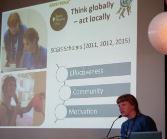 Anna attended the SCGIS Annual International Conference to give the first-ever in-person SCGIS Country
 .jpg) Chapter Report as part of the SCGIS Conference Plenary Session.
Chapter Report as part of the SCGIS Conference Plenary Session.
<--SCGIS 2017 Russia Chapter Report PPT File
2017 SCGIS Status: co-organizer of the 3d SCGIS Russia Conference
2017 Conference Organizers: Anastasia Philippova, Anna Komarova, Ilona Zhuravleva, and Evgeniya Elkina
2015 Profile: Anna & Ilona helped organize the Second National "Conference of the Community Environmental Conservation GIS" The following is taken from their report on the conference (photo below)
"The second Conference of SCGIS - geographic information systems in the field of nature conservation - was held! Three days, from September 25 to September 27, employees of commercial and non-profit organizations, reserves, institutes spoke, discussed, studied, argued, gave gifts, found solutions to each other, and created this conference. We are going to support an active GIS community in Russia. It is! We can confidently say this.
We thank all the participants who watched the broadcast online, expanding the geographical and informational boundaries. All together we had more than 100 people! We hope that the received inspiration will last for a long time, and in a year (two?) We will meet again to assess the direction of the movement of the community and technology, to hear about victories and new projects. Prepare victories and reports! 
Video recordings of session reports and master classes, as well as photographs and summaries of the round tables held, will appear shortly on the conference page . Photos of the conference are available here
2015 Paper Presented by Anna at the SCGIS Russia Conference
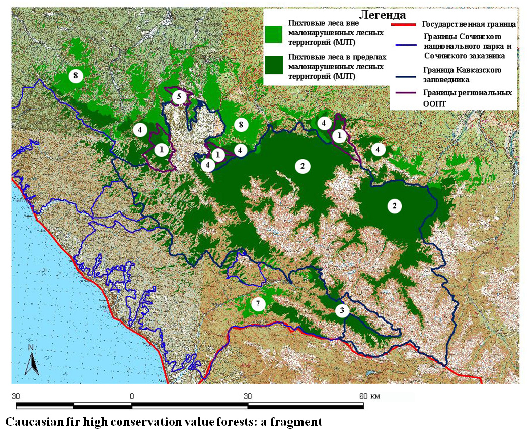
- "Northwest Caucasus: Distribution maps of fir trees from remote sensing data. "
- Anna Komarovakomarova@greenpeace.org, Greenpeace Russia, Moscow.
On the example of mountain forests with a predominance of Caucasian fir illustrated two tasks - the creation of total forest card with a predominance of fir Abies nordmanniana(Stev.) Spach and determination of the share of its participation in the stand. Distribution maps silver fir (forest, where fir dominates the canopy is depending on the overall compactness of the stand, for the entire range of Caucasian fir Russia) and stake fir (classes 0, 0-20, 20-40 and over 40% of closeness to the modeling portion in the upper r.Zelenchuk, Karachay-Cherkessia) were obtained by classification of Landsat TM images in the guise of forest by neural networks (NeRIS) program ScanEx Image Processor. As training geobotanic used to describe them. Verification of fir distribution maps held in winter images Landsat ETM +, products TerraLook Aster GoogleEarth and support services in the grid nodes (Cohen's kappa of 94.6%), the share of card fir participation - on points rekognostsirovok route.
2013 Profile: Anna & Ilona helped organize the National "Conference of the Community Environmental Conservation GIS" , held September 28-29, 2013 at Esri-CIS offices in Moscow. (Photo Below)
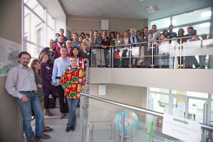
The following is from their conference report: "Friends! In the fall of 2013, the first practical conference with the international participation of the community of environmental GIS in Russia "Using GIS and Earth Remote Sensing Data for Nature Conservation" , dedicated to the use of various GIS technologies for nature conservation, was held. The main goal of the conference was the creation of an active GIS community in Russia and the CIS countries." Conference Photos can be found here
Conference Videos (all in Russian) Can be found here.
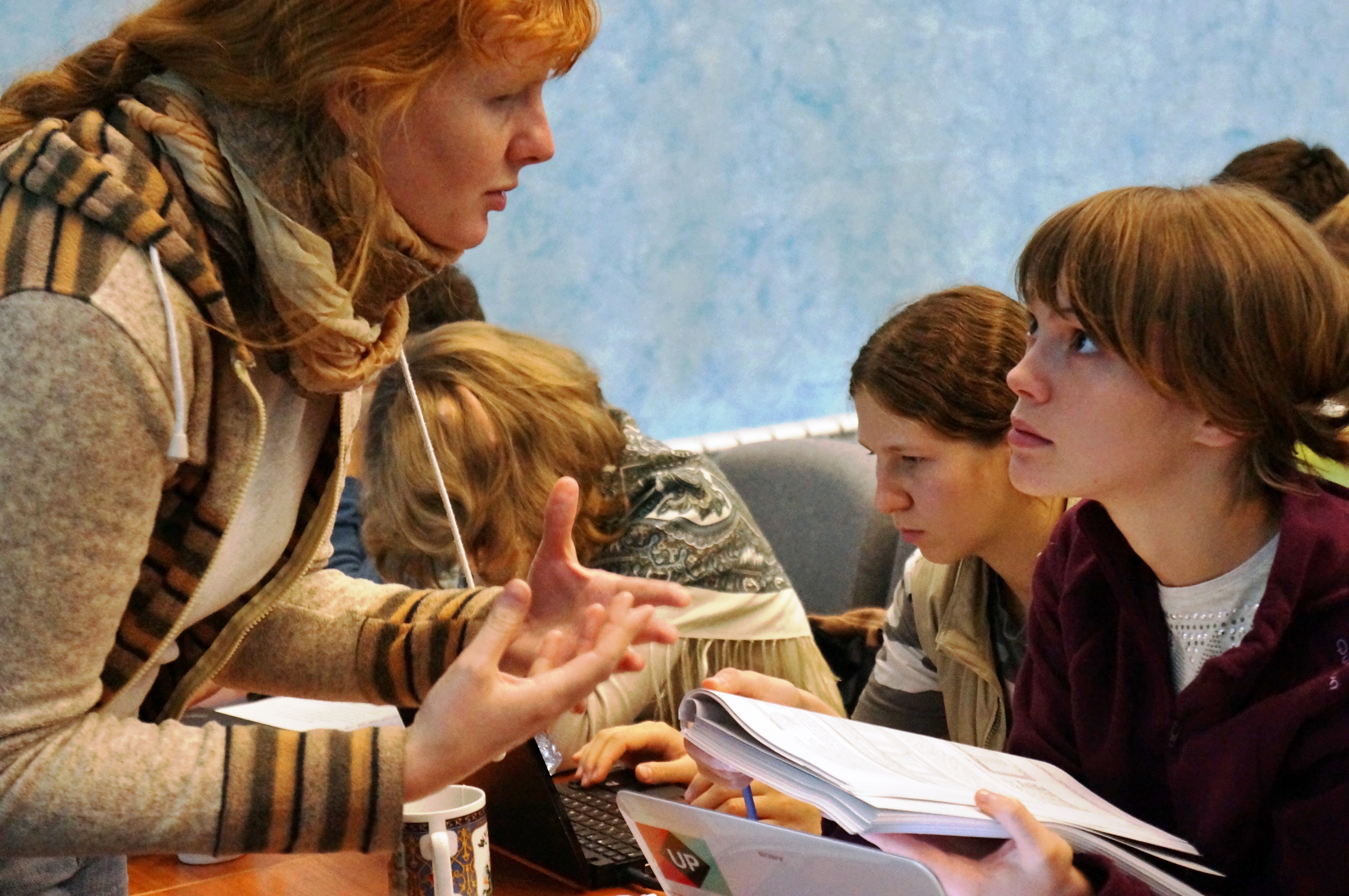
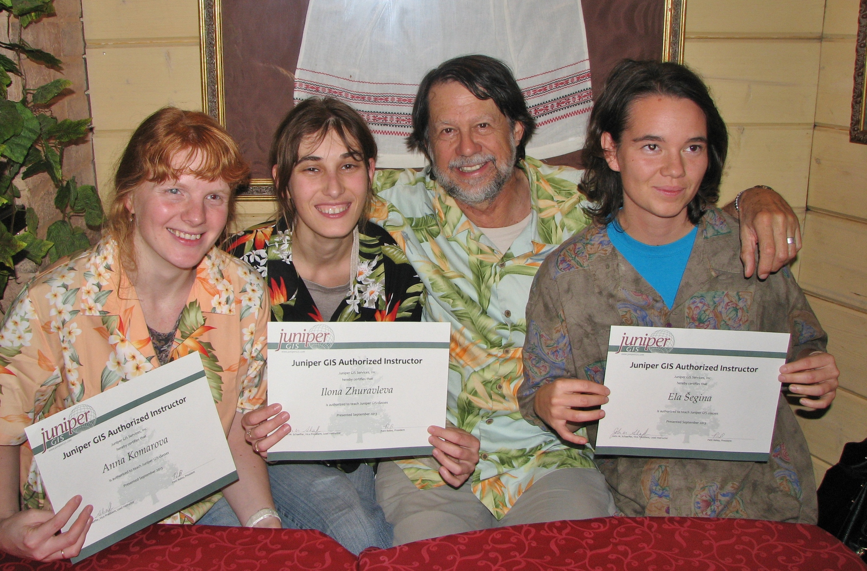
2013 TTT Certification: At the 2013 Conference, week-long workshops were held in Conservation GIS, taught by Anna and Ilona as the final required part of their certification to become SCGIS TTT Trainers. Below is a photo showing Anna hard at work helping other conservation GIS people learn about ArcGIS.
Here Anna, Ilona and Ela Segina from Slovenia proudly holding their new TTT Authorized Trainer Diplomas
Arcnews Article about the 2013 Scgis Russia Training Workshop
"The three former Scholars recently trained in Russia are now ready to teach the AE class, both in terms of their skills and having the material. As they gain experience and confidence, they will add more classes to their repertoire, with the continuing support of Juniper GIS for teaching material. Over the next five years, we would expect to have as many as 300 or more people learning how to use GIS in conservation applications from these three new instructors, which is quite a multiplier effect."
2012 Profile:  Anna's first year with SCGIS was as a scholar in 2012. Even then it was clear that she was destined for great things, as one of the scholarship reviewers noted: "Since I met Anna she has been demonstrating gradual growth of involvement into local level conservation. She works on conservation projects both with individuals and different NGOs and scientific groups functioning as a worker, coordinator, organizer or the leader."
2012 SCGIS Scholarship Essays & Excerpts: (Note, photos are from friends & other scholars in the 2012 program)
- I consider Russian GIS community to be somewhat closed of international GIS society, and Greenpeace GIS project is even more closed because of the small staff and the lack of time. I suppose it’s good for us and for international community if I can tell about our work.
- I hope to make GIS “closer to GP staff’ and to have an opportunity to does on telling international community about GIS work of Greenpeace Russia – and I need ArcGIS Online skills for these tasks.
- One of the main tasks for us now – to enlarge “scientific content” of GP Russia GIS work. We hope that GIS project in Greenpeace stops to be only a tool for campaign and also start to work as science and analysis center for conservation biology. I suppose international communication to be very important in this connection.
- As for science – I’m a PhD student and my PhD work is inter alia connected with remote sensing and image classification. As my department I can’t find a  mentor on GIS. My mentor at the department of plant ecology help me very mush in all question except GIS, but concerning to GIS I have to research without science mentor. So to take part in scholarship is very important for me as GIS researcher.
I’m very interested in ArcGIS Online because I hope GIS simple operations and results to be closer to campaign staff of Greenpeace Russia and Greenpeace International. It’s very important for Kids for forest, Natural Heritage of Russia, Firefighting and Protected areas projects – i.e. for projects which require a lot of expedition and trips. The second aim is to let people all over the world to know about our GIS for conservation work – we will never have enough time to show it regularly by publication, but I hope ArcGIS Online to be a great tool for information communication inside the conservation GIS community.
Please describe the history of your personal work in conservation and GIS:
My conservation work started in September, 2003 – I went to the Student Nature Protection Team of Moscow State University. I worked there to the middle of 2007. In 2004-2007 I was the head of science department of the team and coordinated collaborations concerning to science and (later) GIS of the team and other NGOs.
 At September 2005 I started to work and study GIS at Social Ecological Union. Since Feb 2006 I work at Greenpeace Russia. In 2006-2007 I was an assistant of Nature Protected Areas projects. I managed to get the Ford Foundation grant especially for my work at Greenpeace Russia. The condition of grant was my work for Siberia and Far East. So my tasks were analytic work for value natural areas, especially Samarga (Samarga is a great 1st order river in Russian Far East, i.e. it runs to the Pacific Ocean. Its basin wasn’t influenced by forest cutting to 2003, but in 2003 the “Terneyles” company planned to cut forest there), Bikin (another value river basin in Far East), Ukok (Altay Mountains) and other, and then China illegal wood trade project.
In 2008-2011 I was an assistant of Forest Unit Head. I went on to work for value nature areas, then I made a news delivery of Forestforum (http://www.forestforum.ru/portal.php), took part in firefighting work and in Kids for Forest project, work with forest legislation and write toolkits. To be short – as I was an assistant of Forest Unit Head I took part in all projects of Forest Unit of Greenpeace Russia.
It’s difficult for me to answer the question about my motivation for working in conservation – I know absolutely nothing what anything else I can do. It’s just science worth to do – but I consider Russian science has now sense for conservation biology only.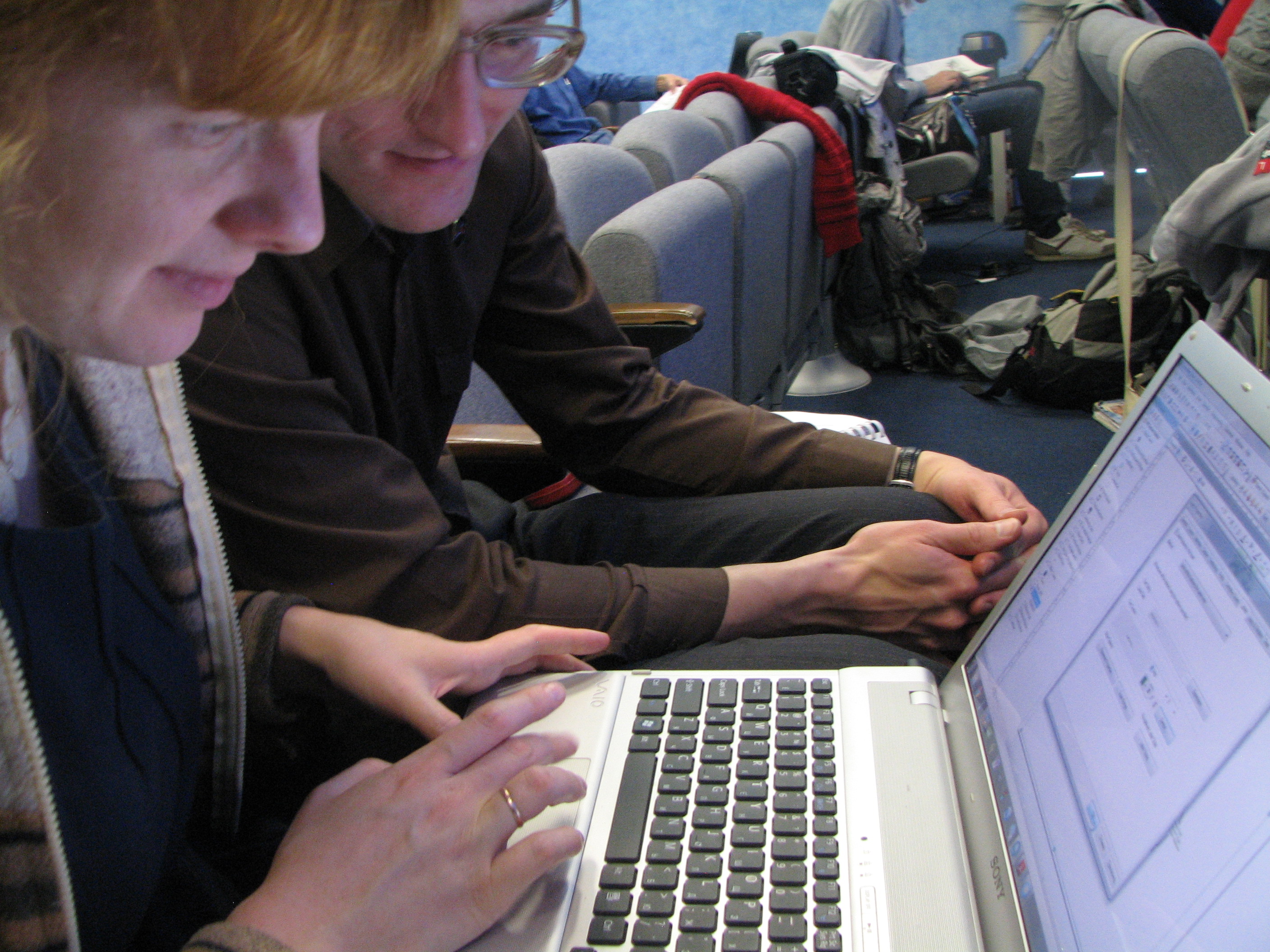
Concerning to GIS I used it since the September of 2005, but to the end of 2011 it wasn’t my main work. I was a Forest Unit Head assistant and I had a lot of other work. I was fond of GIS since I know about this area of knowledge (and even before: in 2004 my friend and I tried to invent GIS for manage geospatial database on html base although I didn’t know anything about GIS since Aug, 2005:)) And time to time I found an opportunity for some GIS researches.
My first GIS work was deal with the Samarga project. I took part in a group which tried to protect the area, and we need to solve some GIS tasks (to make maps for press, for certified public accountants, for discussing of our plans). And I start to learn ArcView 3.3 at the Forest and GIS team of Social Ecological Union. I used ArcView 3.3 and sometimes ArcMap for layouting and visualization and Erdas Imagine for manage image data.
So my GIS work was only tool for solving many small tasks, first it was visualization.
Then I lead some analysis projects (for example if the significant part of forest cut areas of Terneyles leased territory have the slope more than 20 degrees, also we try to know the area where cuttings for illegal trade to China and so on).
The great part of my GIS work was preparing maps for campaign projects (Energy, Kids for forest, Natural Heritage of Russia, Firefighting, Protected 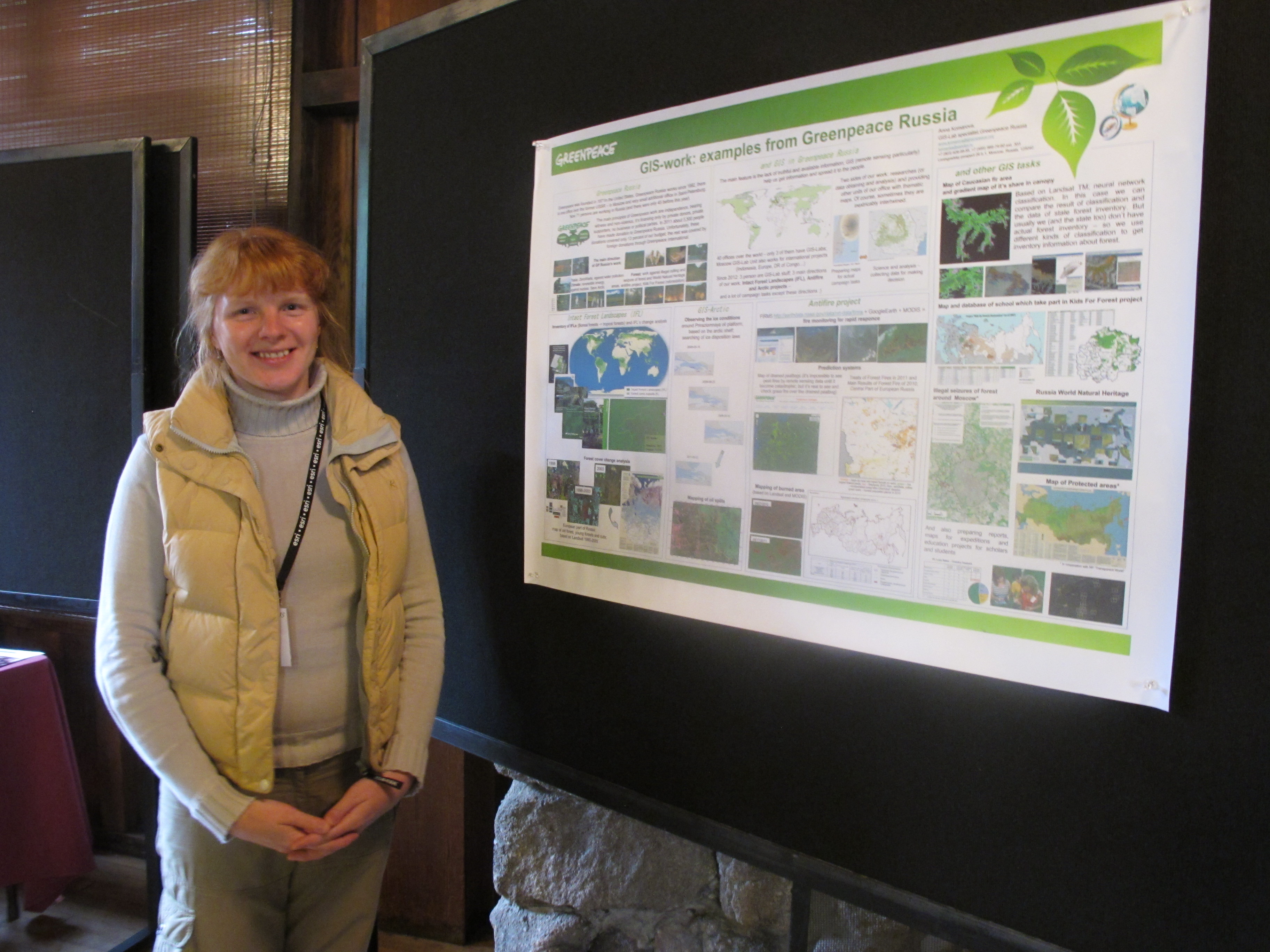 areas and other projects) and for Greenpeace expeditions.
My student, diploma and PhD researches were a first chance to use GIS not only as tool, but us science instrument. My student researches were deal with laws of patterns of Picea-Abies forest on different places of relief and required compare analysis of satellite images and DEM. My diploma research was deal with mapping of Caucasian Abies forest in Adugeya and Krashodar region (the North-West part of Caucasus) using supervised classification in Erdas Imagine, laws of patterns of fir forests on different places of relief, aspects, slopes and level above the sea (this task required computing of coverages in ArcGrid) and the example of high conservation value forest (HCVF) mapping and planning forest conservation regime based on science data.
My PhD research in GIS part is continuation of my diploma. It deals with all fir forests of Russian Caucasus. I will make the map of fir forests wider and more accurate and specify relations between types of forests and relief data. Also I plan to use neural classification for getting detailed information about fir forests spatial structure and to make change analysis of fir forests. The work is a base for HCFV defining project in Caucasus (a part of the process FSC certification).
Another science GIS research was deal with the laws of coexistence of two subspecies of brown willow warbler in the North of European Russia. I worked as GIS-specialist and plant ecologist at the joint project with department of vertebrates of Moscow State University.
Since I started not only doing maps for campaign needs my main theme is fire analysis. We prepared a map of fire risks; I made a map to show relations between roads and fire points in the forests of the North of European Russia; an analysis of Yakutia and Amur regions’ spring forest fires. The last task was an analysis of forest fires-2011 all over Russia, especially Asia part of Russia. This research is very important for firefighting, because the main problem in state forest protection organizations is the lack of money and the funding as goes to reduce as state officials lie and conceal the information about the fires. We try to make people, mass media and then state officials recognize and admit this problem – we suppose government to start action after recognizing the dangerous of fires on natural area.
Except mapping for firefighting in 2011 I took part in preparing map of “hot points of near Moscow area” – the map of lands near Moscow which were illegal occupied or leased since 2002.
Please describe how you work in your local conservation and GIS community: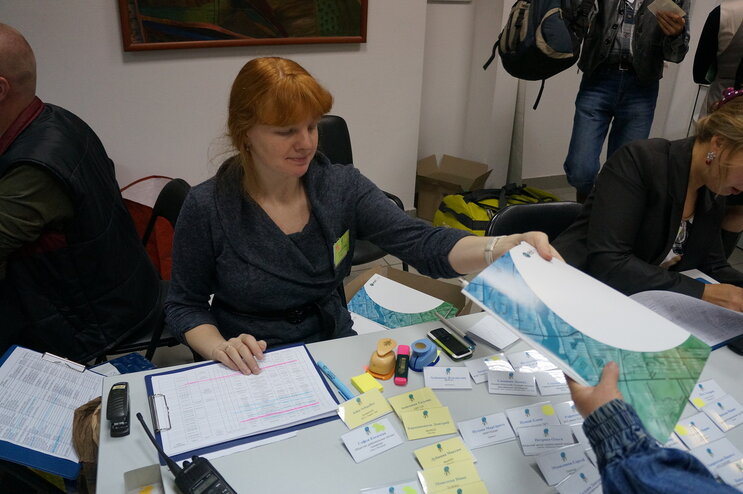
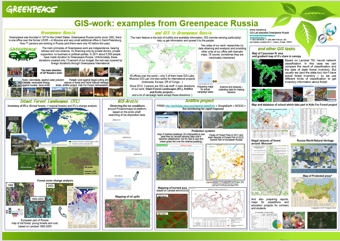
Greenpeace Russia collaborates with a number of NGOs. GIS unit of Greenpeace Russia, “Transparent World”, Arkhangelsk project office of World Wide Fund For Nature (WWF Russia) and Biodiversity Conservation Center (BCC) form a GIS and forest conservation community. There is exchange data, common satellite images databases, work on mapping projects in cooperation and participation in co-expeditions, in forming the process of sustainable development of economy and nature preservation, in protection value natural areas, in ecological education inside this community. The contact data and examples of collaborated projects are listed below.

Please describe what is the most unique and the most challenging about the conservation/GIS work that you do:
- It’s often only Greenpeace Russia (alone or in collaborating with other NGOs) who gives reliable information about natural disaster and lawlessness of officials, and GIS is very important tool. As far as Russia case is concerned, the official source of such information in Russia are not convenient (not reliable, not easy to find, not timely etc).
- The important part of my work is mapping and analysis for firefighting, because the main problem in state forest protection organizations is the lack of money and the funding as goes to reduce as state officials lie and conceal the information about the fires. In 2011 official data about burned area was more than 5 times diminished (our data - only forest burned area is more than 8.2 mln ha). We try to make people, mass media and then state officials recognize and admit this problem – we suppose government to start action after recognizing the dangerous of fires on natural area only.
- I work about closing plant ecology and GIS. I make researches in this area and teacher students of the department of plant ecology.
- I take part in forest cover change researches. They show area fragmentation level and human influence to forest ecosystems. It’s claimed as for intact forest landscapes as the area near Moscow.
- We estimate risks of environment disasters (fire emergency, the probability of illegal occupation of forest area) based on GIS data inter alia. We also prepare recommendation for sustainable development of economy and nature preservation.
2012 Conference Presentation:
Greenpeace Fire Fighting Work: Mapping, Analysis, Rapid Response
Presenter(s): Anna Komarova, Greenpeace, Russia*
"In 2011 official data about burned area was more than 5 times diminished (our data-only forest burned area is more than 8.2 mln ha). But state officials lie and conceal the information about fires. It leads to great suffering for people and for valuable natural areas and to increasing of fires. The mission of Greenpeace is to stop official lying and to make them really act. GIS Unit of Greenpeace Russia works in the next directions: rapid response and mapping for fire expedition, mapping burned area and analysis of fire dynamics and prediction the next fire disasters.
The scheme of rapid response is based on FIRMS (Fire Information for Resource Management System). We present the principles of effectively using FIRMS in Russia for extinguishing different types of fires on natural areas. The mapping of burned area is based on Landsat and Modis data. We present the result map of 2011 and methodology of mapping. Fire analysis (researches on fire dynamics and prediction the next fire disasters) is based on different types of data. We present result maps and methodology of preparing for three products: Threats of Forest Fires in 2011, Frequency of burning areas in Central Yakutia and Relations between roads and fire breeding points in the Northern part of European Russia."
-
 Anonymous User