- Home
- :
- All Communities
- :
- User Groups
- :
- Conservation GIS
- :
- Documents
- :
- Ilona Zhuravleva, Russia
- Subscribe to RSS Feed
- Mark as New
- Mark as Read
- Bookmark
- Subscribe
- Printer Friendly Page
- Report Inappropriate Content
Ilona Zhuravleva, Russia
Ilona Zhuravleva, Russia


Ilona Zhuravleva Greenpeace, Russia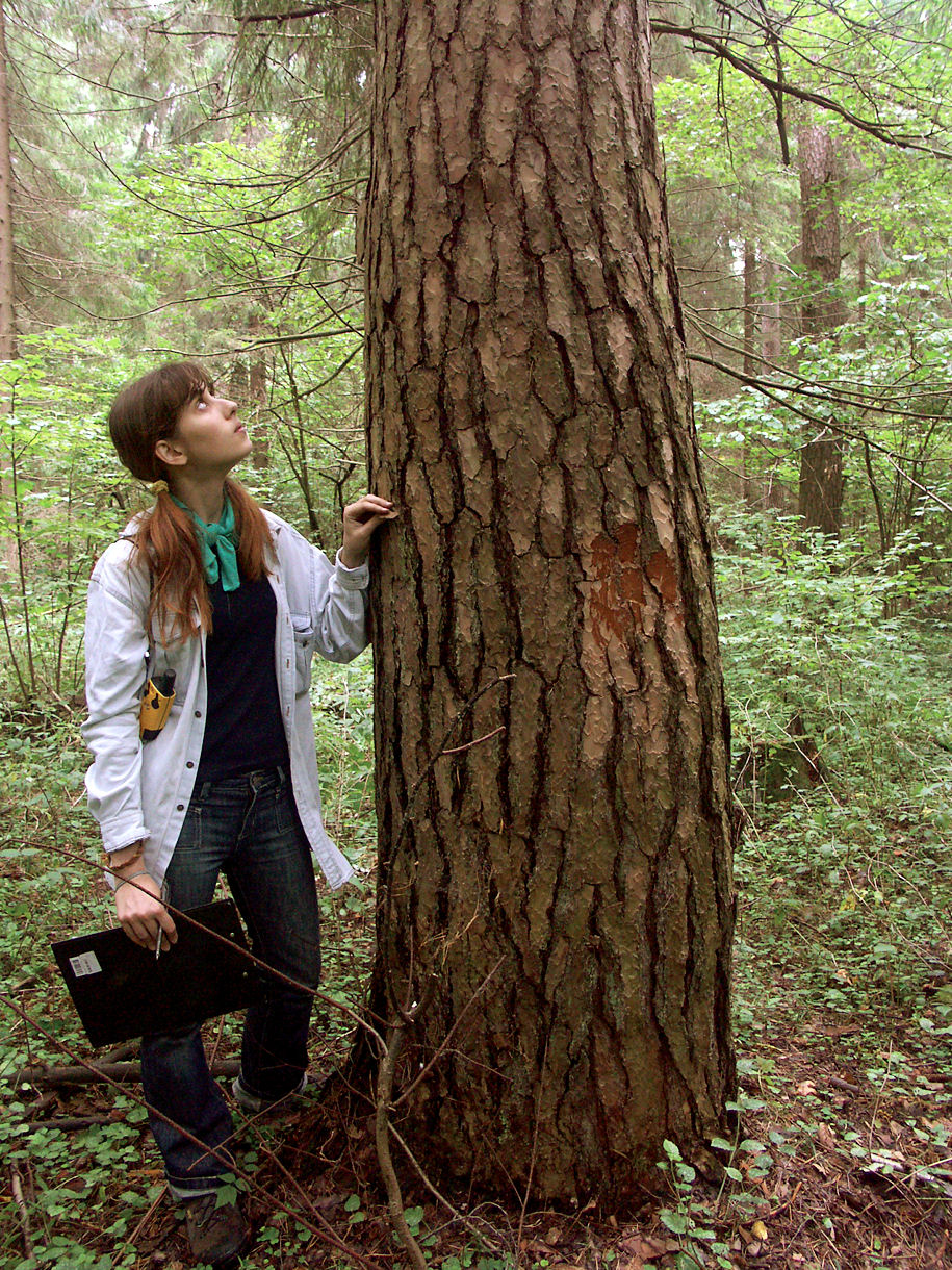
xTTT2010-2019 x2019TTT x2019ConfInterviewer xChapterConference2019 x2017Chapter x2015Chapter x2013TTT x2013Talk xChapterRussia2013 xScholar2011 x2011Talk xScholar2009 x2009Talk xRemote Sensing xForest xFire xScgisChapter xRussia
Ilona distinguished herself as an ecologist very early in her school days. She worked at an Ecological research paper, and participated in Russian competitions in Ecology in 1998 and 1999, winning in the Tver Regional competition, all prior to University. At University she investigated methods of atmospheric monitoring, rare plant species monitoring, regional nature protection, and visualization & analysis of Red Data Book data using GIS-technology. Altogether she published 9 scientific articles in her undergraduate years and attended several municipal and Russian Ecological conferences. After attending a conservation seminar led by Greenpeace Russia she began work with Greenpeace in 2005 and was joined the following year by her friend and colleague Anna Komarova. Since then these 2 scientists have assisted with many SCGIS, Chapter, Conference and Training efforts.
2019 Profile: Ilona is a participant in the first-ever SCGIS TTT Summit Meeting. Ilonais also co-organizer of the National Conference of the Society for Conservation GIS in Russia, Oct 3-5, 2019 at Valdaisky National Park, Novgorod region, Russia
2019 International Conference Interview: Anna & Ilona
2019 Map Gallery Interviewer on TEAM CATILAN
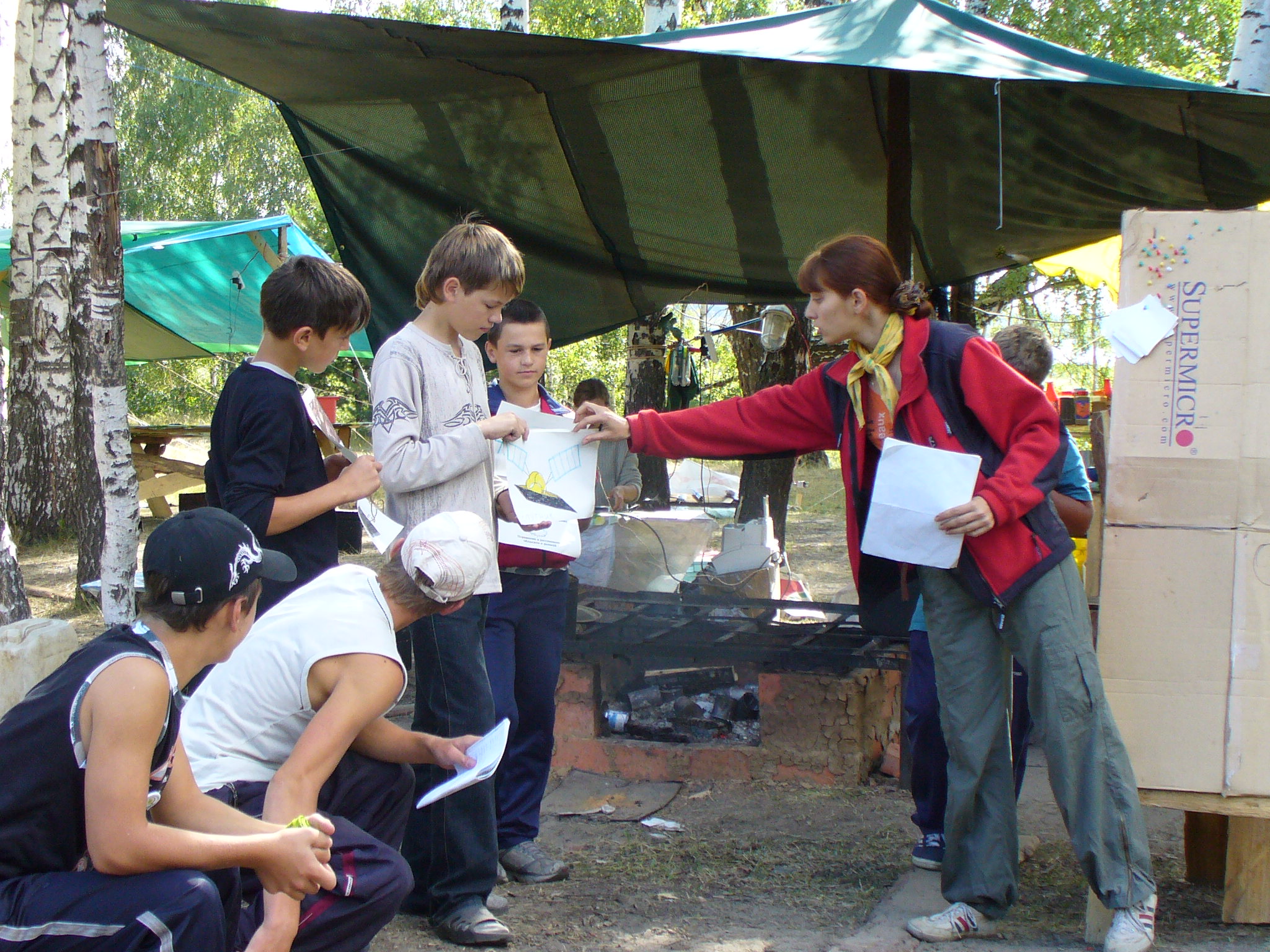
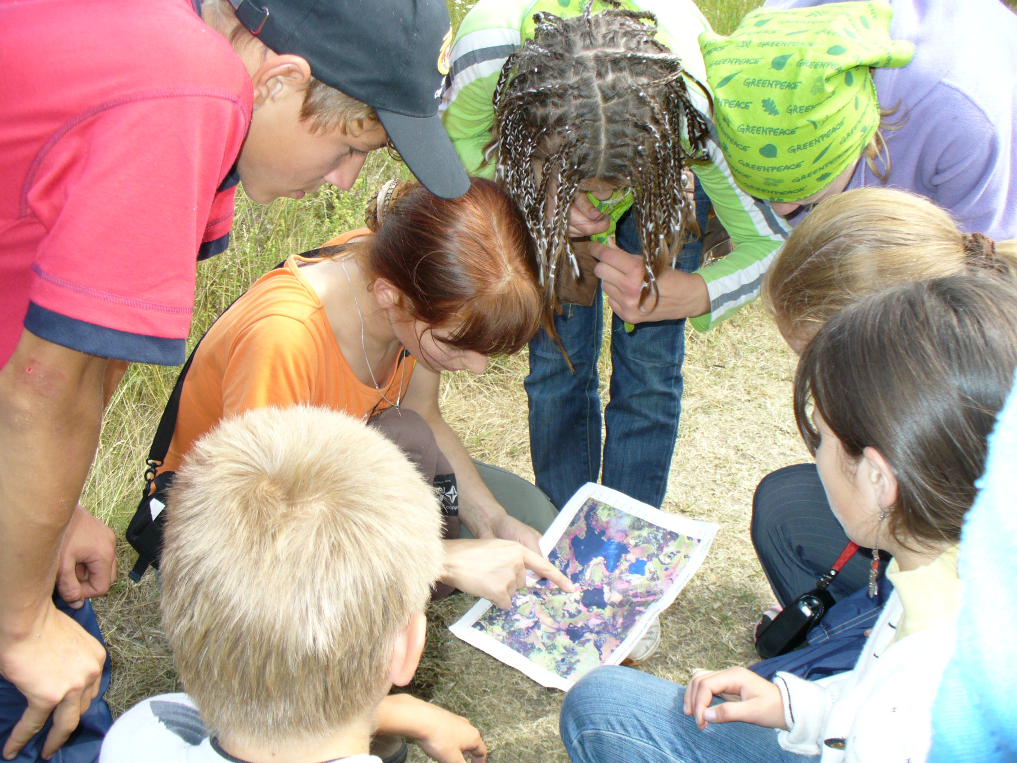
2015 Profile: Ilona & Anna helped organize the Second National "Conference of the Community Environmental Conservation GIS" The following is taken from their report on the conference (photo below)
2013 Profile: Ilona & Anna helped organize the National "Conference of the Community Environmental Conservation GIS" , held September 28-29, 2013 at Esri-CIS offices in Moscow. (Photo Below)
2013 TTT Certification: At the 2013 Russia Conservation GIS Conference,
2011 Profile Ilona Re-applied and again achieved very high rankings and was accepted as Scholar, and was able to attend the full program
2009 Profile Ilona was the highest-ranked applicant from Russia in 2009 and quickly accepted into the program. Unfortunately due to a last minute family crisis on the eve of her flight she was unable to attend the program and thereafter reapplied in 2011
2017 Essay by Anna Komarova as part of her 2017 SCGIS Conference Presentation
"The SCGIS Russia Chapter and Greenpeace Global Mapping Hub: two sides of the same coin"
"The Russia chapter of SCGIS has a long history. The chapter members take part in SCGIS International activities since 1999. Anastasia Filippova, who was selected to participate SCGIS Scholarship program in 2017, is the jubilee 40th scholar from Russia chapterJ
The idea of SCGIS was very popular in Russia in the beginning of 2000s, then was a period of stagnation. Since 2012 we start to produce and realize a conception of chapter development. From 2012 we established the whole system of training, support, conferences, skillshares and so on under the SCGIS guise. In 2013 we were one of the first who held John Shaeffer’s Train-To-Trainer course and start our own course covering nnot only GIS, but remote sensing for environmentalists issues. To the moment we have conducted 6 one-semester academic course and 5 full-three-days trainings for over 80 environmentalists and scientists.
This October we're holding the 3rd regular SCGIS Russia Conference. Two previous conferences in 2013 and 2015 were the biggest conservation events over the post-Soviet countries and gather over 100 specialists in conservation, science and technology.

Greenpeace Russia has the biggest GIS Unit over all Greenpeace offices, and two people of the Unit staff have been SCGIS Scholars in 2011 and 2012. So in fact GIS Unit of Greenpeace Russia is the most active facilitator of SCGIS Russia chapter now. And we also provide the SCGIS ideas over the Greenpeace community. This year the Greenpeace Global Mapping Hub was established. The main goal of the GMH is to provide the information and share the skills of GIS and RS over global Greenpeace. To the moment about 10 short trainings and webinars and one full tree-day training have been organized.
So as the Russia chapter we try to cover all needs within Russia and near countries, and also start to involve to the same idea extremely environmental Greenpeace community. We have some problem with the isolation from SCGIS international community and would like to present our work and probably get some ideas for better engagement and interworking with the SCGIS community."
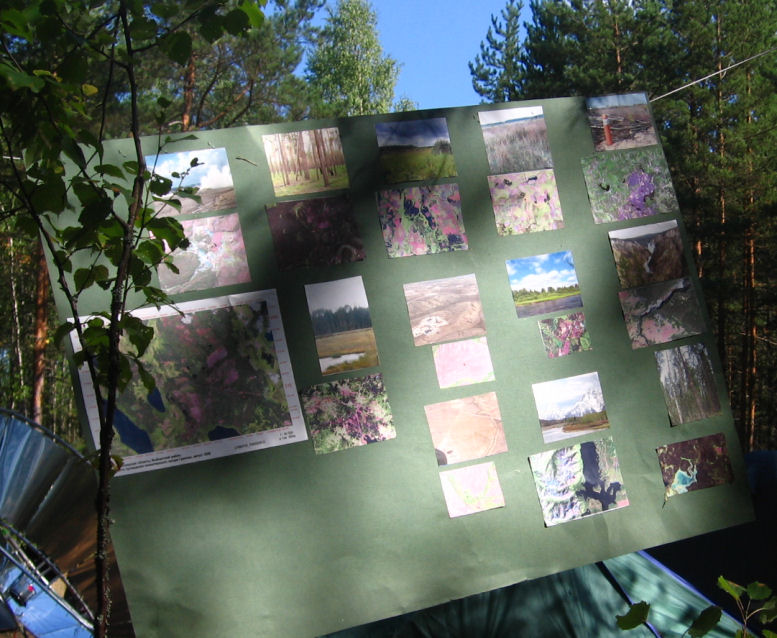
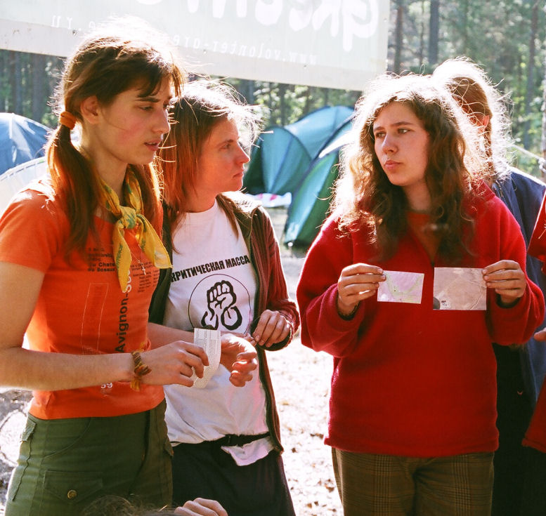
(Photo Above: Ilona at far left as part of a 2006 Greenpeace Forest Action campaign. Photos Below: Ilona on Campaign, and closeup of the GIS Action board)
Ilona & Anna’s role in the history of SCGIS requires a look at the overall History of Conservation GIS In Russia & Greenpeace:
The first Scgis Russian scholar was Sasha Yumakaev in 2001, followed by years of more scholars from the Siberian Altai region including Misha Paltsyn & Irina Mikhailidi. In 2005-2006 our first scholars from the Moscow area arrived, Anna Kostikova and Max Dubinin from the Biodiversity Conservation Center, followed in 2007 by Ekaterina Tsybikova from Transparent World and Ilona Zhuraleva from Greenpeace Russia in 2009, (although a last-minute emergency prevented Ilona attending the program). Nevertheless, Ilona remained active building the Moscow SCGIS chapter and came as our first formal Greenpeace Russia scholar in 2011, and shortly thereafter was chosen along with Anna Komarova as two of the first TTT Trainers in 2013.
My own Conservation GIS history with Greenpeace & Russia began even earlier in 1994 when David Peerla from Greenpeace Canada, Vancouver, attended a gathering of conservation GIS folks at the UC James Reserve, (what was soon to become the Society for Conservation GIS). That connection resulted in several Conservation GIS grants to Greenpeace over the next few years, around the same time I was organizing a more comprehensive granting program with Hewlett-Packard and many other manufacturers called the “Conservation Technology Support Program” (CTSP). Then in Jan 7 1999, Greenpeace Fund USA applied for CTSP Grant on behalf of Greenpeace Russia, saying
“Throughout the worldwide Greenpeace family, our Russian colleagues have won high regards for the work they have done using GIS technology on behalf of the environment. The most visible examples of their achievements thus far are a series of World Natural Heritage Site nominations successfully proposed to UNESCO for inclusion in the World Heritage List, and the December 1998 announcement by a Russian pulp and paper mill to go ancient forest free in their processing operations based on maps provided by Greenpeace. In both cases Greenpeace Russia’s mapping efforts played a crucial role in identifying areas of unique ecological value. In both they have worked with a network of Russian scientists, students and activists to provide access to and training on GIS technology and to significantly expand upon what could be achieved by Greenpeace Russia on their own. Support through your program will assist Greenpeace Russia in taking their GIS capability to the next level, and aid in their goal of creating a “GIS Center of Excellence” serving Russian and global conservation efforts. I feel confident their program is something CTSP would be proud to be part of” Signed, Kristen Engberg, Executive Director, Greenpeace Fund, Wash DC.
2015 Profile: Ilona & Anna helped organize the Second National "Conference of the Community Environmental Conservation GIS" The following is taken from their report on the conference (photo below)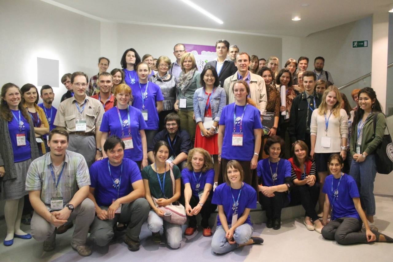
"The second Conference of SCGIS - geographic information systems in the field of nature conservation - was held! Three days, from September 25 to September 27, employees of commercial and non-profit organizations, reserves, institutes spoke, discussed, studied, argued, gave gifts, found solutions to each other, and created this conference. We are going to support an active GIS community in Russia. It is! We can confidently say this.
We thank all the participants who watched the broadcast online, expanding the geographical and informational boundaries. All together we had more than 100 people! We hope that the received inspiration will last for a long time, and in a year (two?) We will meet again to assess the direction of the movement of the community and technology, to hear about victories and new projects. Prepare victories and reports!
Video recordings of session reports and master classes, as well as photographs and summaries of the round tables held, will appear shortly on the conference page . Photos of the conference are available here
2015 Papers Presented by Ilona at the SCGIS Russia Conference
Ilona Zhuravleva & Anna Komarova (Greenpeace Russia, Community of Environmental GIS in Russia) - Plenary Session, Opening of the conference.
Ilona Zhuravleva "Mapping and monitoring of intact forest landscapes in the world." Ilona Zhuravleva zhuravleva@greenpeace.org, Greenpeace Russia, Moscow; Collaborators: Komarov AF, PV Potapov, Turubanova SA, Yaroshenko A.Yu.
ABSTRACT: Intact forest areas (MLT) - large, at least 50 ha, undeveloped areas within the forest area. The large size of the territory helps to maintain stability within the array, as well as data necessary for large predators. On Earth, no more than a quarter of all forest can be considered intact, and they are distributed unevenly - their distribution and the factors influencing the reduction, are highly dependent on the historically developed type of economic activity, territorial system of environmental protection, population growth, etc. Russian Greenpeace in cooperation with other environmental organizations and educational institutions engaged in mapping and monitoring of MLT at the end of the 90s XX. In 2006 came the first world map MLT showing a state of natural forests at the beginning of the XXI century, and in 2014 world map was updated at the end of 2013. In the presentation the authors present the results of the monitoring of MLT 2000-2013 gg. by continent, country, biomes, talk about reducing the MLT within protected areas, focusing on the reasons for reducing the wild forests of the planet.
2013 Profile: Ilona & Anna helped organize the National "Conference of the Community Environmental Conservation GIS" , held September 28-29, 2013 at Esri-CIS offices in Moscow. (Photo Below)
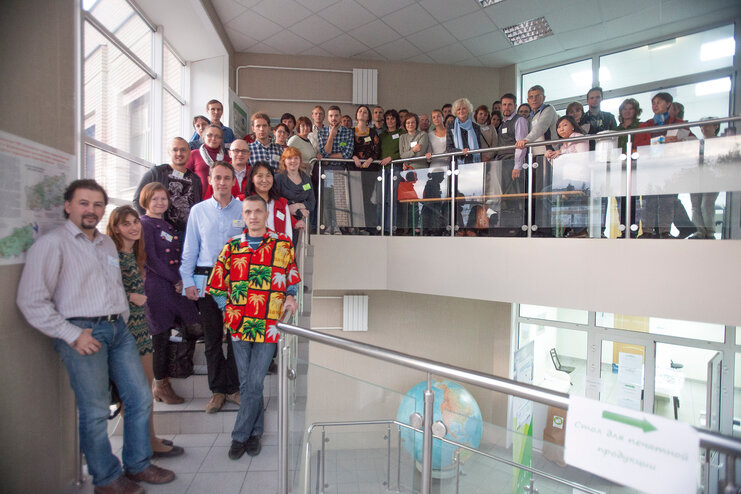
The following is from their conference report: "Friends! In the fall of 2013, the first practical conference with the international participation of the community of environmental GIS in Russia "Using GIS and Earth Remote Sensing Data for Nature Conservation" , dedicated to the use of various GIS technologies for nature conservation, was held. The main goal of the conference was the creation of an active GIS community in Russia and the CIS countries." Conference Photos can be found here
Conference Videos (all in Russian) Can be found here.
2013 Papers Presented by Ilona at the SCGIS Russia Conference
SESSION "Experience in the use of geographic information technologies in the work of environmental organizations."
Ilona Zhuravleva. Using GIS technology in Greenpeace projects.
- "Using GIS technology in Greenpeace projects". Zhuravleva I.V. zhuravleva@greenpeace.org Greenpeace Russia, Moscow Russia
ABSTRACT: Greenpeace is an independent international organization whose goal is to preserve nature and peace on the planet through changing people's attitude to the natural wealth of the Earth. The work of Greenpeace is guided by the principle of independence, including information. Therefore, GIS technologies and remote sensing data in the organization’s projects have been used regularly since the late 90s, especially often in the area of forest conservation and pollution monitoring. GIS departments exist only in three national offices of Greenpeace, including in Russia, and the total staff of GIS specialists for the entire international organization is no more than 10-15 people. The report presents the main areas of GIS work of the Russian office of Greenpeace - international projects (monitoring of intact forests of the world,
2013 TTT Certification: At the 2013 Conference, week-long workshops were held in Conservation GIS, taught by Ilona & Anna as the final required part of their certification to become SCGIS TTT Trainers.
(Photo: Anna (L), Ilona (Left Center) and Ela Segina (R) from Slovenia proudly holding their new TTT Authorized Trainer Diplomas from John Schaeffer (R Center))
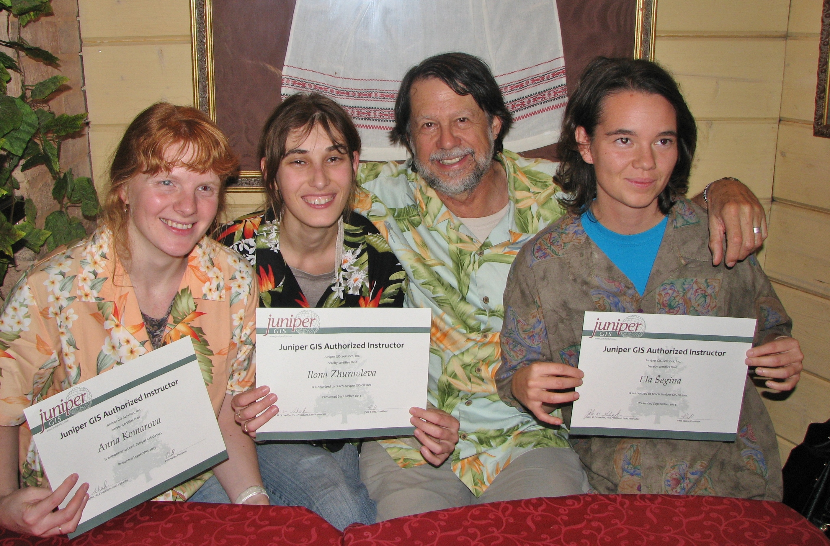
Arcnews Article about the 2013 Scgis Russia Training Workshop
"The three former Scholars recently trained in Russia are now ready to teach the AE class, both in terms of their skills and having the material. As they gain experience and confidence, they will add more classes to their repertoire, with the continuing support of Juniper GIS for teaching material. Over the next five years, we would expect to have as many as 300 or more people learning how to use GIS in conservation applications from these three new instructors, which is quite a multiplier effect."
 2011 Scgis Scholar Profile (Ilona re-applied in 2011 after being accepted in 2009 but unable to attend at the last minute.)
GIS Lab Head, Greenpeace Russia
"Greenpeace has strictly adhered to core principles. Two of them concern and at the same time influence my GIS work – independence and bearing witness. In the world where Governments sometimes hide information, try to receive more money logging the last ancient forests, make forestry non-transparent, show weakness in forest fires  fighting our goal is to provide the public with independent and reliable information (GIS is helpful, powerful and in great demand source and tool for this) and to be donated by individual supporters and foundation grants. I’d like to be selected for The Society for Conservation GIS Global Scholarship Program to become more qualified as one of 5-7 GIS specialists in Greenpeace team over the world and to present Greenpeace not only as campaigning and action organization but also as a scientific organization in conservation
Only 3 from 29 Greenpeace national offices situated in 43 countries have GIS specialists (Greenpeace Brasil, Greenpeace Southeast Asia and Greenpeace Russia). Moreover the GIS-staff is very limited (usually 1-2 persons for 1 office). So we have only 5-7 people for all Greenpeace society. I receive requests not only from Russian office but work mostly for international and other national offices needs. We have no chance to enlarge our mapping staff in Greenpeace Russia. So I need to be fast, high-qualified and decision-making specialist in GIS for conservation, manage and share Russian and international projects.
I’d like to make GIS closer to Greenpeace staff, to make this powerful tool working for campaign, to share and archive our digital geographic data more efficiently. I hope courses and conferences will give me the ideas for proposal how to organize and manage this. For the first view the solution is in inside online geodatabases and webserver for GIS data (it’s needed for all Greenpeace staff, not only for GIS people).
I’d like to participate in conference for showing Greenpeace work results, to convince people that Greenpeace not only for actions, but for science too.
I’m a postgraduate student, so I’m intended to write Ph.D. thesis and probably these training and conferences move me in right direction.
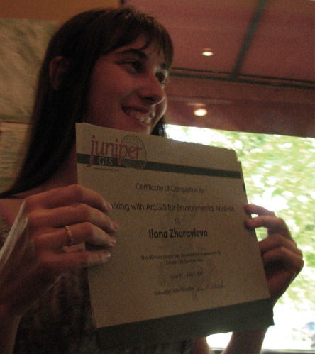
In spite of working in Greenpeace from 2005, I have only one chance to study course on satellite images preparation and correction using Scanex Image Processor. But still I have never studied GIS itself and fill lack of fresh knowledge. All I studied I try to use, but I have no chance to improve it because I have no time for self education and Greenpeace has no funds to pay for my education.
From time to time volunteers do some simple or routine work in Greenpeace, even there are some smart people who try to help me in GIS. Evidently I need to teach them to do some GIS work. In the frame of Kids for Forests project (educational initiative of Greenpeace on planting trees with schoolchildren on bare lands) I teach children to use GPS and “read” printed satellite images. Once I have an opportunity to teach GIS I need to upgrade my skills from time to time and SCIS is the brilliant opportunity to do this. (Note: In 2009 I applied and win scholarship, prepare paper and poster but unfortunately couldn’t present due to family disaster came on the eve of my flight.)
Please describe the history of your local work in conservation and GIS:
Ecology involvement started at school, I worked at ecological research paper, was a winner of Tver regional and a participant of Russian competitions on Ecology in 1998 and 1999.
At the University investigations were continued: methods of atmosphere monitoring in the ecological education, rare plant species monitoring (a first, second-year student), regional nature protection legislation (a third-year student), ability of visualization and analysis of Red Data Book data using GIS-technology (a fourth, fifth-year student). 9 scientific articles were published in Thesis’s of University, municipal and Russian conferences, in “AsEcO” magazine (AsEcO - association of ecological education in Russia). In 2002 being a student I worked as senior laboratory assistant of chair of Ecology in Tver State University. My functions: preparing studies of department, documentary monitoring of objects from protected areas cadastre of Tver region. In 2003 I did educational practice in one of leading school of Tver (gymnasia). My functions: teaching biology and ecology, helping to prepare for ecology municipal and regional competitions, coordination of scientific schoolwork. In 2004 I became a postgraduate student and intend to write Ph. D. Thesis.
In 1999-2004, being a student I was a vice-president and a chief of educational part of non-governmental organization (NGO) “Tver Ecological Club”. This is voluntary public regional organization in which nature-protect minded students and specialists work. Club is a member of Nature Protection Teams Movement (DDOP) and International Social-Ecological Union (SoES). The goals of Club: ecological education and culture, protected areas monitoring, organizing and conducting of ecological actions, working with TV and press, zoological route registration etc. My functions: managing the work of student group of Club, cooperation with municipal agencies, public, finances and International organizations, coordination projects in Tver city and Tver region, creation and conduction educational ecological programs at schools, participation in organizing ecological camps, planning and realization practice work in nature protection, writing application for grants and working in projects, trainings and seminars organizing.
My GIS work started at the turn of scientific and conservation work after Greenpeace Russia seminar for local NGOs. It was a start point for further specialization. In 2003-2004 I had a job of engineer of Ecology under the treaty “Red Data Book Conducting in Tver Region” in State University with such functions: electronic ecological mapping, database creation using GIS-technology.
In 2005 I started to work for Greenpeace Russia. The first large project was World Intact Forest Landscapes mapping (2005-2006). The second – forest cover change analysis and “Central and North European Russia Forests” map (2006-2008). Also different other short projects were managed during 2005-2008: particular intact forests investigations and local conservation strategies for them (in European part of Russia, Congo Basin and Romania), databases creation and spatial analysis maps (European Russia logging for export to Finland, world and Russia nature heritages maps) etc. In 2005-2006 I was an assistant of GIS project manager, in 2006-2009 – GIS campaigner.
(Photos Below: Ilona teaching Forest Conservation & GIS/Remote Sensing to local students in 2007)
 There was a very intensive work on forest fires monitoring in 2010. It was done using FIRMS system based on MODIS satellite images analysis. It provide spots of fires and Modis images as well. The procedure of monitoring is shown in manual which was composed by Greenpeace for all internet users in Russian.
In 2009 I was a participation of Greenpeace learning program – learn campaigning and help with mapping in Greenpeace Great Britain and Greenpeace Indonesia. In 2011 Greenpeace Indonesia, Greenpeace China, Greenpeace Africa and Greenpeace Romania wait strong help from our side in GIS.
Please describe how you work in your local conservation and GIS community:
“Transparent World” (Rossolimo str. 5/22, building 1, 119021, Moscow, Russia, ph.: +7 (499) 246-38-53, info@transparentworld.ru, http://www.transparentworld.ru/en/)
“Transparent World” is a non-profit and non-governmental partnership. Using space images it implements programs and projects for the scientific and applied environmental researches, education, design, tourism and study of local lore.
Greenpeace Russia GIS unit is very close to Transparent World: exchange data, common satellite images databases, work on the same projects in cooperation (Central and North European Russia Forests map (2006-2008) for example), and participate in co-expeditions.
(Ec. Note, Ekaterina Tsybikova in 2007 was SCGIS’ first scholar from Transparent World)
Regional NGO “SPOK” (M.Gorkogo str., 21V, 185035, Petrozavodsk, Republic of Karelia, Russia, ph.: +7 (8142) 769115, spok_office@onego.ru, http://spok.onego.ru, contact person in GIS: Olga Il’ina, Head of Forest department)
Regional non-governmental nature protecting organization "SPOK" have been created for monitoring exploitation of natural resources of the Republic of Karelia; participation in forming the process of sustainable development of economy and nature preservation of the Republic of Karelia; forming careful attitude to nature and its rational exploitation; ecological education.
Greenpeace Russia GIS unit cooperates with “SPOK”: exchange data, work on the same projects in cooperation (for example, map “Intact (old-growth) forest of high conservation value in the Republic of Karelia”, http://hcvf.net/eng/karelia/index.html), participation in co-expeditions on Karelian high conservation value and high social value forest objects in order to develop substantiations of new Karelian protected areas and update GIS “Karelian Protected Areas and old-growth forests of high conservation value” created beforehand as the result of cooperation of Greenpeace Russia GIS unit, “Transparent world”, “SPOK” and other organizations.
World Wide Fund For Nature, WWF Russia, Arkhangelsk project office (K. Marks str.. 31, b.1, office 26, 163000 Arkhangelsk, Russia, +7 8182 651952, fax +7 8182 651952, den-dobrrynin@yandex.ru, http://www.wwf.ru, contact person in GIS: Denis Dobrynin, project coordinator)
WWF is one of the largest environmental organizations in the world with such programs in Russia: Forests, Marine, Climate, Species, Oil&Gas, Reserves. Arkhangelsk project office is working in frame of WWF-Russia Forest Program as a part of a global international WWF program “Forests for Life”. WWF-Russia Forest Program addresses the following themes: development of a network of protected forest areas; introducing sustainable forestry management in the Model Forests network; promoting responsible business strategies, ecological policies and Forest Stewardship Council (FSC) voluntary certification among Russian timber producing companies; curbing illegal logging and timber trade; Forest Law Enforcement and Governance (FLEG) and formulation of a national forest policy.
Greenpeace Russia co-operates with WWF-Arkhangelsk in following fields: satellite images providing, nature protected areas data exchanging, intact forest landscapes monitoring, primary coniferous forest cover change detection, landscape representativeness analysis. We are working also together in frame of Russian-Finish project “Gap-analysis of nature protected areas of North-West Russia”.
Please describe how your work involves cooperation with any international groups:
Greenpeace International (Ottho Heldringstraat 5, Amsterdam 1066 AZ, Netherlands, http://www.greenpeace.org/international/)
Maik Marahrens (Research Unit Head, mmarahre@greenpeace.org)
Christoph Thies (Forest Campaigner, Christoph.thies@greenpeace.org)
Greenpeace is an independent global campaigning organization that acts to change attitudes and behavior, to protect and conserve the environment and to promote peace by
catalyzing an energy revolution,
protecting the world’s ancient forests,
campaigning for sustainable agriculture,
working for disarmament and peace.
Greenpeace Russia’s joined with Greenpeace International as sub-unit with head organization. Greenpeace International supported World Intact Forest Landscapes projects mapping, Regional deforestation maps purchasing satellite images, hardware and other equipment, extending this idea, designing brochures and other presentations.
Except Greenpeace International research unit requests on mapping and spatial analysis we work with different national offices: Indonesia, Africa, Germany, Romania, China. We gave mapping support to Greenpeace India, Finland ect.
World Resource Institute (WRI) and Global Forest Watch (GFW) as World Resources Institute initiative (10 G Street, NE (Suite 800) Washington, DC 20002 USA, +1 (202) 729 76 00, fax: +1 (202) 729 76 86, http://www.wri.org/)
Dr. Lars Laestadius (Project Manager – Russia, larsl@wri.org)
Susan Minimaier (GIS Associate & Lab Manager, susanm@wri.org)
The World Resources Institute is an environmental think tank that goes beyond research to find practical ways to protect the earth and improve people’s lives. Mission is to move human society to live in ways that protect Earth’s environment and its capacity to provide for the needs and aspirations of current and future generations. Because people are inspired by ideas, empowered by knowledge, and moved to change by greater understanding, WRI provides – and helps other institutions provide – objective information and practical proposals for policy and institutional change that will foster environmentally sound, socially equitable development.
Greenpeace Russia cooperates with WRI in such a way: WRI provides software license sharing, exchanges satellite images, releases common map products, invites to skill sharing programs for NGOs.
The Geographic Information Science Center of Excellence (GIScCE) (1021 Medary Ave, Wecota Hall
Box 506B, Brookings SD 57007)
Peter Potapov (Research Scientist, Peter.Potapov@sdstate.edu)
It’s a joint collaboration between South Dakota State University (SDSU) and the United States Geological Survey's National Center for Earth Resources Observation and Sciences (EROS). The purpose of the GIScCE is to enable South Dakota State University faculty and students, and EROS scientists to carry out collaborative research, seek professional development, and implement educational programs in the applications of geographic information science.
Greenpeace Russia cooperates with GIScCE in IFL monitoring projects mostly
Please describe what is the most unique and the most challenging about the work that you do:
There are three items in focus in Greenpeace Russia GIS work: intact forest landscapes, forest fires and forest cover change.
Forest fires areas in Russia grow significantly during last 15 years. It’s the consequences of legislation changes (federal avia-forest-monitoring system closing and giving forestry function to regional level) and decreasing of forest fire defense funding (total funds decease 3 times from 2000 to 2009). In this situation Russian Federal State Statistics give 5 times less forest fires then Remote Sensing. That’s why Greenpeace Russia monitors forest fires not only for rapid response (we have own fire-fighting volunteer group), but for rising awareness while authorities try to hide information. Especially we check protected areas fire status track and fires on contaminated areas after Chernobyl’ disaster.
There are several hotspots of Greenpeace Russia GIS work:
European part of Russia (North and Center) – the main focus, this area is unique for all Russian conservation NGOs working on forests, because the deforestation rate in these most populated regions of Russia is the largest, and the IFLs – the most vulnerable.
Paradise forests – they stretch from South East Asia, across the islands of Indonesia, on to Papua New Guinea and other islands in Pacific. This wonderfully diverse region supports hundreds of indigenous cultures and creatures found nowhere else in the world. The island of New Guinea, the world’s second biggest island, has the largest continuous tracts of ancient forest in the Asia Pacific region. They shelter an amazingly rich number of plant and animal species, many of which occur nowhere else on earth. The Orang Utan, Sumatran Tiger and the world's largest flower, the one meter wide rafflesia all call the Paradise Forests home. Nowadays the main threat for paradise forests is the IFL forests clearing for palm oil plantation.
Congo basin – this is refuge of IFLs. Political situation in these countries is unsustainable and the goal of NGOs is to save large forests till the better time. Forest certification (FSC) is coming to Democratic Republic of Congo, it’s brings the idea of high value conservation forests. One of the value is large size of forest, that’s why intact forests in Congo basin are need to be monitored regularly.
Romania – it’s the only one IFL in not-boreal Europe which is under the press of infrastructure reconstruction and tourism.
The most unique in GIS work of Greenpeace Russia:
- It promotes improvement of conservation and managing of world forests by providing high-quality (reliable, timely and accurate) data for those who are reliable for business, decision making, education and for non-governmental organizations. As far as Russia case is concerned, the official source of such information in Russia are not convenient (not reliable, not easy to find, not timely etc).
- Also the GIS work of Greenpeace Russia is required in other Greenpeace offices worldwide. No one office containing mapping people works for international needs.
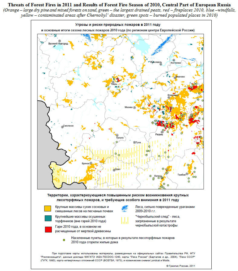
MAPS: Threats of Forest Fires in 2011 and Results of Forest Fire Season of 2010
In Moscow and nearest regions approximately 17% of area is under the forest fire threat for 2011. It was shown on this map. First fires can appear even in spring, when snow smelt and if summer’ll be hot the catastrophic situation can be repeated. This map‘ll help specialists to predict the places and fire damage. Among “great Moscow” area the most dangerous can me Verkhnevolzhskaya and Mesherskaya lowland. This map shows natural areas and populated places burned in 2010.
Map was presented in Jan 2011. Press-release http://www.greenpeace.org/russia/ru/news/19-01-2011-forest-fires/ (in Russian)
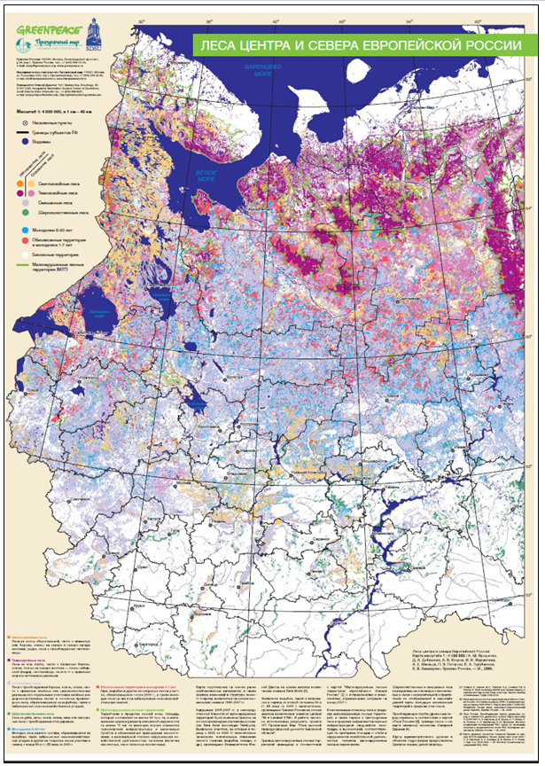
- Central and Northern European Russia Forests (in Russian)
Forest cover change map was a part of complex mapping of Central and Northern European Russia forests as well as earlier Greenpeace Russia map products (Russia's forests. Dominating forests types and their canopy density; Intact Forests Landscapes of Northern European Russia). Forest cover change maps are needed for the detection of most developed forests and understanding forestry prospective in the country. For this purpose, a consistent spatial coverage of accurate, contemporary and cost-effective high- and/or medium-resolution Earth Observation (EO) data were used.
The applicant participated in 1980-2000 forest cover change detection based on Landsat TM, ETM+ images (light blue color polygons on the map), resulting layouting for poster printing (http://www.forestforum.ru/info/map_for_print.pdf) and uploading vector and grid data in the web (http://www.forestforum.ru/info/gis/readme.doc, http://www.forestforum.ru/info/gis/vectors.zip, http://www.forestforum.ru/info/gis/species.zip).
Project was done in 2007-2009.
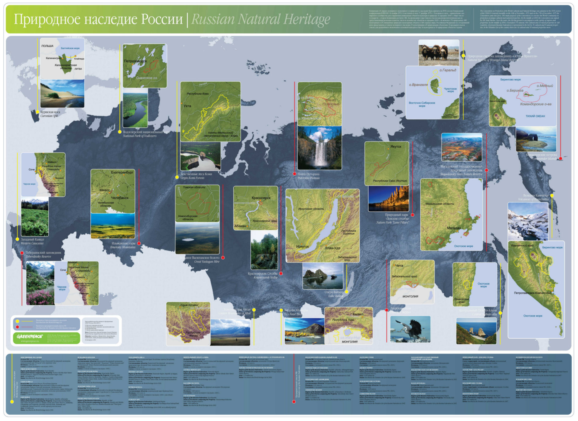
- Nature Heritage Project Mapping Support
The UNESCO Convention Concerning the Protection of the World Cultural and Natural Heritage has been designed to protect among others the natural objects with the "significant importance". Greenpeace Russia reveals, works out the grounds and participates in protection of such unique natural complexes.
This map shows nature heritage sites and those places which are in tentative list. All map insets are done by applicant in 2009.
Link for downloading the map in high resolution http://forestforum.ru/info/pictures/world_her_map_A0.jpg
- Conservation strategy for Intact Forest Landscapes in Romania (Retezat-Godeanu-Tarcu)
- Intact Forest Landscapes mapping
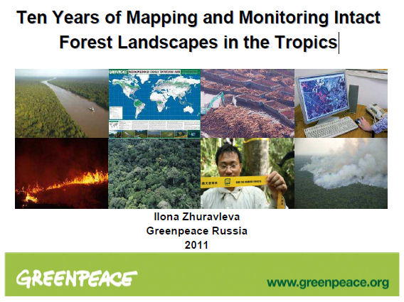 PAPER TITLE: “Ten Years of Mapping and Monitoring Intact Forest Landscapes in the Tropics”
Abstract: In 2006 Greenpeace produced map of intact forest landscapes (IFL). It was done during several years in cooperation with different NGOs (Biodiversity Conservation Center, International Socio-Ecological Union, Luonto-Liitto (Finnish Nature League), Global Forest Watch, Forest Watch Indonesia). By intact forest landscape we understand a seamless whole of natural ecosystems, undivided by elements of infrastructure, in which there are no visible signs of significant human activity. This assessment was based on the most up-to-date high-resolution satellite imagery and a consistent set of global criteria which allows for the first time direct comparison of the state of forests throughout the world.
Obviously monitoring of IFLs was needed – they were not under Governments protection and proceeded to be destroyed and disappear. Especially in tropical countries – Indonesia and Papua New Guinea (paradise forests), Democratic republic of Condo, republic of Congo, Gabon, Cameroon (Congo river basin), Brasilia (Amazon river basin). Tropical forests became focused area for monitoring since 2000 also because there are 30% of IFLs grow in tropics (7 of 65 countries of the world containing IFLs).
In the paper the results of 2000-2010 IFL monitoring will be presented (3 big regions: Paradise forests, Congo basin forests, Brasilia forests). There were 3 steps: 2000, 2005 and 2010. The rate of IFL degradation is calculated, it’s differs from country to country and from year to year. There are province, change dimension, protected areas IFL assessment. The major types of anthropogenic disturbances caused loss of IFL areas’ll be demonstrated. IFL concept and methodology will be shown in details.
More information on IFLs: http://www.intactforests.org/
2009 Scgis Scholar Profile
GIS Project Campaigner, Greenpeace Russia
Please describe what is the most unique and the most challenging about the conservation/GIS work that you do:
"....There are several hotspots of Greenpeace Russia GIS work:
European part of Russia (North and Center) – the main focus, this area is unique for all Russian conservation NGOs working on forests, because the deforestation rate in these most populated regions of Russia is the largest, and the IFLs – the most vulnerable.
Paradise forests – they stretch from South East Asia, across the islands of Indonesia, on to Papua New Guinea and other islands in Pacific. This wonderfully diverse region supports hundreds of indigenous cultures and creatures found nowhere else in the world. The island of New Guinea, the world’s second biggest island, has the largest continuous tracts of ancient forest in the Asia Pacific region. They shelter an amazingly rich number of plant and animal species, many of which occur nowhere else on earth. The Orang Utan, Sumatran Tiger and the world's largest flower, the one meter wide rafflesia all call the Paradise Forests home. Nowadays the main threat for paradise forests is the IFL forests clearing for palm oil plantation.
IFL in Romania – it’s the only one IFL in not-boreal Europe which is under the press of infrastructure reconstruction and tourism.
The most unique in GIS work of Greenpeace Russia: it promotes improvement of conservation and managing of world forests by providing high-quality (reliable, timely and accurate) data for those who are reliable for business, decision making, education and for non-governmental organizations. As far as Russia case is concerned, the official source of such information in Russia are not convenient (not reliable, not easy to find, not timely etc).
Title of the paper you will present: Mapping and Monitoring Central and North European Russia Forests by Remote Sensing.
Abstract/summary of the paper you will present: Greenpeace produced the map that is the combination of earlier Greenpeace Russia map products (Russia’s forests. Dominating forests types and their canopy density http://www.forestforum.ru/info/pictures/engmap.pdf; Intact Forests Landscapes of Northern European Russia http://www.forestforum.ru/info/pictures/map2.pdf) and forest cover change maps with disturbed criteria in mind. Intact forest landscapes borders were verifying due to 2008. Forest cover change analysis was done using different types of satellite images: Terra/Modis, Landsat-5/TM, Landsat-7/ETM+, Terra/Aster (Terralook collection) for 2 periods (1980-2000, 2000-2008). Dominating forests types were displayed as disturbed or non-disturbed. The main result of this work is recent and reliable map of forests, showing the follows:
according official statistics the forests of European Russia are still rich, but this map shows the most part of these forests are already disturbed and government misleads people. These include large unpopulated areas comparatively unprofitable to use as their remoteness, and cheap to conserve because of low current economic value. Greenpeace notices forestry has no economy capacity and should have no rights to extend towards non-disturbed areas. We define this limit border according intactness criteria and real border of disturbances by remote sensing.
The map contains recent data on IFLs borders monitoring (the last time it was 2004).
The map shows different age underwood and deforested areas distribution. The main reason of deforestation defined as logging; on the north fires play a significant role; natural windfalls sometimes became the reason of deforestation in middle-boreal forests.
The forest cover change detection using Landsats satellite images can be presented in details (it was done by me). Other methodologies can be presented generally (they were done by other specialists).
-
 Anonymous User