- Home
- :
- All Communities
- :
- User Groups
- :
- Conservation GIS
- :
- Documents
- :
- Tin Myo Thu, Myanmar
- Subscribe to RSS Feed
- Mark as New
- Mark as Read
- Bookmark
- Subscribe
- Printer Friendly Page
Tin Myo Thu, Myanmar
Tin Myo Thu, Myanmar
Navigation: 2018 Scholar Project ReferenceProject CommunitiesPage ConservationGIS Scgis.org
Tin Myo Thu Wildlife Conservation Society(WCS)-Myanmar Program
Deputy Technician (GIS/RS)
Wildlife Conservation Society(WCS)-Myanmar Program
No.12(B-21, 22), Narnattaw Road, Shwe Kainnayi Housing, Kamayut Township, Yangon, Myanmar
*-Work phone with country and area code: +951535711
*-Main email: [email protected]
https://myanmar.wcs.org/ ,https://web.facebook.com/WCSMyanmar
Skype: tmyothu, https://web.facebook.com/tmyothu
email: [email protected]
xWlidlife xRemote xDeforestation xIndigenous xPPP xPublicParticipation Planning x2018Scholar x2018Talk xScholar xTalk xMyanmar xAsia
Current GIS capability/expertise: I started my career as Deputy Technician(GIS/RS) for Wildlife Conservation Society (WCS-Myanmar Program) based in Tanintharyi Region, Southern part of Myanmar since October 2014when I was in third year physics in bachelor of Science. I had finished my degree on 15th October 2015, University of Dawei, Myanmar. Before I joined WCS I pursued as technical provider in mapping services when I have been doing GIS and RS in 2011 for my own business. My main responsibility is technical support for the development of participatory Land-use mapping to implement protected areas management system for Forest Department, marine spatial sea-use plan for Department of Fishery, as well as GIS database management, remote sensing and data integration to monitor deforestation and degradation and any update for forest cover changes and detection. My learning on GIS is not enough for my career. So, I always do self-teaching by using ESRI GIS Tutorial of nearly 2.5GB data with many exercises and ArcGIS Desktop help. I also learned freely available online GIS Courses such as ESRI, Udemy, ESRI MOOC and Lynda .There are also numerous task specific tutorials available from independent contributors on online platforms such as YouTube. I also participate and learn in regional workshops and training sessions. Since 2016, I have learned new techniques from my new REDD+ Technical Advisor who expert in IT and GIS. My ArcGIS Desktop Single License is provided by my organization head office in Bronx, New York.

*-ORGANIZATION’S WORK: Please describe the work that your current organization does: Wildlife Conservation Society (WCS) is a world leader in on-the-ground wildlife conservation, currently overseeing about 500 projects in 60 countries of 16 priority regions, home to more than 50% of the world’s biodiversity. Our Mission is “WCS saves wildlife and wild places worldwide through science, conservation action, education, and inspiring people to value nature”. Our Vision is “WCS envisions a world where wildlife thrives in healthy lands and seas, valued by societies that embrace and benefit from the diversity and integrity of life on earth”. WCS Myanmar has been working in Myanmar since 1993.WCS was the first international organization to initiate a long-term program in the country. Ever since, we conduct biological surveys, monitor populations of key wildlife species, aid in the establishment of protected areas, and assist protected area staff with trainings on landscape management.Our organization works across eleven project sites in three landscapes: Northern Forest Complex, Irrawaddy River and Southern Forest Complex.
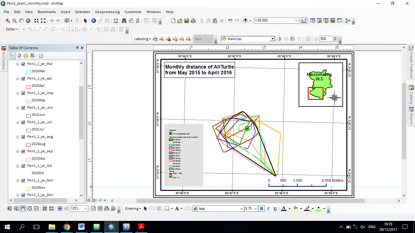
With 6 offices, our presence is distributed all over the country. Through two liaison offices we maintain close collaboration with government decision makers and international partners, and additional 4 field offices allow us to directly engage with nature conservation in the most valuable and unique landscapes in the Indochina region.WCS Myanmar working counterpart with Government of Myanmar by having Memorandum of Understanding (MOU) with two particular ministries:Ministry of Natural Resources and Environmental Conservation (MONREC) and Ministry of Agriculture, Livestock and Irrigation, Forest Department and Department of Fisheries. WCS-Myanmar Program are also collaborate to conserve the tiger and elephant in National Tiger Action Plan for Myanmar and Myanmar Elephant Conservation Action Plan with other partner organizations. Wildlife Conservation Society – Myanmar Program, also working in partnership with Turtle Survival Alliance (TSA) and the Myanmar Forest Department (FD) and greatly successful captive-breeding program at facilities in Myanmar has produced thousands of hatchling Burmese star tortoises since efforts were initiated less than 10 years ago. Captive-breeding has been so successful that a reintroduction program was launched in 2013 to re-establish viable wild populations of star tortoises at Minzontaung Wildlife Sanctuary (MWS). More recently, WCS Marine Program has been working to bring contemporary concepts to Myanmar - to support our goal to create a sustainable ocean economy. Myanmar’s vast marine resources are an integral part of our future development. This strategy presents the results of a significant effort to understand the opportunities and challenges associated with our ambitious sustainable ocean economy goal.WCS has been providing financial and technical support these two ministries to manage protected areas, undertaking applied research, communities to conserve wildlife and their habitats.
There are three main landscape in WCS Myanmar Program. Southern Forest Complex landscape is located in Southern part of Myanmar where is my duty station and included one protected area where is called Tanintharyi Nature Reserve Project. My current role with WCS is to provide technical support for both terrestrial and marine conservation management. Key responsibilities include (1) work with communities for participatory land-use mapping for sustainable resource management, (2) supporting the government’s Forest Department on protected area management, (3) work on marine spatial planning with the Department of Fisheries, (3) remote sensing and data integration for land cover mapping and deforestation and degradation monitoring, and (4) overall cartographic service provision and database management. My main responsibility is to lead the team which provides spatial support to our work as well as develop and provide maps such as village land use zoning maps, Tiger and Elephant camera trap survey maps, Tortoise distribution maps, forest management maps for regional forest department and GIS technical support for WCS field staff and regional forest department and I work closely with WCS senior technical staff. My area of expertise is in participatory land use mapping, GIS database management, remote sensing, data integration and giving GPS/GIS training to regional forest department, Tanintharyi Nature Reserve Project and other Local Civil Society Organizations (CSO). I have to provide at least one time annually GPS/GIS training to core GIS team in my landscape, regional forest department, regional environmental conservation department, Tanintharyi Nature Reserve Project and other relevant Local Civil Society Organizations.Examples of the application of my work are to create village land use map, deforestation and threat maps, ranger patrol maps, and other maps that used for planning and management of protected areas and forest department and analysis map for the university students in our region. I am looking for new opportunities to develop my skills in GIS, particularly in new GIS technologies.
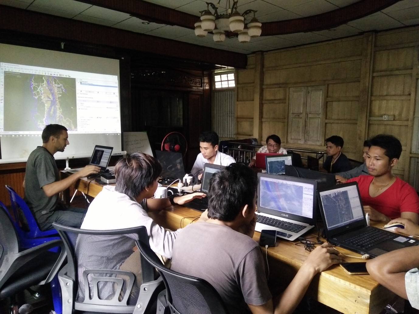
*-HISTORY: I have been working full-time as a Deputy GIS Technician for the WCS-Myanmar Program since 2014. I am based in the Southern Forest Complex landscape, where we work in support of regional and national government, civil society, local communities, with particular focus in the Tanintharyi Nature Reserve. Through my work, I have realized the importance of nature conservation and how GIS/RS techniques can support conservation works, with the potential toanalyze habitats for endangered species, spatial distribution and migration patterns of wildlife, and support data and information for protected area management. Key conservation species for our program include endangered species such as tiger, elephant and tapir inhabit in this region. My team develops and supports the village land use zoning process, supports the regional Forest Department with forest management, and provides general GIS technical support and capacity building for our work. My area of expertise is in participatory land use mapping, GIS database management, remote sensing, data integration and providing GPS and basic GIS training to regional forest department, protected area staff, and other local organizations. Examples of the application of my work are to create, review and refine village land use maps, assess deforestation and land-cover changes from remote sensing, and identify threats, support protected area rangers with patrol maps using the Spatial Monitoring and Reporting Tool (SMART) system, and many other maps that are used for planning and management of protected areas and forest lands. I lead the team of three core staff who provide technical support to the government’s Forestry and Fisheries Departments, as well as local University students and local civil society groups. I also represent WCS in our partnership with OneMap Myanmar project for which we support technical capacity of the Tanintharyi Regional government. Since 2014, I regularly provide basic GIS training to regional forest department, protected area staff, local organizations, and local University students.
I am really ambitious to make this team the strongest GIS Team in the WCS regional program, by building our capacity and improving efficiency of all our team members. I also have experience applying mapping tools on-the-ground, as I worked together with WCS staff for mapping village utilization zones that can help to reduce conflicts between communities and conservation managers. Prior to WCS, I ran a small business as a consultant providing mapping services where I produced maps and provided technical support regional government institutions.I have also experience two times as a translator and assistant trainer in QGIS and RS training by English language at FFI Dawei office in July and August 2014 before I joined to WCS. After joined to WCS, I supported as a translator and assistant trainer in QGIS and Data management training by FFI in English language at Ecodve Dawei office in Dec 2015 again. I could well understand and translate to clarify between local trainees and foreign trainer in all of training. I also got the chance to attend three international training, workshops and seminars where my English has developed further. Especially during the recent Marine GIS training using QGIS in University Malaysia Terengganu, where I was selected the Ocean Teacher Global Academy (OTGA) scholarship program.In that training, I could follow and understand with instructors without difficulties. I have also been improving in understanding and speaking in English language and many technical terms by learning from freely available online GIS Courses such as those from ESRI, Udemy, ESRI MOOC and Lynda and closely working with our regional REDD+ Technical Advisor and some Senior Advisor who are the expert in IT, GIS and conservation field from foreign countries. I also regularly participate and learn in regional workshops and training sessions and I also collaborate with other GIS experts from partner organizations in GIS field for my region. Before I joined to WCS, I ran a small business as a consultant providing mapping services. I had provided various maps and assisted to regional government institutions. I also have provided basic GIS training to regional forest department, Tanintharyi Nature Reserve Project and other Local Civil Society Organizations (CSO). I am really ambitious to make this team of strongest GIS Team of WCS regional programs by building the capacity and improve efficiency to the team members. I also have many experiences for using GIS technique as I worked together with WCS staff for mapping village utilization zones that can reduce conflicts between communities and conservation, especially protected area managers. WCS are now working with several communities on Community Based Natural Resources Management approaches, which the foundation is mapping and agreeing village utilization zones.
Local SCGIS chapter: There is no SCGIS chapter in Myanmar. However, I am an active member in the GIS communities of Myanmar and our region with frequent meetings and workshops with other relevant conservation NGO, INGO organizations, Local Civil Society organization, regional Government institutions and University. I am also a member of Myanmar GIS community on Facebook as well as other GIS groups, such as Myanmar GeoInformatics Society Group, Myanmar Google Earth Engine Group and OpenStreetMap Myanmar Group. For the very first time, we held a GIS practitioners meet up event on 14th August 2017 at OneMap Myanmar Dawei office in my region. Main aim of GIS meeting were to connect to other GIS practitioners in Dawei, share news and update, ask questions and find help. I hope to help establish a Myanmar SCGIS chapter since the GIS groups on social media have greatly expanded, both in numbers of members and in technical capacity.
I have taken on teaching and leadership responsibilities after joining WCS Myanmar Program. Below is a summary:
Participatory Village Land use mapping: Conducted land use zoning map in 52 villages in my landscape.
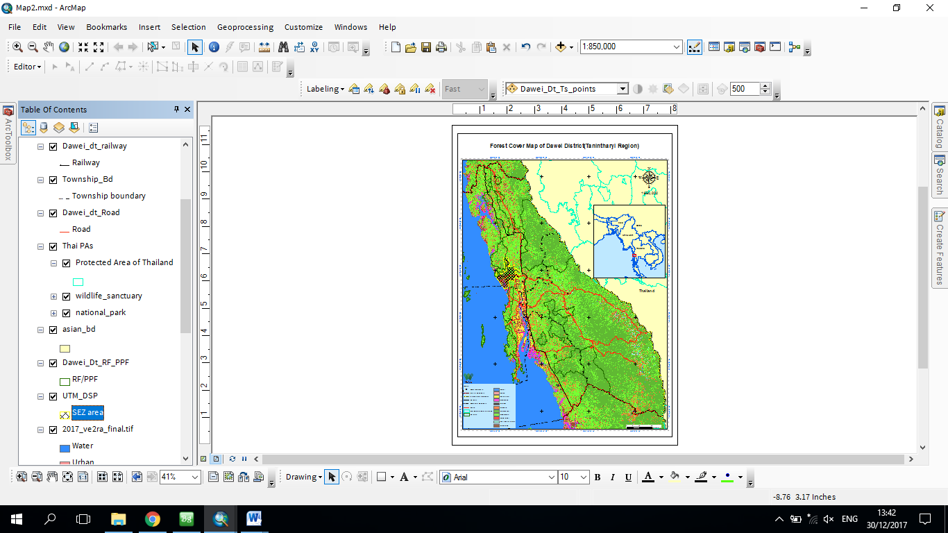
GIS mapping: Developing and providing maps for village land use zone, deforestation and threat maps, ranger patrol maps, and other maps that used for planning and management of protected areas and forest department and analysis map for the university students in our region and for all WCS projects and programmes in Myanmar.
Collaboration: Meeting, consulting and sharing other partner agencies, government institutions and university to develop and update GIS data , maps and technologies
Land use planning: Analysing satellite images, maps, data and government plans to compare past and present land use and forest cover, and make projections for future land use;
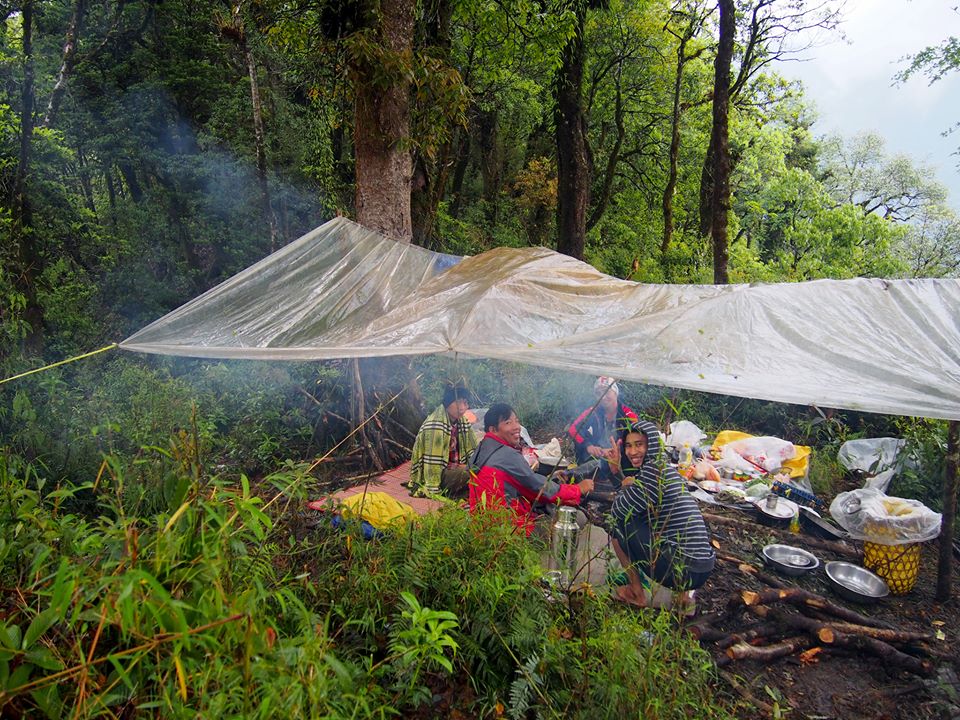
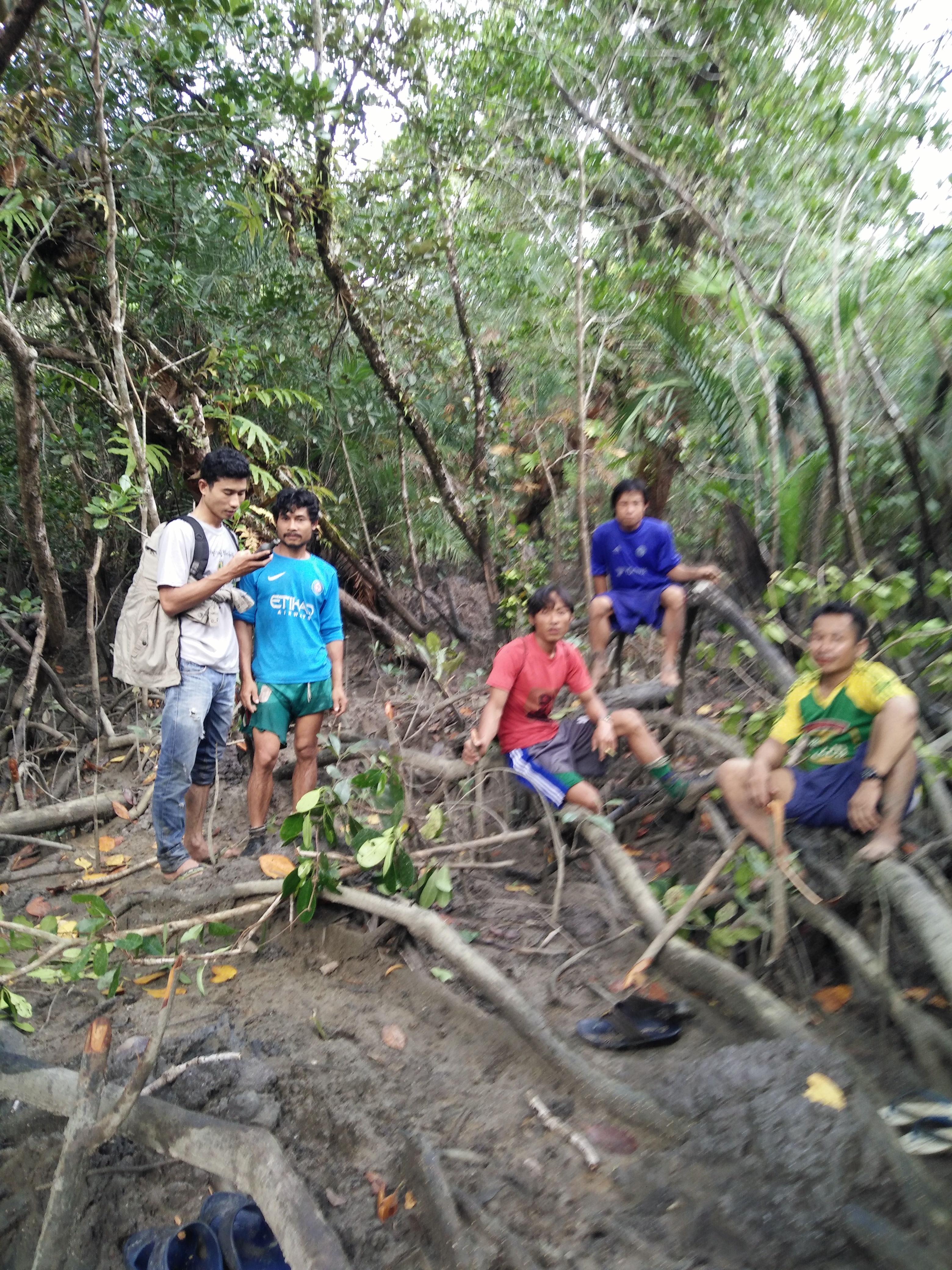
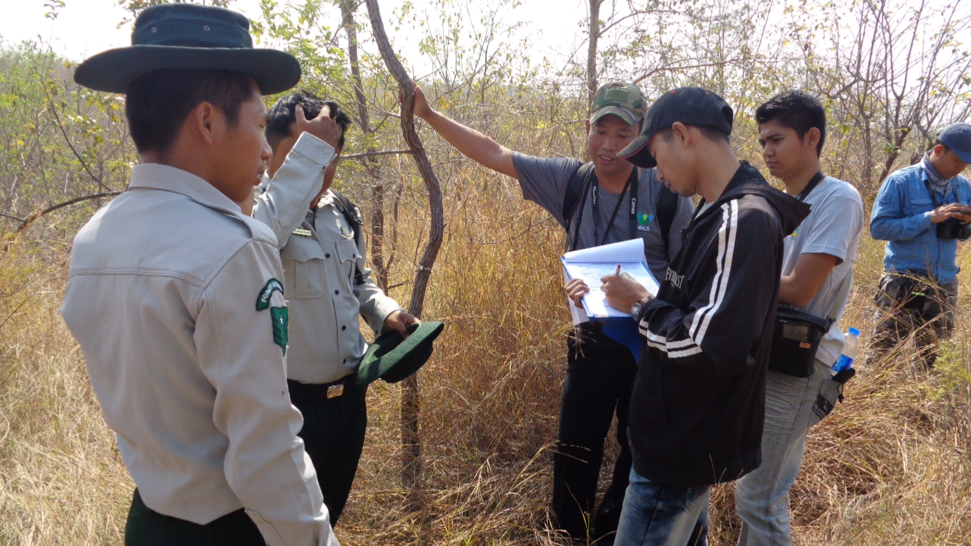
Field survey: I have been involving in various kinds of data collection and verification in the field.
Training: GIS and GPS training are the below list;
Participatory land use field mapping on job training at Tanintharyi Nature Reserve Project(TNRP)(November-2014)
GPS Training at Forest Department, Dawei District (14th Feb 2015)
Sharing knowledge on job training to two GIS assistants of Southern Forest Complex Landscape (ArcGIS and RS) (Aug- 2016)
Participatory land use mapping on job training using ArcGIS at TNRP(Feb-2016)
Participatory land use field mapping and using GPS on job training at TarKaPaw(CSO), Dawei (April-2016)
GPS mobile application training at Forest Department, Tanintharyi Region(Nov-2016)
Collaboration with One Map Myanmar, Oil palm review in Yephyu Township(Capturing
Images using UAV and image processing (Orthomosaic)(Feb-2017)
Using GPS and Topo Map in SMART training at Lampi Marine National Part(Feb-2017)
GPS and QGIS training in Environmental Conservation Department, Tanintharyi Region(Mar-2017)
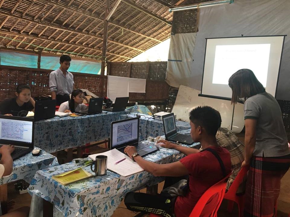
Participatory Land use mapping training using ArcGIS at TarKaPaw(CSO),Dawei (Jul-2017)
ArcGIS intensive training at TNRP(Sep-2017)
Participatory Land use mapping and data management refreshment training using ArcGIS at TarKaPaw(CSO), Dawei (Nov-2017)
GPS on job training at Forest Department ,Thetyetchaung township, Dawei district(Dec-2017)

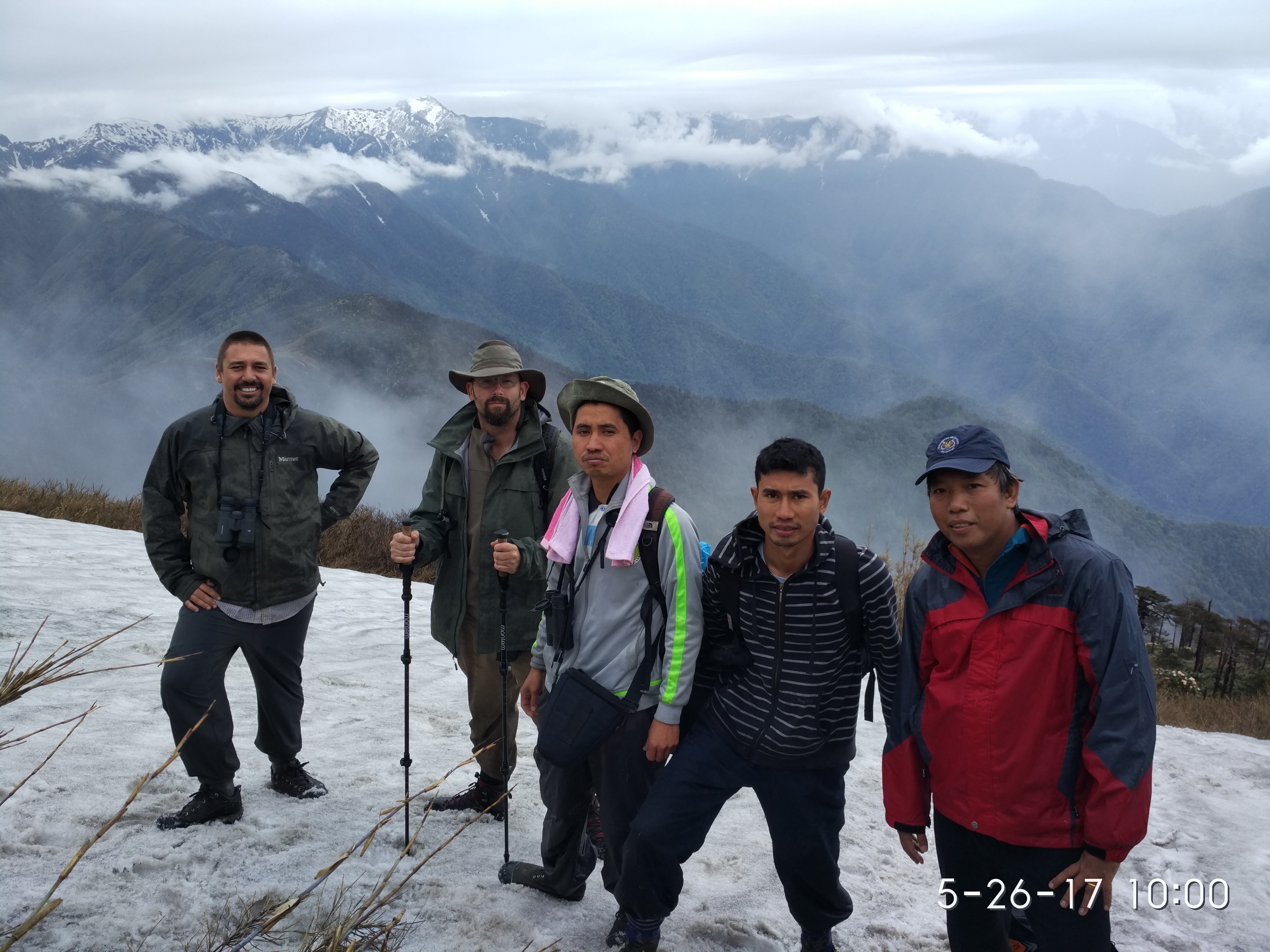
What is the most unique and the most challenging about the conservation/GIS work that you do: GIS support is very important for WCS Myanmar and requires the interaction of multiple groups. My role requires that I interact with community members and leaders, NGO and civil society, development agencies, and both State and indigenous governments. Each requires a different level of engagement, I must constantly adapt to the current environment. Most of these interactions are in extremely remote places with limited resources. The broad scope of stakeholder support requires an equally broad scope of data. Due to the accessibility issues these questions must be answered using remote sensing and spatial analysis. The current methods I use for to be improved for better performance. In Myanmar, Government institutions, supported by NGOs, need to use land-use monitoring techniques to manage land-use change, land-encroachment and leakage outside the boundaries of Land Concessions. Likewise data distribution methods must be established to meet the broad range of partner requirements. While GIS techniques are advancing world wide, only very few can effectively usethese tools in our country. My work in supporting the Government is therefore very important and very interesting, and we are aiming also to develop new tools, such as online platforms. We are creating and friendly with web-based platform for our program and our regions which is an exciting an innovative new development in my role, and also very challenging.
This scholarship program is an ideal platform to support my country's needs and I believe that I could effectively apply my knowledge in our conservation fields as well as to develop our country. I will use the knowledge to support our organization, the Myanmar government, local group, as well as University students and applied research for data gaps. After returning from the SCGIS scholarship, I will aim to teach the rest of my team useful skills and techniques acquired during the training. As a focus project I seek to develop a web-based GIS Platform to access our 20 years of biodiversity data collected by field research staff but not yet made easily accessible. The skills and techniques from this learning experience will help me to bring scientific data into our servers and make them available on web-based maps, to improve the management of conservation areas using near real- time technology. I also have plans over the next year upon completion of the course are to; improve the existing GIS technical support to our government and civil society partners and to better organize our data base system. I also intend to conduct and hold events such as the GIS users meet-up and knowledge sharing, set up a GIS online sharing group in local language - where people have the opportunity to improve the capacity and exchange lessons and experience on social media group.
The conservation importance combined with the geographic, social, and political challenges of the regions I work in require Even though I have been working in GIS career for three years for an internal organization in Wildlife Conservation, I have been using only the techniques which I learnt from basic GIS training and self-taught skills. I have received only three short international trainings specifically on GIS for conservation. My learning on GIS is not sufficient for my responsibilities or my desire to teach others about new techniques. I hope I will be selected by this scholarship so that I could bring new GIS techniques to share with my team that are providing GIS and Remote Sensing support to government, civil society, community and Universities. I know that SCGIS is a non-profit organization that assists the conservationist like us worldwide through building community, providing knowledge and supporting individuals using spatial science for the conservation of natural resources. More than just training, I hope to get experience from GIS specialists who attend the SCGIS Annual Conference and The Esri User Conference. I also plan to share my knowledge widely to my colleagues, trainees and the new generation, so that they can build their skills. Since there are few GIS/RS experts in Tanintharyi region, I could also share my knowledge to regional goverment institutions and
As a GIS/RS technician with WCS in Myanmar for three years, I lead a team with broad responsibilities for conservation GIS. We collect data, make maps, use geoprocessing tools, and perform basic spatial analysis. We support the Myanmar government, local communities, civil society, and Universities. Much of my work is self-taught, and I also do lots of training for others. The SCGIS scholarship is very important for me to learn GIS for conservation and web-based GIS, and to gain experience from GIS specialists from around the world who attend this training course and conference. My participation in this event will not benefit just only myself but also my whole team at WCS regional program and our many partners. I strongly believe that if selected for the Scholarship program, I would try my best to get the most out of the program. I would try to learn as much as I can and return this knowledge to my country. Finally, the scholarship program supports my desire to support the development of my country and also protect the natural heritage of Myanmar.
2018 Conference Paper Title : The roles of GIS and Remote Sensing in detecting deforestation and mitigating development impacts in Tanintharyi Region, Myanmar.
*-Abstract/summary of the paper you will present: "National and Regional development plans, economic growth, social poverty, agricultural land expansion, people landlessness and a legacy of civil war resulting in mixed administrative areas makes conservation in the Tanintharyi Region of southern Myanmar a great challenge. Myanmar is in rich biodiversity and Taninthayi region located in the south of country. It is covered with rain forests inhabiting global endangered species. In the south, Dawei District area is one of the most important area to be given high priority for conservation because of its rich biodiversity. Dawei District located in Tanintharyi Region and lies between 14° 11' 13.8300'' N and 98° 12' 34.3224'' E. Localindigenous groups are numerous in the area with a strong tradition of protecting their natural environment. Following decades of isolation Myanmar is in rapid transition with very high economic growth and natural resources and land are threatened by this growth aided by National and Regional development plans, social poverty, agricultural land expansion and other factors. Urgent measures are needed to protect the area. We are therefore supporting the gathering of all spatial information about the physical and natural environment and biodiversity, land-classification-forest type and development plans. These data are used by local communities and organizations to support their conservation and land protection. We are using Geographic Information System (GIS) and Remote Sensing to monitor land-use changes in and around existing and proposed protected areas, to map hot spots of illegal activities are, to analyze how areas are affected, and to guide action. Deforestation and land clearance are the main threats that we monitor as well as illegal fishing and poaching. Because of competing land requirements, most of conservation areas in Myanmar have been affected by excising land for settlement, agriculture and converted for economic development purposes. We aim to use GIS and Remote Sensing to detect areas where land has been grabbed or cleared illegally, which may have been illegally granted to companies or individuals and can provide an alarm quickly on time to national Government institutions to take action against illegal development and unplanned deforestation. GIS and remote sensing also provides a visually engaging opportunity to share information about the impact and danger of these practices to all stakeholders."