- Home
- :
- All Communities
- :
- User Groups
- :
- Conservation GIS
- :
- Documents
- :
- Bob Rudo Mandinyenya, Zimbabwe
- Subscribe to RSS Feed
- Mark as New
- Mark as Read
- Bookmark
- Subscribe
- Printer Friendly Page
- Report Inappropriate Content
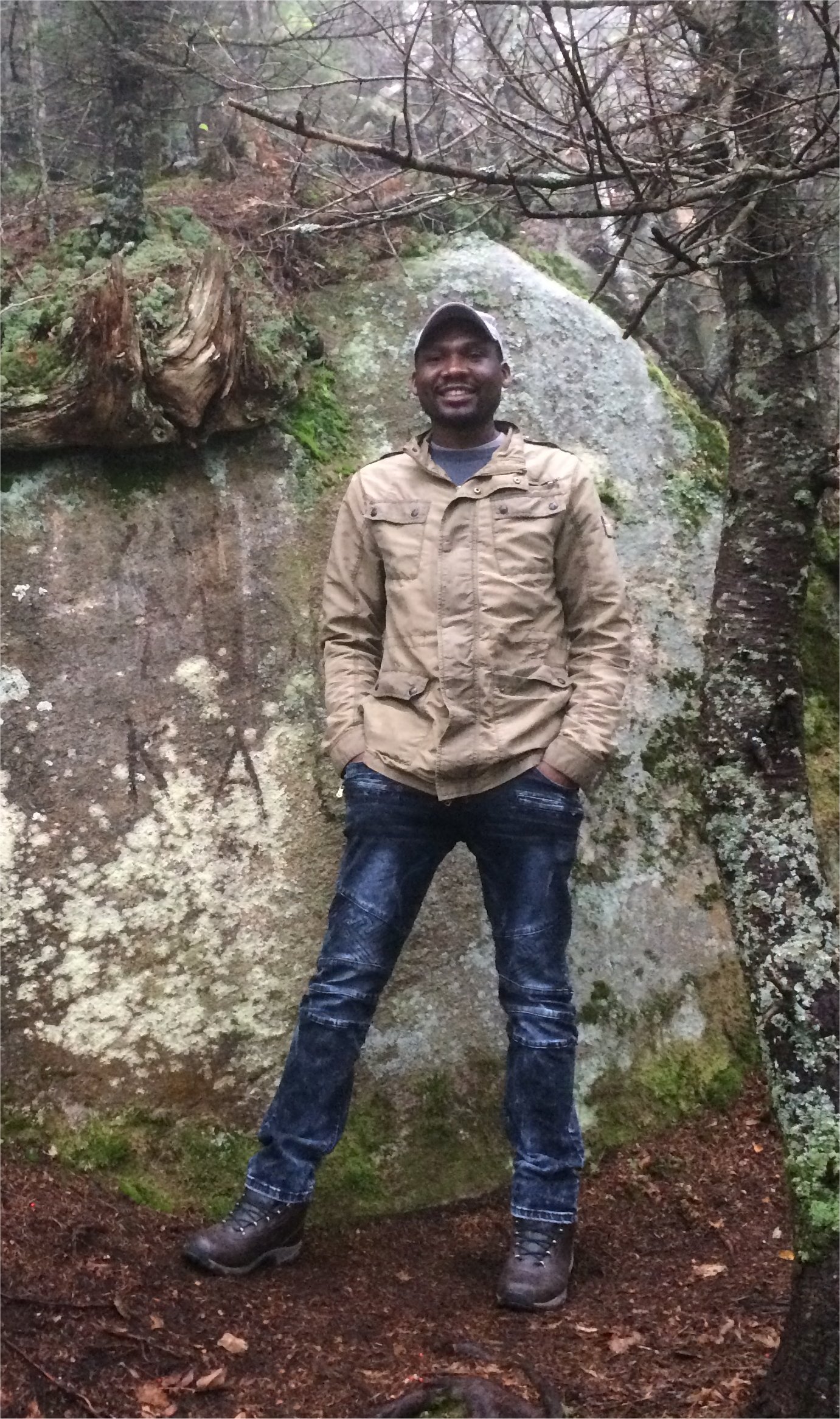
Bob Rudo Mandinyenya, Zimbabwe
Bob Rudo Mandinyenya, Zimbabwe
Navigation: 2018 Scholar Project ReferenceProject CommunitiesPage ConservationGIS Scgis.org
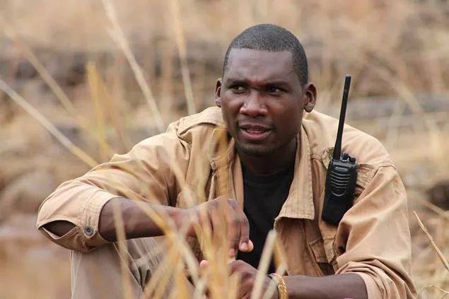
Bob Rudo Mandinyenya
Principal Researcher, African Lion and Environmental Research Trust (ALERT)
xWildlife xMammal xCat xHabitat xRemote x2018Scholar x2018Talk xScholar xTalk xZimbabwe zAfrica
African Lion and Environmental Research Trust (ALERT)
Shop 8, Bata Building, Livingstone Way, Victoria Falls, Zimbabwe
email: info@lionalert.org website: www.lionalert.org
Skype: bob.mandinyenya,
Phone: +1(607)220-3418, +263771142493
Email: brm95@cornell.edu, brmandy@ymail.com,bob@lionalert.org
I started taking interest in conservation when my father was working in the field of agriculture as an extensions officer. He used to take me with him to different areas for his work some of which had wonderful wildlife and during that time I fell in love with animals and initially wanted to be a veterinarian but however as I grew older I decided to be in conservation biology. During my undergraduate, I took a course in GIS and Remote Sensing but because of lack of resources the university was only offering this course as theory without any practical experience with the GIS equipment. This got me to know more about this field which fascinated me and I thought given a chance this was something that I would pursue. During my bachelors` degree, I spent a year doing a work related learning placement with ALERT and during this placement I often had to listen and also talk to different people about how the landscape is changing and how that is affecting wildlife distribution and populations and it was during some of these conversations I felt it would be great if I had the ability to show these changes on a map and help people understand better what I was talking about. It was during the same time when people around me were starting to use GPSs more and collecting location data but no one within the organization could transform this location data and place it on a map. I finished my course and then got employed and it was then when I started connecting with other people who were using GIS and started learning more practical skills of applying GIS and processing GIS data. From then onwards I started plotting the location data of animals from the data that I had collected during population surveys and making my reports more visual. This also helped me realize the extent and coverage of the park that I was surveying and also gave me a visual representation of areas that needed more coverage. Working together with the GIS community in Victoria Falls, we tried to come up with a remotely sensed vegetation map of the Zambezi National Park and also mapped areas of interest within the park, such as watering holes, springs, roads and campsites. I was also honored when the Zimbabwean UNESCO team on wetland management came to Victoria Falls and contacted me to help them map the extent of the Victoria Falls area that would be included in an updated map of this wetland. My career objective is to ensure the conservation of biodiversity through research and dissemination of knowledge on nature conservation so as to prevent the adverse effects of its loss, promoting sustainable development in societies, and I think this can best be done by monitoring landscapes and how they are changing in which case GIS is a very important tool.
Currently, I am working as a principal researcher with the African Lion and Environmental Research Trust in Victoria Falls, Zimbabwe involved in conservation research projects within the Zambezi Valley, focusing on the protection of biodiversity within the Zambezi National Park. This involves carrying out large predator occupancy surveys, monitoring of herbivore populations and distribution, vegetation mapping and also carrying out trials for human wildlife conflict mitigation methods within the surrounding communities. I am dedicated to contributing to solving multidisciplinary and complex issues using geo-information science, geo-informatics and remote sensing. Once finished with this training, I will input significantly, where possible and in all aspects of conservation projects, using the skills I would have acquired and also mentor colleagues, students and interns in their work. There is now an increasing complexity of conservation monitoring technics and societal demands for specialists, who can collect, manage, analyze and present spatial and remotely sensed data using high-tech methods and tools. Being part of this SCGIS training program will offer me this unique opportunity to be a specialist in geo-information science methods, technologies and their applications within conservation, environmental and life sciences. This training is also going to equip me with the necessary tools and skills that I will require to monitor and analyze landscape changes so as to positively impact communities` perspective towards conservation and thereby improving their adaptive potential to solutions for prevailing conservation problems without harming nature. As someone who has been working in conservation research, mostly in the field, I would like to take this opportunity of attending the SCGIS to equip myself with the practical skills and theoretical understanding needed to contribute effectively to conservation research and action in the developing world, which is where I am from. Being part of the SCGIS training, is going to improve my field applications of GIS technics and technologies to conservation research and my capacity to understand new knowledge of geo-information science and also to apply it to solve a range of conservation challenges.
The African Lion and Environmental Research Trust (ALERT) is a non-profit making and non-governmental organization based in Zimbabwe and Zambia. Its vision is to ensure that viable populations of African lions are maintained as an integral part of functional ecosystems. The African Lion and Environmental Research Trust (ALERT) is dedicated to a multi-disciplinary approach for the facilitation and promotion of sound conservation and management plans for the African lion (Panthera leo) and the ecosystems on which the species relies. Through responsible development ALERT aims to realize the species’ potential to provide substantial social, cultural, ecological and economic benefits, which are distributed equitably amongst stakeholders to promote sustainable motivation in them for the protection of Africa’s natural heritage. I manage ALERT`s research projects in Victoria Falls; reporting to the Director of Research; providing a high level of scientific research expertise, planning, and scientific direction for interdisciplinary research projects and research activities, associated with project initiatives, new and on-going development activities; preparing progress, final reports and journal articles to disseminate the results of the research; developing budgets, external funding proposals for research projects and liaising with sponsors of ongoing projects; providing mentorship and supervision to university students on attachment and interns.

ALERT`s projects are basically divided into in situ and ex situ lion conservation, conservation education, social development, and conserving biodiversity. In Zimbabwe, we carry out these projects in partnership with the local communities and authorities such as the Zimbabwe Parks and Wildlife Managements Authority. In situ lion conservation projects include protection and restoration of habitat for lions, assessing and monitoring population size and health, mitigation of the conflict between lions and communities, improving our understanding of lion ecology and behavior, and assisting wildlife authorities to develop and implement appropriate policies to conserve lions. In Victoria Falls, we conduct research and conservation projects in the Zambezi National Park and these projects include large mammal population surveys, large carnivore occupancy surveys, spotted hyena home range analysis and human carnivore conflict mitigation in the Matetsi Communal areas. ALERT`s responsible development approach also ensures that its lion conservation efforts extend beyond the species itself to incorporate inter-related ecological, social and economic issues. The ex situ lion conservation projects involve the release into wild of offspring of captive bred lions, that would have gone through a rehabilitation process such as living as a pride and being exposed to hunting within a semi-wild environment.
ALERT also conducts conservation education in local schools with the aim to empower communities through either support of the formal education sector through School Development Projects, or to compliment formal education through our ALERT Education Centers. School Development Projects focus on school building and refurbishment to create improved learning environments; resource provision of educational materials needed to enhance lessons; and teacher assistance to help teachers plan and run lessons more effectively. All programs are operated in agreement with the school in question, and with approval from relevant educational boards.
ALERT Education Centers` aim is to complement the formal education sector by assisting vulnerable students with access to education, offering extra-curricular activities that enhance student learning, and providing fully funded internship and facilitated research placements. Current programs at the ALERT Education Centers in Victoria Falls (Zimbabwe) include classes in conservation education and English literacy; providing funding to pay the fees of vulnerable students to take part in education from pre-school to university level, and; fully funded internship and facilitated research placements for university level students to gain work experience in a variety of fields, and undertake data collection for their theses.

Local SCGIS work: I am closely involved with the community of conservation GIS within the Victoria Falls and Hwange regions of Zimbabwe. We often share spatial data on movements of our research animals especially if they would have wondered into areas that we are not able to get to but we have colleagues that are closer than us and hence have a better chance of seeing these animals. We have also joined resources from time to time such as when we were mapping the distribution and Lantana camara, an alien invasive plant species. We then consolidated spatial data on the location of these plants and then published an article in the local newspaper informing people about where these plants where within their communities and this helped them know where to go to cut them down. In 2015 we also participated in training on GIS and Remote Sensing for Wildlife Management as a way to enhance our skills in this field. This training was something that we organized as a team of conservation GIS colleagues in the area because we felt we needed to learn more about so as to be more effective in the field and also in our analyses and reporting of our work.
Local Community work: As part of the effort to educate pupils in local schools, I have been conducting conservation education lessons in local schools. I also developed the conservation education curriculum which is being delivered, by ALERT, to pupils at schools within the Hwange District so as to encourage improved people`s attitudes towards wildlife, particularly predators. As a Principal Researcher for ALERT Victoria Falls, I lead research and conservation projects that are being conducted in the Zambezi National Park and the surrounding communities.
I have been working with ALERT as their Principal Researcher in Victoria Falls since October 2012 and my roles include managing research and conservation projects. These also include providing a high level of scientific research expertise, planning, and scientific direction for interdisciplinary research projects and research activities, associated with the project initiatives, new and on-going development activities. I also prepare progress, final reports and journal articles to disseminate the results of the research; budgets, external funding proposals for research projects and liaise with sponsors of ongoing projects. I also work with university students and research interns, providing mentorship and supervision.
During the time I have spent with ALERT, I have initiated and worked alongside Zimbabwe Parks and Wildlife Management Authority personnel in the execution of research and conservation projects within the Zambezi and Victoria Falls National Parks. These projects include the following:
- Large Predator Occupancy Survey – This survey involves assessing habitat occupancy for selected large predator, i.e. African Lion (Panthera leo), Spotted Hyena (Crocuta crocuta), Cheetah (Acinonyx jubatus), Leopard (Panthera pardus) and African wild dog (Lycaon pictus) meta-populations across Zambezi National Park, through employing a spatially replicated spoor survey to explicitly address imperfect detections. Ecological predictions about these species` presence are being confronted with sign detection data generated from occupancy sampling sites, each of 4 km2.
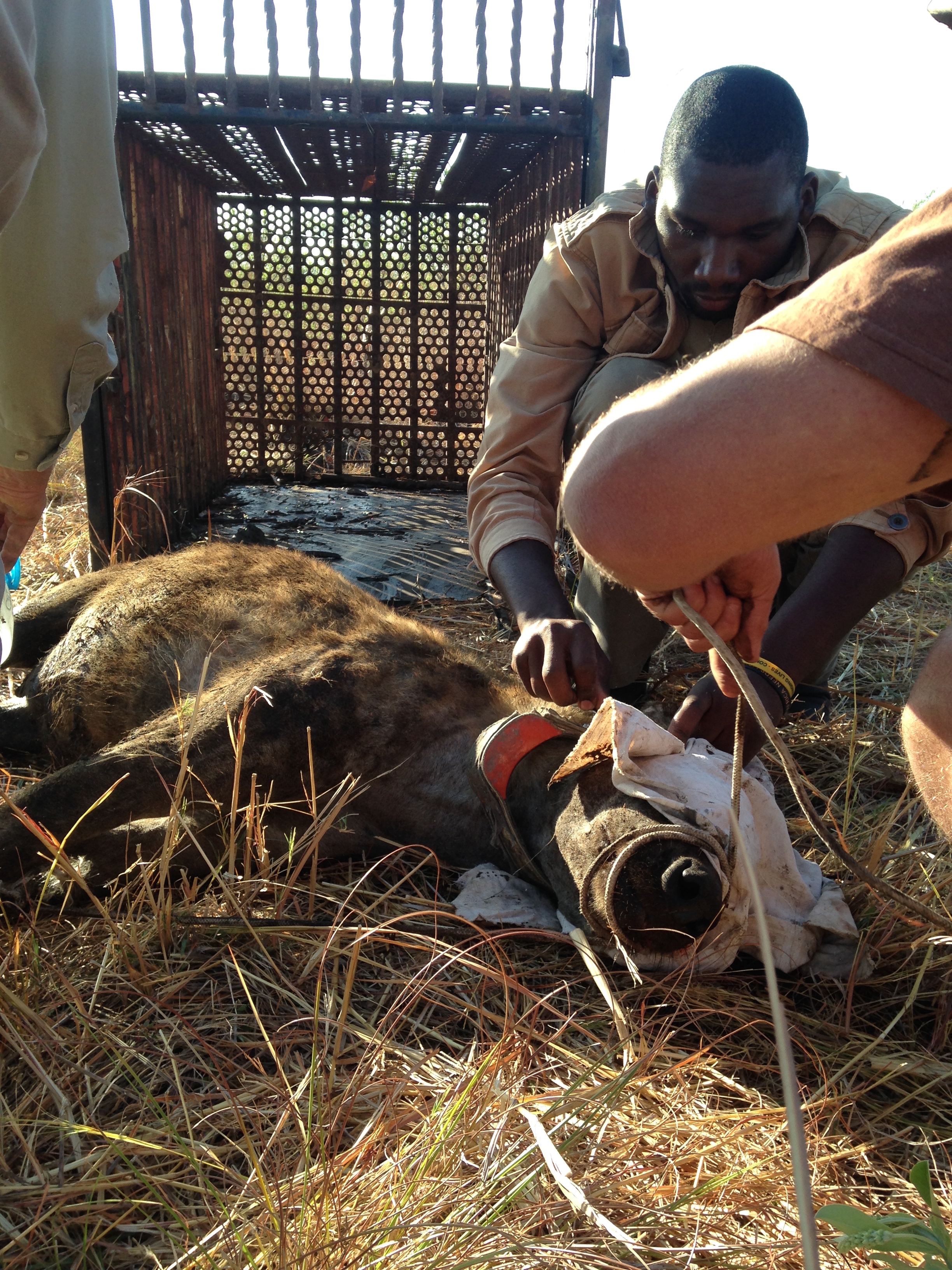
- Spotted Hyena Monitoring – This study is on spotted hyenas and this study is looking at the population dynamics of this species in and around the Zambezi National Park to obtain population size, population dynamics, recruitment, home-range, prey preference and interaction with livestock. The interaction between lions and hyenas is also being studied as these two species are major competitors and are known to limit population growth within their populations. This study is undertaken as a joint project between the Parks and Wildlife Management Authority and ALERT.
- Biodiversity Monitoring for large mammals – This project of counting large mammal species upon a driven transect has been ongoing since 1973 with a database of sightings on established transects being kept and trends monitored. The data collected is used to calculate density indices, encounter rates and abundance kilometric indices. This data also gives an indication of population trends in terms of numbers and age sex ratios over time. It is hoped that continuing this monitoring study in partnership with the Zimbabwe Parks and Wildlife Management will ensure that appropriate conservation management plans can be developed and implemented.
- Entomology Survey – The aim of this project is to come up with a checklist of the entomofauna found within the Zambezi National Park and it`s objects also include determining species and functional diversity and also producing an identification guide or keys to the major orders of insects found within the Zambezi National Park.
- Human Wildlife Conflict – This project is being conducted in conduction with Coventry University and it`s aims are to alleviate Human Wildlife Conflict (HWC) in ‘hotspot’ Matetsi Conservancy, Hwange District, Zimbabwe, by implementing a light deterrent system and also to improve attitudes to lions by delivering conservation education in local schools. The Red LED flashing lighting system is new for lion HWC mitigation and coupled with conservation education, this innovative two-pronged approach provides a sustainable, inexpensive HWC solution and highlights the role of social sciences in conservation.
- Vegetation Mapping - During the month of June 2013, we undertook a vegetation field sampling exercise to produce a vegetation map for Zambezi National Park and Matetsi units 6 and 7, complimenting an exercise which was done in Matetsi units 1-5 from the 17th to 22nd of April 2013. The exercise included a field campaign aimed at collecting data on vegetation types in the area. This attempt was aimed at producing a remote sensing based vegetation map simplified enough to be used by personnel in the field. For this exercise, satellite data used was from Landsat TM 5 image and an unsupervised classification of the image was done during which time the image was classified into 4 color classes using the K means classification algorithm. The vegetation map is still to be produced.
- Invasive Alien Plant Removal - In September 2014, I was part of the team that carried out a Lantana camara identification survey to identify locations of Lantana camara and other invasive alien plants in Victoria Falls town. This survey was done on behalf of the Zimbabwe Parks and Wildlife Management Authority and also included other stakeholders such as Environment Africa and the Victoria Falls Wildlife Trust.
Southern African Bird Atlas Project 2 (SABAP2) – I am a registered observer collecting data for the sightings of birds for the purpose of the second Southern African Bird Atlas Project.
- Conservation Education – Apart from conducting conservation lecturers in locals, I also developed the conservation education curriculum that ALERT is delivering to pupils at schools within the Hwange District to encourage improved population attitudes towards wildlife, particularly predators.
What is the most challenging about the conservation/GIS work that you do?
My work includes monitoring populations and distribution on herbivores and large carnivores within a national park. This gives me the opportunity to have a better understanding of prey and predator interactions and changes that take place during different seasons and when disturbances such as fire take place. Because I work in collaboration with the Zimbabwe Parks and Wildlife Management Authority, I am able to communicate these changes to their conservation managers as quickly as possible so that they can put into effect any management strategies to protect their wildlife. One of the challenges that I experience in this is accessing the whole park so as to be able to get a true representation of the spatial distribution of these animals and how that distribution if affected by vegetation, predation and other factors. The other challenge is also of lack of access to resources and good equipment such as GPSs and up-to-date software that I can use.
2018 Conference Title & Abstract
“The influence of normalized difference vegetation index (NDVI), grass production and quality, on large herbivore habitat selection.”
Remotely sensed vegetation indices such as satellite-derived Normalized Difference Vegetation Index (NDVI) are increasingly being used to predict herbivore habitat selection. However, the reliability of NDVI in predicting herbivore habitat selection, particularly in areas with poorly utilized forests, has not been extensively tested. We related NDVI values to three herbivore (impala, buffalo and zebra) densities in the Zambezi National Park, Zimbabwe. Herbivore density was used as a proxy for habitat selection. Herbivore density was also correlated to grass production (biomass, basal cover and height) and quality (crude protein, fibre, calcium, phosphorus, in vitro gas production and metabolisable energy) parameters. In addition, NDVI was related to the grass production and quality parameters. All three herbivores selected habitat patches with low NDVI, grass biomass, basal cover and height. We found no significant relationship between herbivore densities and grass quality parameters. NDVI was strongly correlated to grass crude protein, in vitro gas production and metabolisable energy. We conclude that in areas with poorly utilized forests NDVI was a poor predictor of herbivore habitat selection. NDVI was a good index of grass quality but a poor measure of grass quantity.