- Home
- :
- All Communities
- :
- User Groups
- :
- Conservation GIS
- :
- Documents
- :
- Animesh Ghose, Bangladesh
- Subscribe to RSS Feed
- Mark as New
- Mark as Read
- Bookmark
- Subscribe
- Printer Friendly Page
- Report Inappropriate Content
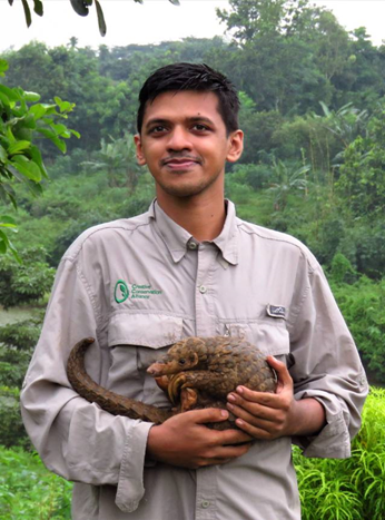
Animesh Ghose, Bangladesh
Animesh Ghose, Bangladesh
Navigation: 2018 Scholar Project ReferenceProject CommunitiesPage ConservationGIS Scgis.org
ANIMESH GHOSE
xIndigenousKnowledge xMammal xReptile xWildlife xSpecies xCommunity x2018Scholar x2018Talk xScholar xTalk xBangladesh xAsia
 <-pdf
<-pdf  2018 Conference Presentation: mp4->
“Filling the knowledge gap using traditional ecological knowledge of indigenous people:Status of Asian pangolins in Bangladesh ”
 <- 2018 SCGIS Interview: on the essential role of local indigenous forest peoples in high-tech endangered species protection in difficult border regions of government conflict and rebellion
2018 Scholarship Training Program Storymap Project on the Burmese Python (coming soon)
ANIMESH GHOSE
Consultant, Creative Conservation Alliance, Bangladesh
Programme Officer, WildTeam Bangladesh
Member, IUCN SSC Pangolin Specialist Group
Graduate Student, Institute of Forest Research, UQAT, Canada
Whatsapp: +8801711326865/+14382703553; Messenger: animesh.ayon
email: animesh.sust@yahoo.com
2018 Scholar Program Video Introduction:
UPDATE :
I am now doing my Masters in Ecology at the University of Quebec in Canada. My masters research topic broadly cover spatial ecology and forest ecology. Besides this, I am working with our CCA team to finalise our Burmese python conservation handbook and pangolin telemetry study program.
ORGANIZATION’S WORK
The Creative Conservation Alliance (CCA) is a government registered non-profit organization, dedicated to ecological and cultural preservation within Bangladesh’s last remaining wild places. Our organization is achieving conservation success through partnerships with government and non-government stakeholders, provision of alternative income sources of the local communities, rigorous scientific research, and the sustainable protection of natural resources. Both with our Chittagong Hill Tracts Program and with the Northeast Program, we are giving local communities a voice and the tools to succeed in staving off the destruction that their lands face.
Chittagong Hill Tracts Program: Since 2011, we’ve been working closely with the local communities in the Sangu-Matamuhuri Reserve Forest (located in south eastern Bangladesh), listening to their concerns and gaining their trust. We’re now positioned to affect real change in the region, but this is no small task! Change requires a multi-directional approach culminating in a holistic program engaging both local stakeholders and government agencies. We are providing solutions from all possible angles including the mitigation of subsistence wildlife hunting and commercial poaching in exchange of primary schools, marketing traditional crafts to reduce the ethnic community’s dependency on the forest resources, empowering former hunters as parabiologists/conservation heroes, and establishing rare plant nurseries, marketing sustainable-grown cash crops, and petitioning the highest levels of government.
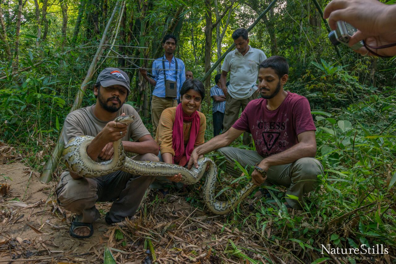 North-east program: We conduct species-specific research utilizing Lawachara National Park in northeast Bangladesh as an experimental platform. Our work results in sustainable management decisions applicable to species conservation throughout human-modified landscapes of Asia. You can study globally-threatened Burmese pythons, Chinese pangolins and elongated tortoises using radio-telemetry equipment in this mixed-evergreen forest surrounded by the famous Sylhet tea gardens. Lawachara also serves as our base of operations for our annual Tropical Field Biology Course, previously known as the Bangladesh Python Project Workshop.
ROLE IN THE ORGANIZATION
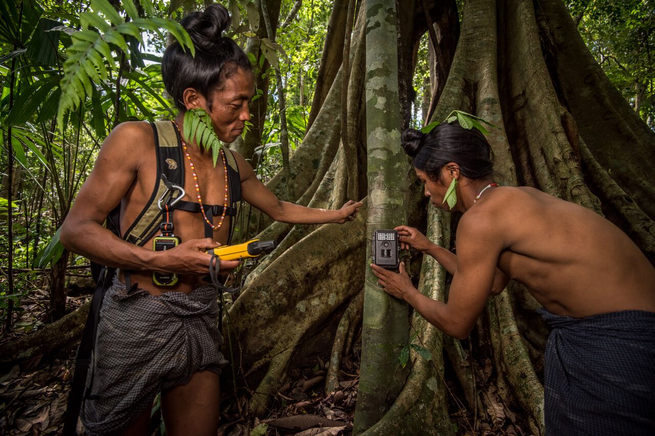
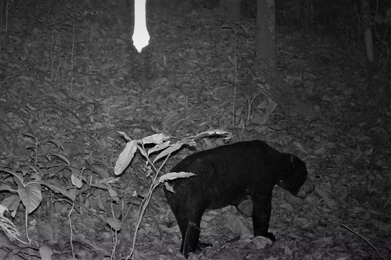
From our organization we are doing radio telemetry study on Burmese python and elongated tortoise in north eastern Bangladesh, camera trapping on large mammals in south eastern Bangladesh , presence-absence survey on Asian pangolin and community based forest conservation.
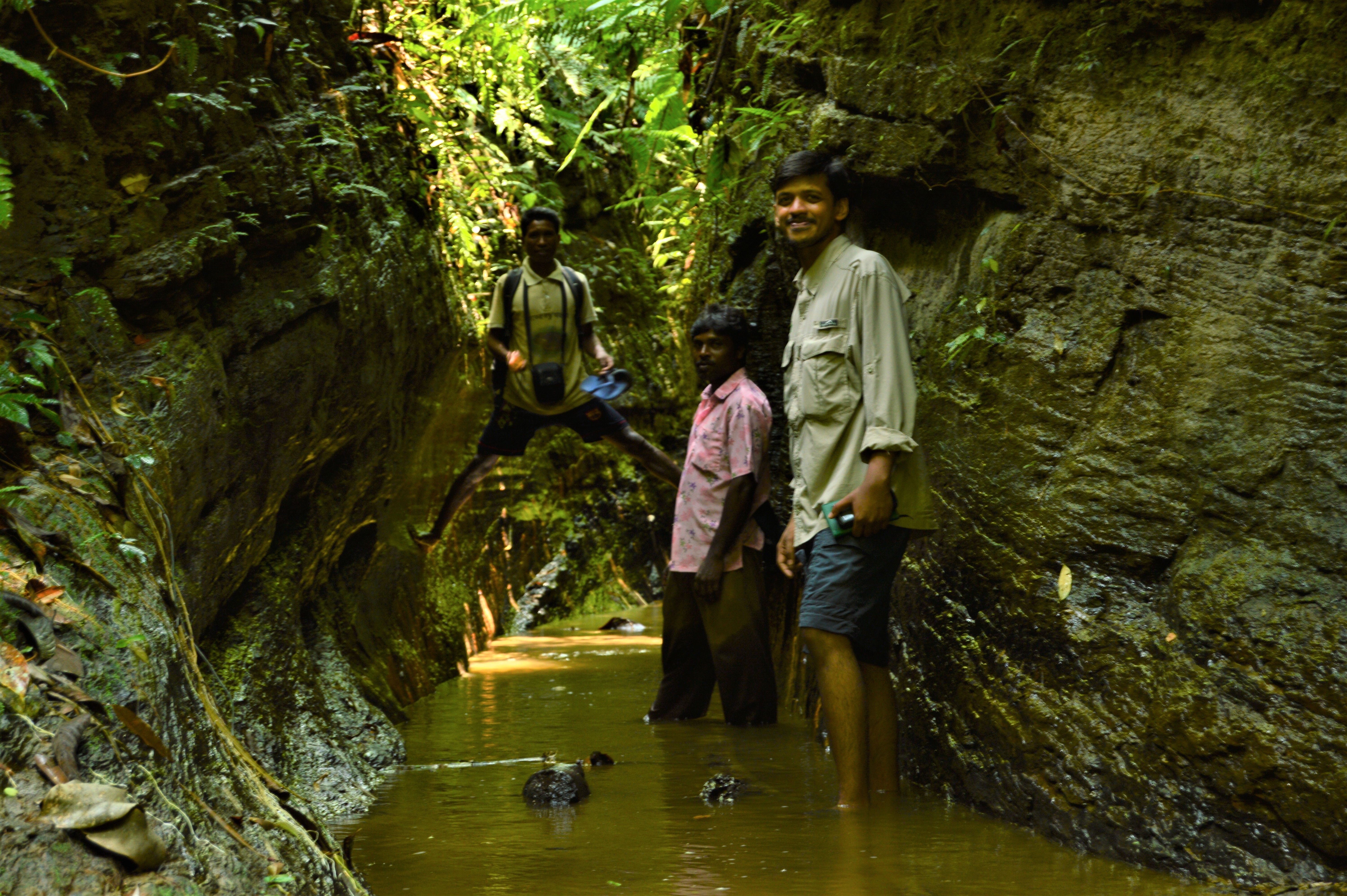
I have been working with Creative Conservation Alliance (CCA) since 2011, when I started as a volunteer with then Bangladesh Python Project, this project is now one of the flagship projects of the organization, where I am now a wildlife biologist. We went to forest early in the morning with VHF receiver to track our radio tagged Burmese python and elongated tortoise.
In my organization I am the data guy, I mostly work with organizing the raw data that our field technicians collect from two different projects, the “Parabiologist Initiative” and the Bangladesh Python Project. Through our “Parabiologist Initiative” we conduct camera trapping study in the Chittagong Hill Tracts of the southeast Bangladesh. Every month, we receive bunch of raw data from the field, I insert those data into the computer, organize them, and prepare those data for further analysis. I also create GIS based maps for those projects, especially by using the data collected from the python radio telemetry project.
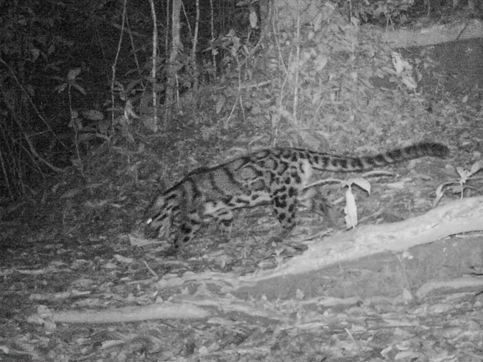 We are doing camera trap study on large mammals in south eastern part of Bangladesh and presence-absence survey of pangolin in 10 forest areas of Bangladesh with the help of our indigenous parabiologists. Traditionally, the indigenous communities living in close proximity of forest in Bangladesh, have been hunting pangolins and other wildlife for hundreds of years for subsistence, and these people are highly skilled in finding wildlife in wild, in remote and rugged terrains. We have identified some of these highly skilled hunters, and empowered them from hunter to conservationist. Our organization CCA has been working closely with the communities for the last few years and This has been possible based on trust and relationship that CCA has built. Not only these individuals are highly effective on surveying pangolins or other animal and but acting as role models for wildlife conservation in their area.
 Moreover, I lead the Bangladesh Pangolin Project. Through this project we are mapping the distribution of the remaining pangolin populations throughout the country through presence/absence survey. We are currently collecting data from 10 different forest patches of three different regions of Bangladesh, i.e. north, northeast, and southeast Bangladesh.
I am a data “geek”, and I feel great, when I can convert all those data into a meaningful map, that anyone can understand with minimal expertise. Therefore, I have applied to the SCGIS scholarship to play with our data with GIS techniques. Moreover i conduct workshop on research method, introduction to GIS, Data analysis with R, Basic QGIS for undergraduate students..
HISTORY
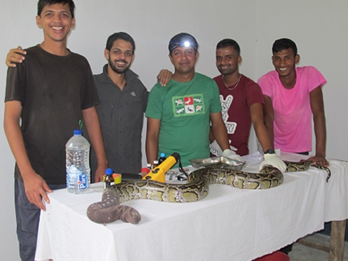 Earlier in my life I wanted to be a physician, but later I became attached to the nature. I was lucky enough to study Forestry and Environmental Science in the Shahjalal University of Science and Technology. 2011 was one of turning point in my life, when I became a volunteer in the Bangladesh Python Project. Being part of the team that was conducting first ever radio telemetry study on Burmese pythons was beyond my dream. That made me more passionate, dedicated and hard-working field biologists. I used to hike into rugged terrain to collect GPS locations of the radio-tagged pythons, later I insert those locations into the computer to create a location map. This made me more interested about utilizing data in a more meaningful way.
Besides being a biologist, I am a conservationist too, and conservation of species require great deal of negotiations with different government, non-governmental agencies, and other stakeholders. It’s pivotal to communicate in a language that everybody understands. Maps are the best way to explain complex statistics about complex biology of the species.
In 2016 I completed my Master’s in forestry, my Master’s thesis was about the spatial ecology of elongated tortoises in Bangladesh. During working on my thesis I became familiar with advanced GIS along with the spatial analysis tools in ArcMAP, that was a new experience for to study home ranges, of the radio-tagged tortoises.
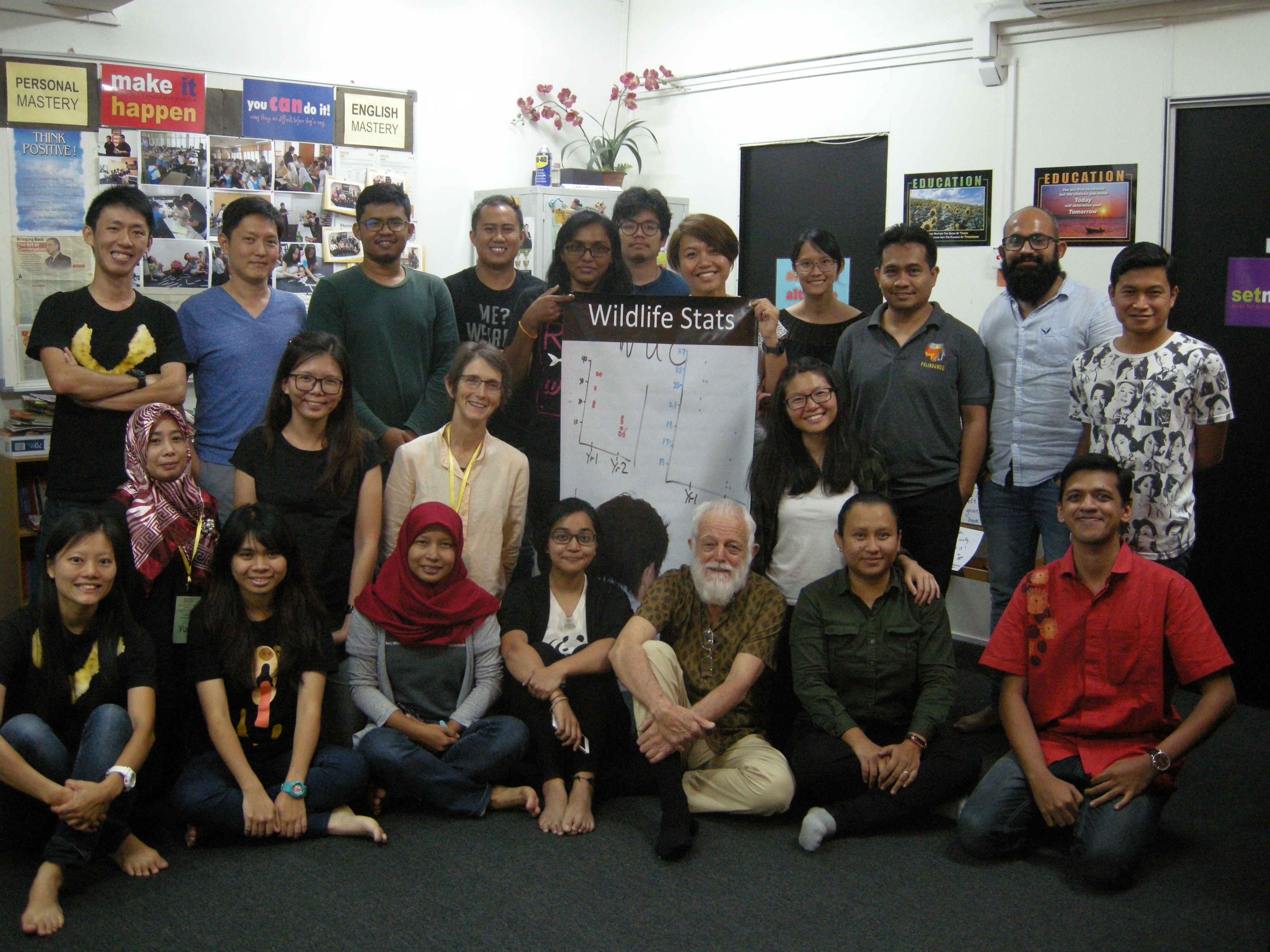
I have participated workshop, conferences, seminars, and boot-camp in and abroad, I have participated into statistical boot-camp in 2015 and 2017 in Bangladesh and Bhutan respectively. Earlier this year I participated into training program on hierarchical statistical modeling using R and JAGS in Malaysia, I also participated another training program on open source GIS mapping using Q-GIS this year in Malaysia (Conducted by BCSS Malaysia).
ROLE IN THE LOCAL SCGIS CHAPTER
I have no connection with SCGIS chapter. But I am in touch with some SCGIS member
TEACHING & LEADERSHIP
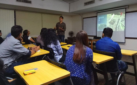 I was working with Forestry Science and Technology Institute as course instructor (part-time).The institute works under auspices of the Ministry of Environment and Forest. This institute offer Diploma in Forestry course to the forest officer who did not complete their graduation or diploma on Forestry. I have also conducted several workshop with the undergraduate students of different universities on the use of GIS in Wildlife conservation, research methodology, R software etc.
I am a member of IUCN SSC Pangolin Specialist Group which is a global platform for the conservationist who actively working for the Pangolin research and life time member of Green Explore Society- a student organization of Shahjalal University of Science and Technology, fully dedicated for nature conservation.
Learning GIS
My introduction with GIS was began with a course ‘Remote Sensing and GIS’ at my university. Later I did a short course from online platform ‘Coursera’. Recently I did a week long workshop on ‘QGIS’ in Kualalumpur, Malaysia.
Beside this, I am in touch with my mentors Mr. M Abdullah Abu Diyan ,Mr Hasan Ahmed and Ms Voon Feng.
My current GIS capability/expertise
My current level of GIS knowledge is at a basic level, including- creating map, analyzing density etc. Here are some works of mine:
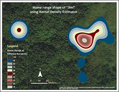
Fig.: A kernel density map
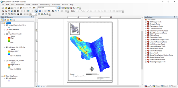
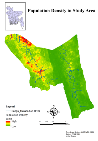
Fig. Preparing a map on the population density of a reserved forest from the south-eastern region of Bangladesh
- Mark as Read
- Mark as New
- Bookmark
- Permalink
- Report Inappropriate Content
Really interesting!