- Home
- :
- All Communities
- :
- Industries
- :
- Public Safety
- :
- Public Safety Blog
- :
- Leveraging GIS Technology in Emergency Communicati...
Leveraging GIS Technology in Emergency Communications
- Subscribe to RSS Feed
- Mark as New
- Mark as Read
- Bookmark
- Subscribe
- Printer Friendly Page
- Report Inappropriate Content
By Mike King
Director, Emergency Communications Solutions – Esri
Last week I had the opportunity to provide a keynote address at the annual conference of one of our computer-aided dispatch partners. My remarks centered on leveraging geographic information system (GIS) technology in a presentation titled "The Art of the Possible—GIS for PSAPs."
I focused my comments on four important, and often disregarded, topics in the 911 industry: digital information sharing, migrating GIS data from 2D to 3D, embracing out-of-the-box web applications, and enhancing business intelligence tools with GIS, specifically focusing on Insights for ArcGIS.
Digital Information Sharing
Agencies around the world are frustrated with the antiquated analog approach of uploading address database information, service areas, and other CAD foundational information on a periodic basis. They recognize that the moment the data is uploaded, it is outdated.
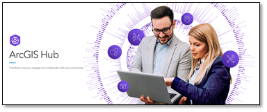
Forward-thinking agencies are embracing digital transformation, allowing end users to take advantage of the most up-to-date information the moment it becomes authoritative. This effort requires agencies to use modern technologies like ArcGIS Hub or Portal for ArcGIS. A hub or portal allows agencies to manage and share geospatial data quickly and securely to those with a need to know.
ArcGIS Hub is an easy-to-configure cloud platform that organizes people, data, and tools to accomplish initiatives and goals. Organizations of any type and any size can maximize engagement, communication, collaboration, and data sharing using the ArcGIS Hub initiative-based approach.
With ArcGIS Hub, organizations can leverage their existing data and technology to work together with internal and external stakeholders while tracking progress, improving outcomes, and creating vibrant communities. Use Hub to share data, create unlimited websites, organize your work around initiatives, enable collaboration, and inspire action.
Migrating Your 2D GIS Data to 3D
Soon, public safety answering point (PSAP) personnel and first responders will begin receiving z-axis location information (elevation) in the packet of 911 data received in the PSAP. As this information becomes available, agencies will need to view this information on 3D maps to better understand and respond.
The FCC ruling on location accuracy and indoor routing will soon become a reality across America, and it is incumbent upon PSAPs to be able to appropriately respond to the data. This will require significant effort on the part of private and public entities to fully embrace and prepare for the eventuality. With the tools that help you build a 3D infrastructure, your agency can also leverage the analytic functions of 3D, including solutions like the line of sight capabilities and building height and distance measurements.
Embracing Out-of-the-Box Web Applications
Delivering comprehensive GIS capabilities to the field is possible with web applications and native apps for iOS, Android, and Windows. Dashboards, field collection tools, workforce assignment, and tracking are all within reach with Esri's apps for field operations, a collection of integrated, location-based apps that work wherever you do. That means you will have functioning and integrated maps on your desktop, on your mobile devices, or in your browser. It has been proven effective in disconnected environments and on all broadband networks, including the First Responder Network Authority (FirstNet).

Using field apps improves coordination, achieves operational efficiencies, and helps you gain insight. Your authoritative data deserves a solution as specialized as the insight it provides. ArcGIS ensures that your teams in the field or in the command center are using the same data to reduce errors, boost productivity, increase operational understanding, and save money.
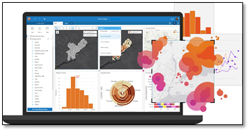 Enhance Business Intelligence Tools with ArcGIS Insights
I have watched closely as agencies around the world grapple with visualizing and understanding data. ArcGIS Insights offers a data analytics workbench where you can explore spatial and nonspatial data in an easy-to-use drag-and-drop environment. You don't need to be an expert in data or geographic information systems. You simply access the data and begin to explore
and solve spatial problems. You'll answer questions you didn't know you needed to ask and quickly deliver powerful results.
I'm excited to announce that ArcGIS Insights is now available in beta for Windows and macOS! This means you can work connected or disconnected, right from your desktop. Check it out at ArcGIS Insights.
Interested?
If you’d like to learn more, downoad our eBook, “5 Ways GIS Empowers Next Generation 911,” or email me and start a dialogue.
All the best, Mike
mking@esri.com
www.Esri.com/911
You must be a registered user to add a comment. If you've already registered, sign in. Otherwise, register and sign in.