- Home
- :
- All Communities
- :
- Industries
- :
- Public Safety
- :
- Public Safety Blog
- :
- Hurricane Harvey Assistance One Click Away
Hurricane Harvey Assistance One Click Away
- Subscribe to RSS Feed
- Mark as New
- Mark as Read
- Bookmark
- Subscribe
- Printer Friendly Page
- Report Inappropriate Content
Hurricane Harvey, at one point a category 4 hurricane, has brought devastating amounts of rainfall with extensive damages to Texas and Louisiana. As Harvey continues its catastrophic path, Esri’s Disaster Response Program (DRP) is here to support you around the clock 24/7.
If you need support with additional software, data, or technical support you can request immediate assistance from the DRP.
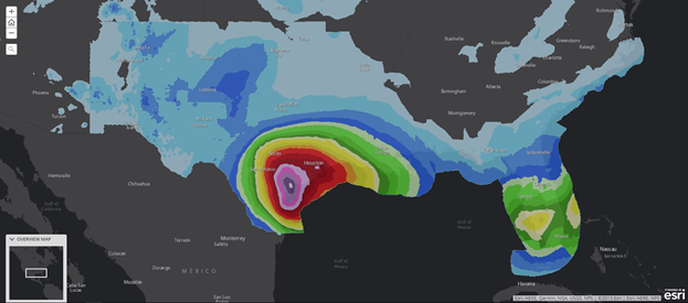
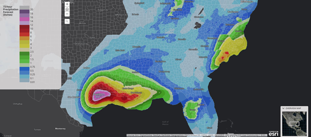
The Hurricanes and Tropical Cyclones Overview map provides up to date information on the potential impact, precipitation, and path of Harvey.
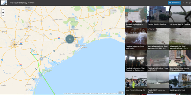
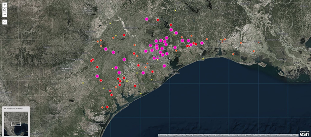
Emergency management agencies are also using social media and crowd sourcing to gain insight on the situation. This Crowdsource Story Map helps responders and emergency managers gain insight into the situation on the ground.
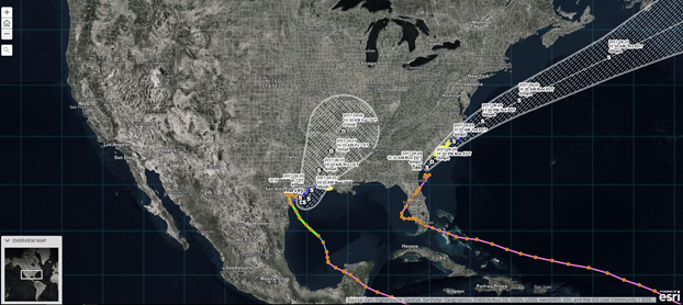
The Tropical Strom Harvey: Current Conditions Application
This interactive web application features Hurricane Harvey tracking, traffic alerts, road closures, shelter locations, flood gauges and more.
Track and forecast the path of Harvey:
Stay up to date with traffic alerts and closures:

Locate a shelter location nearest you:
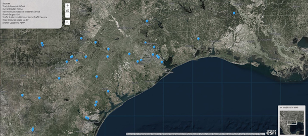
Analyze the current situation of flood gauges:
Analyze 72-hour precipitation forecast:
You must be a registered user to add a comment. If you've already registered, sign in. Otherwise, register and sign in.