- Home
- :
- All Communities
- :
- Products
- :
- ArcGIS Data Interoperability
- :
- ArcGIS Data Interoperability Blog
- :
- See Inside Earth With ArcGIS Data Interoperability
See Inside Earth With ArcGIS Data Interoperability
- Subscribe to RSS Feed
- Mark as New
- Mark as Read
- Bookmark
- Subscribe
- Printer Friendly Page
- Report Inappropriate Content
Earthquakes definitely fall into the 'hard to see' category, but also tricky to get right in your GIS.
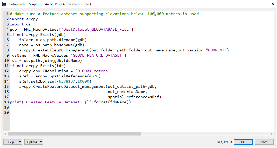
You can easily find earthquake data, government agencies offer feeds and historic databases from which you can extract data. This is great for 2D maps, but often the Z (vertical) coordinates are given as positive depth values in kilometers, so 'going the wrong way' for the normal 'positive up' coordinate system. Another wrinkle is the default Z domain for geodatabases has a Z minimum at -100,000, and the lithosphere extends below this depth in meters, so you can lose features on the way in.
I'm not going to do a big post on coordinate systems, I'm just going to throw a couple of things over the fence for you to look at. Firstly watch the movie file in the blog downloads. I was involved a few years ago in adjusting GIS data after an earthquake moved the ground (a lot, over 6m in some places). Just watch the movie to see a year's worth of quakes go by and fly to where a lot of deformation occurred after a severe one; you'll fly past labels of movement values and to a homestead that shifted. The apparent sudden jump of the property is real, and what you'll see is high resolution orthophotography before and after the adjustment work (it didn't have to be re-flown, just adjusted).
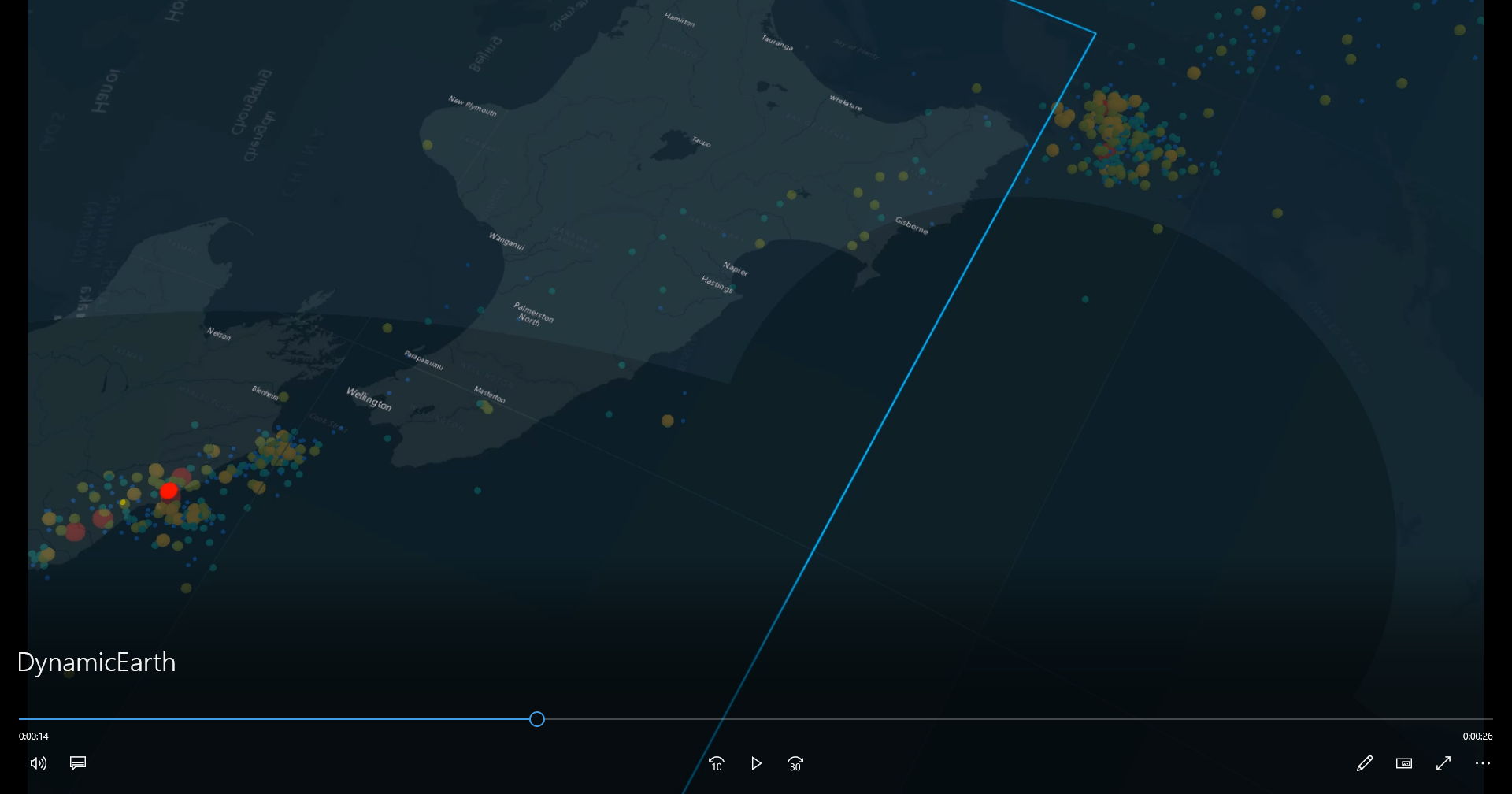
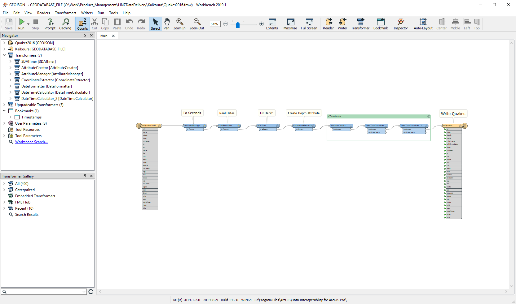
The movie was exported from an ArcGIS Pro 3D Scene, but this was only possible with correct 3D points for the quakes, and that data was made from a GeoJSON download and processing with the Spatial ETL tool Quakes2016.fmw that is the second download file.
Its a really simple workspace....
..until you go to the Tool Parameters>Scripting>Startup Script setting and see a bit of fancy footwork making a custom Feature Dataset in the output geodatabase with a Z domain that goes to the center of the earth. The takeaways are you might not have known about startup scripts and that you can use one to operate on workspace parameters.
Please comment on the post with your experiences and ideas.
You must be a registered user to add a comment. If you've already registered, sign in. Otherwise, register and sign in.