- Home
- :
- All Communities
- :
- Products
- :
- ArcGIS Data Interoperability
- :
- ArcGIS Data Interoperability Blog
- :
- Don't leave LAS behind!
Don't leave LAS behind!
- Subscribe to RSS Feed
- Mark as New
- Mark as Read
- Bookmark
- Subscribe
- Printer Friendly Page
- Report Inappropriate Content
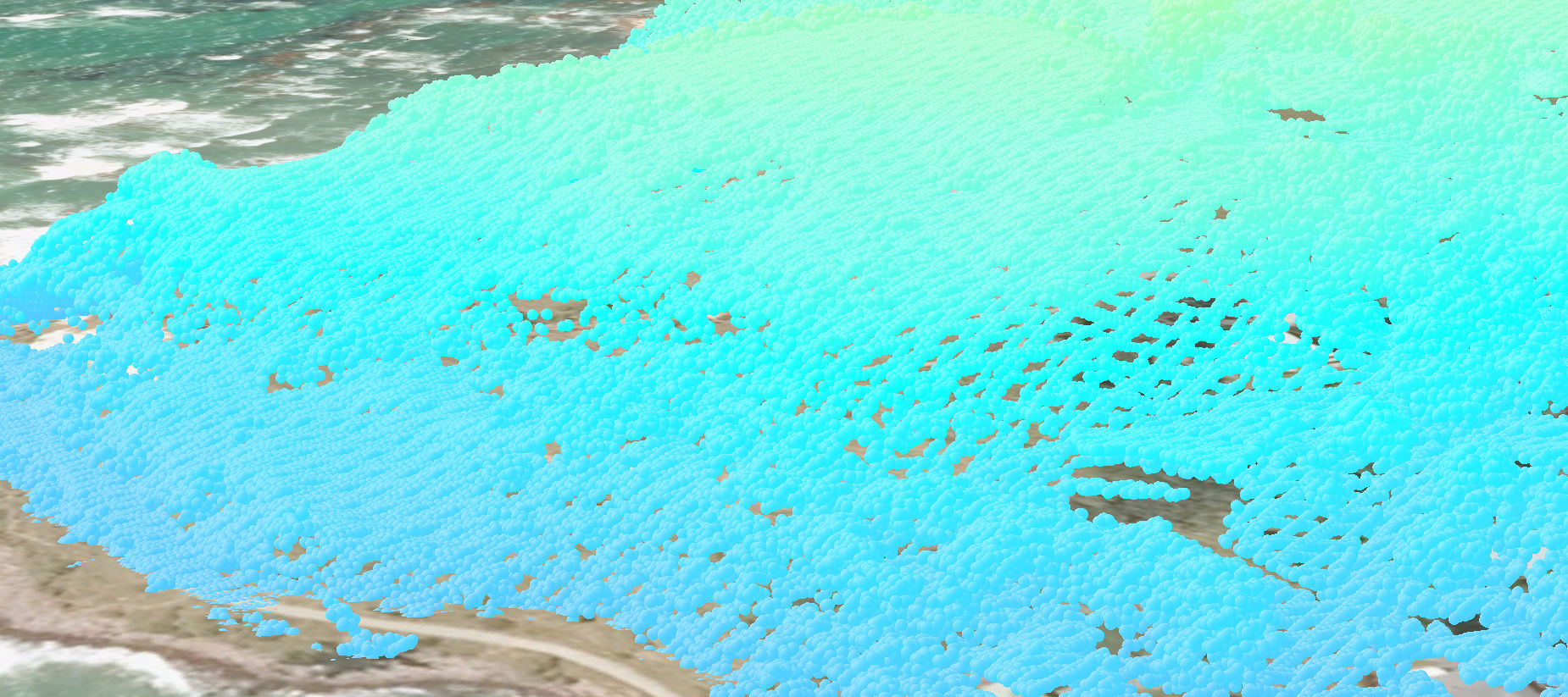
Data Interoperability extension sees Point Cloud data, such as ASPRS LAS and Esri LAS Dataset as their own feature type, just like many other formats. Here is some on a coastline - surf's up! (Look above the headland)
Formats are designed to deliver specific capabilities, but all geospatial formats have something in common - a coordinate system - and your GIS needs to be able to manage it. LAS data is a bit of an outlier here as we expect ArcGIS users to collect their data in the coordinate system they intend to use, and stick with it, but in the case where the 'ground moves' (literally, like plate drift or quakes, or if a new datum or realization is published) then ArcGIS's comprehensive core projection tools don't yet support the format.
A situation we hear about is people have LAS data in ellipsoidal heights (say WGS84) and want to generate DEMs in orthometric heights. Orthometric heights are gravity-defined and approximate height above mean sea level, so they are important if you need to model coastal or estuarine flooding, for example. You can always create a DEM and reproject its vertical coordinate system with the geoid grids delivered by the ArcGIS Coordinate Systems Data install, or your own local ones, but that leaves the LAS data behind  .
.
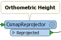
Your LiDAR vendor would be pleased to reprocess your LAS data but you can do it yourself with ArcGIS Data Interoperability extension. The secret is in this transformer - CsmapReprojector:
In the blog download there is a sample specific to accommodating a new vertical datum for New Zealand, but read between the lines in the document delivered in the download and leverage the vertical grids delivered in the Coordinate Systems Data install, or geoid grids you obtain locally, and reproject your LAS data how you need.
Then when a point says its floating you can trust it  (bad I.T. pun).
Note: The blog download and the Geoprocessing gallery sample here are equivalent.
You must be a registered user to add a comment. If you've already registered, sign in. Otherwise, register and sign in.