Community Closeup with Dan Patterson
- Subscribe to RSS Feed
- Mark as New
- Mark as Read
- Bookmark
- Subscribe
- Printer Friendly Page
- Report Inappropriate Content
Community Closeup is a member profile series where we get to know members in GeoNet, The Esri Community.
About Dan

If you have ever asked a question in the GeoNet Community, you likely received a response from Dan Patterson, or maybe you've been one of the several thousand users that have referred to his free tools and helpful guides from Py…blog where his wealth of knowledge has amassed to 119 blog posts. Dan is a GeoNet MVP from Ottawa, Canada, who has been a part of the Esri Community since 1992.
"I was known as ‘the computer guy.’ I took my first computer science course in high school around 1968. When I got to university, I discovered most people hadn't had that opportunity." - Dan Patterson
When Dan finished his undergrad and graduate studies at Carleton University, the university decided to start a GIS program. Instead of continuing his studies to pursue his dreams of a Ph.D., he became full-time faculty with the developing program to teach Statistics, Intro to GIS, Intermediate Raster/Vector Geospatial Analysis Course, and Advanced Applications of GIS.
 His guidance for GIS students and professionals online and offline led to his earned nickname 'ObiDan,' modeled after the revered mentor and teacher Obi-Wan Kenobi from Star Wars. It fits for someone with an extensive history as an educator in the GIS field for 31 years. Students that are actively working in the geospatial industry experienced his "fail, figure out why, and fix it" teaching style that encouraged exploratory learning of spatial science.
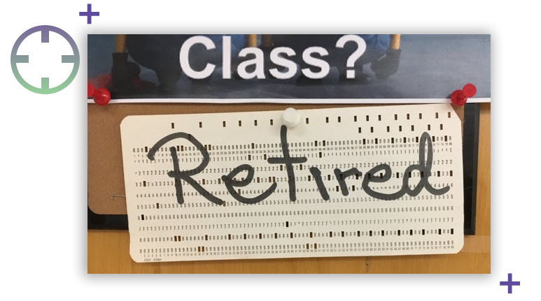
Pictured: His retirement notice for the last days of class.
Fun Fact from Dan: “I got my first research assistant job in the summer of 1st year because of my ‘ability to program in Fortran’, which I knew nothing about, but 5 days later, I could DO-loop with the best of them.”
:information: DO-loop is a command that executes repetitive statements in Fortran, a programming language developed by IBM.
Q&A Interview
 What brought you to GeoNet?
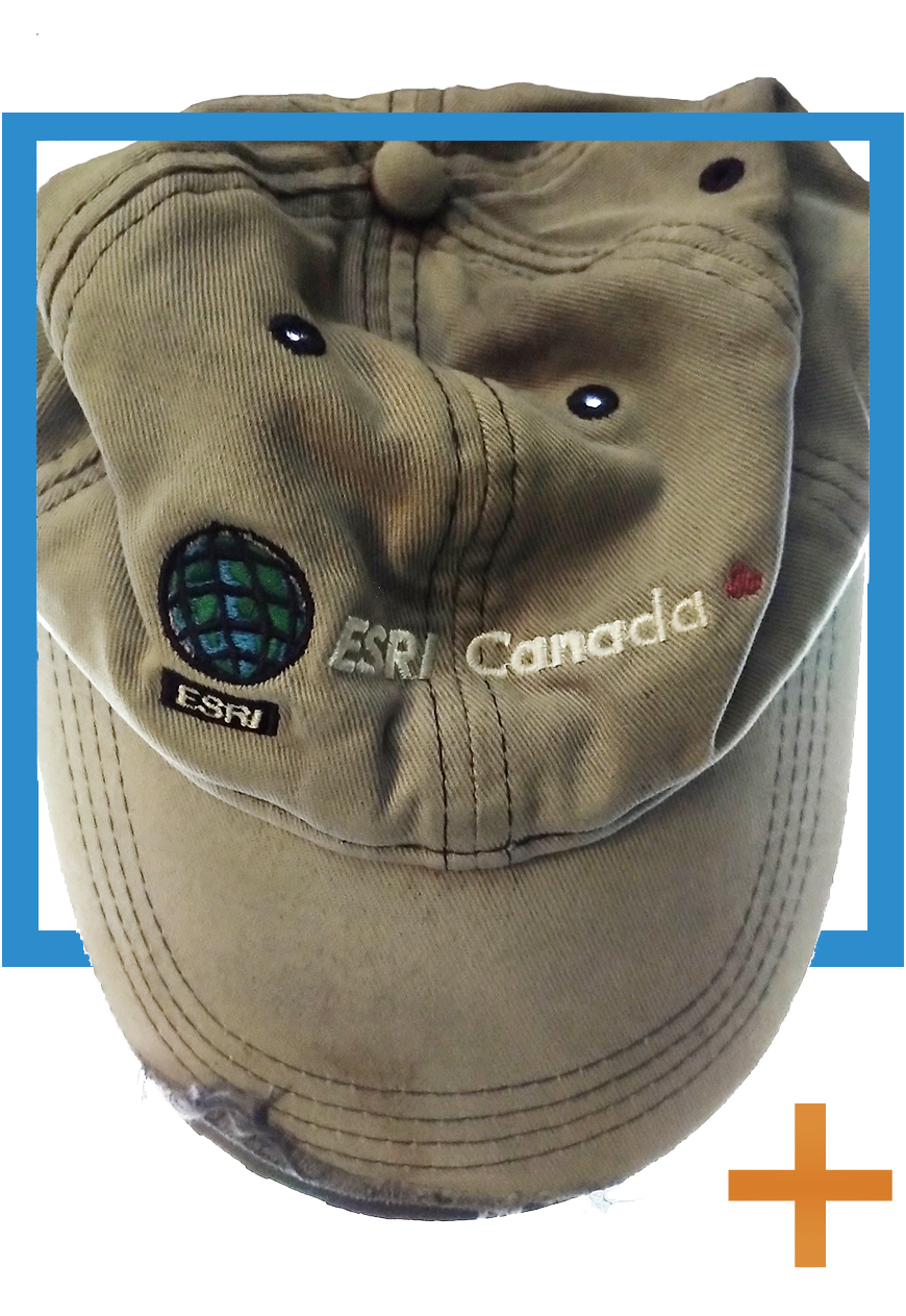
I preceded GeoNet by many years, having participated in the ArcView 2.x/3.x forum, long before ArcMap was on the scene. I was looking for interesting questions that I could use as examples of real-world situations where GIS analysis was applied. In those early years, archeologists were dabbling, engineers of various flavours were trying to add new tools to their arsenal, and biologists were interested in things relating to fragmentation of landscapes and mapping in general. I was hooked when I ranked as an MVP with about 32 points in one quarter, and I got an Esri hat (pictured).
What unique value does the GeoNet Community have from your perspective?
There is much talent out there amongst the users. If people spent more time sifting through the posts in a particular place, they might find answers to their questions or interesting things to pursue. It has been great in the last few years that some of the Esri staff have become active in taking over the moderation of spaces and providing answers.
| Dan enjoys spatial analysis and the reward of overcoming the math challenges that come with it. While he feels intimidated by math like most people, he faces it as a learning opportunity to create tools, write blogs, and answer questions to help the novice and the experienced professional get over the wall of labor-intensive effort or the lack of know-how. |
What types of questions in the community are the most interesting to you?
Questions relating to geometry, geometric constructs, computational geometry, and multidimensional raster stuff. I suck at math, and I just love reinventing the wheel for various algorithms.
How do you decide what to contribute?
I contribute answers when I need a break from what I am working on. It provides a distraction. A quick pop-over to GeoNet, see what’s up, answer a question or two, then back to work.
Now that I am retired from teaching, I want to blog about some of those ‘math’ things that most people hate or have avoided, just to provide a free record of things you can do. The “Free Tools”!!! blog came about because I was surprised people hadn’t discovered several things that require an Advanced License could be done without one by using the tools that Esri provided. Split By Attributes was my first venture into tools. I originally published it around 2005, but It wasn’t until 2016 that it became available at the basic level in ArcGIS.
What are your favorite applications or projects that use ArcGIS Pro and Python?
 I worked in the areas of the geometric properties of roads, permafrost modeling, some biomedical stuff like rabbit bladder dynamics (a cross-over between CT scans and raster analysis over time). The Center of the Ottawa project was fun.
Beyond the usual, I like working with NumPy and the ArcGIS Spatial Analyst extension. I like ‘art’ and the purity of being able to represent things numeric in a visual form. Mandelbrot and Julia Sets are two examples (pictured). There are also areas that I have only dabbled in, like terrain simulation algorithms.
:information: NumPy is a programming language for scientific computing and processing of multidimensional array objects.
How has GeoNet played a role in your career or made an impact with members?
Students always could get a hold of me at any time. I constantly get reminded by students that they were looking up solutions on GeoNet and came across my name and it reminded them of class. Many students going back decades still keep in touch professionally and personally. I do love it when I get a big thanks from a person on GeoNet in my e-mail. It usually comes with a more elaborate explanation of their problem and how the seemingly innocuous question I answered fit into a bigger picture.
How do you think other GeoNet members should contribute to the community?
Contribute your expertise on the fundamentals: Math, cartography, programming/scripting. If you can’t do it yourself, then line up the resources in terms of people or tools that will get the job done for you. Remember when you were a newbie? Now you might be the expert. People are strapped for time, but so what? Everyone is. If you see a question you can answer, spend 5 minutes on it. Also, don’t map boring stuff.
|
While Dan settles into his retirement plans of gardening and spending time with family, he has ideas to venture into Esri CityEngine but mainly will concentrate on writing more blogs. Writing blogs is a slight change from his original plan to write books. "I gave up on the notion of books. Even though I have a few on the go, I know I will never finish them. Besides, what interests me in education and educating is what I don't know."
For more from Dan, follow him on GeoNet to learn about his latest explorations with GIS. |

Extreme Closeup: Dan’s “5 Favs”

What’s your favorite map, and why? Hobbit, Lord of the Rings, and all those inspired from them. I was impressed that Tolkien saw the maps as an integral part of his work. There is some good work done here by Robert Rose. 
What’s your favorite place in the world? I actually don't have one. I am not really a 'where' person, but a 'what' person. My 'travels' have been through the stories told by my students, who have come from, or traveled to all the continents. 
What's your favorite thing to listen to while you’re working? Sometimes radio news, but when I'm on the road, it’s tunes by Little Feat or Ry Cooder. 
Favorite item on your desk? Family pictures. They ground me and remind me that I really shouldn't be at my desk working. 😉 
What’s your favorite office snack? Costco mini dark chocolates. You could buy them by the bag. I had them in my office for students for years. They were there for the grazing, and I, of course, did quality control testing to ensure that they were still fresh. Occasionally I got pressured to buy the milk chocolate kind, but the dark chocolates are healthier (I think). |
New to GeoNet? Learn more and join the Community today!
You must be a registered user to add a comment. If you've already registered, sign in. Otherwise, register and sign in.