- Home
- :
- All Communities
- :
- Events
- :
- DevSummit Conference
- :
- DevSummit Conference Blog
- :
- Live from the DevSummit Plenary
Live from the DevSummit Plenary
- Subscribe to RSS Feed
- Mark as New
- Mark as Read
- Bookmark
- Subscribe
- Printer Friendly Page
- Report Inappropriate Content
Welcome to the 2018 Esri #DevSummit Plenary! We will be sharing the latest news and updates during the plenary. Thanks for following along and we look forward to seeing your feedback and contributions in the comments below!
Be sure to check out each DevSummit 2018 daily recap.
- 8:10 - DevSummit Attendees have entered the room and seats are filling fast.
- 8:28 - Let the show begin!
- Product: ArcGIS Online
- Speaker: Sud Menon, Director of Software Development
- 9:00AM– Mapping- How to Smart Map
- Product: ArcGIS Runtime SDKs,ArcGIS API for JavaScript
- Speaker: Jeremy Bartley, Software Product Development
- 9:07 AM -Data exploration with Arcade
- Speaker: KristianEkenes
- 9:12 AM - Client-side processing of the feature
- Speaker: Yann Cabon
- 9:17 AM - 3D Viewer Apps and 3D is JS API
- Speaker: Javier Gutierrez and Russ Roberts
- 9: 25 AM - Widgets
- Speaker: Juan Carlos Franco
- 9:31 AM - ArcGIS Configurable Appsin 4X API
- Speaker: Kelly Hutchins
- 9:35 AM–Building API withwebpack
- Speaker:ReneRubacalva
- 9:38 AM – Analytics
- Products:Insights for ArcGIS, ArcGIS Pro, ArcGIS API for Python
- Speaker: Jim McKinney
- 9:40 AM - Insights
- Speakers: Linda Beale & Art Haddad
- 9:49 AM -Analysis in ArcGIS Pro
- Lauren Bennett andMarjeanPobuda
- 10:00 AM – Python API
- Speakers: Jay Theodore & Rohit Singh
- Break -Jim McKinney returns to the stage to release the audience for break until 10:45 AM.
- During the Break
- 10:45 AM- Jim McKinney Welcome back from break and introduces David Cardella
- 10:46 AM- Developer Experience
- Product: ArcGIS Online Developers
- Speaker: David Cardella
- 10:53 AM – Extending & Automating Your Enterprise
- Product: ArcGIS Pro, ArcObjects, ArcGIS API for Python
- Speaker: Jim McKinney
- 10:54– ArcGIS Pro for Utility Networks
- Speaker: Rich Ruh
- 11:08 AM – The Power of Python in ArcPy
- Speaker: Shaun Walbridge
- 11:13 AM– Broader Scope of Automation
- Speaker: Jay Theodore & Atma Mani
- 11:25 AM – Native app development (Why native?)
- Product: Native App Developers
- Speaker: Euan Cameron
- 11:28 - Working with Maps in ArcGIS Runtime
- 11:30 AM – Layers types with Runtime
- Speaker: Divesh Goyal
- 11:38 AM – 3D Mapping with Runtime
- Speaker: Kerry Robinson
- 11:45 AM – AR and VR
- Speaker: Adrien Meriaux, joined by Rex Hansen
- 11:50 AM - Wrap Up from Euan Cameron and Summary from Jim McKInney.
- Thank you for attending the #EsriDevSummit.
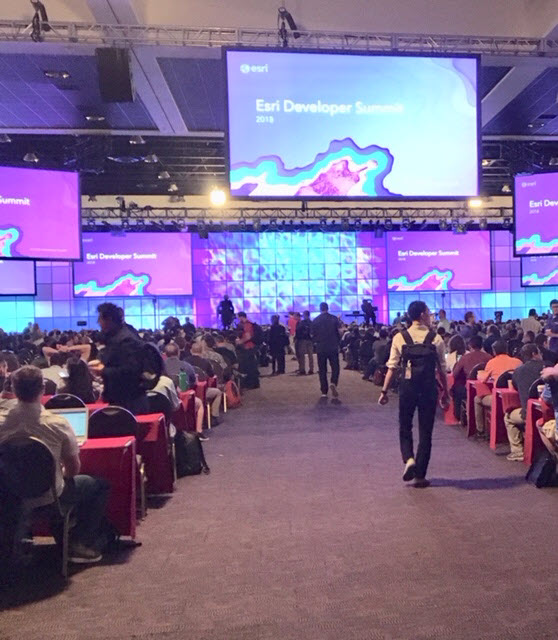
8:10 - DevSummit Attendees have entered the room and seats are filling fast.This Summit is expected to be the largest DevSummit audience ever, more than 2,000 for 2018. Picture: GeoNet team ready to feed you the action from the DevSummit Plenary. Right to left: Candace Loya, Chris Catania, and Michelle Mathias | 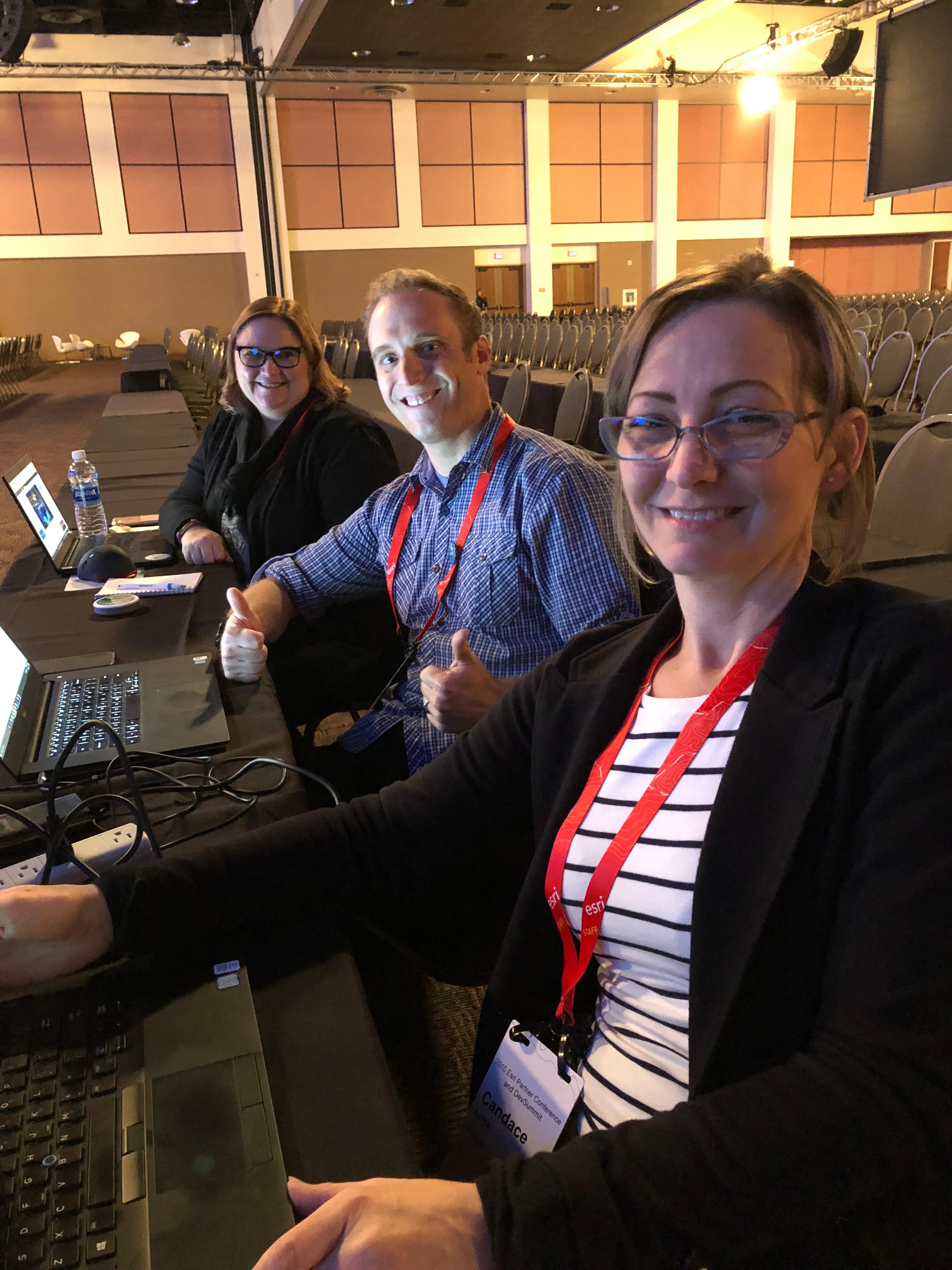 |
8:28 - Let the show begin! | |
Jim McKinney, ArcGIS Program Manager, CTO ArcGIS Desktop, opens the plenary with a few words and introduces Jack Dangermond, Esri Founder and CEO
Jack welcomes attendees to the DevSummit 2018 and shares the focus for this year’s conference. And keeping with tradition he asks attendees to stand and introduce themselves to someone new. Before exiting the stage Jack quotes McKinney, "There is a human connection." McKinney congratulates the winners of the SAP-Esri Hack-a-Thon from Saturday to Monday during the EPC. He continues with an overview of the plenary and DevSummit events, highlights, and how to be part of the closing sessions.
McKinney introduces Sud Menon, first speaker of the morning. |
|
8:40 AM- ArcGIS: A Platform for Developers with Platform Overview Product: ArcGIS OnlineSpeaker: Sud Menon, Director of Software DevelopmentEsri’s Director of Software Development, Sud Menon, introduces an amazing overview video on the ArcGIS Platform and is now describing the capabilities of ArcGIS as a platform for developers including highlights of significant improvements and expansion capabilities. Menon explains mapping behind the scenes with things like dynamic feature tiles, apps in the field for field mobility of mobile workers, and location analytics through Insights for ArcGIS online also includes App Builders that allow you to build apps on any device. Runtime APIs are for building native apps for mobile devices. "ArcGIS Enterprise includes are of these capabilities." Menon continues explaining the full capacity of tools available through ArcGIS. |  |
9:00 AM – Mapping - How to Smart MapProduct: ArcGIS Runtime SDKs, ArcGIS API for JavaScriptSpeaker: Jeremy Bartley, Software Product DevelopmentJeremy Bartley starts immediately with a demo on How to Smart Map, showing mapping of Zillow data for house pricing and peak month dates. He is using the simple user experience and tells how he can also make the updates with Python.
You can follow more on Mapping in the ArcGIS Runtime SDK for Java. |  |
9:07 AM - Data exploration with ArcadeSpeaker: Kristian EkenesKristian Ekenes gives a key demonstration the experience of using the Arcade expression-based scripting language including attribute pop-ups. He reminds everyone that all capabilities remain the same. | |
9:12 AM - Client-side processing of the featureSpeaker: Yann CabonCabon captivates the audience with client-side queries, loading data and the projection engine with a demonstration of New York construction. Follow Yann Cabon and see all the question he answers. | 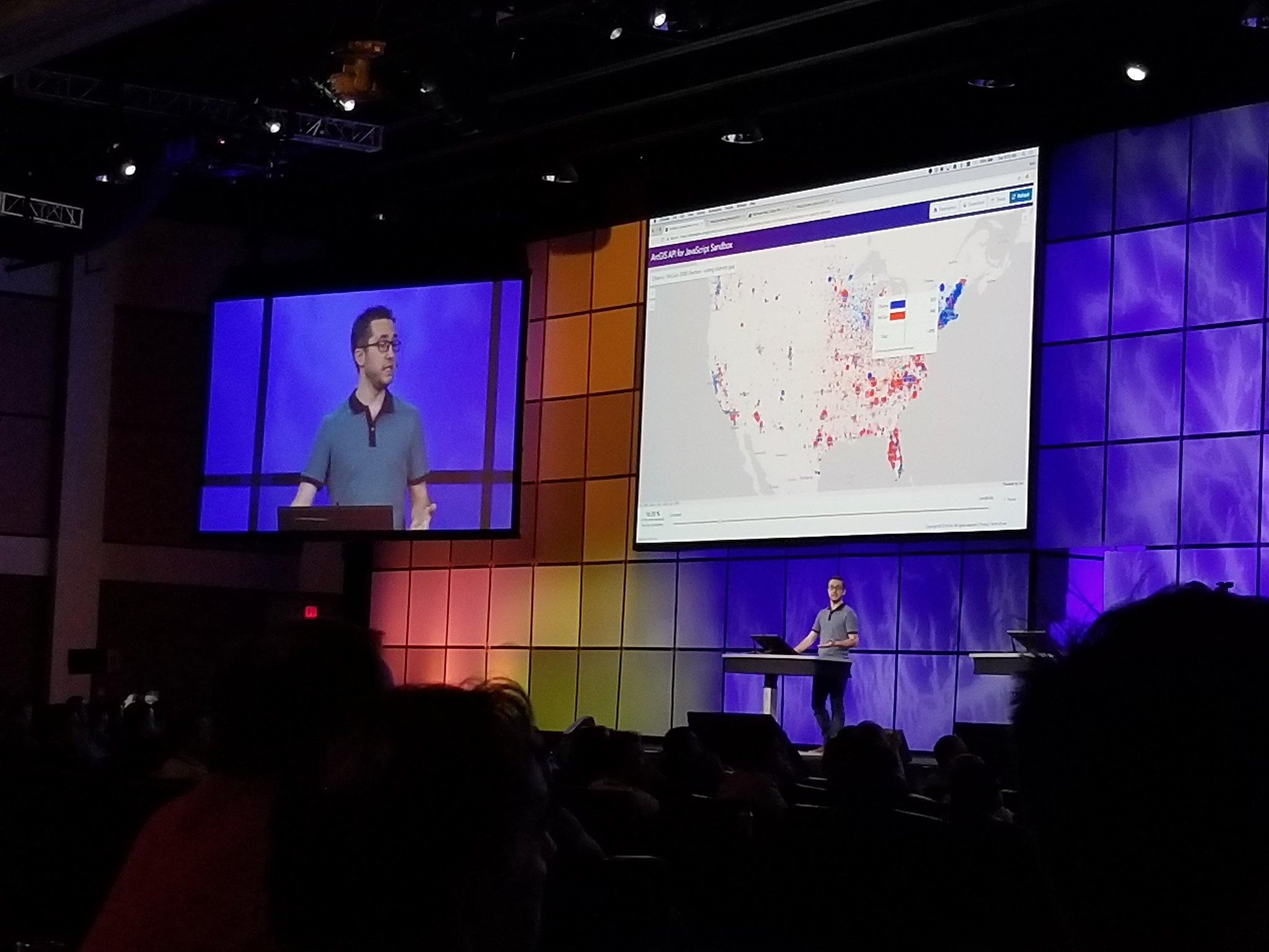 |
9:17 AM - 3D Viewer Apps and 3D is JS APISpeaker: Javier Gutierrez and Russ RobertsUsing 3D Viewer apps for mobile allows developers to use scene viewer for iPad to building attributes. Roberts displays his iPad experience for residential buildings in Raleigh, NC 3D. He also shows point cloud seem layers for Mud Creek to see the progression that CalTrans made to make new roads. Roberts hands over to Gutierrez for a demonstration of 3D in JavaScript API using code developed for the Swiss National Park using line symbology, call outs and images on maps for hiking trails that can be applied to responsive web apps. See a video of Javier's demonstration at #EsriDevSummit. | 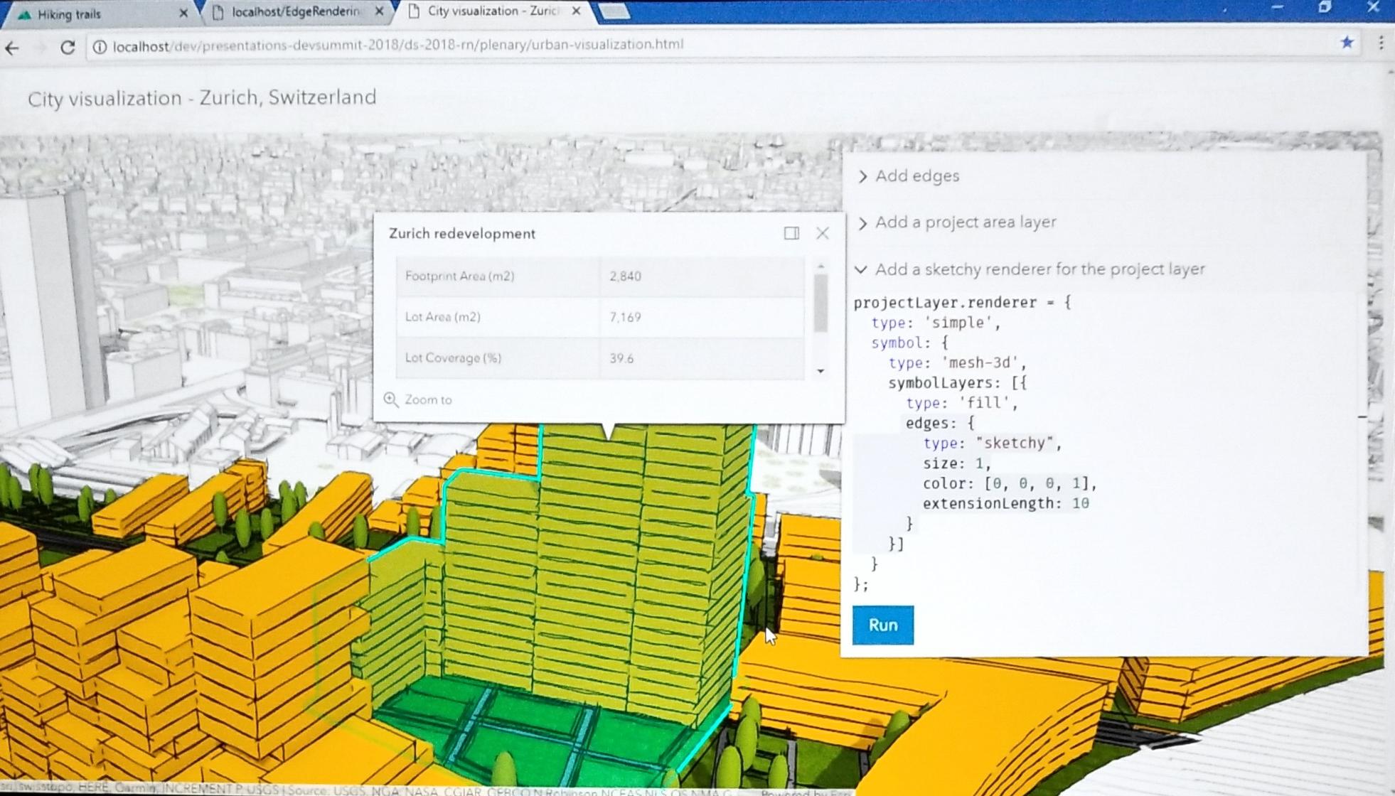 |
9: 25 AM - WidgetsSpeaker: Juan Carlos FrancoJuan Carlos Franco or “Franco” as he is introduced, presents on the exciting world of Widgets discussing some of the comings enhancements
| |
9:31 AM - ArcGIS Configurable Apps in 4X APISpeaker: Kelly Hutchins"You get all this capability with just a few lines of code." Widgets are easily searched. They are accessible via the keyboard. The 4x API is building better apps with typescript and easy to use the latest features in JavaScript, nice code assist with typescript, and can get a "Read more..." help topic to assist.
| |
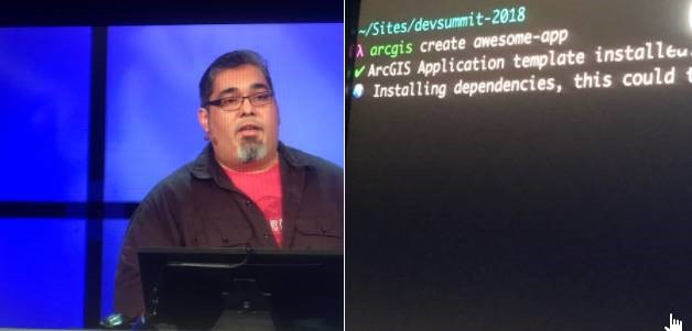
9:35 AM – Building API with webpackSpeaker: Rene Rubacalva
| |
9:38 AM – AnalyticsProducts: Insights for ArcGIS, ArcGIS Pro, ArcGIS API for PythonSpeaker: Jim McKinneyJim McKinney reminisces on commands in ArcInfo glued together with AML or ArcView and Navigator, or the emergences of over 1,200 geoprocessing tools. The analytics options available now and in the future bring a lot of powerful tools for developers. ArcGIS is a platform for geoanalytics, spatial statistics, and data science. Esri development leads and engineers demonstrate new tools and improved capabilities of proven tools, such as Insights for ArcGIS and using Python notebooks to improve the flow of analysis as well as provide open interoperability with third party packages. | 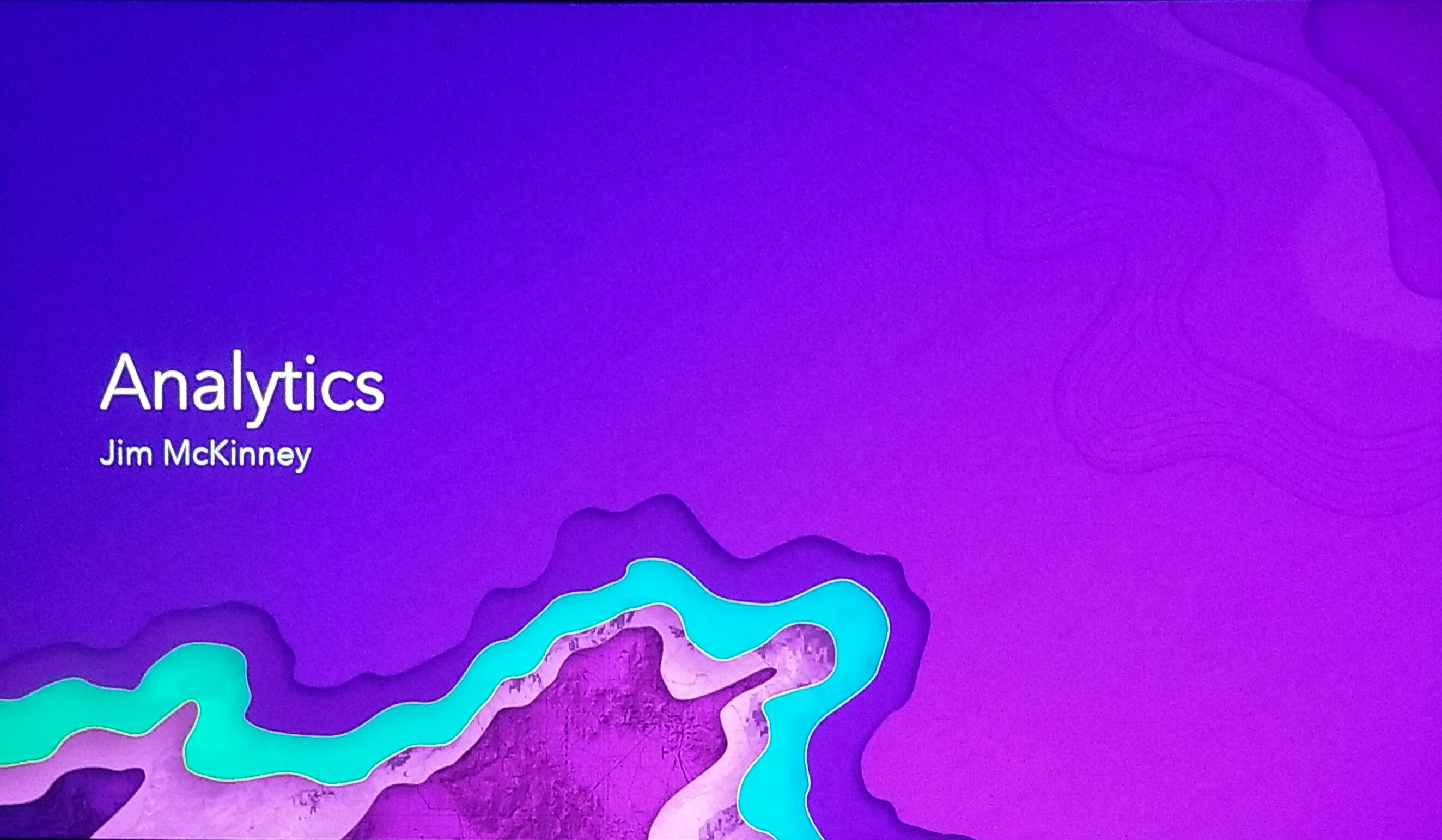 |
9:40 AM - InsightsSpeakers: Linda Beale & Art HaddadBeale demonstrates data exploring fatal accident data in Los Angeles, California including the patterns visible in tables, charts, and maps. She also looks at the demographics against education, income and employment exploring multiple numeric variables. She further explains that her data can also be shared for further analysis. There is one feature in Insights that is different...sharing multiple relationships in one map allows data to joined together and explored to get answers. | |
9:49 AM - Analysis in ArcGIS ProLauren Bennett and Marjean Pobuda
Bennett explains that Esri is constantly working to add new capabilities to the platform. She then demonstrates the data-based clustering provided by Waze. Marjean Pobuda explains how entwining geoprocessing tools, charts and python and R - ArcGIS Bridge to create a powerful analysis of workflows and expands all data types. She then references a model sample of locations where African Cape Buffalo have been observed in South Africa. She uses ArcGIS for R to determine a location suitable for conservation preservation. Pro is connected to the rest of the platform allowing data scientists to share their results of analysis. |
Lauren Bennett
Waze Mapping Data |
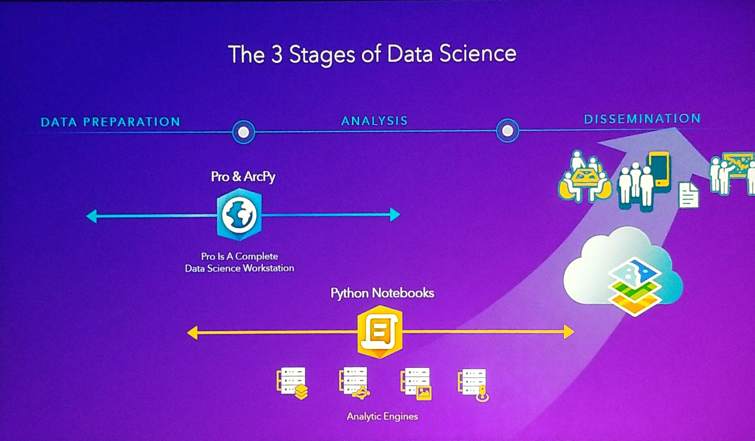
10:00 AM – Python APISpeakers: Jay Theodore & Rohit SinghData science, R Analytics answers the 5Ws to gather data. Theodore quote, “Data Science is data driven.” Three stages of Data Science:
Data science is a collaborative exercise between
|  |
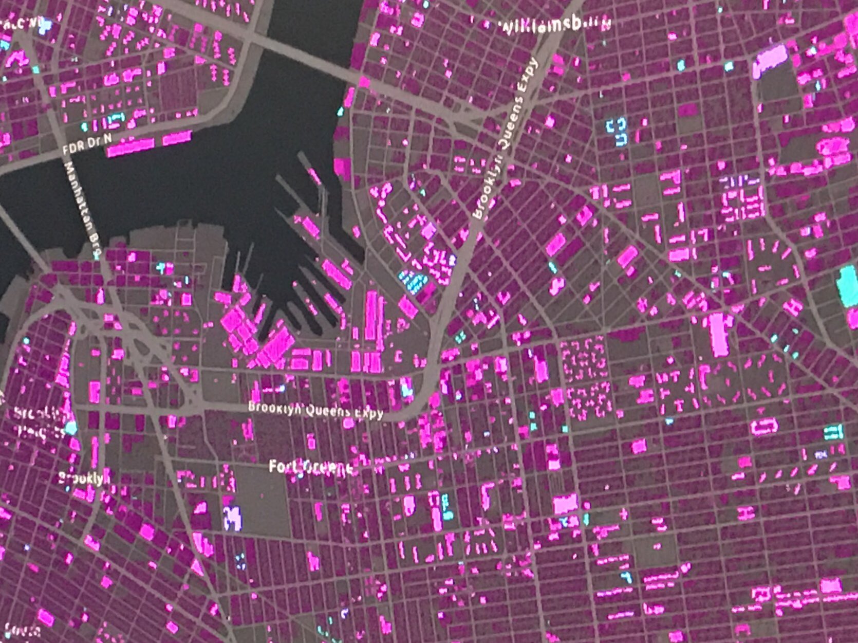
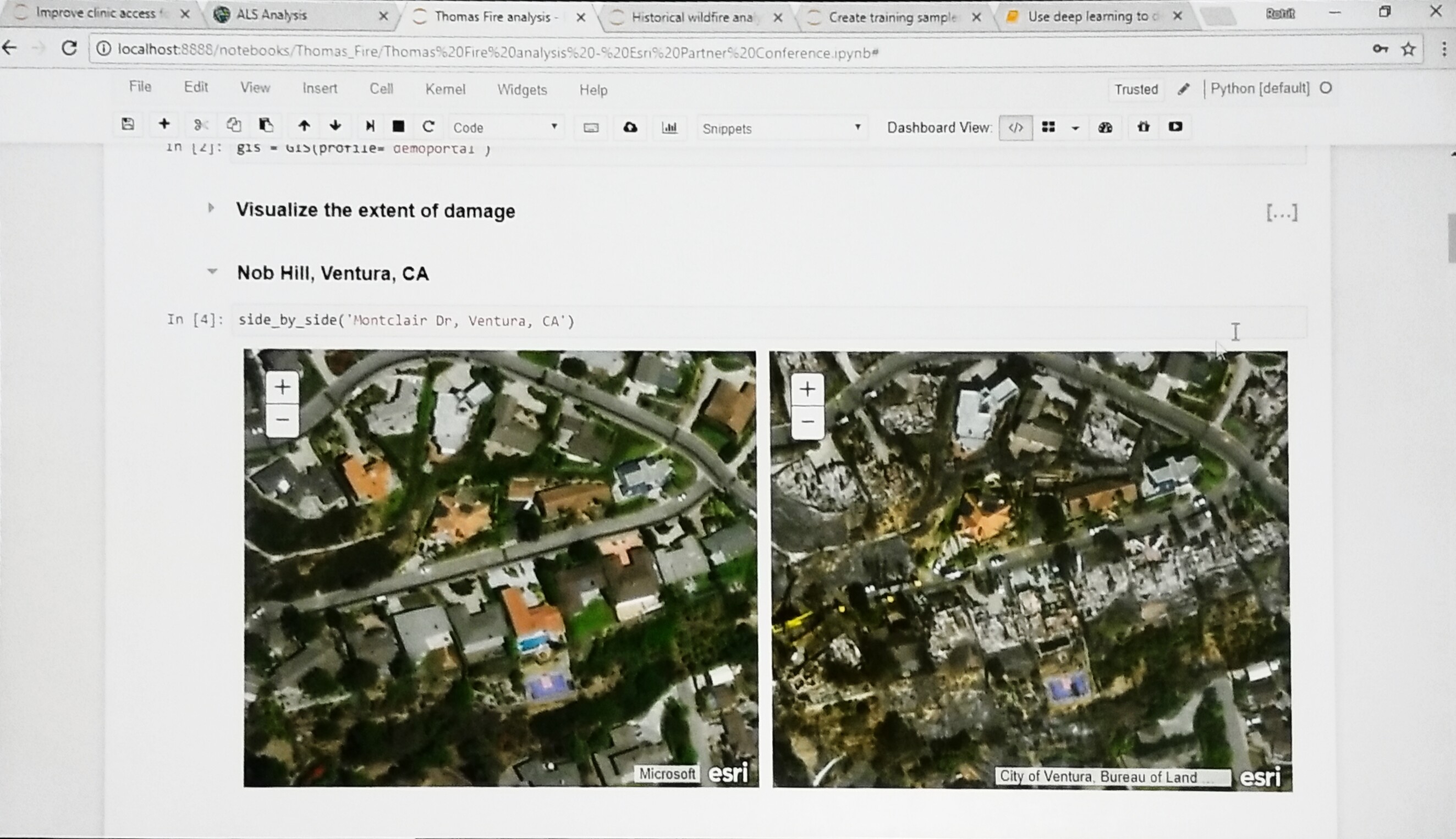
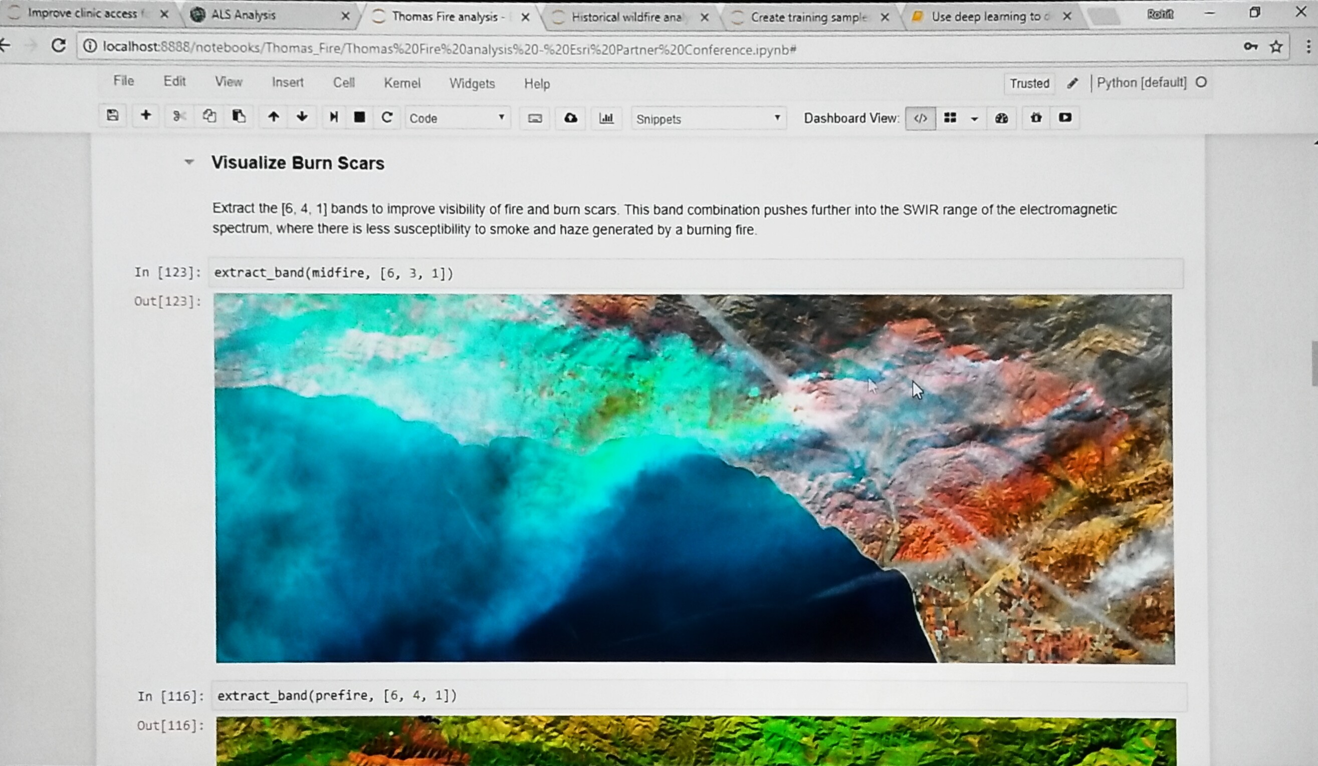
Singh continues demonstrating how government departments such as fire, police, and other field crews used workforce management to collaborate in the field during the Thomas Fire.
Extent of damage from Thomas Fire demonstrated |
|
Break - Jim McKinney returns to the stage to release the audience for break until 10:45 AM. | |
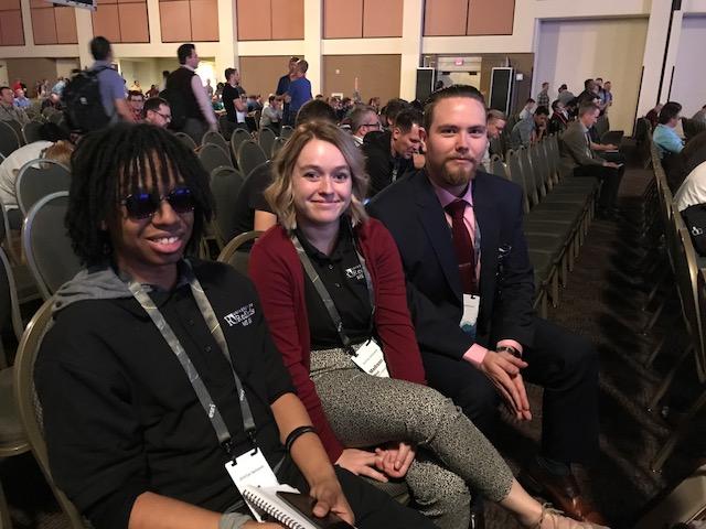
During the BreakDuring the break we connected with Bruce, Madison and Shane (left to right,) graduate students from the University of Redlands attending their first DevSummit.
What did they enjoy the most during the first half? "The 3D stuff is really cool! We're excited to learn more about machine learning, too," said Madison and Bruce. "I liked the Edge rendering on 3D models; it added some needed texture," explained Shane. "We also use the Jupyter notebook. It really helps us to understand the script. We use it in all our projects." | |
10:45 AM - Jim McKinney Welcome back from break and introduces David Cardella | |
10:46 AM - Developer ExperienceProduct: ArcGIS Online DevelopersSpeaker: David CardellaEsri's developer technologies product manager Dave Cardella briefs our developer community on new and improved options for licensing the use of developer tools and deployment that include them. He will also demonstrate and describe improvements to the developer website and self-help learning and productivity resources. ArcGIS developer technologies and toolkits for desktop, server, web, and mobile. Two questions are often asked, "What can ArcGIS do for me?" and "How do I get started?" Improvements
Cardella talks further about success stories such as CommandX leveraging ArcGIS identities. How are the success stories implemented? Cardella explains who the ArcGIS API for JavaScript is used to tell the story. Suggests developer audience signing up for the developer program. |  |
10:53 AM – Extending & Automating Your EnterpriseProduct: ArcGIS Pro, ArcObjects, ArcGIS API for PythonSpeaker: Jim McKinneyIn this section, Esri presenters discuss and demonstrate continued support for ArcObjects developers, as well as the expansion of the capabilities of ArcGIS Pro and the ArcGIS API for Python. The focus is desktop software and using Python. More information can be found on these GeoNet spaces and groups.
| 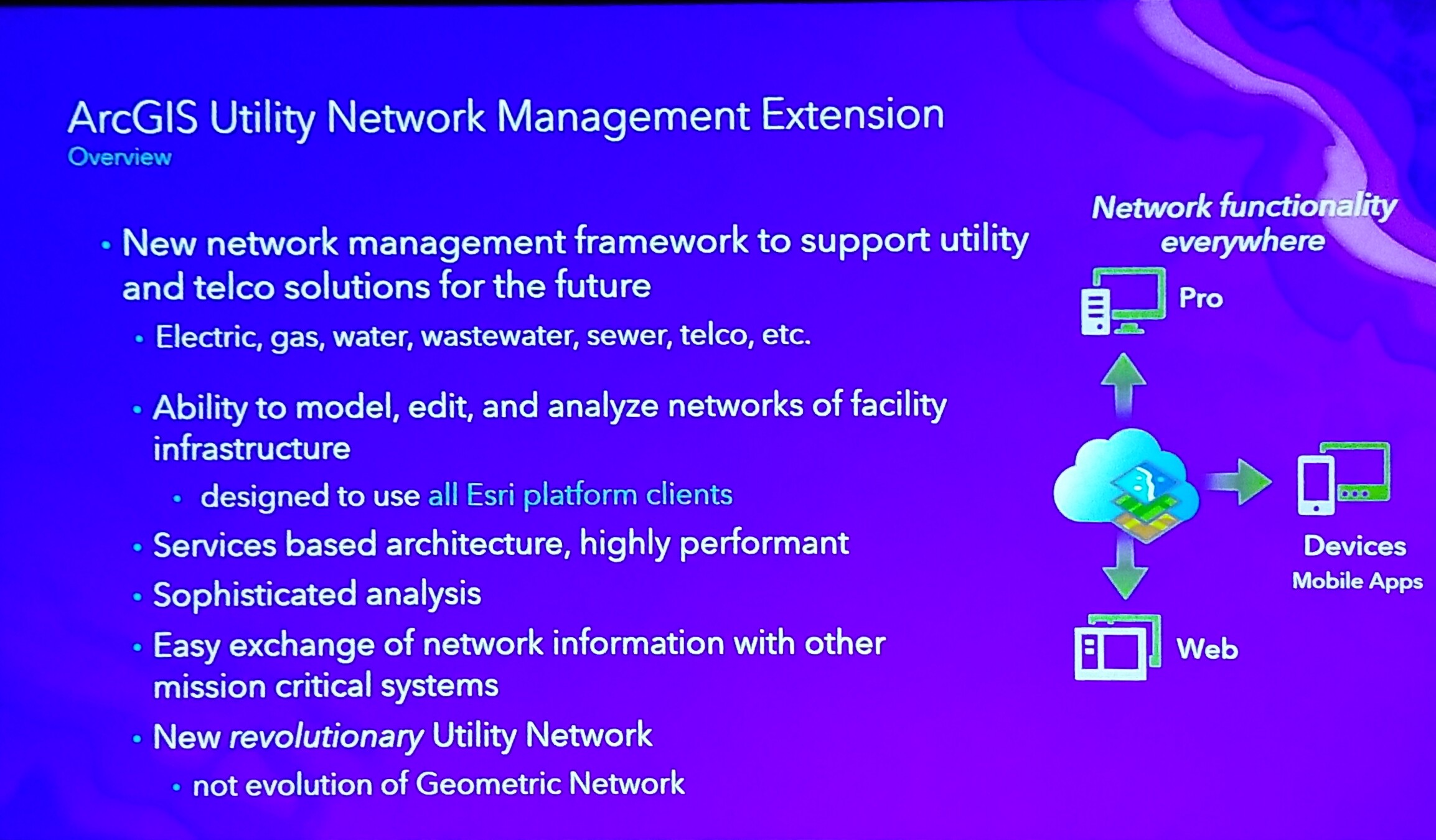 |
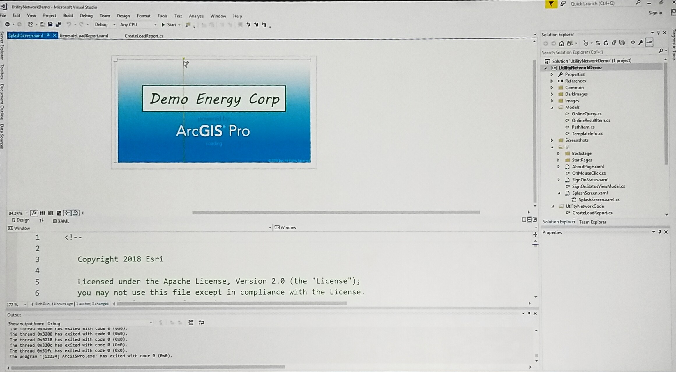
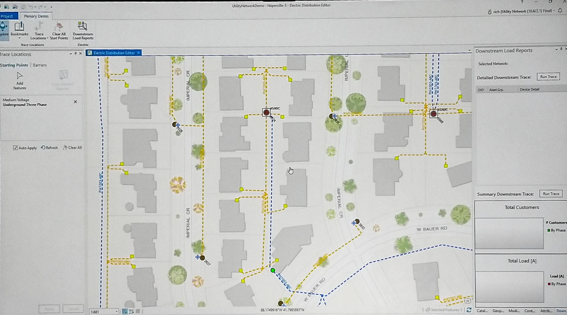
10:54– ArcGIS Pro for Utility NetworksSpeaker: Rich RuhUsing trace location data to create maps in Pro SDK
|
Demo of Utility in ArcGIS Pro |
11:08 AM – The Power of Python in ArcPySpeaker: Shaun WalbridgeWalbridge introduces encrypted toolboxes and looks at the ways to work faster with ArcPy. He gives a demonstration in VisualStudio to help with debugging. | |
11:13 AM – Broader Scope of AutomationSpeaker: Jay Theodore & Atma ManiSharing the stage, Jay and Atma demonstrate the broader scope of automation. Using ArcGIS Enterprise, Mani walks the audience through the steps to get a distributed system going, configuring the system and content. He continues demonstrating how government departments such as fire, police, and other field crews used workforce management to collaborate in the field during the Thomas Fire. Theodore recaps on the workflow demonstrated by Mani. | |
11:25 AM – Native app development (Why native?)Product: Native App DevelopersSpeaker: Euan CameronArcGIS Runtime is now a native app development platform that all can use, and is ready for capabilities that used to be served by ArcGIS Engine. Building apps for online/offline use, consistent user experience across desktop and mobile, as well as some new examples of using ArcGIS with augmented reality and virtual reality are demonstrated. Why native?
Native Dev options:
| |
11:28 - Working with Maps in ArcGIS Runtime | |
11:30 AM – Layers types with RuntimeSpeaker: Divesh Goyalwith the geopackage, Goyal demonstrates connected and disconnected layers on his iPad using featured data within many apps. He shows how to display tiles from the FAA Visual flight rules and dynamic data for no fly zones for drones in The Netherlands. | |
11:38 AM – 3D Mapping with RuntimeSpeaker: Kerry RobinsonRobsinson demos of Runtime open for business with 3D layers and additional scene layers analysis, shapefiles of observer locations run, and LOS/viewshed all on a mobile device. Robinson continues to demonstrate code for GeoElementsLineOfSight. The Runtime 3D allows you to develop code for mobile devices. | |
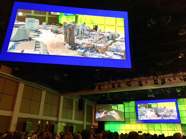
11:45 AM – AR and VRSpeaker: Adrien Meriaux, joined by Rex HansenMeriaux and Hansen demonstrates the use of mapping with VR visiting downtown San Diego while still on stage including the use of viewshed.
This is just one of the new experiences you can build using VR. If you would like to apply for the Beta Program, please email arcgisruntimerarvrbeta@esri.com. | |
11:50 AM - Wrap Up from Euan Cameron and Summary from Jim McKInney. | |
Thank you for attending the #EsriDevSummit. | |


You must be a registered user to add a comment. If you've already registered, sign in. Otherwise, register and sign in.