- Home
- :
- All Communities
- :
- ArcGIS Topics
- :
- Esri Labs
- :
- Esri Labs Blog
- :
- Trek2There Updated - 3.0.36 Available
Trek2There Updated - 3.0.36 Available
- Subscribe to RSS Feed
- Mark as New
- Mark as Read
- Bookmark
- Subscribe
- Printer Friendly Page
- Report Inappropriate Content

Trek2There has been updated! Version 3.0 includes a number of fixes and some exciting new functionality.
The biggest change to Trek2There is that you can now connect to external GNSS receivers. The most common connection we expect users to try is a Bluetooth connection to a receiver from Trek2There on your Windows, iOS or Android device, but you can also connect via USB (on Windows) or a TCP/IP connection (any device) to a receiver on the same network.
External GNSS receiver support
To see what devices should work with Trek2There see: Supported devices.
To connect to a GNSS receiver in Trek2There you must first pair it to your device. Typically, launch the Bluetooth settings page on your device, browse for your receiver and connect to it. For more information on pairing see: API Guide.
Once your receiver and device are paired, you can browse for the receiver in Trek2There. To do this:
- Launch Trek2There
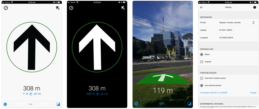
- Go to the settings page and choose ‘Use external receiver’
- On the search external receiver page, select the receiver from the list. Once you are successfully connected, you will be returned to the settings page.
- Enter a destination and return to the navigation page. On the navigation page, you will see the distance and bearing to your destination. Whilst you are using an external receiver, you will see an icon in the top right-hand corner (looks like a satellite). This indicates that the external receiver is in use. If this icon disappears, it means you have switched to using the internal position source (for example, perhaps the external receiver’s power has gone off).
If you shut down Trek2There and restart it, the external receiver should be remembered and you shouldn’t need to configure it again. It will take a few seconds to reconnect, but it should be automatic. Whilst it is connecting you should see a progress icon in the top right-hand corner of the navigation page (where the satellite icon will display).
Using Trek2There with an external receiver is a great way to navigate to a feature or location that is not in a published route-able network. It's also a good way for you (and us) to get ready for GNSS receiver integration in other Esri apps. Sneak peak: Based on this work in Trek2There, Survey123 will be getting the GNSS receiver makeover next!
Bug fixes and other improvements
- A destination can now be entered as decimal degrees, degrees minutes seconds, degrees decimal minutes, UTM (WGS84) or MGRS coordinates.
- Bearing values is displayed on the navigation page (as well as the direction arrow).
- Accuracy value now shown to two decimal places.
- Reduced direction arrow bouncing when stationary.
- Now when using the experimental compass mode, you will see a compass indicator in the top left-hand corner of the navigation page as a reminder.
- Improved timing and display of arrival at your destination.
- Improved speed in getting a 'fix' when Trek2There is launched from another app.
- Coordinates can now also be copy / pasted from another app on Android (previously only iOS).
- On Windows, when you launch Trek2There from another app, a new instance is no longer launched if an existing one is already open

Downloads:
iOS: Trek2There on the App Store
Android: Trek2There on Google Play
Windows: Trek2There™ – HockeyApp
You must be a registered user to add a comment. If you've already registered, sign in. Otherwise, register and sign in.