Learning Plans and Learn Paths
- Subscribe to RSS Feed
- Mark as New
- Mark as Read
- Bookmark
- Subscribe
- Printer Friendly Page
- Report Inappropriate Content
One of the easiest ways to teach and learn with online GIS tools, data, and activities is with Learning Plans and Learn Paths because they offer a sequenced way of learning specific content and tools. What are they and how can you use them?
I. Learning Plans
A Learning Plan is a set of resources (readings, hands-on activities, videos) that is sequenced for learning about a particular topic. You can choose plans from a wide variety of topics, scales, and specific Esri GIS tools. By signing in to Esri training (www.esri.com/training), you can track your own progress through plans that you have chosen, identify plans that you would like to take in the future, and assign plans to your students.
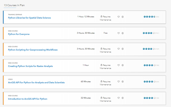
A sample Learning Plan, for Spatial Data Science, showing the courses, videos, and seminars that comprise it.
Dozens of Learning Plans are available. We’ve highlighted a few below, and you can browse the catalog for others (filter by Format) based on your interests and needs.
Recommended Learning Plans for new GIS users:
- ArcGIS Online Fundamentals: https://www.esri.com/training/catalog/5b733e9d2fad23092c930883/arcgis-online-fundamentals/
- GIS Fundamentals:
https://www.esri.com/training/catalog/5b73407f8659c25ea7014330/gis-fundamentals/ - Fundamentals of Mapping and Visualization:
https://www.esri.com/training/catalog/5b29690fe620ca23e6541b54/fundamentals-of-mapping-and-visualiza...
Recommended Learning Plans for select topics:
- ArcGIS Technology for Spatial Data Science:
https://www.esri.com/training/catalog/5e4c5550a333e81cae8274f0/arcgis-technology-for-spatial-data-sc... - Image classification using ArcGIS:
https://www.esri.com/training/catalog/5ce42f4388c6106da2d53044/image-classification-using-arcgis/
II. Learn Paths
A Learn Path is a set of resources (readings, hands-on activities, videos) from the Esri Learn ArcGIS collection that is sequenced for learning about a particular topic. You can choose from among many tools and topics; each of which features Learn lessons that have been created by instructors at Esri and at universities. Each path and lesson is kept current with the latest tools and data sets. To discover available Learn Paths, see: https://learn.arcgis.com/en/gallery/#?t=path
Dozens of Learn Paths are available. We’ve highlighted a few below, and you can browse the Learn collection for others (filter by Type) based on your interests and needs.
Recommended Learn Paths for new GIS users:
Getting Started with Maps and Data in ArcGIS Online.
1. A beginner’s guide to ArcGIS Online.
https://learn.arcgis.com/en/paths/getting-started-with-maps-and-data-in-arcgis-online/
2. Try ArcGIS Pro.
Get started with the essentials of ArcGIS Pro.
https://learn.arcgis.com/en/paths/try-arcgis-pro/
3. Resources for Teaching with ArcGIS Pro.
Learn path for your students to become familiar with ArcGIS Pro.
https://learn.arcgis.com/en/paths/resources-for-teaching-with-arcgis-pro/
Recommended Learn Paths for select topics:
1. GIS in the Age of Community Health.
Arm yourself with hands-on skills and knowledge of how GIS tools can analyze health data and better understand diseases.
https://learn.arcgis.com/en/paths/gis-in-the-age-of-community-health/
2. For Geospatial Analysts:
Create a project, ingest data, process data, analyze data, share/publish results.
https://learn.arcgis.com/en/paths/learn-path-for-geospatial-analysts/
3. Solving Problems with GIS and public domain geospatial data 1 of 3:
Learn how to find, evaluate, and analyze data to solve location-based problems through this set of 10 chapters and short essay readings, and 10 hands-on lessons:
https://learn.arcgis.com/en/paths/the-gis-guide-to-public-domain-data-learn-path/

Sample Learn Path, for Geospatial Analysts activities in the path.
You must be a registered user to add a comment. If you've already registered, sign in. Otherwise, register and sign in.
-
Administration
38 -
Announcements
44 -
Career & Tech Ed
1 -
Curriculum-Learning Resources
178 -
Education Facilities
24 -
Events
47 -
GeoInquiries
1 -
Higher Education
518 -
Informal Education
265 -
Licensing Best Practices
46 -
National Geographic MapMaker
10 -
Pedagogy and Education Theory
187 -
Schools (K - 12)
282 -
Schools (K-12)
184 -
Spatial data
24 -
STEM
3 -
Students - Higher Education
231 -
Students - K-12 Schools
85 -
Success Stories
22 -
TeacherDesk
1 -
Tech Tips
83
- « Previous
- Next »