- Home
- :
- All Communities
- :
- Industries
- :
- Education
- :
- Education Blog
- :
- A half-day workshop on GIS in Environmental Scienc...
A half-day workshop on GIS in Environmental Science
- Subscribe to RSS Feed
- Mark as New
- Mark as Read
- Bookmark
- Subscribe
- Printer Friendly Page
- Report Inappropriate Content
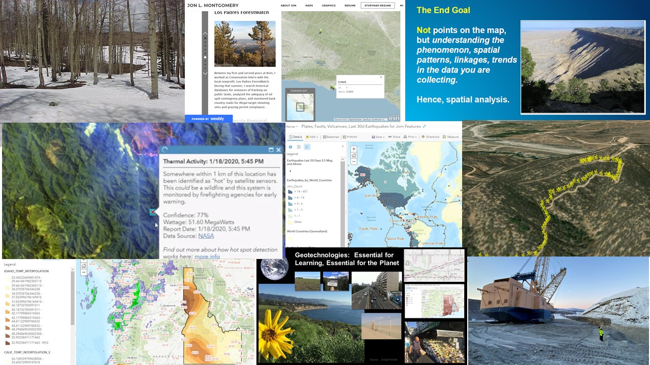
I developed a GIS workshop for environmental science university students that you might wish to use portions of or in its entirety in your own instruction. The workshop can be covered in a half day, but ideally is a full day; or it could be parsed into several standard class periods. Updated: January 2021.
The workshop is designed to:
1. Develop knowledge and skills in geotechnologies focusing on environmental applications: GIS, remote sensing, and
GPS/GNSS, technical skills and foundational underpinnings, cloud and SaaS data sources and formats, multimedia, data quality; projections, symbolizing, georeferencing, measurement, classification, databases, and mobile workflows.
2. Develop workforce awareness of pathways in environmental careers that use GIS and how to prepare for them.
3. Develop confidence that you can use these skills and perspectives to move forward with your own career.
I state the workshop philosophy at the beginning of the instruction:
• This is your workshop. Let me know how we can help you today and in the future as you use geotechnologies.
• Using geotechnologies effectively is a journey that will require building a network with your colleagues.
• We will not work with every GIS tool and data set that exists, but we will build a foundation so that you will be empowered and feel confident.
• The activities include core themes and skills that can be used in many aspects of environmental work.
The workshop uses the following tools: ArcGIS Online, web mapping applications such as Dashboards and Storymaps, Survey123 field data collection tool. For more advanced work, there are links to ArcGIS Pro and Insights.
The workshop includes the exploration of data from local to global scale, including ecoregions, river systems, population change, historical and current satellite imagery, human health, weather and climate, and natural hazards. The field activity involves gathering tree type, height, species, and condition on whatever campus you happen to be teaching in.
Underlying the workshop are the following themes:
(1) Geotechnologies are critically important tools in environmental science to build a healthier, more sustainable future.
(2) Geotechnologies are essential tools for your environmental career: They enable you to apply your environmental skills and knowledge and contribute to the work that nonprofits, government agencies, private industry, and academia is using everyday.
(3) Modern cloud-enabled GIS tools and spatial data mean that it is easier than ever to learn how to apply GIS to solve problems.
The attached document contains the workflow and all the links for the workshop to be successful. I hope this resource is useful.
You must be a registered user to add a comment. If you've already registered, sign in. Otherwise, register and sign in.
-
Administration
38 -
Announcements
44 -
Career & Tech Ed
1 -
Curriculum-Learning Resources
177 -
Education Facilities
24 -
Events
46 -
GeoInquiries
1 -
Higher Education
518 -
Informal Education
264 -
Licensing Best Practices
46 -
National Geographic MapMaker
10 -
Pedagogy and Education Theory
187 -
Schools (K - 12)
282 -
Schools (K-12)
183 -
Spatial data
24 -
STEM
3 -
Students - Higher Education
231 -
Students - K-12 Schools
84 -
Success Stories
22 -
TeacherDesk
1 -
Tech Tips
83
- « Previous
- Next »