- Home
- :
- All Communities
- :
- Industries
- :
- Education
- :
- Education Blog
- :
- More Inspiring 2019 GIS Day Stories
More Inspiring 2019 GIS Day Stories
- Subscribe to RSS Feed
- Mark as New
- Mark as Read
- Bookmark
- Subscribe
- Printer Friendly Page
- Report Inappropriate Content
I recently highlighted some incredible GIS Day stories from 2019, but more stories continue to be submitted. I feel that these additional stories are so inspiring that they too really need to be shared, which I have done, below. Want to see even more stories? See those submitted by event hosts via this story map.
India: A GIS Day event was organized by and held at the Training Centre, Department of Geoinformatics, Karnataka State Rural Development and Panchayat Raj University (KSRDPRU), Gadag, Karnataka, India, with the objective to create an awareness and applications of GIS technology in various fields, especially in rural development. Coordinators, Head of Departments, Faculty, and Students from all Departments of the university were invited. The event included Formal Talks and Presentations, GIS Resource Mapping, a GIS field hunt, and a GIS Quiz. The chief guest was Prof. Dr. Suresh V. Nadagoudar, Registrar and Vice Chancellor (Acting),KSRDPRU, Gadag. First, the Honorable Prof. Dr. Nadagoudar addressed the gathering, explaining the need and importance of GIS in our daily life. He urged to make use of GIS technology for all the students in their studies and their research. In his talk he quoted the transparency brought in MGNREGA by implementing a GIS system. The Course Coordinator Shri. Suresh Lamani communicated the importance, use of GIS technology and its applications in various fields. The hands-on workshop focused on how to prepare and produce the map of natural as well as man-made resources using ArcGIS 10.5 software. The GIS hunt was a fun field game on collection of GPS coordinates using handled GPS devices and and smartphones. The GIS Quiz was a multiple choice quiz competition. At the event, students of other departments came to know about the importance of GIS applications in daily life and for better decision making. This event brought-out awareness about how GIS plays a key role in various fields of spatial planning and management of rural lives.
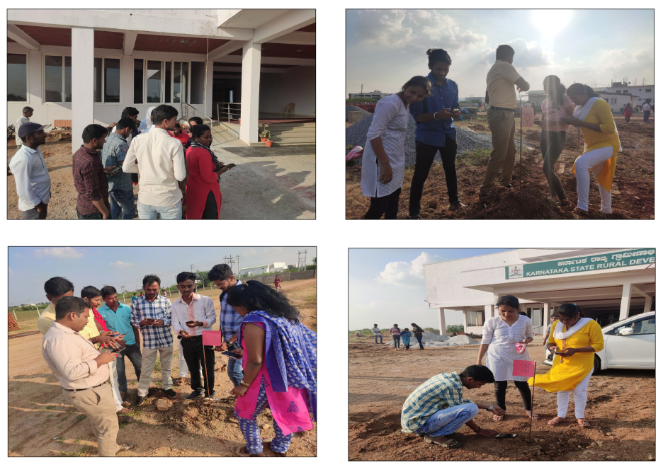
Karnataka State Rural Development and Panchayat Raj University GIS Day event, India, outside activities.
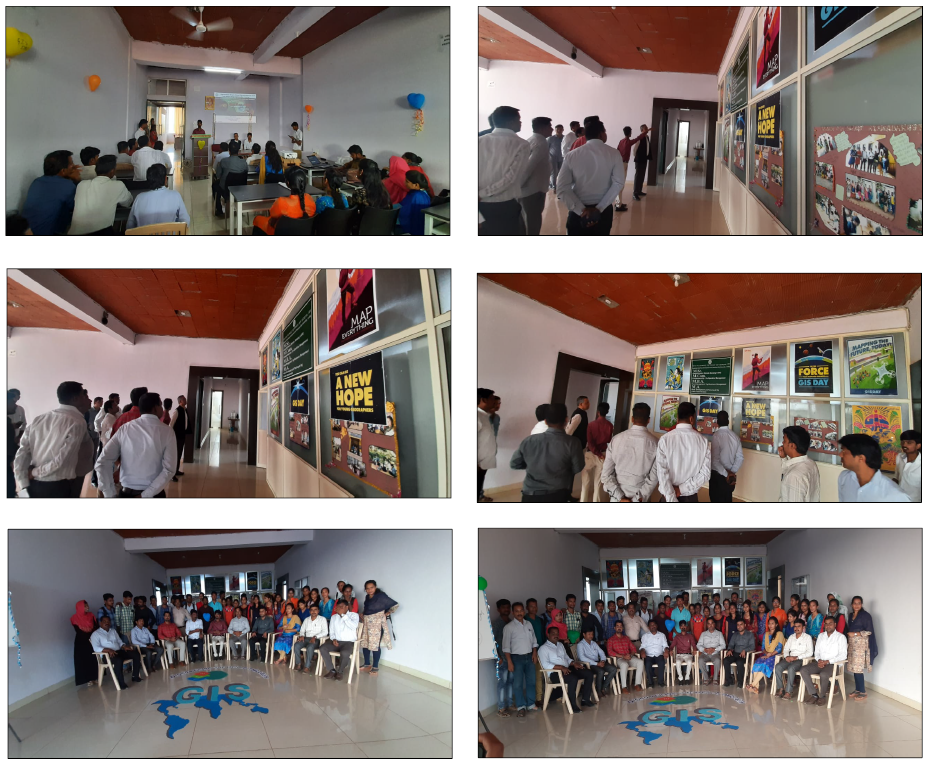
Karnataka State Rural Development and Panchayat Raj University GIS Day event, India, inside activities.
Belarus: Olga Serebryannaya, Esri Internationalization Product Engineer, shared this inspiring GIS Day story from Belarus. Held at the Mogilev State A. Kuleshov University, Professor Natalia Tupitsyna and her students created and shared this story map (https://arcg.is/uSiy9) in which multiple student projects are featured. These include a set of Survey123 quizzes to check the knowledge of geography for middle school students, a Country of Fairy Tales showing precise geographical locations of the best books for kids, including Garry Potter, Pinocchio, the Mermaiden, and many others, Ramsar Convention Wetlands of Belarus, National Parks of Belarus, National parks and Natural reserves of Turkmenistan, The most famous Football Clubs, Noise pollution in a city of Mogilev (Belarus), Twilights and real world (geographical locations of the Twilights movies). In another event in Belarus at the Brest State A.S.Pushkin University, students presented an amazing array of projects (https://arcg.is/0auaaq), including georeferenced historical photos of the City of Grodno – a city of ancient temples of different religions, the most famous world attractions and points of interest, the most amazing world zoos, the most popular YouTube channels, pollution of world cities, the most dramatic earthquakes, and UNESCO features of Italy.
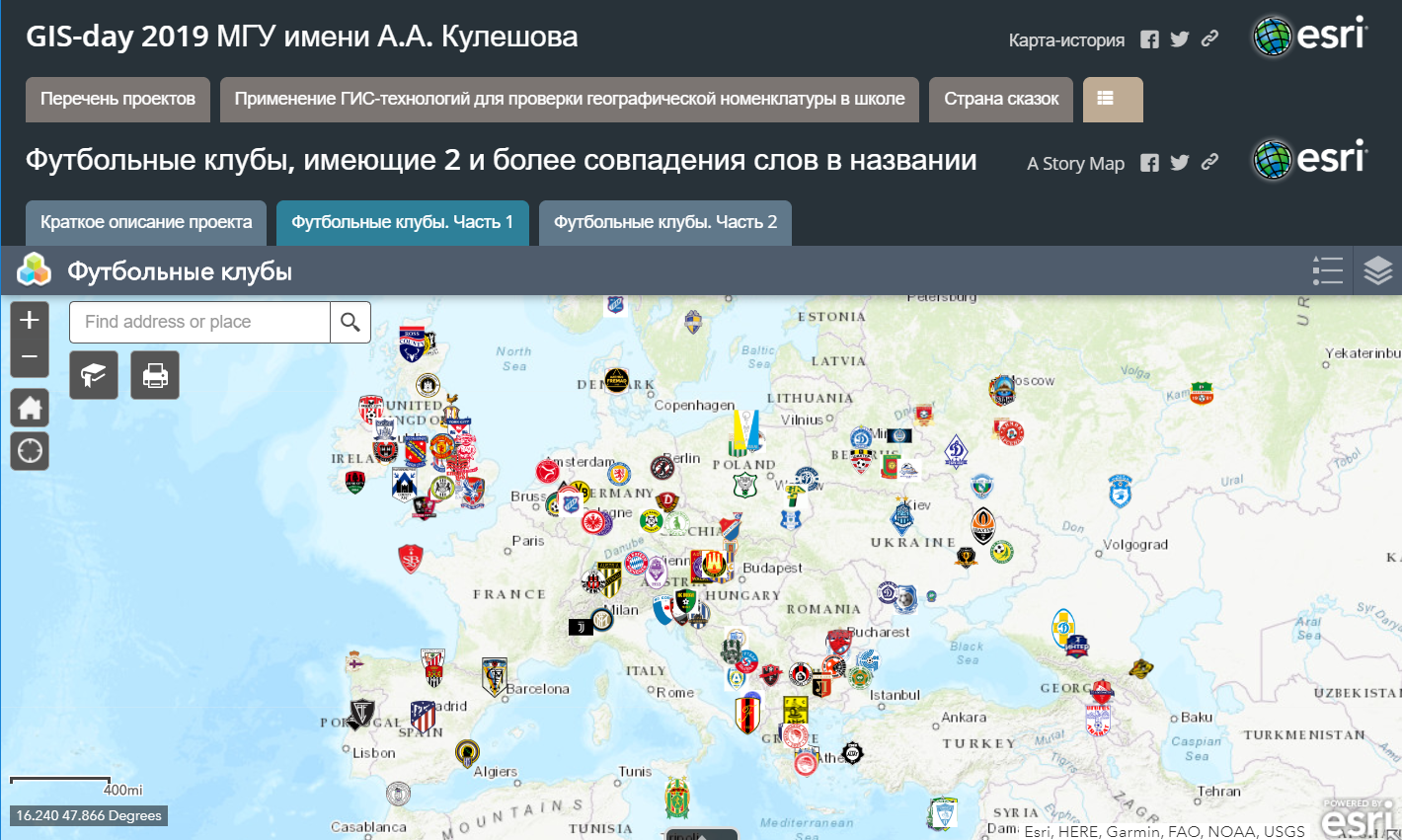
One of the story maps created and featured during the GIS Day events in Belarus--of selected football (soccer) teams.
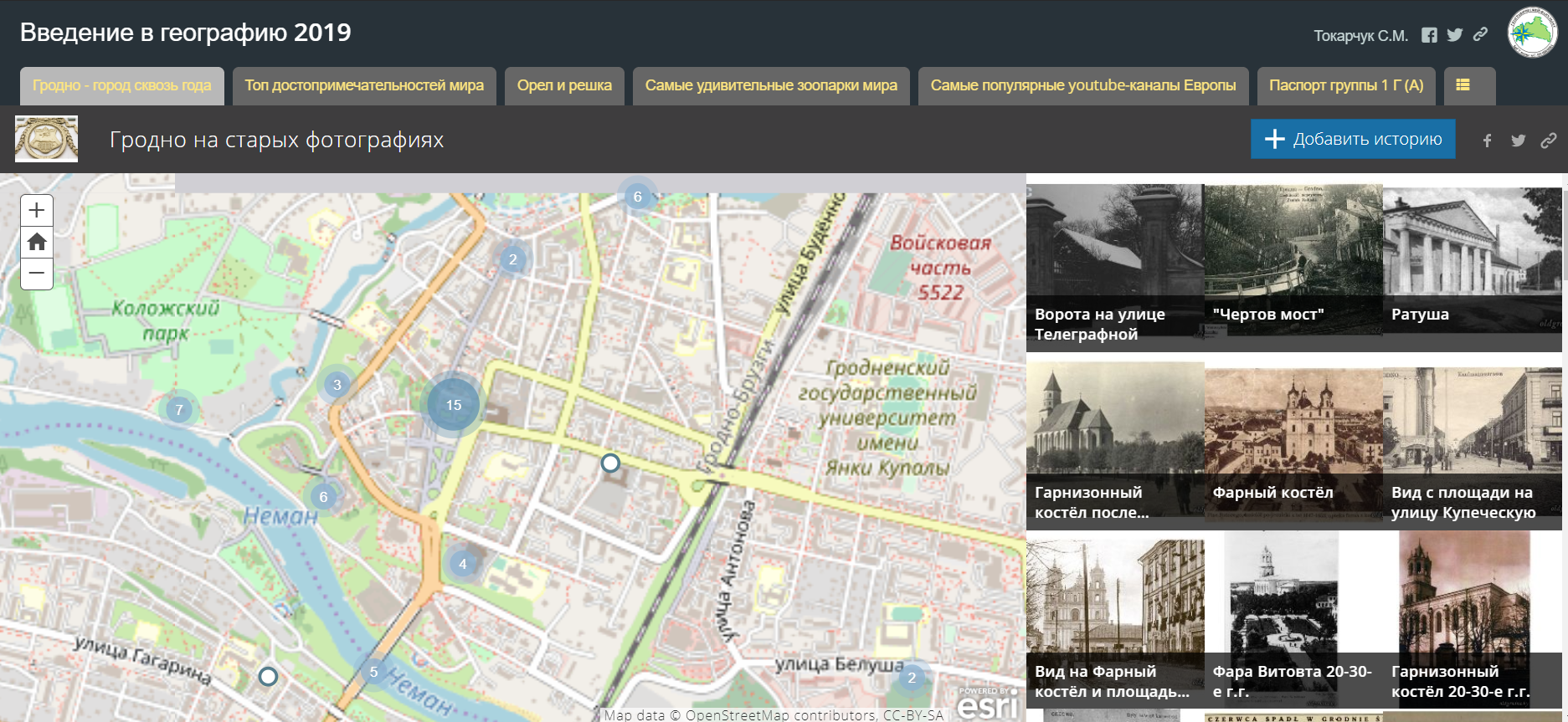
Another web map, on historical points of interest, created and shown at the GIS Day events in Belarus.
Argentina: At Argentina's National Technical University, Tucumán Region, GIS is an elective subject of the fourth year for students in Information Systems Engineering. Ten students presented their projects in the university's 12th GIS Day event and showed how GIS can contribute to society and the place where people live. Mr. Alejandro Báscolo, Professor of the GIS Chair Geographic Information System explained: "This event exposes the intentions of the Faculty to advance with disruptive knowledge that can improve the quality of life of the environment as a university extension and contribution by students. More information, including the press release about the event, is available here:
http://www.frt.utn.edu.ar/index.php?s=noticia&id=2427.
GIS Day event at Argentina's National Technical University, Tucumán Region.
Guatemala: Silvia Forno reported on a very successful day in Guatemala, held by the Municipality of Guatemala, Dirección de Información Geográfica Municipal. A total of 8 presentations were given and they raffled off GIS t-shirts and ArcGIS personal use licenses that were donated to the event hosts. You can discover more here: https://sig.muniguate.com/gisday/.
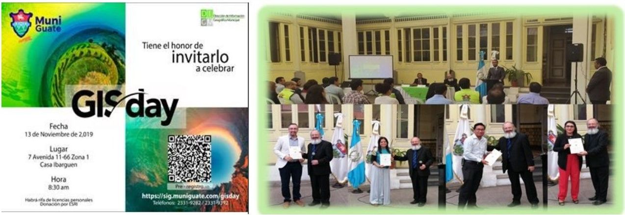
Guatemala GIS Day celebration.
Malaysia: The TNB GIS DN (GIS Project for Distribution Network, Tenaga Nasional Berhad, Malaysia) hosted its first GIS Day celebration with 50 attendees. They reported that they celebrated with cake, pizza, and happiness! Very spatial!
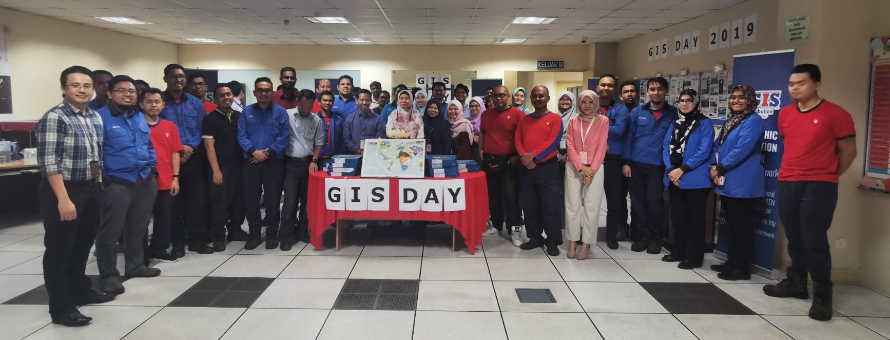
GIS Day celebration at the GIS Project for Distribution Network, Tenaga Nasional Berhad, Malaysia.
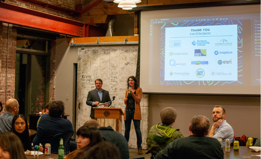
Portland Oregon USA: Christina Friedle, Geography Faculty and Department Chair at Portland Community College, reported that their 8th Annual GIS day celebration attracted over 150 people (their largest one yet) with a great deal of enthusiasm, sponsors, and speakers. The Portland GIS Day event has always been grassroots, with a volunteer group of organizers and open to anyone who interested in attending. Christina Friedle (Portland Community College) and Madeline Steele (Tri Met) first organized the Portland GIS Day event in 2012, with Alexa Todd (Metro) joining them in 2016. This year, Debbie Blackmore (EYEON18) and Liam Neeley-Brown (Kroger) join the group or organizers, making it a well-rounded team.
The highlight of the evening was our Keynote Speaker, Metro Planner and "Geospatial Philosopher" Matthew Hampton. His presentation titled “Alis Volat Propriis” explored what it means to be an Oregonian and fly with your own wings. Hampton entertained with a retro “Streetview” video tour of Aspen, CO from 1978 and a live demonstration of black-powder mapping.
A record number of local businesses and organizations, whose donations covered the cost of the venue, food and beverages, raffle prizes, a speaker gift and other giveaways, sponsored the event. Sponsors included the American Society for Photogrammetry and Remote Sensing, Ecotrust, Esri, Mapbox, Oregon Chapter of Urban and Regional Information Systems Association, DOGAMI, Portland Community College - Geography, Portland State University - Geography, Quantum Spatial, Society for Conservation GIS, Gartrell Group, and Timmons Group.
Following another GIS Day tradition was the late afternoon Missing Maps Mapathon, led by Chaelese Kailewa and Dale Kunce (co-founder of the Missing Maps project!). This event brought together 25-30 people to digitize buildings in Tegal, Indonesia using OpenStreetMap. The data created during this event will be used by the Red Cross to assist in forecasting future disaster impacts by knowing in advance what is likely to be impacted, its exposure and vulnerability. Many thanks to the PSU Geography department for use of the computer lab. The data improvements made during this Mapathon - and others like it - make a huge difference for aid groups around the world. Christina added, "Thank you to all the additional volunteers who made the night run smoothly – PCC students Catherine Greene, Ben Meister, and Michael Puma; our photographer Kelly Neely-Brown; and our video production team at Outlier."
Watch the GIS Day video, read a summary of the event, and view some photos from the event, here:
http://www.christinafriedle.com/blog/8th-annual-geocelebration-on-gis-day.
One of the images from the Portland GIS Day event; for more photos, see above link.
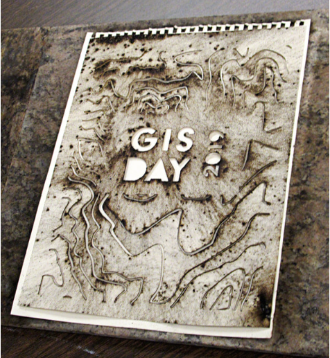
One of the black powder mapping results--boom!
You must be a registered user to add a comment. If you've already registered, sign in. Otherwise, register and sign in.
-
Administration
38 -
Announcements
44 -
Career & Tech Ed
1 -
Curriculum-Learning Resources
178 -
Education Facilities
24 -
Events
47 -
GeoInquiries
1 -
Higher Education
518 -
Informal Education
265 -
Licensing Best Practices
46 -
National Geographic MapMaker
10 -
Pedagogy and Education Theory
187 -
Schools (K - 12)
282 -
Schools (K-12)
184 -
Spatial data
24 -
STEM
3 -
Students - Higher Education
231 -
Students - K-12 Schools
85 -
Success Stories
22 -
TeacherDesk
1 -
Tech Tips
83
- « Previous
- Next »