- Home
- :
- All Communities
- :
- Industries
- :
- Education
- :
- Education Blog
- :
- Fun with GIS 254: ArcGIS QuickCapture
Fun with GIS 254: ArcGIS QuickCapture
- Subscribe to RSS Feed
- Mark as New
- Mark as Read
- Bookmark
- Subscribe
- Printer Friendly Page
- Report Inappropriate Content
Two excellent apps were released in summer 2019: ArcGIS QuickCapture and the Attachment Viewer web app template. Educators can use these powerfully! To test both, I decided to record notables on my morning walk.
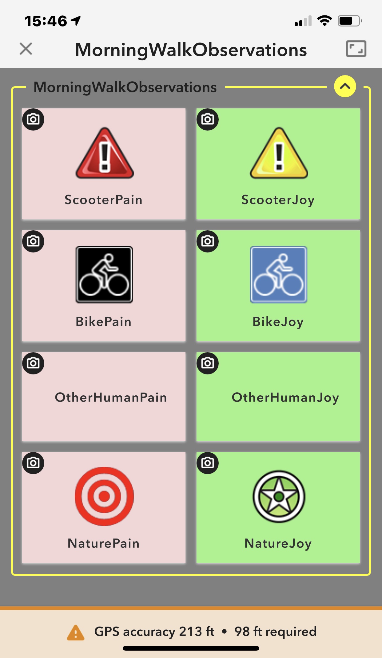
Electric scooters have sprouted like fairy rings in my neighborhood. QuickCapture lets me capture the location (click#1) and a photo (click#2) and confirm the data (click#3), which auto-sends while I move poorly parked ("strewn") scooters out of the path of others. I created a point feature service with 8 elements to choose from, essentially converting an 8-item pulldown into 8 big buttons, which I laid out in two columns ("pain" or "joy") for each of four items (scooters, bikes, other human things, and natural things). With a little exploring and experimentation, I was able to configure the buttons and ensure each permitted a photo.
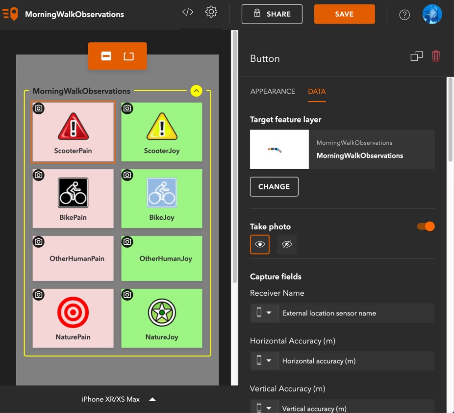
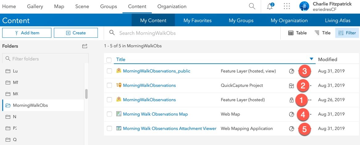
QuickCapture lets you tweak your "project" setup after creation, so I tested and adjusted things a couple of times, optimizing for data sufficient to play with behind the scenes, but not display on the map. Because I wanted to share the results focusing on the photos (with the map simply as context until I get enough data), I used the new Attachment Viewer web app template. This meant creating a view of my feature service (to protect the source data; create item 3 from item 1, below), building and configuring a map (item 4), and sharing it by creating and configuring a web app from a template (item 5). Ta-da!
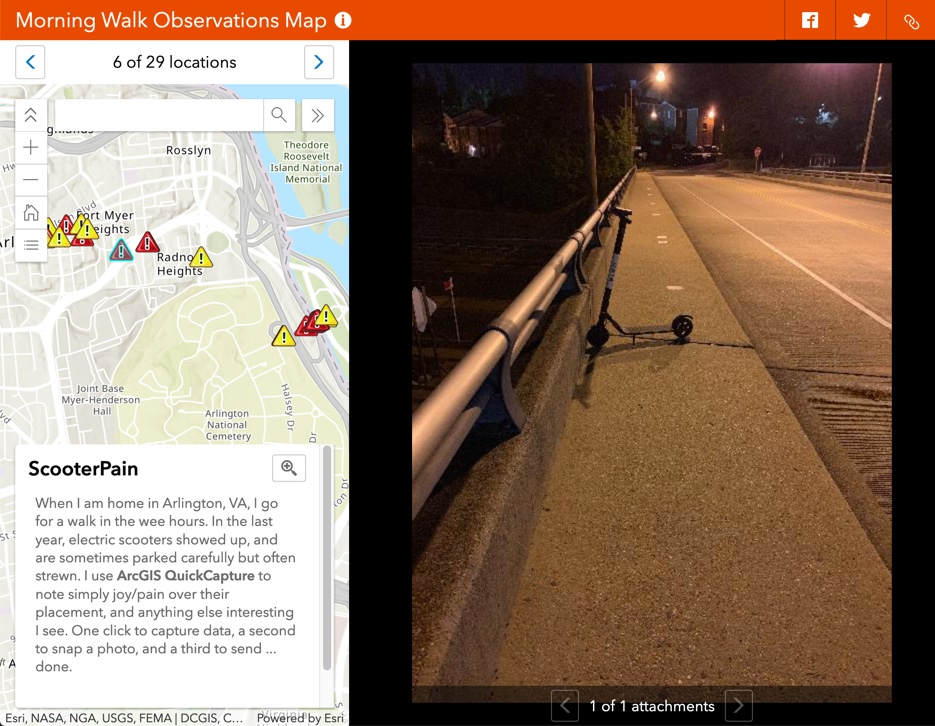
The Attachment Viewer will work with any feature service used for data collection, so think Survey123 and Collector as well. The rather minimalist display gives enough space for map, context, and image. This will be ideal for educators and students after a data gathering experience! (See my neighborhood scooters!)
The GIS toolkit for educators keeps getting better and better. Take some time to try these apps. I have updated a document about Survey123 and Collector to include QuickCapture as well.
My morning walk has a new appeal for me, and even the irritation of hazardously placed or strewn objects now has a slight silvery lining for me.
You must be a registered user to add a comment. If you've already registered, sign in. Otherwise, register and sign in.
-
Administration
38 -
Announcements
44 -
Career & Tech Ed
1 -
Curriculum-Learning Resources
178 -
Education Facilities
24 -
Events
47 -
GeoInquiries
1 -
Higher Education
518 -
Informal Education
265 -
Licensing Best Practices
46 -
National Geographic MapMaker
10 -
Pedagogy and Education Theory
187 -
Schools (K - 12)
282 -
Schools (K-12)
184 -
Spatial data
24 -
STEM
3 -
Students - Higher Education
231 -
Students - K-12 Schools
85 -
Success Stories
22 -
TeacherDesk
1 -
Tech Tips
83
- « Previous
- Next »