- Home
- :
- All Communities
- :
- Industries
- :
- Education
- :
- Education Blog
- :
- Paradigm Shift! Using raster data in the cloud in...
Paradigm Shift! Using raster data in the cloud in your GIS analysis
- Subscribe to RSS Feed
- Mark as New
- Mark as Read
- Bookmark
- Subscribe
- Printer Friendly Page
- Report Inappropriate Content
Ever since Rajinder Naji, Dr Dawn Wright, and my other Esri colleagues announced that elevation services were in ArcGIS Online, I have been wanting to use them in Pro not just for visualization, but analysis. More than elevation services are now available--land cover, for example, is another. I recently began using these services and am quite pleased with the results. I am using them in some lessons I have written where students analyze wildfires in grasslands, the optimal site for cell phone towers, and suitable lands for specific types of agriculture. Moreover, I believe this advancement represents an excellent example of the paradigm shift that GIS is in the midst of, namely, from desktop to cloud, including Software-as-a-Service (SaaS) and Data-as-a-Service. No longer do you need to follow the standard workflow of the past two decades, where you download data that you need to your local device where you then perform the analysis. You can access the services online and use them inside ArcGIS Pro. Advantages are many: You do not have to spend your valuable time searching for, downloading, clipping, and reprojecting pieces of data, which took many steps as shown in our exercises associated with the Esri Press GIS Guide to Public Domain Data book. Furthermore, you do not have to store large data sets on your local device. Rather, you can stream the data in for your desired study area and thus have more time for investigating, analyzing, concluding, and publishing your results.
Elevation data supports numerous GIS applications ranging from deriving slope and aspect, stream delineation, cut and fill analysis, viewshed analysis, orthorectification of aerial photography or satellite imagery, rendering 3D visualizations, creating relief maps, and for various types of analysis and visualizations. The elevation and land cover services are available for use within the ArcGIS Online platform, and are part of the Living Atlas. You can access the entire collection of layers along with geo-processing tools from within the Elevation Layers Group on ArcGIS Online. Access to these global layers is free and does not consume any credits; all you need is an ArcGIS Organizational account. The "old paradigm" of downloading and using data locally still has its place, and it will be around for some time to come. But that's not the only option these days. Moreover, I suspect that more raster data sets will be added in the future to the Living Atlas, and as it is added, the streaming method will become even more attractive in the future.
If you want to simply visualize elevation, slope, aspect, and land cover, for example, use Add Data > Portal > Living Atlas > search for these layers and add them to your map view in ArcGIS Pro. To do analysis on land cover, elevation, slope, or aspect, you need to select such items as “terrain: slope in degrees” – and “aspect” – not the map, but the service. Also important is to use Environments in the raster calculator (or any other geoprocessing tool that you are using) to set the analysis extent to your display, a watershed, or some other specific area so you’re not analyzing the whole country or the whole world!. See screens below (my study area is the wonderful terrain in western Colorado).
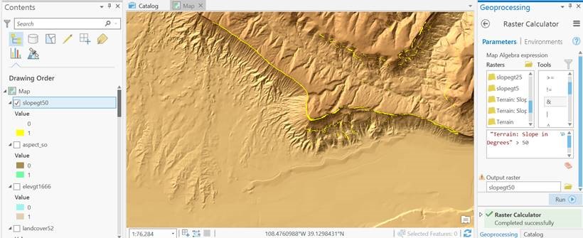
The results of my raster calculator on streaming terrain--the thin yellow areas are where the slopes are greater than 50 degrees.
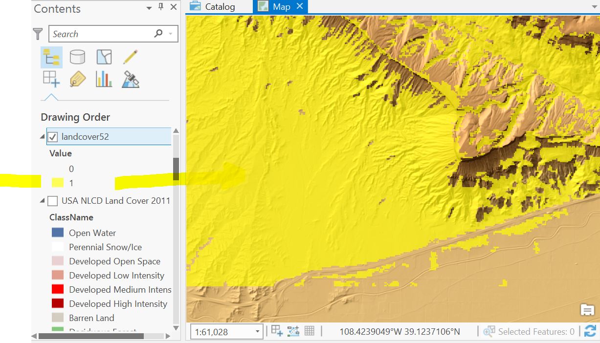
Results after Raster Calculator analysis was applied to the streaming NLCD Land Cover data, with shrub/scrub land cover shown in yellow.
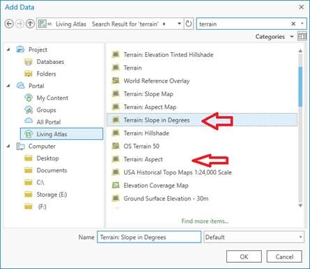
Searching for Terrain Slope in Degrees and Terrain Aspect (direction of slope) from the Living Atlas, using the Add Data tool in ArcGIS Pro.
For more details, see my video on this topic. Enjoy the new paradigm! Please share your reactions in the comments below.
You must be a registered user to add a comment. If you've already registered, sign in. Otherwise, register and sign in.
-
Administration
38 -
Announcements
44 -
Career & Tech Ed
1 -
Curriculum-Learning Resources
177 -
Education Facilities
24 -
Events
46 -
GeoInquiries
1 -
Higher Education
518 -
Informal Education
264 -
Licensing Best Practices
46 -
Pedagogy and Education Theory
187 -
Schools (K - 12)
282 -
Schools (K-12)
183 -
Spatial data
24 -
STEM
3 -
Students - Higher Education
231 -
Students - K-12 Schools
84 -
Success Stories
22 -
TeacherDesk
1 -
Tech Tips
83
- « Previous
- Next »