- Home
- :
- All Communities
- :
- Industries
- :
- Education
- :
- Education Blog
- :
- Accessing USGS Topographic Maps on The Internet Ar...
Accessing USGS Topographic Maps on The Internet Archive
- Subscribe to RSS Feed
- Mark as New
- Mark as Read
- Bookmark
- Subscribe
- Printer Friendly Page
- Report Inappropriate Content
I have used The Internet Archive (https://archive.org/about/) for many things over the years, from archiving multimedia that I created for my story maps to looking up information on historical web pages through their Wayback Machine, (as well as listening to some old wonderful sound recordings) and through those efforts became aware of the wealth of information on the site. And when I say wealth, I truly mean enormous - 279 billion web pages, 11 million books and texts, 4 million audio recordings (including 160,000 live concerts), 3 million videos (including 1 million Television News programs), 1 million images, and100,000 software programs. But did you know that The Internet Archive also houses some geospatial data? The Internet Archive, a 501(c)(3) non-profit organization that has existed since 1996, states that its mission is to "provide Universal Access to All Knowledge," so it makes sense that some geospatial data for the public good is there.
Let's focus here on the USGS topographic map data on The Internet Archive, also known as Digital Raster Graphics (DRGs). Start here for a list of these maps by state, and then underneath each state, a variety of search options are available. It isn't the most intuitive unless you know the specific map name that you are looking for, so a topographic map index may still come in handy; a scanned version of these is not easy to come by, but one such archive is here. Formats include GeoTIFF, essential for use in a GIS.
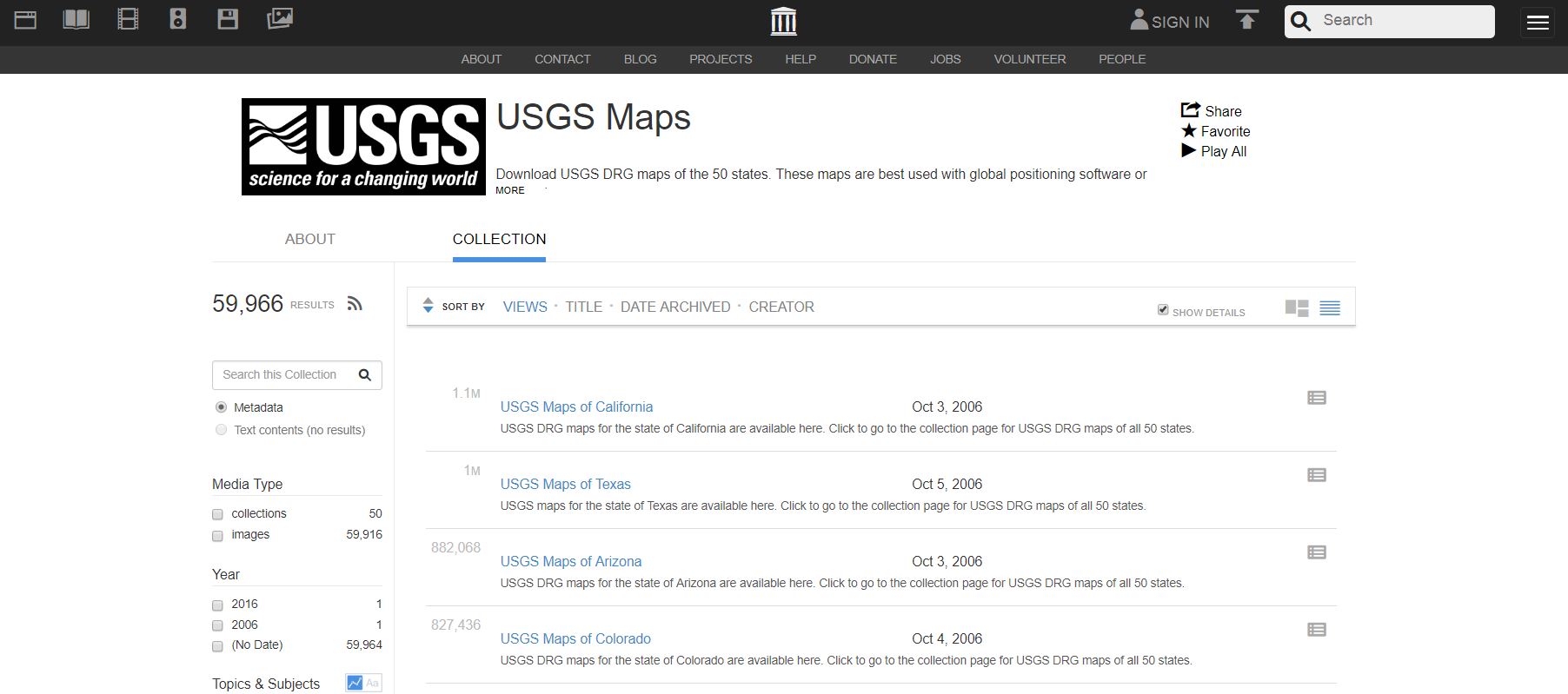
Interface on The Internet Archive for USGS Digital Raster Graphics.
While I still find the interface on the other main DRG archive, LibreMap, to be a bit easier to use, LibreMap is not maintained any longer, and is starting to return some errors during certain searches. The Esri USGS Historical Map Explorer, and the USGS TopoView, which I reviewed here, is more modern approach to obtaining topographic maps, with the added benefit of historical editions. USGS topographic maps are part of the set of basemaps available inside ArcGIS Online as data services, which is increasingly part of modern GIS workflows, rather than downloading the data and using it locally. Still another archive is that from Historical Aerials, which I reviewed here.
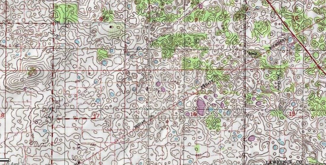
A section of my all-time favorite USGS topographic map, for Mitchell Indiana, simply because of the intricacies of the depression contours and disappearing streams in this magnificent karst landscape.
You must be a registered user to add a comment. If you've already registered, sign in. Otherwise, register and sign in.
-
Administration
38 -
Announcements
44 -
Career & Tech Ed
1 -
Curriculum-Learning Resources
178 -
Education Facilities
24 -
Events
47 -
GeoInquiries
1 -
Higher Education
518 -
Informal Education
265 -
Licensing Best Practices
46 -
National Geographic MapMaker
10 -
Pedagogy and Education Theory
187 -
Schools (K - 12)
282 -
Schools (K-12)
184 -
Spatial data
24 -
STEM
3 -
Students - Higher Education
231 -
Students - K-12 Schools
85 -
Success Stories
22 -
TeacherDesk
1 -
Tech Tips
83
- « Previous
- Next »