Turn on suggestions
Auto-suggest helps you quickly narrow down your search results by suggesting possible matches as you type.
Cancel
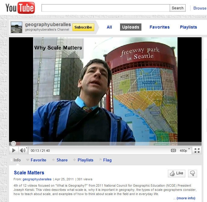
Scale Matters, 2 of 2
Subscribe
268
0
06-29-2017 12:13 AM
- Subscribe to RSS Feed
- Mark as New
- Mark as Read
- Bookmark
- Subscribe
- Printer Friendly Page
- Report Inappropriate Content
06-29-2017
12:13 AM
Several types of scale exist in geography. Cartographic scale refers to the size of a feature on a map relative to its actual size in the real world. Cartographic scale can be expressed as a verbal statement such as “one inch equals one mile”, or graphically as in a scale bar, or as a representative fraction, such as 1:24,000 scale. A small scale map (such as 1:1,000,000) shows a great amount of area but not much detail. A large scale map (such as 1:24,000) shows a great amount of detail but not much area. This may seem counterintuitive but it is because the ratio 1:1,000,000 (or 1/1,000,000) is smaller than 1/24,000. A small fraction means a small scale map. Confusion sometimes occurs because when we discuss large scale phenomena, we usually are referring to things operating over a large area, like hurricanes. But if we were to map all of the hurricanes in a year over the North Atlantic, the map would actually have to be at a small scale to see them all at once. To clarify, I often use the terms “fine scale” and “coarse scale.”
Analysis scale refers to the size of the unit at which a particular problem is analyzed, such as on a scale of a watershed or neighborhood. Phenomenon scale, as referred to by UCSB’s Daniel Montello, is the size at which human or physical earth structures or processes exist, regardless of how they are studied or represented. They are interrelated. For example, choices concerning the scale at which a map should be made depend in part on the scale at which measurements of earth features are made and the scale at which a phenomenon actually exists.
Therefore, scale is important far beyond the map. It is important in deciding at what scale to analyze a problem. For example, for analyzing river systems, is it most appropriate to study whole drainage basins, or select a sample of watersheds? For languages, should you study dialect areas or whole language regions? We often use terms such as local, micro, meso, macro, and global in discussing scale. The idea of nesting is also important – blocks nest inside block groups, which nest inside census tracts which nest inside counties for US demographic analysis based on US Census Bureau geography. Sometimes we have to generalize features and phenomena to really see the pattern, simply because there is too much detail at a local level, and so generalization has to do with scale as well.
I discuss all of this in a video on: http://esriurl.com/scalematters. GIS contains many functions that can be effectively used in teaching about scale. How might you use GIS to teach about scale?
-Joseph Kerski, Education Manager
You must be a registered user to add a comment. If you've already registered, sign in. Otherwise, register and sign in.
About the Author
I believe that spatial thinking can transform education and society through the application of Geographic Information Systems for instruction, research, administration, and policy.
I hold 3 degrees in Geography, have served at NOAA, the US Census Bureau, and USGS as a cartographer and geographer, and teach a variety of F2F (Face to Face) (including T3G) and online courses. I have authored a variety of books and textbooks about the environment, STEM, GIS, and education. These include "Interpreting Our World", "Essentials of the Environment", "Tribal GIS", "The GIS Guide to Public Domain Data", "International Perspectives on Teaching and Learning with GIS In Secondary Education", "Spatial Mathematics" and others. I write for 2 blogs, 2 monthly podcasts, and a variety of journals, and have created over 5,000 videos on the Our Earth YouTube channel.
Yet, as time passes, the more I realize my own limitations and that this is a lifelong learning endeavor and thus I actively seek mentors and collaborators.
Labels
-
Administration
38 -
Announcements
44 -
Career & Tech Ed
1 -
Curriculum-Learning Resources
178 -
Education Facilities
24 -
Events
47 -
GeoInquiries
1 -
Higher Education
518 -
Informal Education
265 -
Licensing Best Practices
46 -
National Geographic MapMaker
10 -
Pedagogy and Education Theory
187 -
Schools (K - 12)
282 -
Schools (K-12)
184 -
Spatial data
24 -
STEM
3 -
Students - Higher Education
231 -
Students - K-12 Schools
85 -
Success Stories
22 -
TeacherDesk
1 -
Tech Tips
83
- « Previous
- Next »