Turn on suggestions
Auto-suggest helps you quickly narrow down your search results by suggesting possible matches as you type.
Cancel
- Home
- :
- All Communities
- :
- Industries
- :
- Education
- :
- Education Blog
- :
- Explore Locally with Your Senses, Curiosity, and t...
Explore Locally with Your Senses, Curiosity, and the Spatial Perspective
Subscribe
127
0
06-28-2017 11:28 PM
- Subscribe to RSS Feed
- Mark as New
- Mark as Read
- Bookmark
- Subscribe
- Printer Friendly Page
- Report Inappropriate Content
06-28-2017
11:28 PM
Soccer fields and playgrounds provide some means of allowing youth to get outside. But, as Richard Louv so well stated in his book Last Child in the Woods, these adult-constructed environments are no substitutes for “wild places” – those places that are untouched or minimally touched by humans. “Wild places” could be a local ridge or hill, a stream or pond, or even a vacant lot.
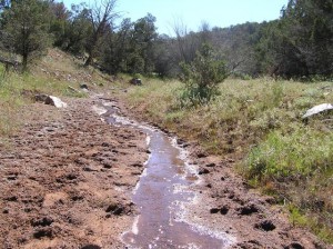
For me growing up in western Colorado, I loved the riparian zones that were adjacent to local gullies, what the locals called “washes.” In this semiarid landscape, walking down into these riparian zones was like descending into another world. They were sometimes so much lower than the surrounding landscape that sharp cliffs in the shale enclosed them. A different and a greater abundance of vegetation added to their character—indeed, they were a mini-ecosystem, but to a child growing up, like a whole different world. They were filled with sage, willows, yucca, and tamarisk—some native species, some invasive, all fascinating and so different from the alfalfa, orchard fruit, and corn being grown in the fields above. Another adventure awaited every autumn after the irrigation canals were shut off and drained. All sorts of strange things that had been hidden all summer were now in view along the canal beds and underneath the bridges that spanned them. How our senses were awakened to every new sound, smell, and sight in these washes and dry canal beds.

Nowadays, we have a wide variety of electronic means at our disposal, from probes, GPS receivers, smartphones, to other devices, to record phenomena while in local wild places. The data can be easily mapped in ArcGIS Online. Yet I submit that before taking full advantage of learning with these means, three things must first be in place. The first is the ability to use one’s own senses and interpret the results of one’s own observations. The second is curiosity, and from curiosity comes asking questions. The third is the spatial perspective—seeing the world geographically.
These three things sometimes take years to cultivate, and one could argue that this cultivation is a lifelong endeavor. Yet I certainly don’t recommend that instructors wait until all students exhibit curiosity before embarking on a field-based experience. Being purposeful about using all five senses takes practice. In addition, most students will have no idea at first what it means to “think spatially.” And don’t be discouraged if despite your best laid plans, some students appear completely disengaged from your carefully designed field experiences. Go back to Richard Louv’s advice on outdoor education—start early, and do it often.
What are some of your methods of instilling curiosity about the world around us—beginning with your own local wild place?
- Joseph Kerski, Esri Education Manager
You must be a registered user to add a comment. If you've already registered, sign in. Otherwise, register and sign in.
About the Author
I believe that spatial thinking can transform education and society through the application of Geographic Information Systems for instruction, research, administration, and policy.
I hold 3 degrees in Geography, have served at NOAA, the US Census Bureau, and USGS as a cartographer and geographer, and teach a variety of F2F (Face to Face) (including T3G) and online courses. I have authored a variety of books and textbooks about the environment, STEM, GIS, and education. These include "Interpreting Our World", "Essentials of the Environment", "Tribal GIS", "The GIS Guide to Public Domain Data", "International Perspectives on Teaching and Learning with GIS In Secondary Education", "Spatial Mathematics" and others. I write for 2 blogs, 2 monthly podcasts, and a variety of journals, and have created over 5,000 videos on the Our Earth YouTube channel.
Yet, as time passes, the more I realize my own limitations and that this is a lifelong learning endeavor and thus I actively seek mentors and collaborators.
Labels
-
Administration
38 -
Announcements
45 -
Career & Tech Ed
1 -
Curriculum-Learning Resources
179 -
Education Facilities
24 -
Events
47 -
GeoInquiries
1 -
Higher Education
519 -
Informal Education
266 -
Licensing Best Practices
46 -
National Geographic MapMaker
11 -
Pedagogy and Education Theory
187 -
Schools (K - 12)
282 -
Schools (K-12)
185 -
Spatial data
24 -
STEM
3 -
Students - Higher Education
231 -
Students - K-12 Schools
86 -
Success Stories
22 -
TeacherDesk
1 -
Tech Tips
83
- « Previous
- Next »