Turn on suggestions
Auto-suggest helps you quickly narrow down your search results by suggesting possible matches as you type.
Cancel
- Home
- :
- All Communities
- :
- Industries
- :
- Education
- :
- Education Blog
- :
- Change in GIS: Moving Forward Is Better Than The A...
Change in GIS: Moving Forward Is Better Than The Alternative
Subscribe
168
0
06-29-2017 12:48 AM
- Subscribe to RSS Feed
- Mark as New
- Mark as Read
- Bookmark
- Subscribe
- Printer Friendly Page
- Report Inappropriate Content
06-29-2017
12:48 AM
Like using any technology, using GIS in education involves change. Do you sometimes feel that you are not keeping up well with hardware and software changes that inevitably are a part of our world? Two things have helped me in my GIS career to cope with change. First, one of the things that makes the GIS community special is the open way that everyone shares their knowledge. Even before we had online knowledge bases and Twitter posts, the community was active via telephone, in conferences, and through scholarship, sharing what they knew with others. Realizing that each of us cannot be an expert at everything, but knowing that the community is there to help takes much of the pressure off. Second, with each new version of ArcGIS, the tools are becoming more powerful, and easier to understand, to find, and to use. Yes, it does mean that all of us need to be flexible, but that keeps us moving forward, becoming lifelong learners.
Think of the alternative to moving forward in computer software and hardware. Moving backwards would be worse than the movie “Groundhog Day,” where every day was February 2. Each year, the software would become less powerful and so would my computer. I would lose the cloud. To find data, we would soon be back when all of the web pages were yellow text on a black background. We would then lose the web entirely and rely on gopher, ftp, Lynx, and Archie. Then we would be dependent on telephone calls, spanning floppies with zipping utilities, and 9-track magnetic tapes. At home I would eventually be back on my first PC, an IBM PS/2, using minicomputers and then mainframes at work, restricted to low-resolution imagery and then only vectors. Eventually, I would be sharpening my scribing needle again and unclogging my Rapidograph pen – not a task I would relish.
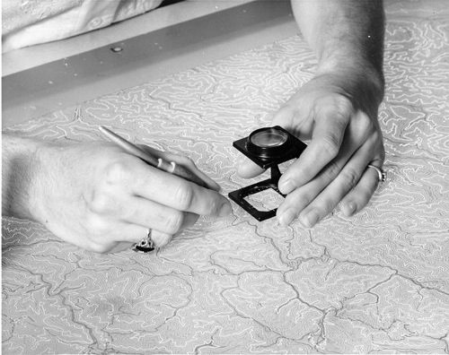
Image courtesy of USGS.
If time ran in reverse, I suppose it would have a few advantages. I would find those sunglasses I lost. But I would be back to the horrible sink I replaced in the bathroom. But much more importantly, GIS would not be as effective in education and society as it is today.
- Joseph Kerski, Esri Education Manager
You must be a registered user to add a comment. If you've already registered, sign in. Otherwise, register and sign in.
About the Author
I believe that spatial thinking can transform education and society through the application of Geographic Information Systems for instruction, research, administration, and policy.
I hold 3 degrees in Geography, have served at NOAA, the US Census Bureau, and USGS as a cartographer and geographer, and teach a variety of F2F (Face to Face) (including T3G) and online courses. I have authored a variety of books and textbooks about the environment, STEM, GIS, and education. These include "Interpreting Our World", "Essentials of the Environment", "Tribal GIS", "The GIS Guide to Public Domain Data", "International Perspectives on Teaching and Learning with GIS In Secondary Education", "Spatial Mathematics" and others. I write for 2 blogs, 2 monthly podcasts, and a variety of journals, and have created over 5,000 videos on the Our Earth YouTube channel.
Yet, as time passes, the more I realize my own limitations and that this is a lifelong learning endeavor and thus I actively seek mentors and collaborators.
Labels
-
Administration
38 -
Announcements
45 -
Career & Tech Ed
1 -
Curriculum-Learning Resources
179 -
Education Facilities
24 -
Events
47 -
GeoInquiries
1 -
Higher Education
519 -
Informal Education
266 -
Licensing Best Practices
46 -
National Geographic MapMaker
17 -
Pedagogy and Education Theory
187 -
Schools (K - 12)
282 -
Schools (K-12)
185 -
Spatial data
24 -
STEM
3 -
Students - Higher Education
231 -
Students - K-12 Schools
86 -
Success Stories
22 -
TeacherDesk
1 -
Tech Tips
83
- « Previous
- Next »