Turn on suggestions
Auto-suggest helps you quickly narrow down your search results by suggesting possible matches as you type.
Cancel
- Home
- :
- All Communities
- :
- Industries
- :
- Education
- :
- Education Blog
- :
- Advancing STEM Education with GIS ebook Released
Advancing STEM Education with GIS ebook Released
Subscribe
485
0
06-28-2017 11:25 PM
- Subscribe to RSS Feed
- Mark as New
- Mark as Read
- Bookmark
- Subscribe
- Printer Friendly Page
- Report Inappropriate Content
06-28-2017
11:25 PM
Science, technology, engineering, and math (STEM) education is a multidisciplinary approach to improving education, the work force, and national competitiveness. President Barack Obama noted that “Strengthening STEM education is vital to preparing our students to compete in the twenty-first century economy, and we need to recruit and train math and science teachers to support our nation’s students.” (White House Press Release, September 27, 2010).
Geographic information system (GIS) technology can engage several critical elements in STEM curriculum and instruction. GIS tools and techniques lead to understanding cross-disciplinary phenomena and solving problems rooted in academic and real world concepts. People use GIS to make maps, analyze data, and decide on best solutions. From a curricular perspective, GIS allows us to study climate change, design cities, inventory geologic samples, plan ecological growth models, catalog contents of an archaeological site, and countless other activities. GIS and related geospatial technologies of global positioning systems (GPS) and remote sensing can be used to simultaneously engage students in science, technology, engineering, and math.
To support the ever growing interest in GIS and STEM from teachers, researchers, and administrators, Esri has released a new (free) ebook addressing the multi-faceted supports GIS offers STEM classrooms. Dr. Tom Baker begins the ebook by addressing the core question, “How does GIS enhance STEM learning?” The ebook is filled with rich case studies of STEM in formal and informal environments. The power of STEM collaborations and partnerships and ties to career and workforce development is also a central theme of the volume. The ebook outlines three beneficial tracks for student learning in STEM by integrating GIS technology:
- Improved declarative knowledge
- Improved procedural knowledge (critical thinking, problem solving, spatial reasoning, etc)
- Career skills development
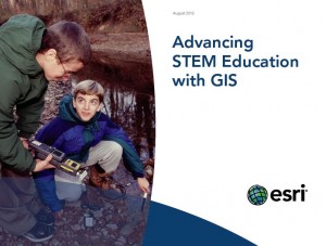
The new ebook Advancing STEM Education with GIS is available now for download in PDF here(right-click to “Save as”), perfect for mobile devices and tablets.
Contributors include:
- Steve Obenhaus, Olathe North High School
- Penny Carpenter, Byron Martin Advanced Technology Center, Lubbock Independent School District
- Matthew North, Washington and Jefferson College
- Kerry Lagueux, Heather Deschenes, and Maria Elena Derrien
- Jim Baumann, Esri
- Nicole Minni, University of Delaware
- Susan Harp, Esri
- Daniel C. Edelson, National Geographic Society
- Karen Dvornich, University of Washington and Dan Hannafious, Hood Canal Salmon Enhancement Group
- Hans Bodenhamer, Bigfork High School
- Joseph Kerski, Esri
You must be a registered user to add a comment. If you've already registered, sign in. Otherwise, register and sign in.
About the Author
I believe that spatial thinking can transform education and society through the application of Geographic Information Systems for instruction, research, administration, and policy.
I hold 3 degrees in Geography, have served at NOAA, the US Census Bureau, and USGS as a cartographer and geographer, and teach a variety of F2F (Face to Face) (including T3G) and online courses. I have authored a variety of books and textbooks about the environment, STEM, GIS, and education. These include "Interpreting Our World", "Essentials of the Environment", "Tribal GIS", "The GIS Guide to Public Domain Data", "International Perspectives on Teaching and Learning with GIS In Secondary Education", "Spatial Mathematics" and others. I write for 2 blogs, 2 monthly podcasts, and a variety of journals, and have created over 5,000 videos on the Our Earth YouTube channel.
Yet, as time passes, the more I realize my own limitations and that this is a lifelong learning endeavor and thus I actively seek mentors and collaborators.
Labels
-
Administration
38 -
Announcements
45 -
Career & Tech Ed
1 -
Curriculum-Learning Resources
179 -
Education Facilities
24 -
Events
47 -
GeoInquiries
1 -
Higher Education
519 -
Informal Education
266 -
Licensing Best Practices
46 -
National Geographic MapMaker
11 -
Pedagogy and Education Theory
187 -
Schools (K - 12)
282 -
Schools (K-12)
185 -
Spatial data
24 -
STEM
3 -
Students - Higher Education
231 -
Students - K-12 Schools
86 -
Success Stories
22 -
TeacherDesk
1 -
Tech Tips
83
- « Previous
- Next »