Turn on suggestions
Auto-suggest helps you quickly narrow down your search results by suggesting possible matches as you type.
Cancel
What it is like to NOT know
Subscribe
682
0
06-16-2016 11:00 PM
- Subscribe to RSS Feed
- Mark as New
- Mark as Read
- Bookmark
- Subscribe
- Printer Friendly Page
- Report Inappropriate Content
06-16-2016
11:00 PM
I recently heard some memorable words which stated that "wise people have recognized the importance of what it is like to not know". This is different from the wisdom of "Socratic ignorance" but may be even more applicable to the use of GIS in education. What it is like to not know in my view means that we as GIS educators understand the challenges that exist in embracing a new set of tools and methods that the use of geotechnologies entails in teaching and learning. In other words, "we've been there!" and can empathize.
I think this empathy is part of the reason why the online and face-to-face professional development workshops and courses (such as the T3G institute) have been so positively received by the education community over the years. Because the instructors have "been there", as instructors, we approach each of these professional development events with sensitivity and humility. As leaders of these institutes, we very purposefully model what we are teaching--we know what it is like to not know about GIS.
We understand what it is like to be immersed in new technology with its associated new terms and new tools. We know what it is like to be simultaneously grappling with new ways of thinking, teaching, and learning. I think back to the first time I took an ArcGIS Server course where all of the other students were systems administrators, who regularly used terms I only had vague notions of. I am reminded on a daily basis how much I still have to learn about GIS, despite having used it since 1984. It's very humbling to be taught new skills by someone who, for example, has "only" been using GIS for a few years. But veteran and new GIS educators alike have much to learn from each other.
GIS has become much easier to use over the past 25 years, though challenges remain. However, for the good of the planet and for the good of our students, I believe that the challenges are worth grappling with. And for those of us who have instructor roles--remember what it was like to not know!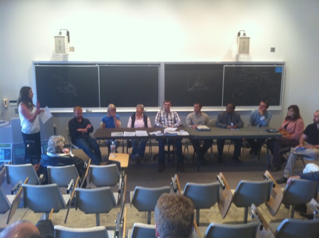

Educators discussing their use of GIS in education.
You must be a registered user to add a comment. If you've already registered, sign in. Otherwise, register and sign in.
About the Author
I believe that spatial thinking can transform education and society through the application of Geographic Information Systems for instruction, research, administration, and policy.
I hold 3 degrees in Geography, have served at NOAA, the US Census Bureau, and USGS as a cartographer and geographer, and teach a variety of F2F (Face to Face) (including T3G) and online courses. I have authored a variety of books and textbooks about the environment, STEM, GIS, and education. These include "Interpreting Our World", "Essentials of the Environment", "Tribal GIS", "The GIS Guide to Public Domain Data", "International Perspectives on Teaching and Learning with GIS In Secondary Education", "Spatial Mathematics" and others. I write for 2 blogs, 2 monthly podcasts, and a variety of journals, and have created over 5,000 videos on the Our Earth YouTube channel.
Yet, as time passes, the more I realize my own limitations and that this is a lifelong learning endeavor and thus I actively seek mentors and collaborators.
Labels
-
Administration
38 -
Announcements
45 -
Career & Tech Ed
1 -
Curriculum-Learning Resources
179 -
Education Facilities
24 -
Events
47 -
GeoInquiries
1 -
Higher Education
519 -
Informal Education
266 -
Licensing Best Practices
46 -
National Geographic MapMaker
11 -
Pedagogy and Education Theory
187 -
Schools (K - 12)
282 -
Schools (K-12)
185 -
Spatial data
24 -
STEM
3 -
Students - Higher Education
231 -
Students - K-12 Schools
86 -
Success Stories
22 -
TeacherDesk
1 -
Tech Tips
83
- « Previous
- Next »