Turn on suggestions
Auto-suggest helps you quickly narrow down your search results by suggesting possible matches as you type.
Cancel
- Home
- :
- All Communities
- :
- Industries
- :
- Education
- :
- Education Blog
- :
- Transformational Change is Enabled as Past Technol...
Transformational Change is Enabled as Past Technologies Simplify
Subscribe
523
0
06-09-2016 11:55 PM
- Subscribe to RSS Feed
- Mark as New
- Mark as Read
- Bookmark
- Subscribe
- Printer Friendly Page
- Report Inappropriate Content
06-09-2016
11:55 PM
Dr Damian Gessler of Semantic Options recently gave a keynote address in which he stated, "transformational change is enabled as past technologies simplify." Immediately, I thought of the many presentations and papers where a few of my colleagues and I have applied Everett Rogers' diffusion of innovations theory to GIS in education. Rogers theory focuses on how innovations are adopted, at first by innovators and then by early adopters. Rogers says that for real change to occur with any technology, the early majority of users, representing one standard deviation below the mean, will need to adopt the technology. Some of us are arguing that with the advent of web based GIS and the resulting lowering of technological and learning barriers, we are beginning to see an "early majority" of educators using GIS in their instruction.
Gessler's point perfectly applies to the use of GIS in education: First, GIS has 50-year roots, so while one can argue that it is changing more rapidly now than ever before, it qualifies as a "past technology" as identified by Gessler. Its methods and models have been tested, vetted, and refined. Second, it has simplified in many ways--through the advent of the graphical user interface around 2000, web based services through the Geography Network of the early 2000s and on through the modern ArcGIS Online platform, and its ability to incorporate real-time data, multimedia (via story maps and other mapping applications), and field data through crowdsourcing and other methods. As it has become easier to use, it has simultaneously become more powerful.
These two simultaneous trends are attracting people in a widening diversity of disciplines to the use of GIS. As they do, decisions are increasingly made using the geographic perspective, and transformational change is enabled, to put it in Dr Gessler's words. In the classroom at the primary, secondary, and university levels in formal and in informal settings, the use of the technologies and methods are beginning to effect transformational change in how skills, content knowledge, and perspectives are taught and learned.
Do you agree that we are seeing a transformational change with regard to the use of GIS in education? What do you recommend that we as the community need to do in order to further encourage and hasten these developments?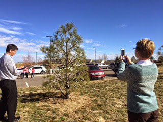

Educators learning how to implement field methods and GIS into their curricula.
You must be a registered user to add a comment. If you've already registered, sign in. Otherwise, register and sign in.
About the Author
I believe that spatial thinking can transform education and society through the application of Geographic Information Systems for instruction, research, administration, and policy.
I hold 3 degrees in Geography, have served at NOAA, the US Census Bureau, and USGS as a cartographer and geographer, and teach a variety of F2F (Face to Face) (including T3G) and online courses. I have authored a variety of books and textbooks about the environment, STEM, GIS, and education. These include "Interpreting Our World", "Essentials of the Environment", "Tribal GIS", "The GIS Guide to Public Domain Data", "International Perspectives on Teaching and Learning with GIS In Secondary Education", "Spatial Mathematics" and others. I write for 2 blogs, 2 monthly podcasts, and a variety of journals, and have created over 5,000 videos on the Our Earth YouTube channel.
Yet, as time passes, the more I realize my own limitations and that this is a lifelong learning endeavor and thus I actively seek mentors and collaborators.
Related Articles
Transformational Change is Enabled as Past Technologies Simplify
JosephKerski
Esri Notable Contributor
0 Kudos
0 Comments
Labels
-
Administration
38 -
Announcements
44 -
Career & Tech Ed
1 -
Curriculum-Learning Resources
178 -
Education Facilities
24 -
Events
47 -
GeoInquiries
1 -
Higher Education
518 -
Informal Education
265 -
Licensing Best Practices
46 -
National Geographic MapMaker
10 -
Pedagogy and Education Theory
187 -
Schools (K - 12)
282 -
Schools (K-12)
184 -
Spatial data
24 -
STEM
3 -
Students - Higher Education
231 -
Students - K-12 Schools
85 -
Success Stories
22 -
TeacherDesk
1 -
Tech Tips
83
- « Previous
- Next »