- Home
- :
- All Communities
- :
- User Groups
- :
- Cave and Karst GIS
- :
- Blog
- :
- Teaching about the Thailand Cave Rescue
Teaching about the Thailand Cave Rescue
- Subscribe to RSS Feed
- Mark as New
- Mark as Read
- Bookmark
- Subscribe
- Printer Friendly Page
- Report Inappropriate Content
A recent addition to the Teach with GIS lessons is Thailand's Cave Rescue Miracle. It's among many exercises that teachers can use to create engaging and innovative materials for their students.You'll plenty more at the Teach with GIS Curriculum Builder site.
This particular lesson is of special interest to those interested in caves. On June 23, 2018 twelve boys between 11 and 17 years of age and their coach entered the Tham Luang cave to explore. The team was trapped in the cave by continuous rainfall. They were found and rescued by an international team that involved 100 divers and many countries. They were found on July 2 and were finally all rescued on July 11, 2018.
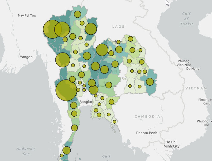
The lesson also covers various ways to show large numbers of features, in this case the caves in Thailand. The image below shows multiple layers using smart mapping capabilities. Counts and Amounts Size and Counts and Amounts Color are combined to visualize cave density in various provinces.
This lessons will build skills in the following areas:
- Select by attribute
- Create bookmarks
- Configure pop-ups
- Search for data Filter
You must be a registered user to add a comment. If you've already registered, sign in. Otherwise, register and sign in.