- Home
- :
- All Communities
- :
- Products
- :
- ArcGIS QuickCapture
- :
- ArcGIS QuickCapture Blog
- :
- What's new in ArcGIS QuickCapture (October 2020)
What's new in ArcGIS QuickCapture (October 2020)
- Subscribe to RSS Feed
- Mark as New
- Mark as Read
- Bookmark
- Subscribe
- Printer Friendly Page
- Report Inappropriate Content
ArcGIS QuickCapture is Esri's rapid field data collection mobile app. If you are not familiar with QuickCapture, have a look at this short video:
We just updated ArcGIS QuickCapture across all supported platforms. The new build number is 1.7. With this new release, you can build much more powerful field data collection mobile apps, while keeping the end-user experience as simple as the single tap of a button. This video gives summarizes the highlights of this release:
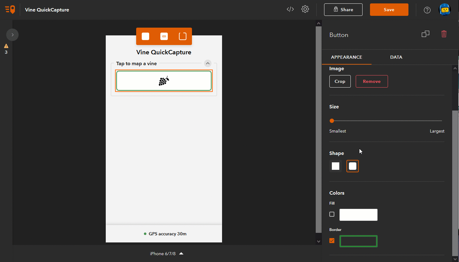
Bigger buttons, of course.
With this update, you can configure your QuickCapture apps with bigger buttons. This is useful when authoring projects for large tablets, with very few or even a single button. Larger buttons help you take full advantage of the available screen real estate on the device, facilitating data capture.
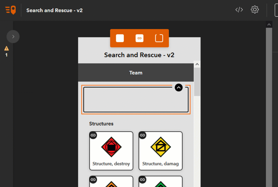
Enhanced Project User Inputs (Define lists from designer)
When configuring your QuickCapture app, you can define a Project User Input. A Project User Input presents a dialog where information can be entered, prior to start capturing data. This information can then be used to automatically populate attributes of collected data. For example, say you are building a Pavement Condition QuickCapture app. You may want to configure a Project User Input for field crews to enter a charge code number or the ID of the field crew. That charge code or field crew ID can then be automatically added as an attribute to every feature collected. Checkhttps://community.esri.com/community/arcgis-quickcapture/blog/2019/10/06/understanding-user-inputs-i... for more details on Project User Inputs.
Up until this release, you could only create free text Project User Inputs. That is, a dialog with either a single line or a multi line text input control. Starting with version 1.7, you can also present a list with well defined values. Using lists makes sense when you want to limit entries to a well known collection of choices. It is easier for users to pick an option than having to type.
The animation below shows you can now create a Project User Input and define a list of values for it.
Once you have your project input dialog defined, just as before, you can choose which buttons will make use of that value.
Enhanced Project User Inputs (Remember previous entries)
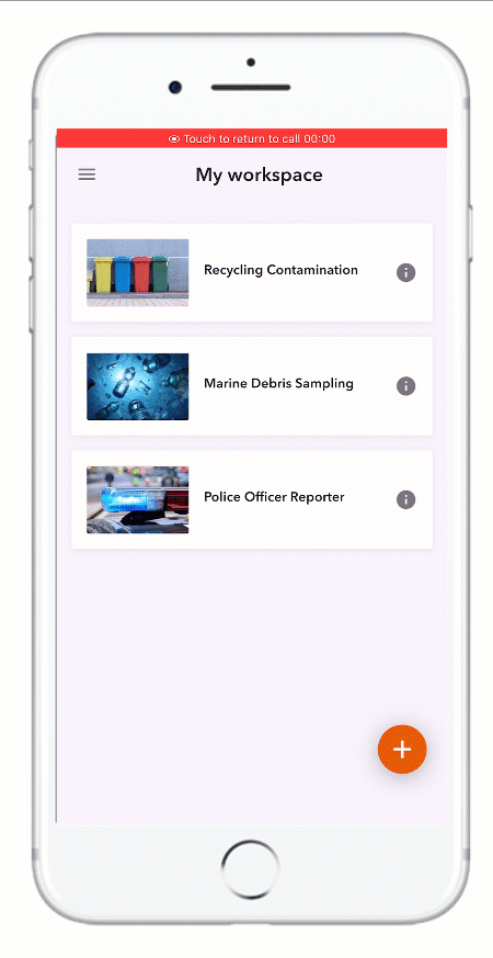
To facilitate quick data entry from end users, the QuickCapture mobile app now remembers previous Project User Input entries. In the animation on the side, for example, the Police Officer Reporter app presents a dialog for end users to enter the ID of the person that will collect data. Note that the dialog presents two options in a list right below the text input control. The end user can either enter a new ID, or tap on any of the previously entered IDs.
The QuickCapture mobile app will list the three last entries. The idea listing previous entries is to accelerate data capture and reduce errors when entering this information.
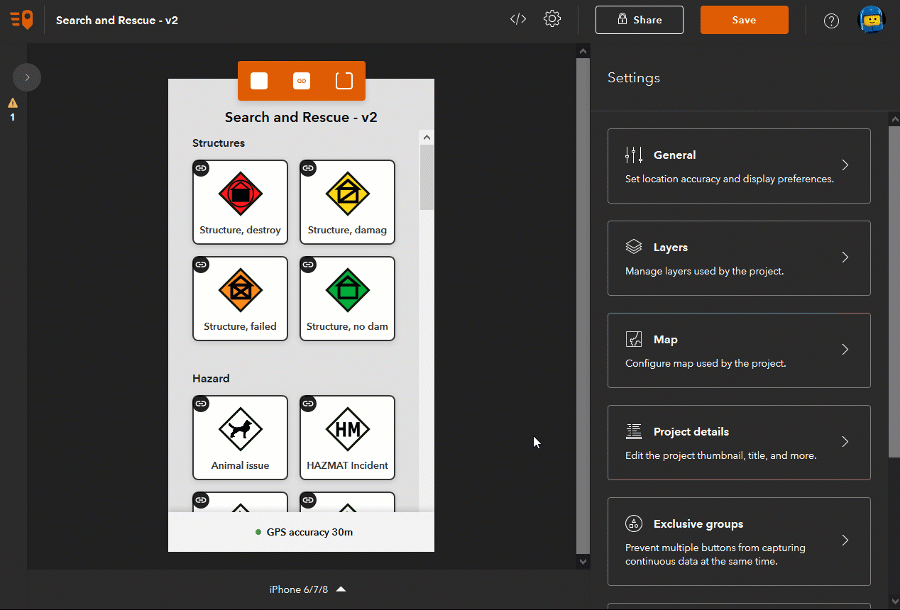
Locked Groups
QuickCapture buttons can be logically organized in groups. Groups help end users navigate across QuickCapture apps that include many buttons.
By default, groups can be collapsed and expanded by end users.With this update, the QuickCapture app author can decide to hide the handle to collapse and expand a group. This is useful when you want to make sure a set of buttons will always be visible to users. You can control the group properties from QuickCapture designer.
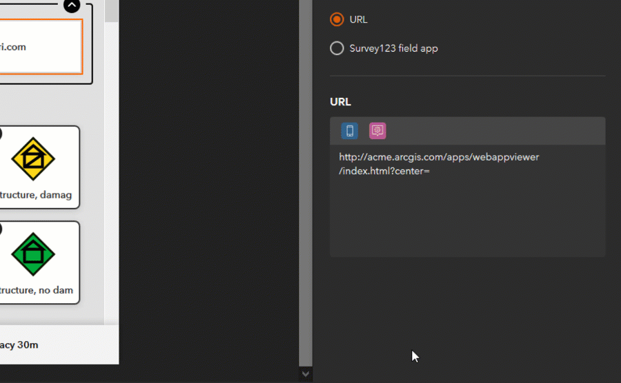
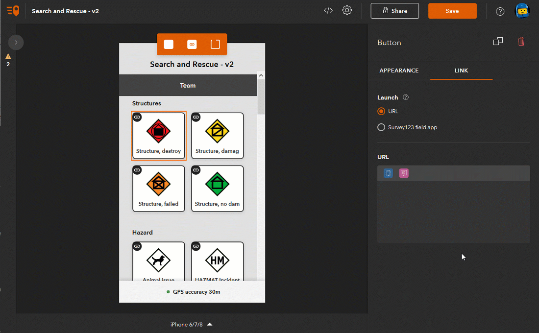
Link buttons (launching any URL)
Link buttons allow you to open other mobile or web apps right from within ArcGIS QuickCapture. For example, you may want to configure a button to open a live dashboard in a web browser, a PDF file or launch a Survey123 smart form. With link buttons you can convert your QuickCapture project into a launchpad for other applications.
The animation below shows how you can add a new link button into a QuickCapture app, to launch a website.
You can include dynamic content in your target URL. For example, you may want to add custom URL parameters to center a Web AppBuilder application at the user's location, or pass a filter into an ArcGIS Dashboard. For more information about URL parameters in ArcGIS Dashboards and Web AppBuilder, check the following links:
- URL parameters—ArcGIS Dashboards | Documentation
- Use URL parameters—ArcGIS Web AppBuilder | Documentation
In the animation below, we are passing the current latitude and longitude of the user when the link button is pushed. Note that dynamic content in the URL can be populated from device variables as well as from the Project User Input.
You can really launch any URL from a link button. This includes URLs to launch mobile apps. For example, using app link syntax you can launch Survey123, Tracker, Collector, Navigator and even third party apps. Here are some links to help you better understand how to build URLs to launch other apps:
- Open Tracker from a link
- Open Survey123 from a link
- Open Collector from a link
- Open Navigator from a link
- Open Waze from a link
Link buttons (launching Survey123)
If you want to launch a Survey123 smart form from QuickCapture, you do not need to figure out how to build the custom URL link yourself. We have added a streamlined user experience so you can more easily launch Survey123 forms and pass parameters to them.
You can select a survey and what dynamic data you want to pass into it.
Once you configure a link button in this manner, Survey123 will be automatically invoked when you press the QuickCapture button.
With link buttons, you can now model much more sophisticated data collection workflows. You can for example configure a few buttons to capture quick field observations and a button to launch Survey123 to do more involved reporting.
More device variables
Device variables in QuickCapture allow you to automatically populate attributes in the GIS features you collect. Device variables let you capture for example the exact time when a button is pushed, the speed and direction of travel, or the horizontal accuracy of your GPS. The complete list of device variables is available in the Configure a project—ArcGIS QuickCapture | Documentation help topic. In this release, we are adding the following new variables:
- Photo: Lat, Lon, Heading
- Travel: Cardinal direction
- Location: DMS, DDM, USNG, MGRS
- Device Info: App Version and Device Operating System
- Length and Area
EXIF metadata
Starting with version 1.7 of QuickCapture, all photos taken from the mobile app will include EXIF metadata.
You must be a registered user to add a comment. If you've already registered, sign in. Otherwise, register and sign in.