- Home
- :
- All Communities
- :
- Products
- :
- ArcGIS Living Atlas of the World
- :
- Living Atlas Blog
- :
- What's New in Esri Vector Basemaps (February 2019)
What's New in Esri Vector Basemaps (February 2019)
- Subscribe to RSS Feed
- Mark as New
- Mark as Read
- Bookmark
- Subscribe
- Printer Friendly Page
- Report Inappropriate Content
Esri vector basemaps updated
Recent updates to Esri Vector Basemaps deployed new map content from contributing cities and counties who supplied data through our Community Maps Program to enhance our maps. Contribute your organization’s local, authoritative content through this program. Esri integrates your data with other providers and publishes the tile set as the ArcGIS Online vector basemap. Additionally, this release has one of the first rounds of contributions coming from the Esri Community Maps Editor. With the start of baseball spring training, there is a new Community Maps Challenge focused on compiling detailed content of the stadiums. Details available online.
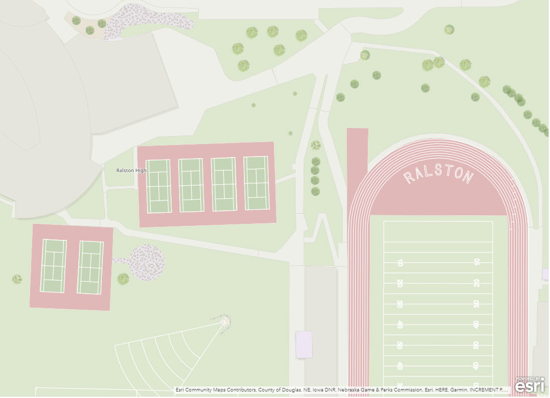
Ralston High School campus and sport facilities compiled through the Esri Community Maps Editor app.
Basemap localization
Czech, Finnish, Hebrew, and Swedish are the newest languages in our vector basemap localization styles. Currently we publish 17 languages, besides our global English map, in nine basemap styles each. The available languages:
The link on the language names takes you to a group page of web maps. To get localized language maps in your ArcGIS.com gallery, change your organization’s Region and Language in the General settings. Make sure Esri vector basemaps are set as the default gallery. This option is in the Map settings. More language updates and more languages are planned in future releases. Translations are expanding across more feature classes and to larger scales.
Do you want to convert one of your custom Esri vector basemaps into a map that displays a localized language? Our World_Basemap_v2 tile set includes the language data that allows you to do that. See the Esri Vector Basemap Reference Document (v2) for details on how to customize your map to expose translated labels. The reference document includes the list of layers this supports and the 2-digit language codes needed when editing json. Try starting with one of our existing localized map styles and apply your own cartographic styling.
The reference document also provides details on how to customize the vector basemap boundaries and names to display a preferred world view. Disputed boundaries can be removed or changed to non-disputed. Alternate names for select features can appear on the map by json code modifications (for example, The Gulf -or- Persian Gulf -or- Arabian Gulf). Note: North Macedonia country name can be exposed by a JSON modification to your own map layer. It will be the default name on the Esri Vector Basemaps in our March update.
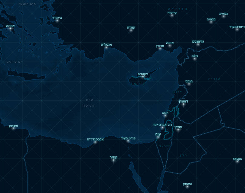
This example shows the Nova creative vector basemap style with Hebrew labels. You can achieve a similar result with any of the Esri creative styles or your own vector style built on the Esri Vector Basemaps. Make a copy of the tile layer in your own account using the ArcGIS Vector Tile Style Editor. Download the root.json style file from this new tile layer's item page. Select fields identified in the reference document are edited in Notepad++ changing _name to _name_he ("he" for Hebrew): "text-field" : "{_name_he}". Fonts also change to Arial Unicode (bold or regular) to display the appropriate glyphs, Finally, update the item's root.json style file.
Community: a new creative style for vector basemaps
A new creative vector style is available for your basemap use. “Community” provides a customized world basemap that is uniquely symbolized. It is optimized for the display of special areas of interest (SAI) created and edited by Community Maps contributors. These special areas of interest features include landscaping polygons and sport ammenity lines. These are features such as grass, trees, rock, tennis courts, football and baseball lines, and more. This vector tile layer is built using the same data sources used for the World Topographic Map and other Esri basemaps. Cindy Prostak is the cartographer behind the design of Community, as well as many of our other creative styles including Charted Territory, Colored Pencil, Mid-Century, Modern Antique, Newspaper, and Nova.
Check out this Story Map which builds off both our Community Maps baseball stadium challenge and our new Community style vector basemap. It also presents a number of real-world running challenges for you to conquer!
Customize the look of your own vector basemaps
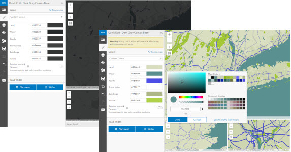
In addition to customizing the language or geopolitical view of your vector basemaps, you can also edit overall cartographic styling. Change the root.json code in a text editor and update your tile layer. Alternately, try the ArcGIS Vector Tile Style Editor (beta) app for a user-friendly experience to change your map’s look. The Quick Editor function changes features en masse. In contrast, the editor also has an Edit Layer Styles option for a deep dive into individual map specifications. Change style settings for text, sprites, lines, polygons, and point features with the editor app. Edit one of the Esri vector basemaps or use it to edit your own vector tile layer created through ArcGIS Pro.
Feedback
Have you ever seen a problem with Esri Vector Basemap data? Report issues directly on this Feedback Map. Our team reviews your comments and considers the update for one of our frequent releases.
This was originally posted on our ArcGIS Blog page: What's New in Esri Vector Basemaps (February 2019)
You must be a registered user to add a comment. If you've already registered, sign in. Otherwise, register and sign in.