- Home
- :
- All Communities
- :
- Products
- :
- ArcGIS Living Atlas of the World
- :
- Living Atlas Blog
- :
- What's new in Esri Vector Basemaps (December 2018)
What's new in Esri Vector Basemaps (December 2018)
- Subscribe to RSS Feed
- Mark as New
- Mark as Read
- Bookmark
- Subscribe
- Printer Friendly Page
- Report Inappropriate Content
This blog was originally posted on the esri.com ArcGIS blog site. For more Esri vector basemap blogs, see this page.
Esri Vector Basemaps were recently updated with new data, a new Ocean Reference style and made more localized languages available.
New content added to the Esri Vector Basemap tile set is available across all the styles of our vector tile layers. These updates include data from HERE as well as from our Community Maps Program contributors. The banner image of this blog shows voestalpine steel mill in Austria, a new addition of contributed data to the map. This industrial campus displays trees, parking lots, and other special areas pertinent to this site. Learn more about what data your campus or community can contribute to the ArcGIS.com platform. Visit this Living Atlas of the World page.
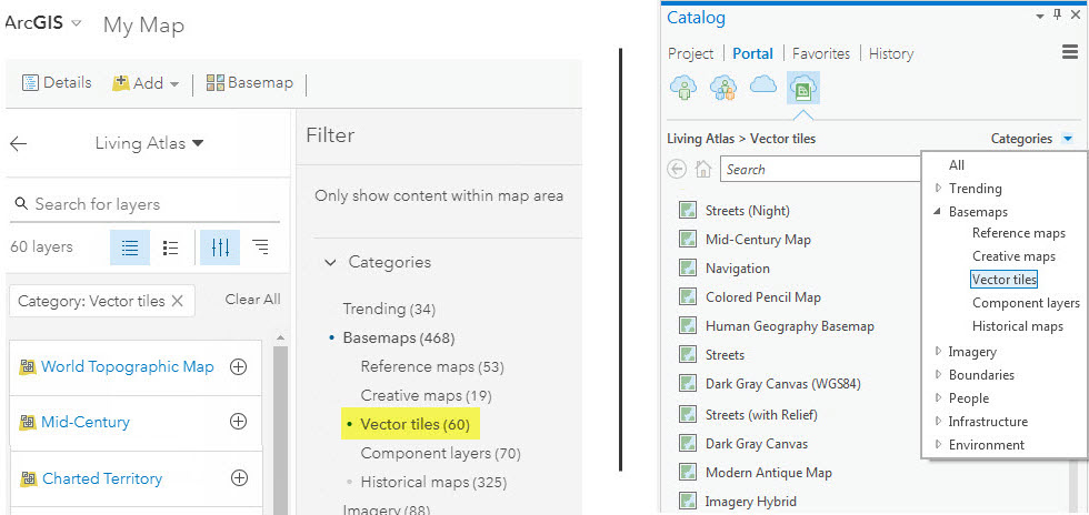
The Living Atlas is also a great place to find the Esri Vector Basemaps. Find the layers and maps directly from the Living Atlas website or search the Living Atlas through ArcGIS Online (left image below) or Pro (right). Narrow your search to vector maps, a sub-category of the basemaps category. Additionally, the Esri Vector Basemaps can be set as the default maps for your basemap gallery.
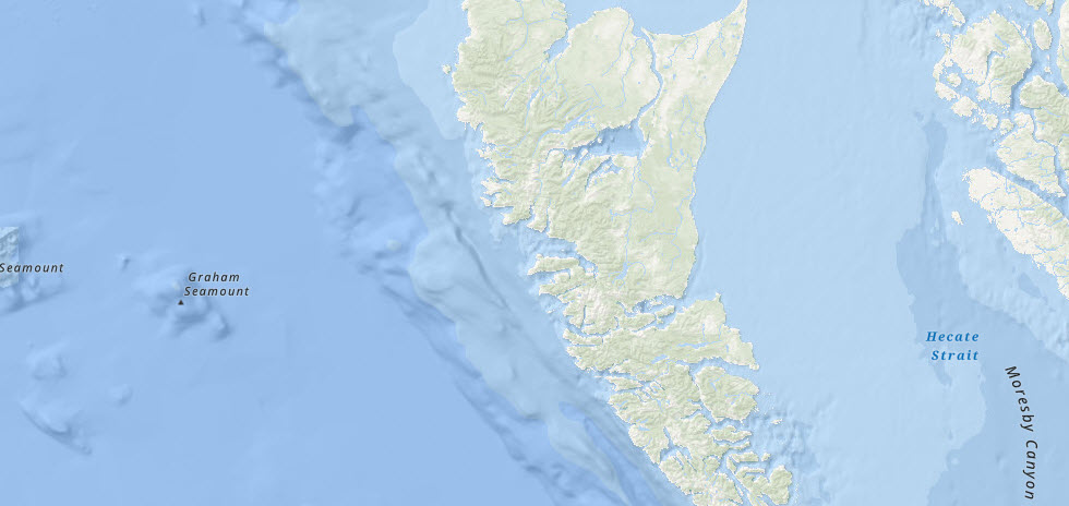
Ocean reference vector layer
New additions to the suite of Esri Vector Basemap layers and maps are the World Ocean Reference vector layer and Ocean Basemap web map which utilitizes the vector layer. The new vector ocean reference layer has similar content and design as the existing raster ocean reference layer (boundaries and all labels). Because it is vector format, there is the ability to customize not only the content of the layer, but also the appearance of the display. This includes changing boundary line symbolization and font styles (face, color, size). This customization can be made through the editing of the root.json style file of your tile layer or through the ArcGIS Vector Tile Style Editor app.
Localization of vector basemaps
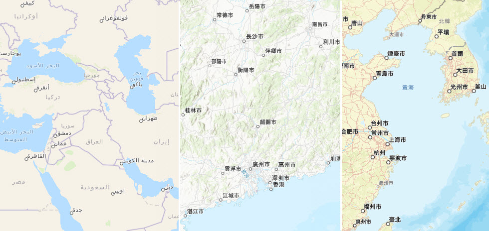
There are three additional languages available across the vector basemap styles. This brings our current total to twelve languages. Each language localized is available in nine different basemap styles. New are Arabic, Chinese (Hong Kong) and Chinese (Taiwan). These join previously released Modern Chinese, French, German, Italian, Japanese, Polish, Brazilian Portuguese, Russian, and Spanish. To make localized maps the default basemap, change the organization’s Region and Language in the General settings. Also, change the Map setting to display Esri vector basemaps as the default gallery. Each language above is linked to a group of web maps. Localized labels display primarily at small scales; however, we are expanding translations across more feature classes and at more scales. Additional languages will be deployed in future releases.
Customizing Esri Vector Basemaps
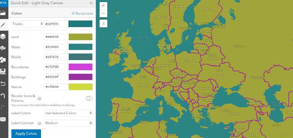
The Esri Tile Layer Style Editor (Beta) provides an easy way to customize vector basemaps. Experiment (& save!) different cartographic styles with this app. Start from an Esri vector basemap or one of your own vector tile layers. Two styling paths exist:
Quick Edit is only configured for Esri vector basemaps. This quick path sorts map features into six high-level categories. Apply random colors for cartographic inspiration, or apply a pre-defined color palette to each category.
Edit Layer Styles works with Esri vector maps and your own styles. It offers more control over each map feature’s spec. Countless options are available to customize your new vector map. Save your new style as a tile layer in your ArcGIS.com account and use the new style in your web maps and apps. This blog and space on GeoNet offers information about the Style Editor. This recent Esri Webinar showcased the Style Editor. Follow-up questions and answers are at this Living Atlas GeoNet page.
Feedback
Have you ever seen a problem with Esri Vector Basemap data that needs to be fixed? Report issues directly on this Feedback Map. Our team reviews your comments and considers the update for one of our frequent releases.
You must be a registered user to add a comment. If you've already registered, sign in. Otherwise, register and sign in.