- Home
- :
- All Communities
- :
- Products
- :
- ArcGIS Living Atlas of the World
- :
- Living Atlas Blog
- :
- Which Way Will the Lava Flow?
Which Way Will the Lava Flow?
- Subscribe to RSS Feed
- Mark as New
- Mark as Read
- Bookmark
- Subscribe
- Printer Friendly Page
- Report Inappropriate Content
by Michael Dangermond
After learning about the new 10m resolution hydrology analysis service for Hawaii, I decided to take the new service for a test-drive. As of May 14, 18 fissures have opened in Puna District, Hawaii Island, spewing magma and gas. What I really want to know is, which way will the lava coming from these fissures flow? Do these flows have the potential to cut off access to the easternmost part of the island?
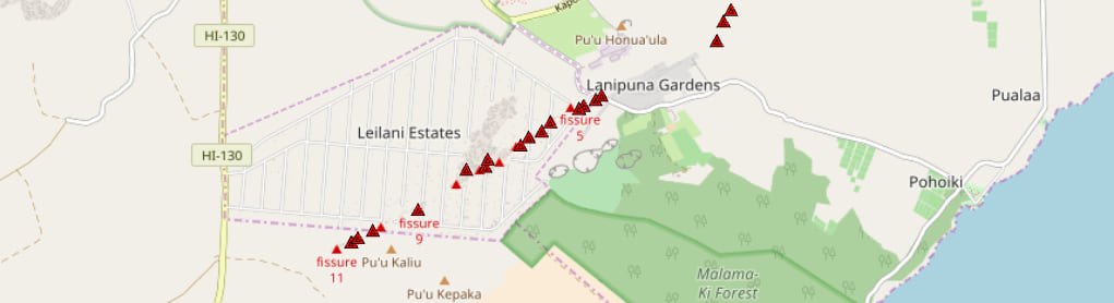
First I saw that someone has been adding the fissure locations to Open Street Map in almost real-time. So I added these points to ArcGIS Desktop. (When we zoom out, the fissure locations appear to move, but my fissure location points were digitized at a finer scale of 1:1000.)
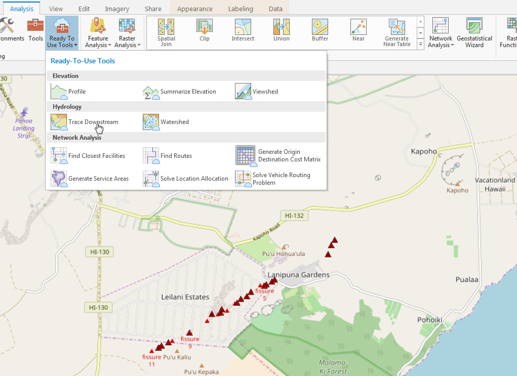
Next I added the server hydro.arcgis.com to my catalog pane and used the trace downstream tool to find the lava’s path to the sea. (The trace downstream tool consumes credits.)
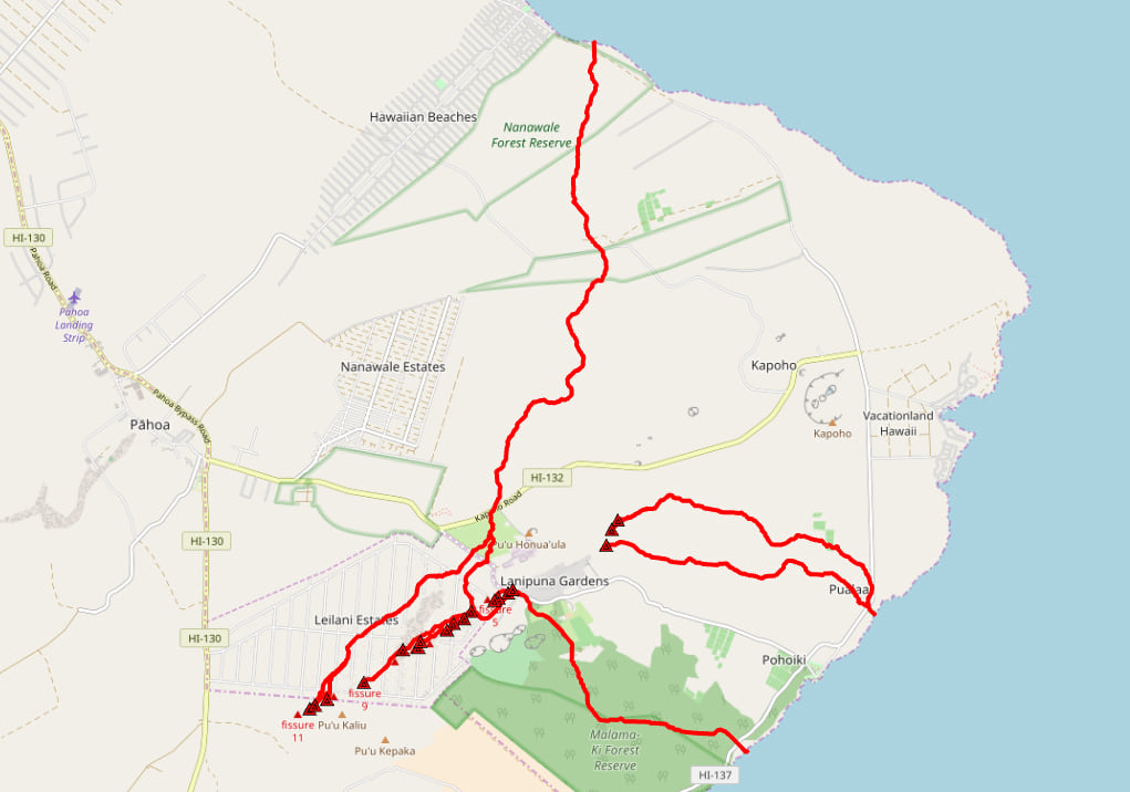
My analysis found that the lava will be heading from the fissures in three directions: North, East, and Southeast. And it has the potential to cut off a whole portion of Puna District!
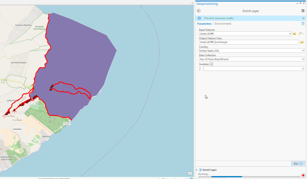
Next I wanted to find out how many people live in this area of Puna. So I drew the area and ran the enrich layer tool.

From my estimate, 1130 residents of East Puna would need to be evacuated from the area if it were cut off. There are 765 total housing units in this area. 162 are occupied by renters and 226 are considered vacant, so there may be a few hundred more tourists that need to be evacuated as well. Good thing the lava moves slowly and Hawaii Civil Defense has helicopters ready to go.
You must be a registered user to add a comment. If you've already registered, sign in. Otherwise, register and sign in.