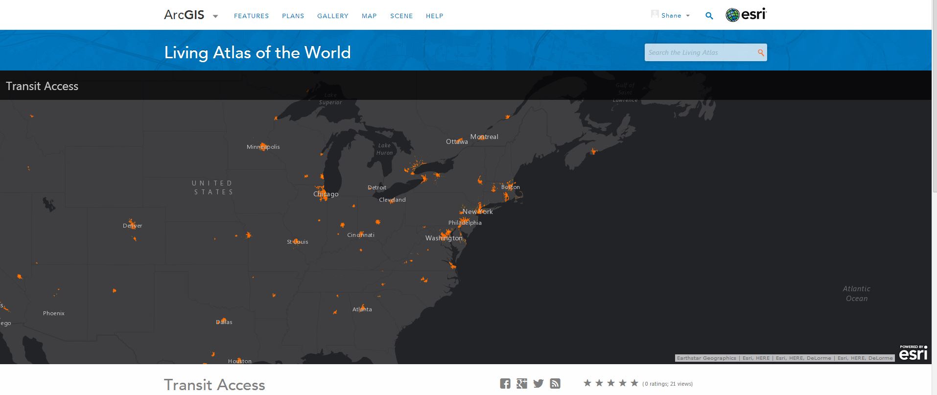
Transit Access Added to the Living Atlas and Urban Observatory
- Subscribe to RSS Feed
- Mark as New
- Mark as Read
- Bookmark
- Subscribe
- Printer Friendly Page
- Report Inappropriate Content
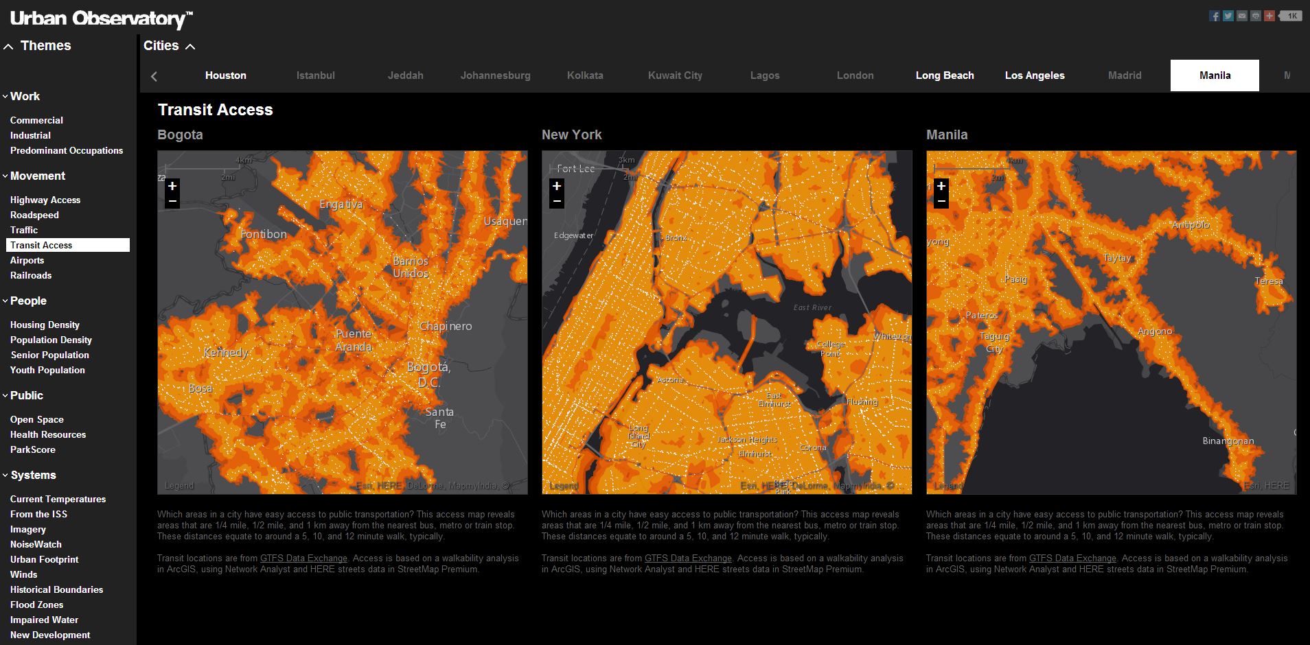
The Urban Systems collection of the Living Atlas has recently expanded to include Transit Access. Defined as which areas in a city have easy access to public transportation? This access map reveals areas that are 1/4 mile, 1/2 mile, and 1 km away from the nearest bus, metro or train stop. These distances equate to around a 5, 10, and 12 minute walk, typically.
This new map theme is also comparable to other select cities in the Urban Observatory.
Is there a transit map theme you would like to see become a reality? I am all ears. For example, how far are you from a ski resort? Personally, if I lived 15 minutes. from a ski resort, I would not be able to hold down a job.
Your input is welcome.
You must be a registered user to add a comment. If you've already registered, sign in. Otherwise, register and sign in.