User Community Map Layers Improve the World Topographic Map and Add Content to the Living Atlas
- Subscribe to RSS Feed
- Mark as New
- Mark as Read
- Bookmark
- Subscribe
- Printer Friendly Page
- Report Inappropriate Content
The ArcGIS Content Team has updated the World Topographic Map for the second time this month! Another big thanks to the user community who are helping improve the Community Basemaps by submitting new and updated content to the ArcGIS Living Atlas of the World. This week’s refresh includes new contributions and updates for several cities and counties throughout the United States and Canada.
When we socialize “Community Basemaps have ‘improved’ by incorporating new contributions and updates“, what does that really mean? This release has some very compelling detail that I believe should be exposed. The images below speak for themselves. Improved detail in the online basemaps supports more useful web maps and apps, a better user experience, and access to contemporary content.
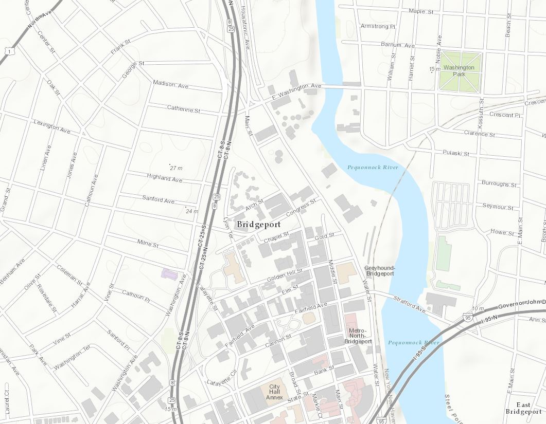
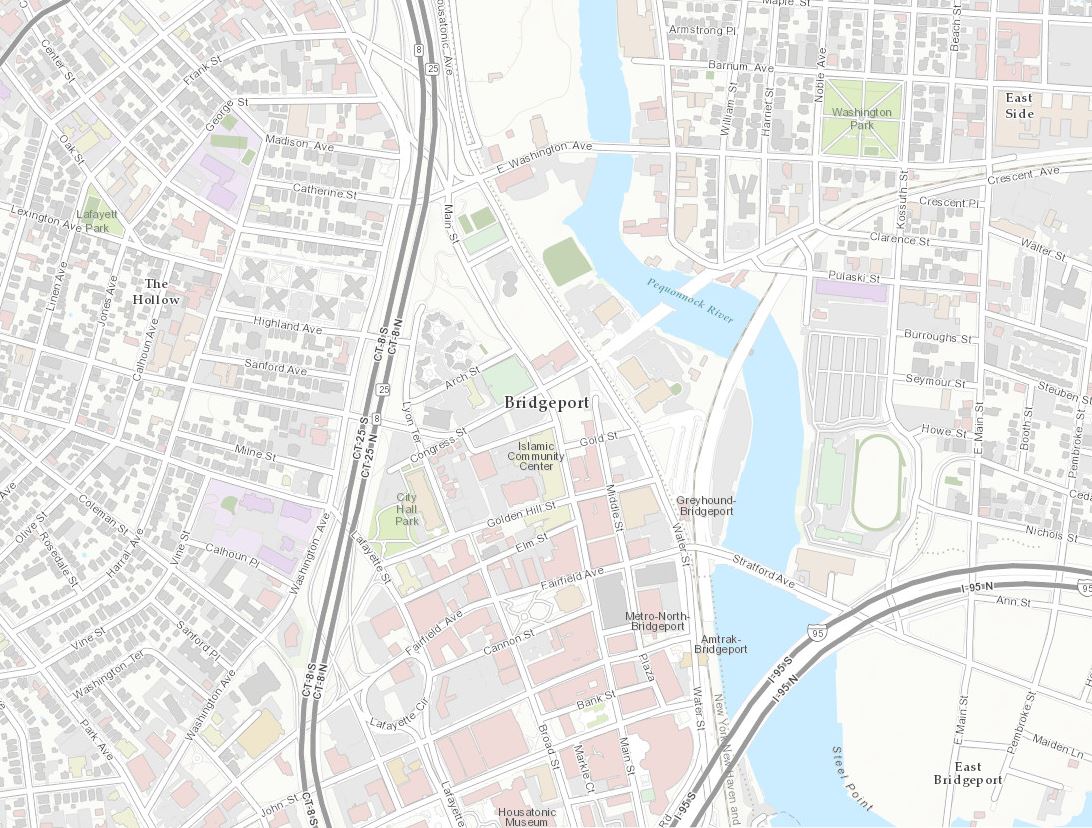
Our first new contributor is the Greater Bridgeport Regional Council (Topo 1:9k to 1:1k). This regional planning agency guides decision making that promotes growth and development in the region.
Bridgeport, CT 1:9k
Greater Bridgeport Regional Council 1:9K
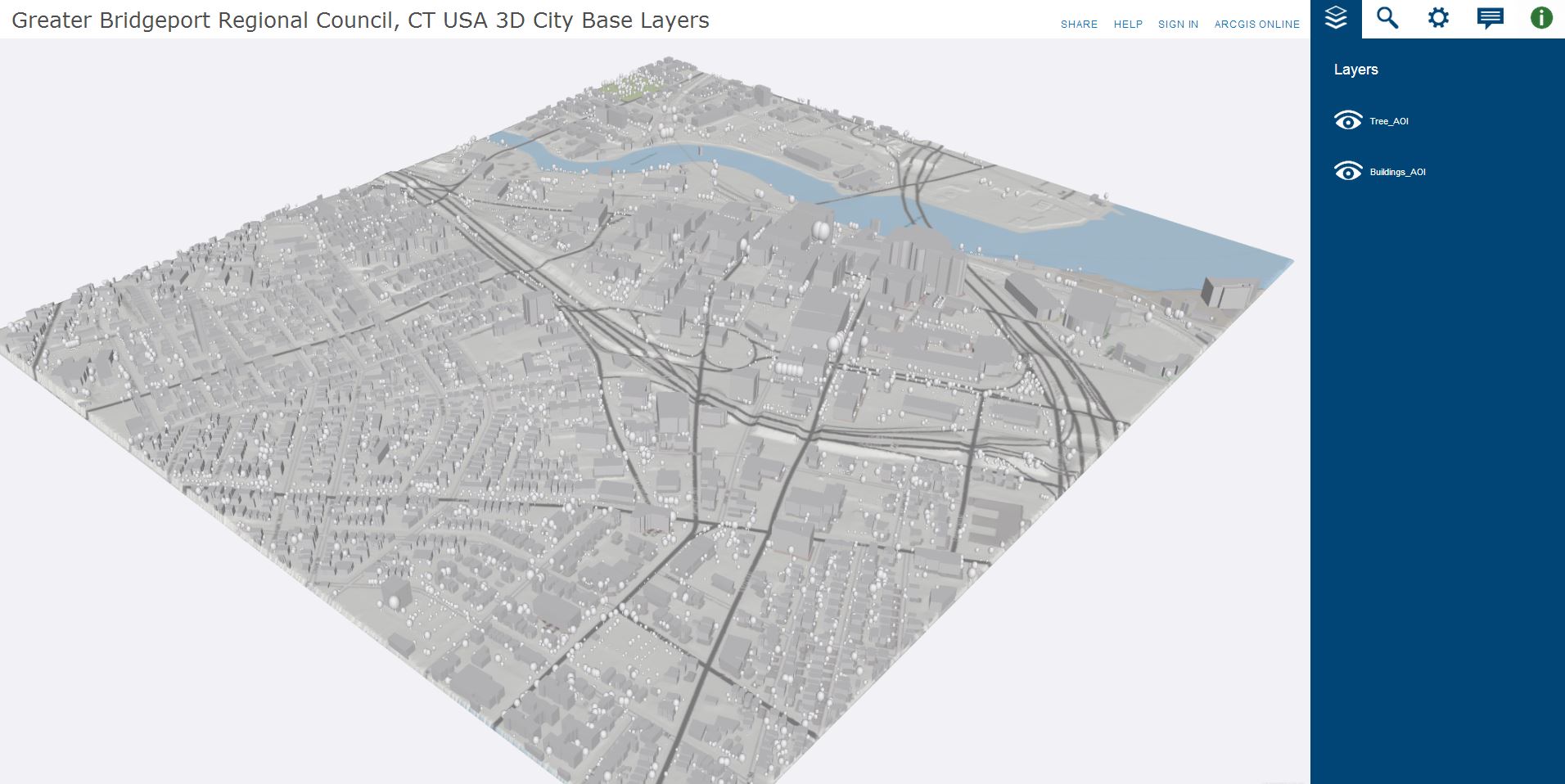
This region is now able to incorporate this new content into a 3D Base Layer. This Base layer provides a 3D foundation for a region or city, gives context to projects, acts as a canvass for projects and analysis, and can be shared in apps to the global community.
Greater Bridgeport Regional Council, CT 3D City Base
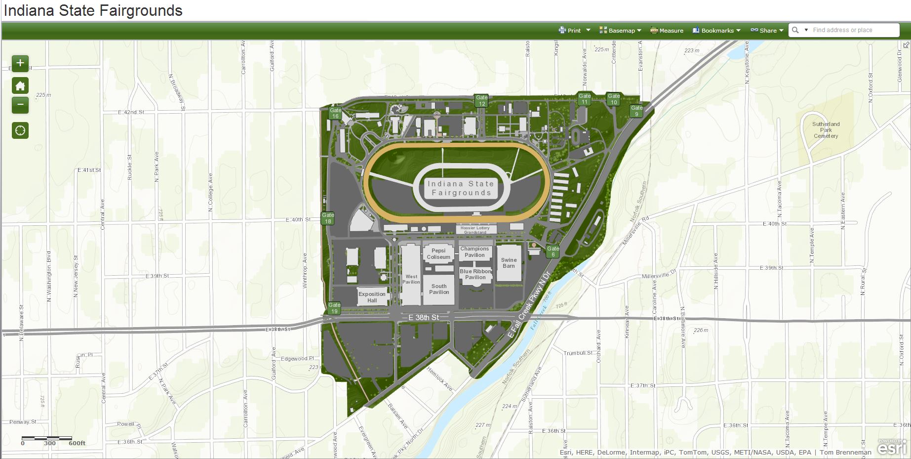
Our next new contribution is Indiana State Fairgrounds, IN (Topo 1:9k to 1:1k), built by Tom Brenneman in Esri’s St. Louis Regional Office.
Indiana State Fairgrounds 1:9K (Before)
Indiana State Fairgrounds 1:9K (After)
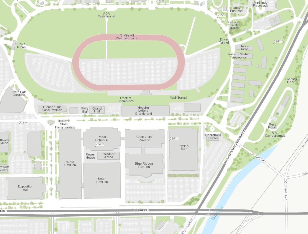
It will be interesting to see how this new web app is used with the introduction of this great new detail.
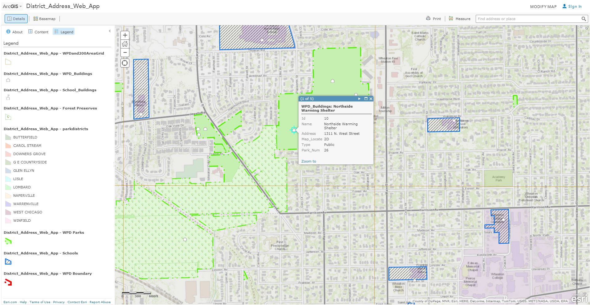
The Wheaton Park District, IL (Topo 1:9k to 1:1k) is our next new contributor. This park district supports their community by providing diverse leisure pursuits and appreciation of the natural world through a variety of programs held at various parks and facilities.
Northside Park 1:4K (Before)
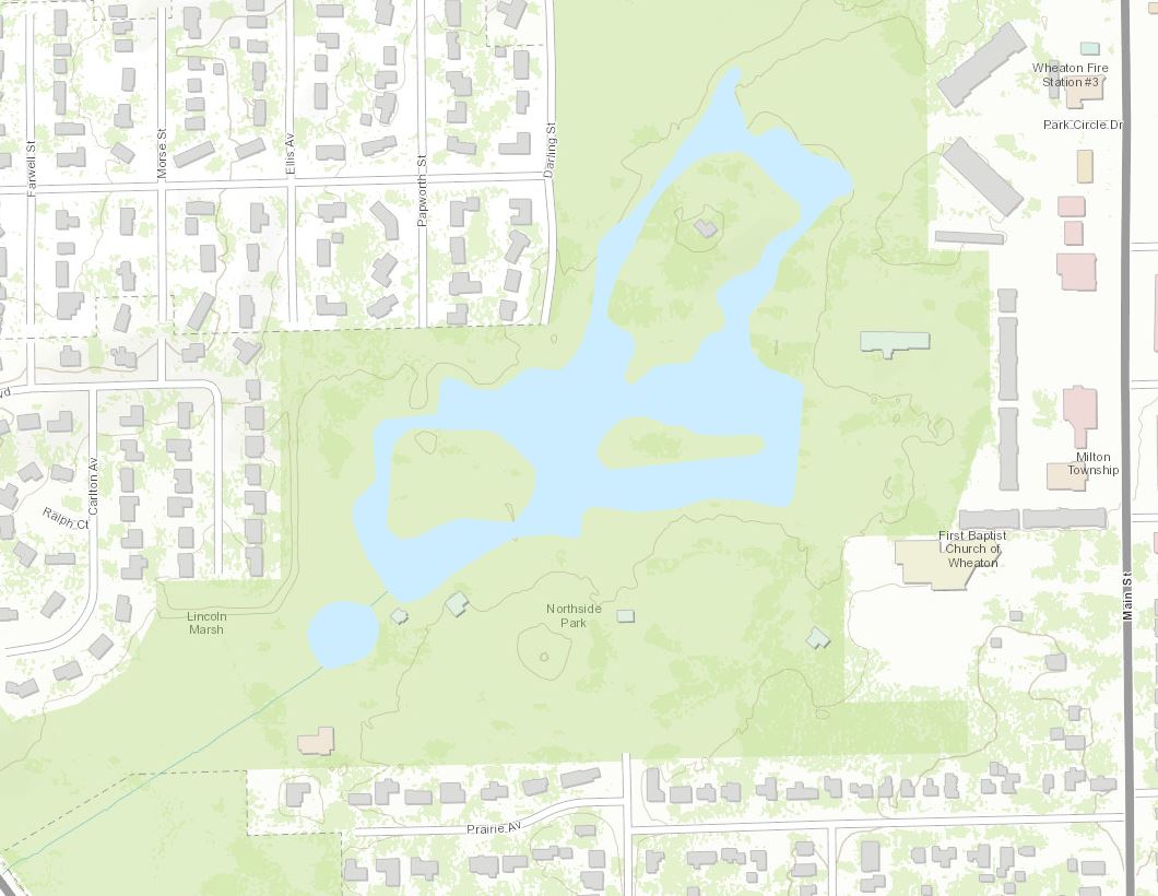
Northside Park 1:2K (After)
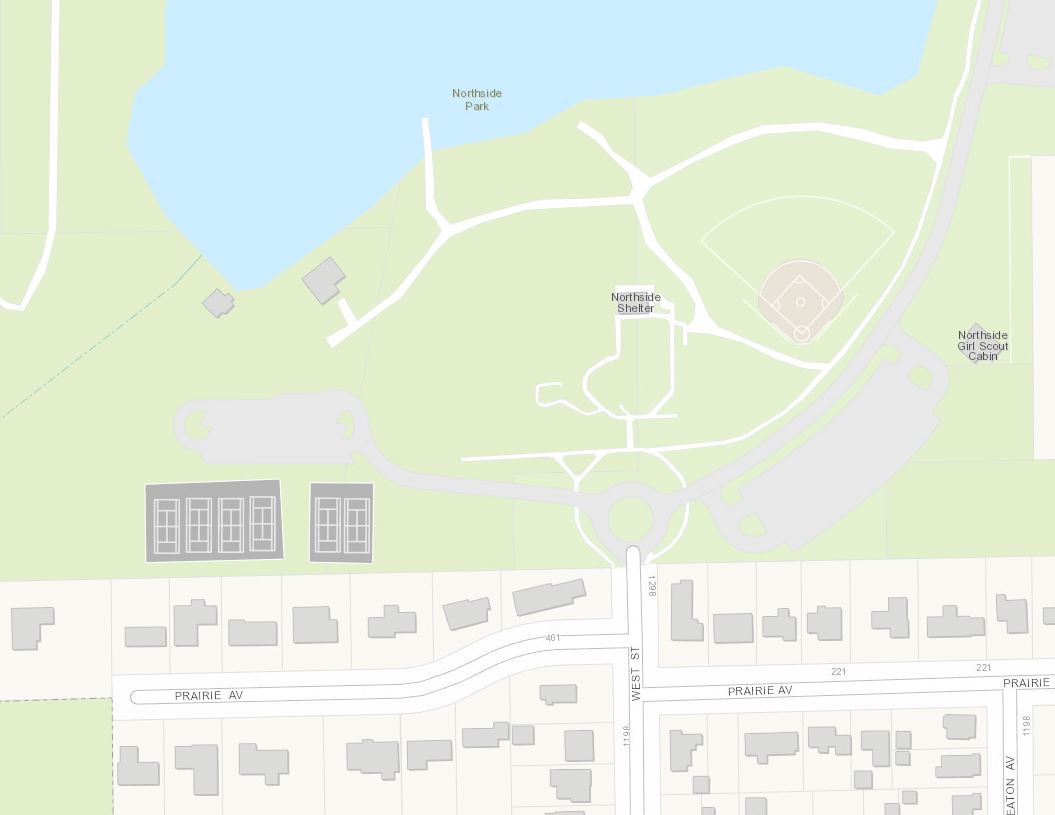
This useful web map illustrates addresses within the Wheaton Park District using DuPage County Jan 2014 parcel data.
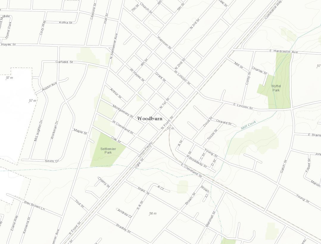
Our final new contributor in this release takes us to the west coast of the United States to Woodburn, OR (Topo 1:9k to 1:1k).
Woodburn, OR 1:9K (Before)
Woodburn, OR 1:9K (After)
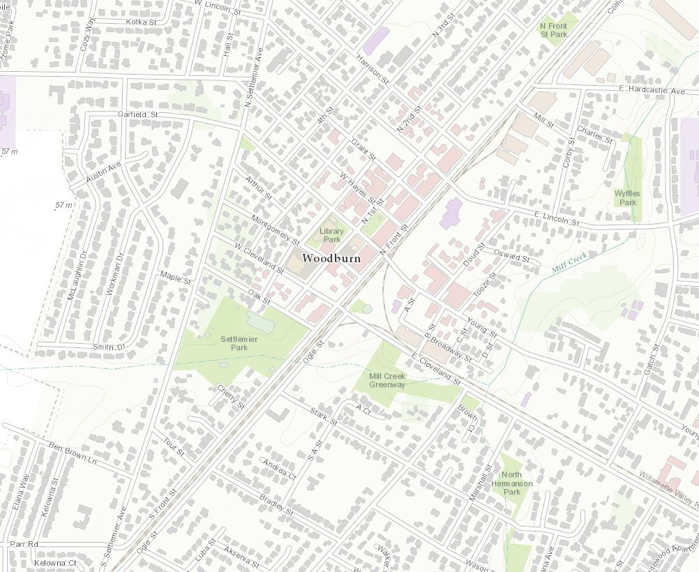
The new content for Woodburn will help better support this Oregon Zoning web map.

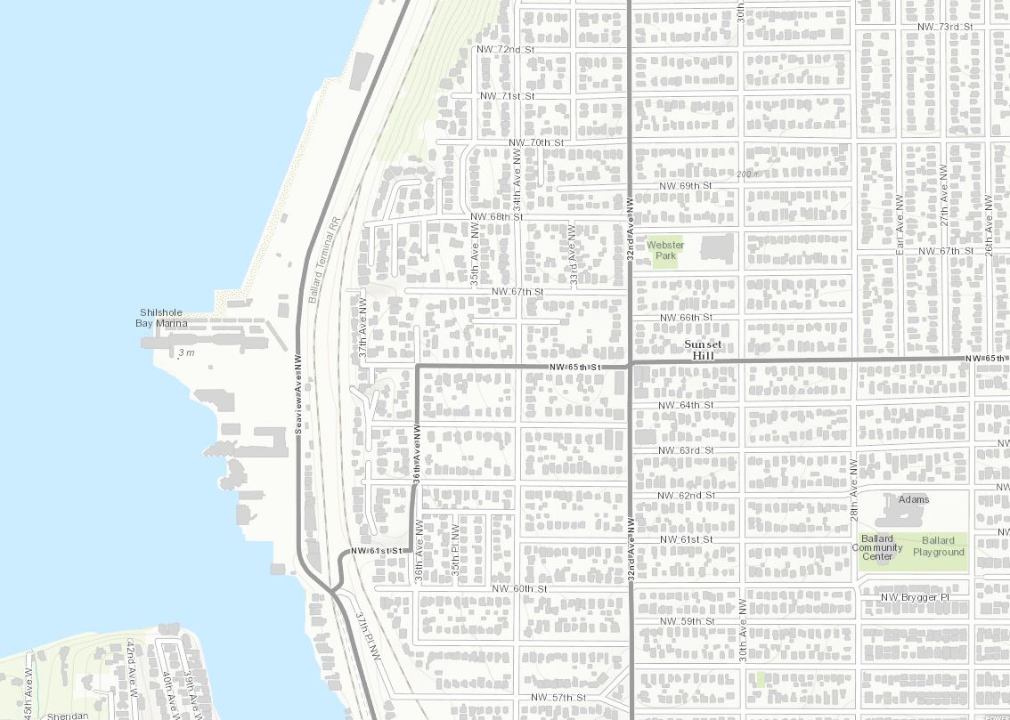
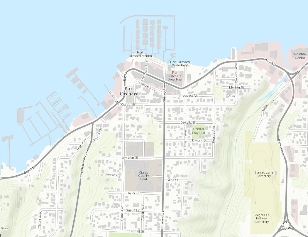
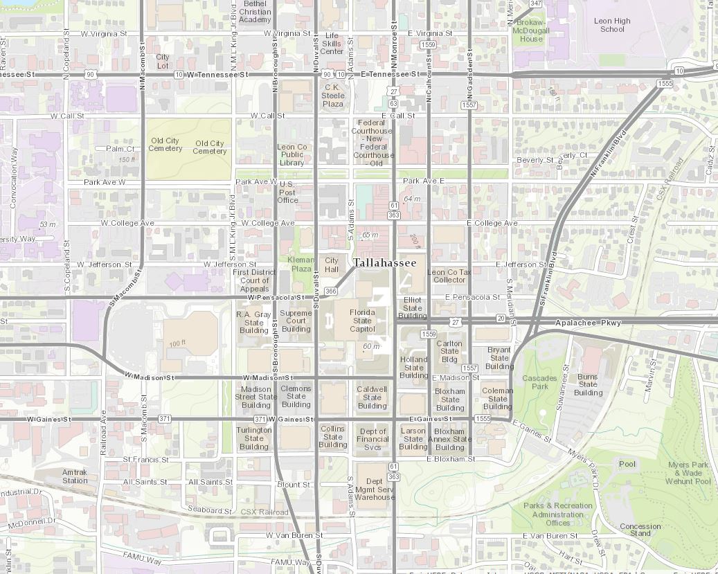
Included in this release are 6 updates from existing Community Maps contributors.
Kitsap County and Seattle, WA 1:9K (Before)
Kitsap County and Seattle, WA 1:9K (After)
Leon County, FL (county seat Tallahassee) 1:9K (Before)
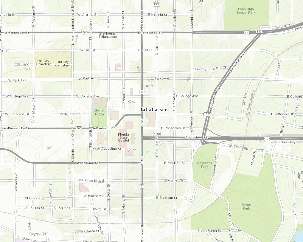
Leon County, FL (county seat Tallahassee) 1:9K (After)
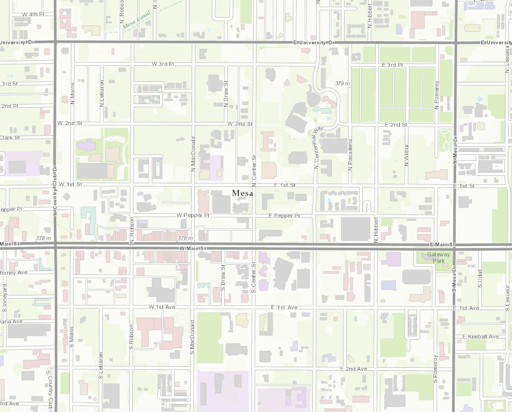
Mesa, AZ 1:9K
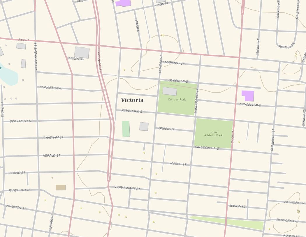
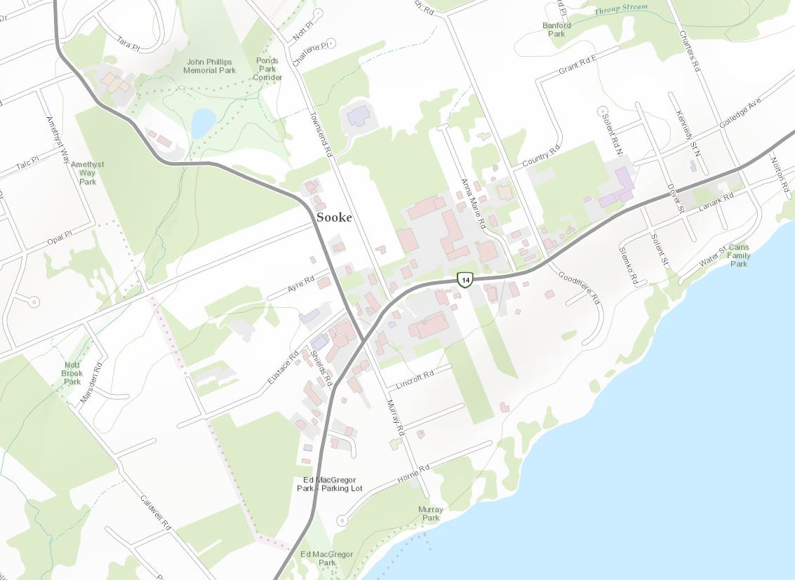
District of Sooke/City of Victoria, BC, Canada 1:9K (Before)
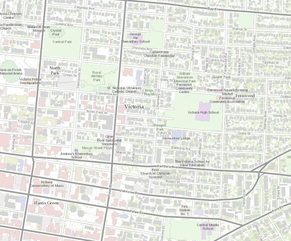
District of Sooke/City of Victoria, BC, Canada 1:9K (After)
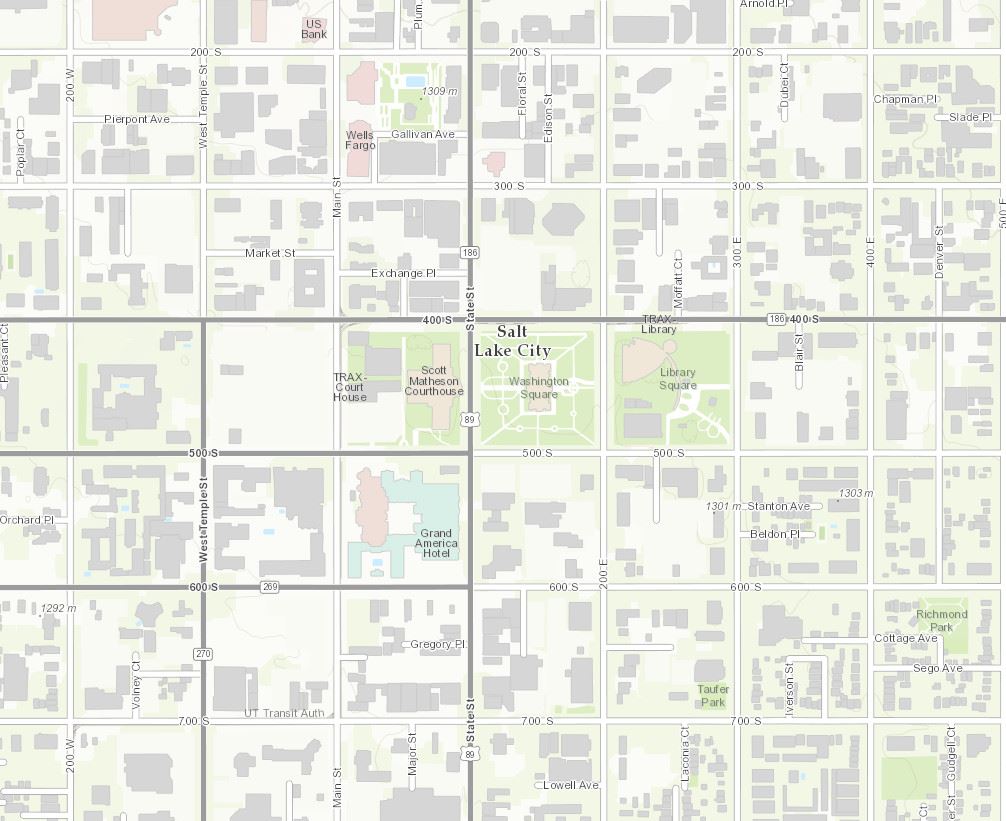
Utah AGRC 1:9K
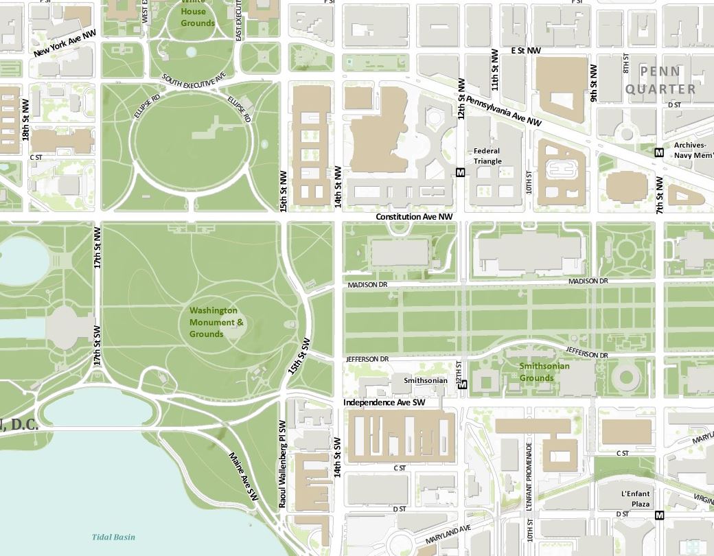
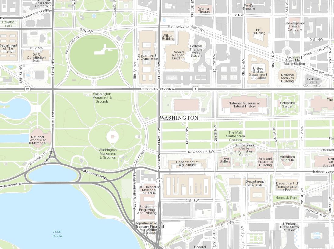
Our final update for this release is Washington, D.C. (Topo 1:18k to 1:1k).
Washington, D.C. 1:9K (Before)
Washington, D.C. 1:9K (After)
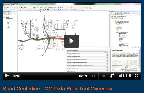
Need help preparing your content for Community Maps? We can help your organization, university, or campus by way of our new and improved Community Maps data prep tools. We offer a domestic and international tool set to help you get your content in the basemaps quickly. These tools will assist you with map layers included in the World Topographic Map, including road centerlines. The video below explains how to use the Road Centerline Data Prep Tool to prepare your road data for contribution to Community Maps and the ArcGIS Living Atlas of the World.
Showcase your organization! If you work for an organization that is benefiting from Community Maps Participation and would like to share your work with our expanding user community, please contact Shane Matthews (smatthews@esri.com) or Community Maps (communitymaps@esri.com) and tell us your story and have a chance to be featured in a Community Maps Webinar segment.
Here’s a list of all the community contributors for this release:
- Greater Bridgeport Regional Council (Topo 1:9k to 1:1k) New Contributor
- Indiana State Fairgrounds, IN (Topo 1:9k to 1:1k) New Contribution
- Wheaton Park District, IL (Topo 1:9k to 1:1k) New Contribution
- Woodburn, OR (Topo 1:9k to 1:1k) New Contributor
- Kitsap County and Seattle, WA (Topo 1:9k to 1:1k) Update
- Leon County, FL (Topo 1:9k to 1:1k) Update
- Mesa, AZ (Topo 1:9k to 1:1k) Update
- District of Sooke/City of Victoria, BC, Canada (Topo 1:144k to 1:1k) Update
- Utah AGRC (Topo 1:9k to 1:1k) Update
- Washington, D.C. (Topo 1:9k to 1:1k) Update
These contributions were made through the Community Maps Program. For more information visit the Community Maps Program Resource Center.
The service was updated on the following servers: services.arcgisonline.com and server.arcgisonline.com. If you have previously used the World_Topo_Map, you may need to clear your cache in order to see the updates.
If you have feedback on content, try our Topographic Map Feedback web map.
If you have other feedback or comments, please post them to the ArcGIS Discussion Group on GeoNet.
You must be a registered user to add a comment. If you've already registered, sign in. Otherwise, register and sign in.